- Chippewa County, Wisconsin
-
Chippewa County, Wisconsin 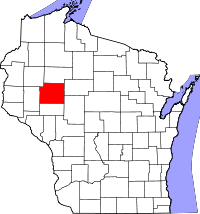
Location in the state of Wisconsin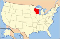
Wisconsin's location in the U.S.Founded February 3, 1845, separated from Crawford Co.[1][2] Named for Ojibwa Seat Chippewa Falls Largest city Chippewa Falls Area
- Total
- Land
- Water
1,041 sq mi (2,697 km²)
1,010 sq mi (2,617 km²)
31 sq mi (80 km²), 2.97%Population
- (2000)
- Density
55,195
55/sq mi (21/km²)Time zone Central: UTC-6/-5 Website www.co.chippewa.wi.us/ Chippewa County is a county located in the U.S. state of Wisconsin. As of 2000, the population was 55,195. Its county seat is Chippewa Falls[3]. The United States Census Bureau's Eau Claire Metropolitan Statistical Area includes all of Chippewa County (as well as Eau Claire County to the south). Together with the Menomonie Micropolitan Statistical Area (which includes all of Dunn County) to the west, the Eau Claire metropolitan area, forms the Census Bureau's Eau Claire-Menomonie Combined Statistical Area, which had a consolidated 2010 population of 205,008.
Contents
Geography
According to the U.S. Census Bureau, the county has a total area of 1,041 square miles (2,696.2 km2), of which 1,010 square miles (2,615.9 km2) is land and 31 square miles (80.3 km2) (2.97%) is water.
Adjacent counties
- Rusk County – north
- Taylor County – east
- Clark County – southeast
- Eau Claire County – south
- Dunn County – west
- Barron County – northwest
Major highways
 U.S. Highway 12
 U.S. Highway 53
 Highway 29 (Wisconsin)
 Highway 40 (Wisconsin)
 Highway 64 (Wisconsin)
 Highway 27 (Wisconsin)
 Highway 124 (Wisconsin)
 Highway 178 (Wisconsin)
Demographics
 2000 Census Age Pyramid for Chippewa County.
Historical populations Census Pop. %± 1900 33,037 — 1910 32,103 −2.8% 1920 36,482 13.6% 1930 37,342 2.4% 1940 40,703 9.0% 1950 42,839 5.2% 1960 45,096 5.3% 1970 47,717 5.8% 1980 52,127 9.2% 1990 52,360 0.4% 2000 55,195 5.4% 2010 62,415 13.1% WI Counties 1900-1990 As of the census[4] of 2000, there were 55,195 people, 21,356 households, and 15,013 families residing in the county. The population density was 55 people per square mile (21/km²). There were 22,821 housing units at an average density of 23 per square mile (9/km²). The racial makeup of the county was 97.85% White, 0.16% Black or African American, 0.32% Native American, 0.89% Asian, 0.01% Pacific Islander, 0.17% from other races, and 0.60% from two or more races. 0.52% of the population were Hispanic or Latino of any race. 44.1% were of German, 15.8% Norwegian and 5.8% Irish ancestry.
There were 21,356 households out of which 33.70% had children under the age of 18 living with them, 58.30% were married couples living together, 8.00% had a female householder with no husband present, and 29.70% were non-families. 24.70% of all households were made up of individuals and 11.00% had someone living alone who was 65 years of age or older. The average household size was 2.53 and the average family size was 3.03.
In the county, the population was spread out with 26.50% under the age of 18, 7.70% from 18 to 24, 28.20% from 25 to 44, 23.10% from 45 to 64, and 14.60% who were 65 years of age or older. The median age was 38 years. For every 100 females there were 99.10 males. For every 100 females age 18 and over, there were 96.00 males.
Cities, villages, and towns
 A farm in Chippewa county
Cities
- Bloomer
- Chippewa Falls*
- Cornell
- Eau Claire* (part)
- Stanley
Villages
* indicates a municipality considered part of the Eau Claire-Chippewa Falls metropolitan area.
Unincorporated communities
- Albertville
- Crescent
- Eagleton
- Edson
- Holcombe
- Howard
- Jim Falls
- Lake Wissota*
- Old Albertville
- Pine Grove
- Tilden
Economy
The largest employers in Chippewa County are:[5]
1 TTM Advanced Circuits 2 Chippewa Falls Public Schools 3 Saint Joseph's Hospital 4 Wisconsin Department of Corrections 5 Wal-Mart 6 Mason Companies Inc 7 Chippewa County 8 Mayo Health System 9 Silicon Graphics International 10 Cooperative Educational Service Agency #10 Historical Collections
University of Wisconsin-Eau Claire, Special Collections and Archives
UWEC's Special Collections and Archives, located on the fifth floor of McIntyre Library, houses an extensive collection of public records, books and collections relating Chippewa County. In addition to vital records (birth and marriage) dating to 1907, there are also naturalization records, census records, and civil and circuit court records. These resources are very popular with local genealogists.
Within the local history collection, there are books about immigration to the region, logging, church and cemetery records, reminiscences by local residents, and a number of histories and biographies compiled by local historians.
Special Collections and Archives also houses numerous archives files which relate to Chippewa County. There are many collections which pertain to logging, the railway industry and agriculture.
See also
References
- ^ Taken from Wisconsin Blue Book 1991-1992 p. 731; cited there as from "Wisconsin Historical Records, Origin and Legislative History of County Boundaries in Wisconsin, 1942."
- ^ When Counties Originated from rootsweb.com's Oconto County, Wisconsin webpage.
- ^ "Find a County". National Association of Counties. http://www.naco.org/Counties/Pages/FindACounty.aspx. Retrieved 2011-06-07.
- ^ "American FactFinder". United States Census Bureau. http://factfinder.census.gov. Retrieved 2008-01-31.
- ^ http://worknet.wisconsin.gov/worknet/largemp.aspx, Accessed June 20, 2011.
External links
- Official Chippewa County Government Website
- University of Wisconsin-Eau Claire, Special Collections and Archives
- Chippewa at the Open Directory Project

Barron County Rusk County Dunn County 
Taylor County  Chippewa County, Wisconsin

Eau Claire County Clark County Eau Claire, Wisconsin (metro) Surrounding
communities(over 10,000) (under 10,000) Altoona° | Anson* | Brunswick* | Eagle Point* | Hallie* | Lafayette* | Lake Hallie‡ | Lake Wissota§ | Pleasant Valley* | Seymour* | Seymour§ | Tilden* | Union* | Washington* | Wheaton*
Counties Eau Claire | ChippewaMunicipalities and communities of Chippewa County, Wisconsin Cities Bloomer | Chippewa Falls | Cornell | Eau Claire‡ | Stanley‡

Villages Boyd | Cadott | Lake Hallie | New Auburn‡
Towns CDPs Holcombe | Jim Falls | Lake Wissota
Unincorporated
communitiesAlbertville | Crescent | Eagleton | Edson | Howard | Pine Grove | Old Albertville | Tilden
Footnotes ‡This populated place also has portions in an adjacent county or counties
Categories:- Wisconsin counties
- Chippewa County, Wisconsin
- 1845 establishments in the United States
- Eau Claire metropolitan area


Wikimedia Foundation. 2010.