- Doddridge County, West Virginia
-
Doddridge County, West Virginia 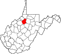
Location in the state of West Virginia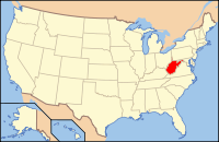
West Virginia's location in the U.S.Founded 1845 Seat West Union Area
- Total
- Land
- Water
320 sq mi (829 km²)
320 sq mi (829 km²)
0 sq mi (0 km²), 0.02%Population
- (2000)
- Density
7,403
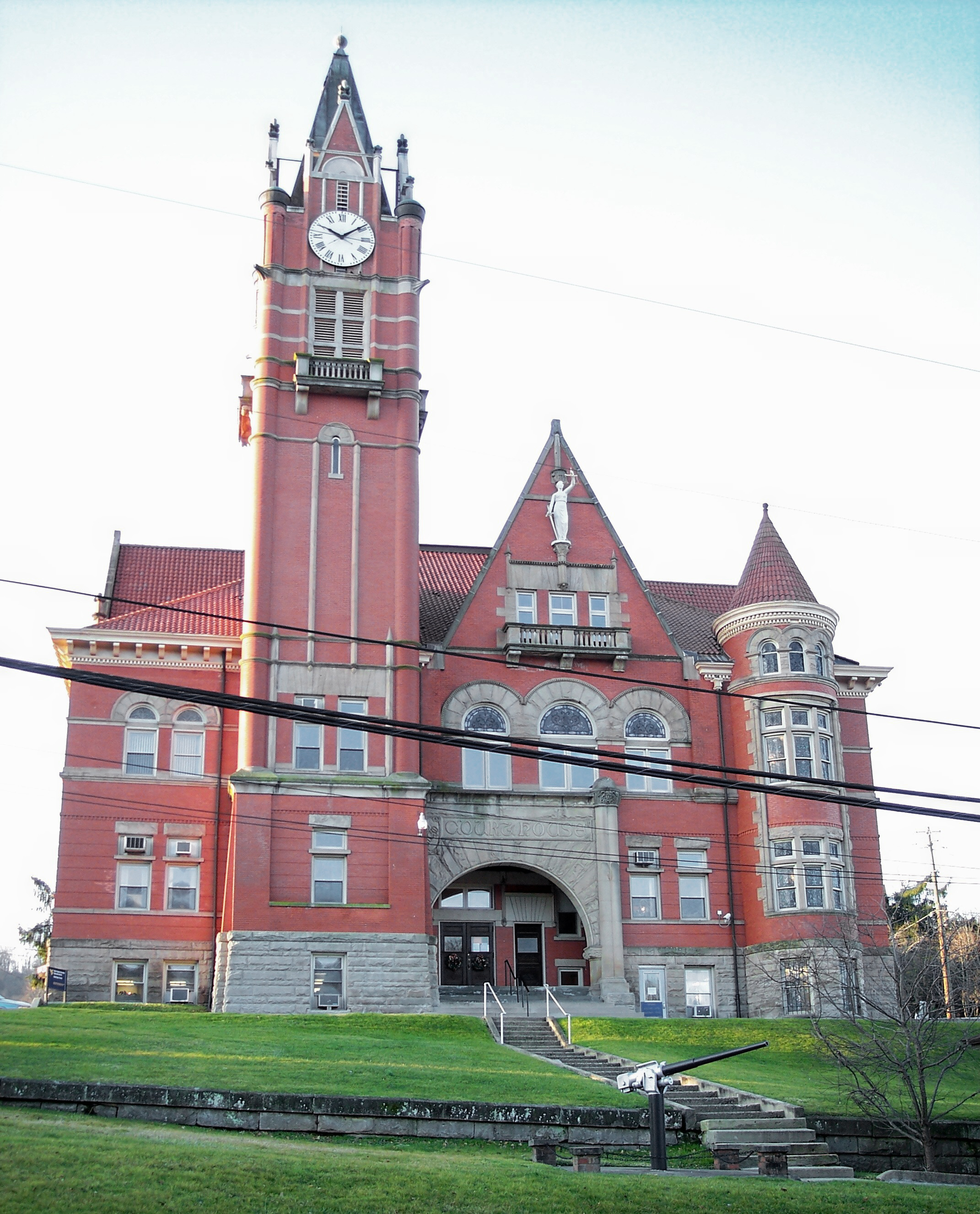
23/sq mi (9/km²)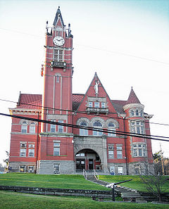 The Doddridge County Courthouse in West Union
Doddridge County is a county located in the U.S. state of West Virginia. As of the 2010 census, the population was 8,202. [1] Its county seat is West Union[1]. Doddridge County was created in 1845 from parts of Harrison, Tyler, Ritchie, and Lewis Counties, and named for Philip Doddridge (1773–1832), a distinguished statesman of Western Virginia, who spent the greater part of his life in Brooke County, West Virginia.
Doddridge County is part of the Clarksburg, WV Micropolitan Statistical Area.
Contents
Geography
According to the U.S. Census Bureau, the county has a total area of 320 square miles (828.8 km2), of which 0.02% is water.
Major highways
 U.S. Highway 50
 West Virginia Route 18
 West Virginia Route 23
Adjacent counties
- Wetzel County (north)
- Harrison County (east)
- Lewis County (southeast)
- Gilmer County (south)
- Ritchie County (west)
- Tyler County (northwest)
Demographics
Historical populations Census Pop. %± 1850 2,750 — 1860 5,203 89.2% 1870 7,076 36.0% 1880 10,552 49.1% 1890 12,183 15.5% 1900 13,689 12.4% 1910 12,672 −7.4% 1920 11,976 −5.5% 1930 10,488 −12.4% 1940 10,923 4.1% 1950 9,026 −17.4% 1960 6,970 −22.8% 1970 6,389 −8.3% 1980 7,433 16.3% 1990 6,994 −5.9% 2000 7,403 5.8% As of the census[2] of 2000, there were 7,403 people, 2,845 households, and 2,102 families residing in the county. The population density was 23 people per square mile (9/km²). There were 3,661 housing units at an average density of 11 per square mile (4/km²). The racial makeup of the county was 98.31% White, 0.27% Black or African American, 0.31% Native American, 0.15% Asian, 0.14% from other races, and 0.82% from two or more races. 0.57% of the population were Hispanic or Latino of any race.
There were 2,845 households out of which 32.50% had children under the age of 18 living with them, 59.30% were married couples living together, 10.30% had a female householder with no husband present, and 26.10% were non-families. 22.50% of all households were made up of individuals and 10.90% had someone living alone who was 65 years of age or older. The average household size was 2.56 and the average family size was 2.98.
In the county, the population was spread out with 25.00% under the age of 18, 8.40% from 18 to 24, 26.60% from 25 to 44, 25.10% from 45 to 64, and 14.80% who were 65 years of age or older. The median age was 39 years. For every 100 females there were 101.90 males. For every 100 females age 18 and over, there were 98.10 males.
The median income for a household in the county was $26,744, and the median income for a family was $30,502. Males had a median income of $26,902 versus $20,250 for females. The per capita income for the county was $13,507. About 15.30% of families and 19.80% of the population were below the poverty line, including 23.00% of those under age 18 and 13.60% of those age 65 or over.
Communities
Town
Other communities
- Center Point
- New Milton
- Smithburg
- Ashley, West Virginia
Notable natives
- Matthew M. Neely, only West Virginian to serve in both houses of the United States Congress and as Governor.
- J. H. Diss DeBar, designed the Great Seal and Coat of Arms of West Virginia.
References
Citations
- ^ "Find a County". National Association of Counties. http://www.naco.org/Counties/Pages/FindACounty.aspx. Retrieved 2011-06-07.
- ^ "American FactFinder". United States Census Bureau. http://factfinder.census.gov. Retrieved 2008-01-31.
Other sources
- Corathers, Lily Smith (1927), History of Nutter's Fork Community; Doddridge County Agricultural Extension Division.
See also
- National Register of Historic Places listings in Doddridge County, West Virginia
- North Bend Rail Trail
External links
- Doddridge County Public Library
- Doddridge County Fair Commission, Inc.
- Doddridge County Community Foundation
- WVGenWeb Doddridge County
- WVU Doddridge County Extension Service

Tyler County Wetzel County Ritchie County 
Harrison County  Doddridge County, West Virginia

Gilmer County Lewis County Municipalities and communities of Doddridge County, West Virginia Town 
Unincorporated
communitiesAshley | Big Isaac | Center Point | Central Station | Duckworth | Greenwood | New Milton | St. Clara | Smithburg | Summers
Categories:- West Virginia counties
- Doddridge County, West Virginia
- 1845 establishments in the United States
- Northwestern Turnpike
- Clarksburg micropolitan area


Wikimedia Foundation. 2010.