- Narrow Water Castle
-
Coordinates: 54°06′53″N 6°16′58″W / 54.1148°N 6.2828°W
 Narrow Water Castle
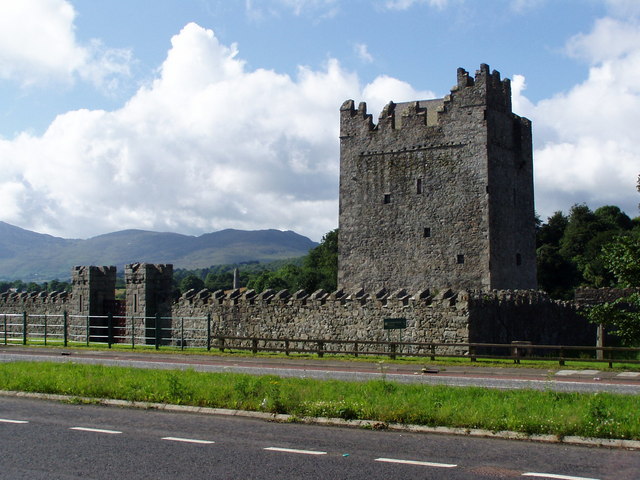
Narrow Water Castle is a famous tower house near Warrenpoint in Northern Ireland, located on the County Down bank of the Clanrye River, which enters Carlingford Lough a mile to the south. Narrow Water Castle was given into state care in 1956 and is one of the finest 16th-century buildings in Ireland.[citation needed] Narrow Water Castle tower house and bawn is a state care historic monument in the townland of Narrow Water, in Newry and Mourne District Council district, at grid ref: J1256 1939.[1]
Contents
History
There has been a keep on this site since 1212. It was originally built to prevent attacks on Newry via the river by Hugh de Lacy, first Earl of Ulster, as part of the Norman fortifications built in the area. The original was destroyed in the 1641 Rebellion.
Built for military purposes during the 1560s, Narrow Water Castle is a typical example of the tower houses erected throughout Ireland from the 14th until the early 17th century. This form of building, normally rectangular in plan and three or more storeys high, comprised a series of superimposed chambers, with stairs, closets and latrines skillfully contrived within the walls (which are 1.5metres or five feet thick in places) or sometimes contained in projecting angle turrets.
Nowadays, cruises past the castle are a regular feature throughout the summer months.
The Troubles
Main article: Warrenpoint ambushOn 27 August 1979, 18 British Army soldiers were killed by a Provisional IRA ambush at Narrow Water Castle. It was the greatest single loss of life for the British Army during The Troubles.[2]
Gallery
-
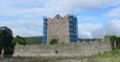
Narrow Water Castle under restoration in 2006
-

Narrow Water Castle
See also
- List of Castles in Northern Ireland
- Warrenpoint ambush
References
- ^ "Narrow Water Castle". Environment and Heritage Service NI - State Care Historic Monuments. http://www.ehsni.gov.uk/state_care_monuments_2007.pdf. Retrieved 2007-12-04.
- ^ "On this day - 27 August". BBC News. 27 August 1979. http://news.bbc.co.uk/onthisday/hi/dates/stories/august/27/newsid_3891000/3891055.stm. Retrieved 2008-04-26.
External links
- Narrow Water Castle Official Site
- Virtual tour of Narrow Water Castle & Keep - Virtual Visit Northern Ireland
- Narrow Water Castle
Categories:- Castles in County Down
-


Wikimedia Foundation. 2010.