- Skagit County, Washington
-
Skagit County, Washington 
Seal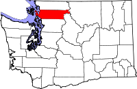
Location in the state of Washington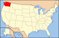
Washington's location in the U.S.Founded November 28, 1883 Seat Mount Vernon Area
- Total
- Land
- Water
1,920 sq mi (4,973 km²)
1,735 sq mi (4,494 km²)
185 sq mi (479 km²), 9.65%Population
- (2010)
- Density
116,901
67/sq mi (26/km²)Website www.skagitcounty.net Skagit County (
 /ˈskædʒɨt/) is a county in the U.S. state of Washington. It is named after the Skagit Indian tribe. As of 2010, the population was 116,901.[1] It is included in the Mount Vernon-Anacortes, Washington, Metropolitan Statistical Area. The county seat is at Mount Vernon, which is also the county's largest city.
Skagit County was formed out of Whatcom County on November 28, 1883.[2]
Contents
Geography
According to the U.S. Census Bureau, the county has a total area of 1,920 square miles (5,000 km2), of which 1,735 square miles (4,490 km2) is land and 185 square miles (480 km2) (9.65%) is water. Also Skagit is a river valley.
Geographic features
 Skagit County Courthouse, Mount Vernon, Washington.
 Majestic Inn, Anacortes, Washington.
 Downtown La Conner, Washington.
 Fir-Conway Lutheran Church.
- Allan Island
- Burrows Island
- Cascade Mountains
- Cypress Island
- Fir Island
- Fidalgo Island
- Guemes Island
- Hart Island
- Hope Island
- Kiket Island
- Pass Island
- Samish Island
- Sauk River
- Sinclair Island
- Skagit Island
- Skagit River
- Vendovi Island
- Mount Buckner, highest point in Skagit County
Major highways
Adjacent counties
- Whatcom County, Washington - north
- Okanogan County, Washington - east
- Chelan County, Washington - southeast
- Snohomish County, Washington - south
- Island County, Washington - southwest
- San Juan County, Washington - west
National protected areas
- Mount Baker-Snoqualmie National Forest (part)
- North Cascades National Park (part)
- Ross Lake National Recreation Area (part)
- Pacific Northwest National Scenic Trail (part)
 Skagit County farmland at the base of the Cascade Mountains, north of Darrington, Washington.
Demographics
Historical populations Census Pop. %± 1890 8,747 — 1900 14,272 63.2% 1910 29,241 104.9% 1920 33,373 14.1% 1930 35,142 5.3% 1940 37,650 7.1% 1950 43,273 14.9% 1960 51,350 18.7% 1970 52,381 2.0% 1980 64,138 22.4% 1990 79,555 24.0% 2000 102,979 29.4% 2010 116,901 13.5% As of the census[3] of 2000, there were 102,979 people, 38,852 households, and 27,351 families residing in the county. The population density was 59 people per square mile (23/km²). There were 42,681 housing units at an average density of 25 per square mile (10/km²). The racial makeup of the county was 86.49% White, 0.44% Black or African American, 1.85% Native American, 1.49% Asian, 0.16% Pacific Islander, 7.17% from other races, and 2.40% from two or more races. 11.20% of the population were Hispanic or Latino of any race. 13.9% were of German, 11.2% English, 9.2% Norwegian, 8.2% Irish and 6.7% United States or American ancestry according to Census 2000.
There were 38,852 households out of which 32.80% had children under the age of 18 living with them, 56.60% were married couples living together, 9.70% had a female householder with no husband present, and 29.60% were non-families. 23.30% of all households were made up of individuals and 10.00% had someone living alone who was 65 years of age or older. The average household size was 2.60 and the average family size was 3.06.
In the county, the population was spread out with 26.30% under the age of 18, 8.60% from 18 to 24, 26.90% from 25 to 44, 23.60% from 45 to 64, and 14.60% who were 65 years of age or older. The median age was 37 years. For every 100 females there were 98.00 males. For every 100 females age 18 and over, there were 95.70 males.
The median income for a household in the county was $42,381, and the median income for a family was $48,347. Males had a median income of $37,207 versus $26,123 for females. The per capita income for the county was $21,256. About 7.90% of families and 11.10% of the population were below the poverty line, including 13.50% of those under age 18 and 6.80% of those age 65 or over.
Government
Skagit County's government is headed by three commissioners, in the system laid out in the state constitution for all counties without charters. Commissioners are "nominated" in the primary by their district, but then are elected in the general by a county-wide vote. Commissioners are therefore said to represent the entire county, not just their district.
The current Skagit County commissioners include Sharon Dillon, a Democrat from District 3, which encompasses Burlington east of Interstate 5, Sedro-Woolley, and the rest of eastern Skagit County; Ken Dahlstedt, a Democrat from District 2, which covers Mount Vernon, Conway, and south county; and Ron Wesen, a Republican from District 1, which includes Anacortes, La Conner, and that area of the county west of Interstate 5 and north of McLean Road.
County conservation efforts
In 2006, the Skagit County Marine Resources Committee commissioned a study to evaluate establishing one or more no-take marine reserves to protect rockfish and other groundfish from overfishing.[4]
Transportation
Skagit Transit provides bus service in Skagit County. It also provides connections to Everett, Bellingham, Whidbey Island and Camano Island. Skagit Transit also operates the Guemes Island ferry linking Anacortes, Washington to Guemes Island.
Incorporated cities and towns
Census-recognized communities
Other communities
- Allen
- Avon
- Birdsview
- Big Rock
- Bow
- Blanchard
- Cedardale
- Day Creek
- Dewey Beach
- Fidalgo
- Fir
- Fishtown
- Guemes Island
- Hickson
- Hoogdal
- Milltown
- Padilla
- Punkin Center
- Rexville
- Samish Island
- Similk Beach
- Summit Park
- Urban
- Whitney
Ghost Towns
- Skagit City
Reservations
- Swinomish Indian Reservation
- Upper Skagit Indian Reservation
See also
References
- ^ "U.S. Census Bureau Delivers Washington's 2010 Census Population Totals, Including First Look at Race and Hispanic Origin Data for Legislative Redistricting" (.xls). U.S. Census Bureau. 2011-02-23. http://www.census.gov/newsroom/releases/archives/2010_census/cb11-cn45.html. Retrieved 2011-03-27.
- ^ "Milestones for Washington State History — Part 2: 1851 to 1900". HistoryLink.org. March 6, 2003. http://www.historylink.org/essays/output.cfm?file_id=5380.
- ^ "American FactFinder". United States Census Bureau. http://factfinder.census.gov. Retrieved 2008-01-31.
- ^ Valz, JH; Dinnel, PA (2007). "Bottomfish Variability in the Proposed Marine Reserves of Skagit County, Washington.". In: NW Pollock and JM Godfrey (Eds.) The Diving for Science…2007, Proceedings of the American Academy of Underwater Sciences, Twenty-sixth annual Scientific Diving Symposium, University of Miami, Miami, FL.. http://archive.rubicon-foundation.org/6986. Retrieved 2009-03-24.
- Skagit County, Washington United States Census Bureau
External links

Whatcom County San Juan County 
Okanogan County  Skagit County, Washington

Island County Snohomish County Chelan County Municipalities and communities of Skagit County, Washington Cities 
Towns CDPs Alger | Bay View | Big Lake | Clear Lake | Conway | Edison | Lake Cavanaugh | Lake McMurray | Marblemount | Rockport
Unincorporated
communitiesAvon | Bow | Samish Island
Indian reservations Seattle metropolitan area Central cities Outer cities Central counties Outer counties Categories:- Washington (state) counties
- Skagit County, Washington
- 1883 establishments in the United States
- Populated places established in 1883
- North Cascades of Washington (state)


Wikimedia Foundation. 2010.