- Okanogan County, Washington
-
This article is about the region in the United States. For other uses of the term, see Okanogan.
Okanogan County, Washington 
Seal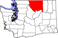
Location in the state of Washington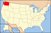
Washington's location in the U.S.Founded February 22, 1888[1] Seat Okanogan Area
- Total
- Land
- Water
5,315 sq mi (13,766 km²)
5,268 sq mi (13,644 km²)
47 sq mi (122 km²), 0.89%Population
- (2010)
- Density
41,120
8/sq mi (3/km²)Website okanogancounty.org Okanogan County (
 /ˌoʊkəˈnɒɡən/) is a county located in the U.S. state of Washington. In area, it is the largest county in the state.[2] As of 2010, the population was 41,120. The county seat is at Okanogan, and its largest city is Omak. The first county seat was Ruby, Washington, which has now been a ghost town for more than 100 years.
The name derives from the Okanagan language place name ukʷnaqín.[3] The name Okanogan (Okanagan) also refers to the region that also encompasses part of southern British Columbia.
Okanogan County was formed out of Stevens County on February 2, 1888.[1]
Contents
Geography
According to the U.S. Census Bureau, the county has a total area of 5,315 square miles (13,770 km2), of which 5,268 square miles (13,640 km2) is land and 47 square miles (120 km2) (0.89%) is water.
Geographic features
- Cascade Mountains
- Columbia River
- Okanogan River
- North Gardner Mountain, the highest point in Okanogan County
Major highways
Adjacent counties
- Ferry County, Washington - east
- Lincoln County, Washington - southeast
- Grant County, Washington - south
- Douglas County, Washington - south
- Chelan County, Washington - southwest
- Skagit County, Washington - west
- Whatcom County, Washington - west
It also shares its northern border with British Columbia, Canada.
- Okanagan-Similkameen Regional District, British Columbia
- Kootenay Boundary Regional District, British Columbia
National protected areas
- Pacific Northwest National Scenic Trail (part)
- Nez Perce National Historical Park (part)
- Okanogan National Forest
Demographics
Historical populations Census Pop. %± 1890 1,467 — 1900 4,689 219.6% 1910 12,887 174.8% 1920 17,094 32.6% 1930 18,519 8.3% 1940 24,546 32.5% 1950 29,131 18.7% 1960 25,520 −12.4% 1970 25,867 1.4% 1980 30,639 18.4% 1990 33,350 8.8% 2000 39,564 18.6% 2010 41,120 3.9% As of the census[4] of 2000, there were 39,564 people, 15,027 households, and 10,579 families residing in the county. The population density was 8 people per square mile (3/km²). There were 19,085 housing units at an average density of 4 per square mile (1/km²). The racial makeup of the county was 75.32% White, 0.28% Black or African American, 11.47% Native American, 0.44% Asian, 0.07% Pacific Islander, 9.58% from other races, and 2.84% from two or more races. 14.38% of the population were Hispanic or Latino of any race. 14.0% were of German, 9.5% English, 9.2% United States or American and 6.8% Irish ancestry according to Census 2000.
There were 15,027 households out of which 33.20% had children under the age of 18 living with them, 54.40% were married couples living together, 11.00% had a female householder with no husband present, and 29.60% were non-families. 24.50% of all households were made up of individuals and 9.70% had someone living alone who was 65 years of age or older. The average household size was 2.58 and the average family size was 3.04.
In the county, the population was spread out with 27.70% under the age of 18, 7.30% from 18 to 24, 25.50% from 25 to 44, 25.50% from 45 to 64, and 14.00% who were 65 years of age or older. The median age was 38 years. For every 100 females there were 99.20 males. For every 100 females age 18 and over, there were 98.00 males.
The median income for a household in the county was $29,726, and the median income for a family was $35,012. Males had a median income of $29,495 versus $22,005 for females. The per capita income for the county was $14,900. About 16.00% of families and 21.30% of the population were below the poverty line, including 28.20% of those under age 18 and 10.40% of those age 65 or over.
Census-recognized communities
- Brewster
- Conconully
- Coulee Dam (partial)
- Elmer City
- Nespelem
- Nespelem Community
- North Omak
- Okanogan
- Omak
- Oroville
- Pateros
- Riverside
- Tonasket
- Twisp
- Winthrop
Other communities
- Aeneas
- Azwell
- Carlton
- Ellisford (aka Ellisforde)
- Havillah
- Loomis
- Malott
- Mason City
- Mazama
- Methow
- Monse
- Nighthawk
- Rocky Butte
- Synarep
- Wauconda
Ghost Towns
See also
Further reading
- An illustrated history of Stevens, Ferry, Okanogan and Chelan counties, State of Washington. Western Historical Pub. Co.. 1904.Available online through the Washington State Library's Classics in Washington History collection
References
- ^ a b "Washington State Archives - Central Regional Branch: Guide to Holdings: Okanogan County". http://www.cwu.edu/~archives/okn.htm#32400000. Retrieved 2007-12-31.
- ^ Wilma, David (January 21, 2006). "Okanogan County — Thumbnail History". HistoryLink.org. http://www.historylink.org/essays/output.cfm?file_id=7608.
- ^ Bright, William (2004). Native American placenames of the United States. University of Oklahoma Press. p. 346. ISBN 978-0-8061-3598-4. http://books.google.com/books?id=5XfxzCm1qa4C&pg=PA346. Retrieved 16 September 2011.
- ^ "American FactFinder". United States Census Bureau. http://factfinder.census.gov. Retrieved 2008-01-31.

Okanagan-Similkameen Regional District, British Columbia, Canada and Kootenay Boundary Regional District, British Columbia, Canada Whatcom County and Skagit County 
Ferry County  Okanogan County, Washington

Chelan County Douglas County and Grant County Lincoln County Municipalities and communities of Okanogan County, Washington Cities 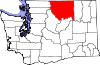
Towns Conconully | Coulee Dam ‡ | Elmer City | Nespelem | Riverside | Twisp | Winthrop
CDPs Unincorporated
communitiesIndian reservation Ghost towns Footnotes ‡This populated place also has portions in an adjacent county or counties
Categories:- Washington (state) counties
- Divided regions
- Okanogan County, Washington
- 1888 establishments


Wikimedia Foundation. 2010.