- Dundurn Street (Hamilton, Ontario)
-
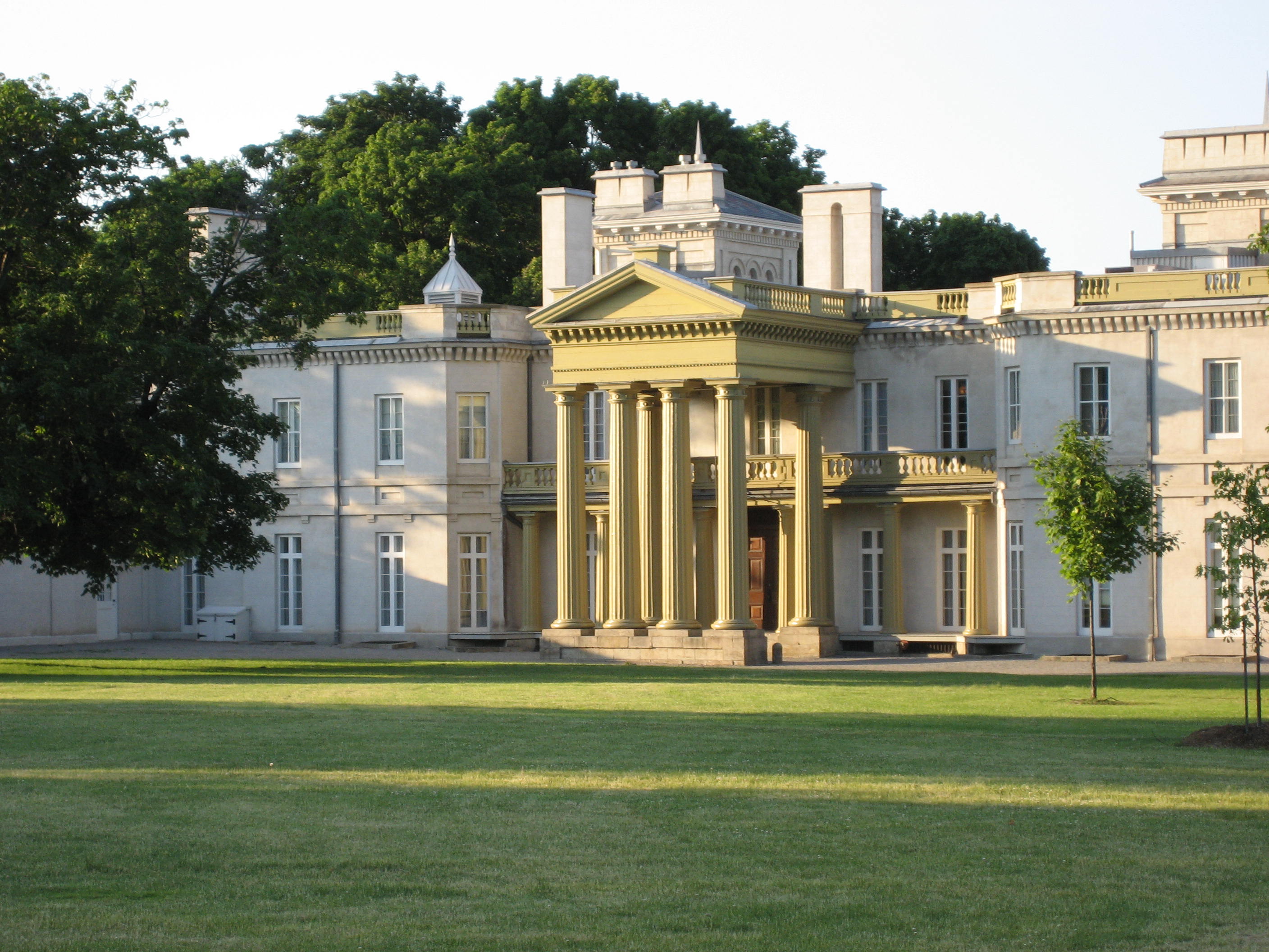
 Dundurn Castle at Dundurn Park. (Summer)
 See also: List of streets in Hamilton, Ontario
Dundurn Street, is a Lower City arterial road in Hamilton, Ontario, Canada. It is a two-way street that starts off at Mountain Face Park, Niagara Escarpment in front of the Bruce Trail as a collector road, right behind Hillcrest Avenue and then turns into a four lane thoroughfare from Aberdeen Avenue northward to York Boulevard where it ends in front of Dundurn Park.
The section of Dundurn Street north of Main Street was designated as part of Highway 2, until January 1, 1998.
Contents
History
 Dundurn Street South neighbourhood
 Dundurn Park, "Mystery building"
Dundurn Street, originated with Sir Allan MacNab who named his home Dundurn Castle and its landscaped grounds Dundurn Park. Originally Dundurn Street, South of King Street West was known as Garth Street up to 1913. Dundurn is a Gaelic word meaning "the fort on the water." [1] (sic - This is a persistent incorrect translation perpetuated in many historical works about Dundurn Castle. The original source of the error is not known. Dundurn actually derives from the Gaelic words dùn meaning "hill fort" and dòrn meaning "fist", thus Dundurn means "hill fort of a fist". It is named after Sir Allan MacNab's ancestral family home in Dundurn, Perthshire, Scotland, just east of Loch Earn, which was the site of an ancient Pictish hill fort named Dùn Dòrn. So named because the hill upon which it sat is shaped like a fist. There are many Gaelic words referring to water, none of which resembles the place name element durn. The erroneous translation "fort on the water" likely derives from a confusion with the Scots word burn, which means "creek" and is not a Gaelic word at all. - citation to be added shortly) Originally, Dundurn Street was called Garth Street. [2]
The Hamilton Military Museum opened in 1976 and is situated inside Dundurn Park adjacent to Dundurn Castle. It tells the story of the service given by citizens of the Hamilton area from the time of the American Revolution to World War II. [3]
The "Mystery building" at Dundurn Park, just east of Dundurn Castle, was a puzzle for many years. Historians felt it may have been a theatre, a laundry, a boat-house, an office or a chapel for Sir Allan's Roman Catholic wife. Urban legend has it that many under ground tunnels were built leading from the Castle to various parts of the estate and one of the entrance ways was through the "Mystery building." The "mystery" was finally solved during a restoration project. It was discovered that the building was built as a cockpit so MacNab's guests could amuse themselves watching cock fights. Since then it has been used as a theatre and for wedding parties.[4]
Le Centre français Hamilton has been pursuing plans to make the 70-seat Staircase Cafe Theatre[5] on Dundurn Street North into a Francophone cultural centre. The Staircase originally was opened by Hugh MacLeod in 1998 and closed down in the summer of 2006. It is scheduled to re-open in the spring of 2007. The Staircase evolved and expanded from an improvisational comedy workshop to include an artist's gallery, a cafe, a theatre for film and live acts, and a rehearsal space. A former variety store next door was also acquired. It will also be hosting a Francophone Film Festival in early spring 2007.[6]
Bruce Trail
One can reach the Bruce Trail via the stairway on Dundurn Street South. The trail cuts through the city along the Niagara Escarpment (mountain) and used by many locals for a full days hike. The Trail is 430 miles long and starts at Niagara Falls, passes through Hamilton and ends at the Bruce Peninsula. Hikers are lead to scenic gorges, hidden waterfalls and places of quiet charm.
Landmarks
 Dundurn Park
 Chedoke Falls
Note: Listing of Landmarks from North to South.
- Dundurn Park
- Dundurn Park "Mystery building"
- Dundurn Castle & Military Museum
- (Just east of Dundurn Castle near Castle Dean at Locke Street north is original burial spot of Sir Allan Napier MacNab)
- The Admiral Inn (Hotel)
- Staircase Cafe Theatre
- Dundurn Plaza (shopping)
- TV Hamilton- Cable 14, building [1]
- Jackson Playground
- Canadian Pacific Railway overpass
- Hill Street Park
- First Unitarian Church
- (M.A.D.) Music Art Drama- Creative Arts School
- Highland Gardens Park, (off of Hillcrest Avenue)
- Mountain Face Park
- Dundurn Street Stairway (Mountain-access), 326 steps [7]
- Chedoke Rail Trail (abandoned railway path)
- Bruce Trail, westward the trail leads to Chedoke Beddoe Civic Golf Course & Chedoke Winter Sports Park, the site of a Ski hill and as well many waterfalls which are listed below. Eastward the trail leads to Highland Gardens Park.
- Chedoke Falls
- Denlow Falls
- Cliffview Falls
- Westcliffe Falls
- Niagara Escarpment ("mountain")
Communities
Note: Listing of neighbourhoods from North to South [8]
- Strathcona
- Kirkendall North
- Kirkendall South
Major roads that cross Dundurn Street
Note: Listing of streets from North to South.
- York Boulevard - One way street (Eastbound Only)
- King Street West - One way street (Westbound Only)
- Main Street West - One way street (Eastbound Only)
- Charlton Avenue West - One way street (Westbound Only)
- Aberdeen Avenue
Roads that are parallel with Dundurn Street
Note: Listing of streets from West to East.
- Longwood Road, North, South
 Chedoke Parkway
- Dundurn Street, North, South
- Locke Street, North, South
- Queen Street, North, South
- Hess Street, North, South
- Bay Street, North, South
- MacNab Street, North, South
- James Street, North, South
- Hughson Street, North, South
- John Street, North, South
- Catharine Street, North, South
- Ferguson Avenue, North, South
Images
-

Chedoke Rail Trail
-

Dundurn Street South, Mountain-access stairway
-

Chedoke Civic Golf Course can be reached via the Bruce Trail, West of Dundurn Street South
References
- ^ Houghton, Margaret (2002). Hamilton Street Names: An Illustrated Guide. James Lorimer & Co. Ltd.. ISBN 1-55028-773-7.
- ^ Manson, Bill (2003). Footsteps In Time: Exploring Hamilton's heritage neighbourhoods. North Shore Publishing Inc. ISBN 1-896899-22-6.
- ^ "Hamilton Military Museum (www.myhamilton.ca)". Archived from the original on 2007-04-03. http://web.archive.org/web/20070403101122/http://www.myhamilton.ca/myhamilton/CityandGovernment/CultureandRecreation/Arts_Culture_And_Museums/HamiltonCivicMuseums/MilitaryMuseum/index.htm. Retrieved 2007-04-21.
- ^ Watson, Milton (1938). Saga of a City. The Hamilton Spectator.
- ^ "The Staircase Cafe Theatre". http://www.staircase.org/. Retrieved 2007-04-03.
- ^ Foley, Doug (2007-01-16). "Vive The Staircase Theatre". The Hamilton Spectator. pp. Go 10.
- ^ Toffoletti, Paul (2007-04-16). "Seven steps to correct Mountain stairs myths". The Hamilton Spectator.
- ^ "Hamilton Neighbourhood Boundaries, (map.hamilton.ca)". Archived from the original on 2007-09-27. http://web.archive.org/web/20070927235056/http://map.hamilton.ca/Static/PDFs/General+Interest+maps/Overall+City/NeighbourhoodBoundaries.pdf. Retrieved 2007-05-11.
- MapArt Golden Horseshoe Atlas - Page 647 - Grids F10, G10, H10, J10
External links
- Kirkendall.ca (Kirkendall neighbourhood)
- Niagara Escarpment Commission (NEC) Official web site
- Google Maps: Dundurn Street (Hybrid)
Roads and streets in Hamilton, Ontario Lower City Arteries
(Primary)Aberdeen • Barton • Bay • Burlington • Centennial • Cootes • Dundurn • Gage • James • John • Kenilworth • King (Hamilton) • King (Dundas) • Main • Ottawa • Parkdale • Queen • Queenston • Victoria • Wellington • Wentworth • Woodward • YorkLower City Collectors
(Secondary)Mountain-access roads Beckett Drive • Claremont Access • Highway 20 • Highway 403 • James Street Access • Jolley Cut/ Arkledun Ave. • Kenilworth Access • Mount Albion • Red Hill Valley Parkway • Sherman Access • Upper Centennial ParkwayUpper City Arteries Concession • Fennell • Garth • Mohawk • Mountain Brow • Mud • Rymal • Stone Church • Upper Gage • Upper James • Upper Kenilworth • Upper Ottawa • Upper Paradise • Upper Sherman • Upper Wentworth • Upper Wellington • West 5th • Wilson (Ancaster)Upper City Collectors Municipal Expressways: Burlington • The Linc • Red Hill ValleyProvincial Highways Former Provincial Highways Numbered City Roads
(Formerly Regional Roads)5 • 8 • 20 • 56 • 65 • 97 • 99Former Numbered
Regional Roads2 • 52 • 53 • 203 • 216 • 222 • 223 • 243 • 248 • 253 • 260 • 299 • 305 • 330 • 331 • 341 • 344 • 364 • 399 • 411 • 412 • 424 • 425 • 430 • 434 • 445 • 450 • 455 • 458 • 501 • 503 • 508 • 528 • 535 • 551 • 597 • 610 • 613 • 614 • 622 • 626 • 633 • 634 • 637 • 639 • 640Roads in Ontario  Bike and Hiking Trails in CanadaBruce Trail • Canol Heritage Trail • Chilkoot Trail • Confederation Trail • Cycloparc PPJ • East Coast Trail • Galloping Goose Regional Trail • International Appalachian Trail • Iron Horse Trail • La Cloche Silhouette Trail • Mantario Trail • Nipissing-North Arm Orienteering Trail • North Coast Trail • Oak Ridges Trail • P'tit Train du Nord • Rideau Trail • Route Verte • Trans Canada Trail • Waskahegan Trail • Waterfront Trail • West Coast Trail • WildsideCategories:
- Roads in Hamilton, Ontario


Wikimedia Foundation. 2010.