- Island County, Washington
-
- This article is about the specific place. For the similarly named article with different information, see County island.
Island County, Washington 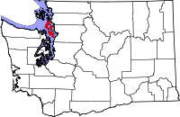
Location in the state of Washington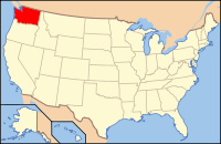
Washington's location in the U.S.Founded January 6, 1853 Seat Coupeville Area
- Total
- Land
- Water
517 sq mi (1,339 km²)
208 sq mi (539 km²)
309 sq mi (800 km²), 59.71%Population
- (2010)
- Density
78,506
377/sq mi (145.6/km²)Website www.islandcounty.net Island County is a county located in the U.S. state of Washington. In 2010 census, its population was 78,506. Its county seat is Coupeville, while its largest city is Oak Harbor.
Its name reflects the fact that it consists of two large islands, Whidbey and Camano, and seven smaller islands (Baby, Ben Ure, Deception, Kalamut, Minor, Smith, and Strawberry). Island County was created out of Thurston County on December 22, 1852, by the legislature of Oregon Territory,[1] and is the eighth-oldest county in Washington. It originally encompassed what are now Snohomish, Skagit, Whatcom, and San Juan Counties.
Contents
Geography
According to the U.S. Census Bureau, the county has a total area of 517 square miles (1,339.0 km2), of which 208 square miles (538.7 km2) is land and 309 square miles (800.3 km2) (59.71%) is water.
Geographic features
Adjacent counties
- Snohomish County, Washington - east
- Kitsap County, Washington - southwest
- Jefferson County, Washington - west
- San Juan County, Washington - northwest
- Skagit County, Washington - north
National protected areas
- Pacific Northwest National Scenic Trail (part)
- Ebey's Landing National Historical Reserve
Demographics
 Sunset South Whidbey State Park
Historical populations Census Pop. %± 1860 294 — 1870 626 112.9% 1880 1,087 73.6% 1890 1,787 64.4% 1900 1,870 4.6% 1910 4,704 151.6% 1920 5,489 16.7% 1930 5,369 −2.2% 1940 6,098 13.6% 1950 11,079 81.7% 1960 19,638 77.3% 1970 27,011 37.5% 1980 44,048 63.1% 1990 60,195 36.7% 2000 71,558 18.9% 2010 78,506 9.7% As of the census[2] of 2000, there were 71,558 people, 27,784 households, and 20,254 families residing in the county. The population density was 343 people per square mile (133/km²). There were 32,378 housing units at an average density of 155 per square mile (60/km²). The racial makeup of the county was 87.17% White, 2.36% Black or African American, 0.97% Native American, 4.19% Asian, 0.44% Pacific Islander, 1.43% from other races, and 3.44% from two or more races. 3.97% of the population were Hispanic or Latino of any race. 16.2% were of German, 11.2% English, 9.9% Irish, 7.2% United States or American and 6.0% Norwegian ancestry according to Census 2000. 92.5% spoke English, 2.5% Spanish and 2.2% Tagalog as their first language.
There were 27,784 households out of which 33.30% had children under the age of 18 living with them, 62.20% were married couples living together, 7.80% had a female householder with no husband present, and 27.10% were non-families. 21.50% of all households were made up of individuals and 8.30% had someone living alone who was 65 years of age or older. The average household size was 2.52 and the average family size was 2.93.
In the county, the population was spread out with 25.50% under the age of 18, 8.50% from 18 to 24, 28.00% from 25 to 44, 23.70% from 45 to 64, and 14.30% who were 65 years of age or older. The median age was 37 years. For every 100 females there were 100.40 males. For every 100 females age 18 and over, there were 97.90 males.
The median income for a household in the county was $45,513, and the median income for a family was $51,363. Males had a median income of $35,331 versus $25,612 for females. The per capita income for the county was $21,472. About 5.10% of families and 7.00% of the population were below the poverty line, including 8.80% of those under age 18 and 4.40% of those age 65 or over.
Transportation
The primary islands of Island County, Whidbey Island and Camano Island are served by a total of 3 Washington State Routes, those being SR 20 and SR 525, on Whidbey Island, and SR 532 on Camano Island. SR 20 enters Island County via the Port Townsend-Coupeville (Keystone) ferry route from the West, and departs via the Deception Pass Bridge in the North. SR 525 enters Island County from the East/South via the Mukilteo-Clinton ferry and terminates at an intersection with SR 20, South of Coupeville. SR 532 begins on Camano Island, just a few hundred yards inside Island County at an intersection with Sunrise Boulevard and departs Island County to the East via the Mark Clark Bridge. These islands are also served by a fare-free/pre-paid bus service called Island Transit.
Politics
Island County is divided in many ways between its north and south. While the north (Oak Harbor) is conservative - George W. Bush received almost 65 percent of the 2004 vote and carried all precincts - all southern and central precincts voted for John Kerry. This is probably accounted for by the presence of Naval Air Station Whidbey Island, located north of Oak Harbor. The south-central area (Coupeville, Langley) voted over 60 percent for Kerry. Camano Island has a Republican lean and went for Bush with 52 percent of the vote in 2004, but is much less polarized than the rest of the county.
Notable natives and current or former residents
Athletes
- Joel Kortus, basketball player at the University of Nebraska
Businessmen, Professionals and Entrepreneurs
- Craig Platt, eminent criminal defense lawyer and senior partner of the Seattle based law firm Platt & Buescher.
Communities
Incorporated cities and towns
Census-designated places (CDPs)
- Ault Field (Proper name for Naval Air Station Whidbey Island)
- Camano
- Clinton
- Freeland
Other communities
- Admirals Cove
- Arrow Head Beach
- Austin
- Baby Island Heights
- Bayview
- Bells Beach
- Beverly Beach
- Cama Beach
- Camp Grande
- Camp Lagoon
- Cavelero Beach
- Columbia Beach
- Cornell
- Glendale
- Greenbank
- Indian Beach
- Keystone
- Lona Beach
- Mabana
- Madrona Beach
- Maxwelton
- Mountain View Beach
- Pebble Beach
- Penn Cove Park
- Possession
- Prairie Center (area located within the southern section of the town of Coupeville)
- Rodena Beach
- San De Fuca
- Saratoga
- Smith Prairie
- Sunlight Beach
- Sunny Shore Acres
- Sunset Beach
- Terrys Corner
- Tyee Beach
- Utsalady
- Woodland Beach
See also
References
- ^ Reinartz, Kay. "History of King County Government 1853–2002". p. 2. http://www.metrokc.gov/kc150/historical%20overview.pdf. Retrieved 2007-12-30.
- ^ "American FactFinder". United States Census Bureau. http://factfinder.census.gov. Retrieved 2008-01-31.
External links
- County Website
- Island Transit (free public transportation in Island County)
- Official Island County Tourism Website (free maps, guides and event calendar. Stories, photos, videos about things to do on Whidbey and Camano Islands, Island County)

San Juan County Skagit County Jefferson County 
Snohomish County  Island County, Washington

Kitsap County Municipalities and communities of Island County, Washington Cities 
Town CDPs Ault Field | Camano | Clinton | Freeland
Unincorporated
communitiesBaby Island Heights | Bayview | Keystone | Greenbank | Maxwelton | San de Fuca | Utsalady
Seattle metropolitan area Central cities Outer cities Central counties Outer counties Categories:- Washington (state) counties
- Seattle metropolitan area
- Island County, Washington
- 1853 establishments in the United States


Wikimedia Foundation. 2010.