- Clallam County, Washington
-
Clallam County, Washington 
Seal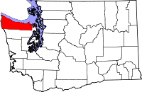
Location in the state of Washington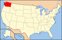
Washington's location in the U.S.Founded April 26, 1854 Seat Port Angeles Area
- Total
- Land
- Water
2,670 sq mi (6,915 km²)
1,739 sq mi (4,504 km²)
931 sq mi (2,411 km²), 34.86%Population
- (2010)
- Density
71,404
41/sq mi (15.8/km²)Website www.clallam.net Clallam County is a county in the U.S. state of Washington. As of 2010, the population was 71,404. The county seat is at Port Angeles, which is also the county's largest city. The name is a Klallam word for "the strong people."
Clallam County was formed on April 26, 1854.[1]
Contents
Geography
According to the U.S. Census Bureau, the county has a total area of 2,670 square miles (6,915.3 km2), of which 1,739 square miles (4,504.0 km2) is land and 931 square miles (2,411.3 km2) (34.86%) is water.
Located in Clallam County is Cape Alava, the westernmost point in both Washington and the continental United States, with a longitude of 124 degrees, 43 minutes and 59 seconds. Also, near Cape Alava is Ozette, the westernmost town in the continental United States (See Extreme Points for more information).
Geographic features
- Mount Angeles
- Cape Flattery
- Clallam River
- Dungeness Spit
- Elwha River
- Hoh River
- Hoko River
- Hood Canal
- Lake Crescent
- Lake Ozette
- Lyre River
- Pacific Ocean
- Pysht River
- Seven Lakes Basin
- Sol Duc Hot Springs
- Sol Duc River
- Strait of Juan de Fuca
- Tatoosh Island
- Waadah Island
Major highways
Adjacent counties
- Jefferson County, Washington - south, east
- Capital Regional District, British Columbia - north, across the Strait of Juan de Fuca
- Cowichan Valley Regional District, British Columbia - northwest, across the Strait of Juan de Fuca
National protected areas
- Pacific Northwest National Scenic Trail (part)
- Dungeness National Wildlife Refuge
- Flattery Rocks National Wildlife Refuge
- Olympic National Forest (part)
- Olympic National Park (part)
- Quillayute Needles National Wildlife Refuge (part)
Demographics
Historical populations Census Pop. %± 1860 149 — 1870 408 173.8% 1880 638 56.4% 1890 2,771 334.3% 1900 5,603 102.2% 1910 6,755 20.6% 1920 11,368 68.3% 1930 20,449 79.9% 1940 21,848 6.8% 1950 26,396 20.8% 1960 30,022 13.7% 1970 34,770 15.8% 1980 51,648 48.5% 1990 56,464 9.3% 2000 64,525 14.3% 2010 71,404 10.7% As of the census[2] of 2000, there were 64,525 people, 27,164 households, and 18,064 families residing in the county. The population density was 37 people per square mile (14/km²). There were 30,683 housing units at an average density of 18 per square mile (7/km²). The racial makeup of the county was 89.12% White, 0.84% Black or African American, 5.12% Native American, 1.13% Asian, 0.16% Pacific Islander, 1.18% from other races, and 2.44% from two or more races. 3.41% of the population were Hispanic or Latino of any race. 17.2% were of German, 13.1% English, 9.3% Irish, 8.3% United States or American and 6.0% Norwegian ancestry according to Census 2000. 95% spoke English and 3.2% Spanish as their first language.
There were 27,164 households out of which 25.70% had children under the age of 18 living with them, 53.90% were married couples living together, 9.00% had a female householder with no husband present, and 33.50% were non-families. 28.10% of all households were made up of individuals and 13.40% had someone living alone who was 65 years of age or older. The average household size was 2.31 and the average family size was 2.78.
In the county, the population was spread out with 22.00% under the age of 18, 7.10% from 18 to 24, 22.80% from 25 to 44, 26.90% from 45 to 64, and 21.30% who were 65 years of age or older. The median age was 44 years. For every 100 females there were 98.70 males. For every 100 females age 18 and over, there were 96.60 males.
The median income for a household in the county was $36,449, and the median income for a family was $44,381. Males had a median income of $35,452 versus $24,628 for females. The per capita income for the county was $19,517. About 8.90% of families and 12.50% of the population were below the poverty line, including 17.10% of those under age 18 and 6.80% of those age 65 or over.
Politics
Modern Clallam County is generally regarded as a competitive area politically. In the 2008 presidential election, Democrat Barack Obama narrowly won the county with 50.5% of the vote, compared to 47.2% for Republican candidate John McCain. However, Republican George W. Bush carried Clallam twice, defeating John Kerry by 51.3% to 46.3% in 2004, and Al Gore by 50.4% to 42.7% in 2000 (although Bush lost Washington as a whole both times). Clallam County is a bellwether, voting for the nationwide winning candidate in every presidential election from 1980 onward.[3]
Democratic candidates are generally most successful in the county seat and largest city, Port Angeles, which casts a significant number of votes. The city of Sequim and its general vicinity (excepting newer developments such as Bell Hill which tend to be Republican) is generally considered a battleground area. The Forks area is generally Republican, with the exception of Native American areas. The Makah tribe areas around Neah Bay are some of the most Democratic areas in the state. Otherwise, with the exception of a few locations (such as Blyn and Jamestown near Sequim), unincorporated Clallam County has a strong Republican lean.
Census-recognized communities
Other communities
- Agate Beach
- Agnew
- Beaver
- Bogachiel
- Clallam Bay
- Crane
- Diamond Point
- Dungeness
- Elwha
- Fairholm
- Hoko
- Joyce
- La Push
- Maple Grove
- Mora
- Mount Pleasant
- Ozette
- Pysht
- Piedmont
- Sappho
- Schoolhouse Point
- Sekiu
- Upper Hoh
See also
References
- ^ "Milestones for Washington State History — Part 2: 1851 to 1900". HistoryLink.org. 2003-03-06. http://www.historylink.org/essays/output.cfm?file_id=5380.
- ^ "American FactFinder". United States Census Bureau. http://factfinder.census.gov. Retrieved 2008-01-31.
- ^ "David Leip's Atlas of Presidential Elections". David Leip. 2009-10-28. http://uselectionatlas.org/RESULTS.
External links
- North Olympic Library System
- Clallam County - Thumbnail History
- University of Washington Libraries Digital Collections – The Pacific Northwest Olympic Peninsula Community Museum A web-based museum showcasing aspects of the rich history and culture of Washington State's Olympic Peninsula communities. Features cultural exhibits, curriculum packets and a searchable archive of over 12,000 items that includes historical photographs, audio recordings, videos, maps, diaries, reports and other documents.
- Clallam County Official website for Clallam County government

Strait of Juan de Fuca Pacific Ocean 
Jefferson County  Clallam County, Washington

Jefferson County Municipalities and communities of Clallam County, Washington Cities Forks | Port Angeles | Sequim

CDPs Bell Hill | Blyn | Carlsborg | Neah Bay | Port Angeles East | River Road
Unincorporated
communitiesAgnew | Beaver | Clallam Bay | Diamond Point | Dungeness | Elwha | Fairholm | Joyce | La Push | Ozette | Piedmont | Sappho | Schoolhouse Point | Sekiu
Indian reservations Lower Elwah Reservation | Makah Reservation
Coordinates: 48°6′45″N 123°26′27″W / 48.1125°N 123.44083°W
Categories:- Washington (state) counties
- Clallam County, Washington
- 1854 establishments in the United States


Wikimedia Foundation. 2010.