- Chelan County, Washington
-
-
- See Chelan for other uses.
Chelan County, Washington 
Seal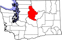
Location in the state of Washington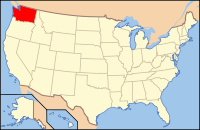
Washington's location in the U.S.Founded March 13, 1899 Seat Wenatchee Area
- Total
- Land
- Water
2,994 sq mi (7,754 km²)
2,921 sq mi (7,565 km²)
72 sq mi (186 km²), 2.41%Population
- (2010)
- Density
72,453
25/sq mi (9.5/km²)Website www.co.chelan.wa.us Chelan County (
 /ʃəˈlæn/) is a county located in the U.S. state of Washington. Its population was 72,453 at the 2010 U.S. census. It is part of the 'Wenatchee–East Wenatchee, Washington Metropolitan Statistical Area'. The county seat is at Wenatchee, which is also the county's largest city. "Chelan" derives from a Chelan Indian word meaning "deep water," likely a reference to 55-mile (89 km)-long Lake Chelan, which reaches a maximum depth of 1,486 feet (453 m).
Chelan County was created out of Okanogan and Kittitas Counties on March 13, 1899.[1][2]
Contents
Geography
According to the U.S. Census Bureau, the county has a total area of 2,994 square miles (7,754.4 km2), of which 2,921 square miles (7,565.4 km2) is land and 72 square miles (186.5 km2) (2.41%) is water.
Geographic features
- Cascade Mountains
- Chelan River
- Chiwaukum Mountains
- Columbia River
- Stuart Range
- The Enchantments
- Bonanza Peak, highest point in Chelan County
- Chelan Mountains
- Entiat Mountains
Major highways
Adjacent counties
- Okanogan County, Washington northeast
- Douglas County, Washington east
- Kittitas County, Washington south
- King County, Washington southwest
- Snohomish County, Washington west
- Skagit County, Washington northwest
National protected areas
- Lake Chelan National Recreation Area
- North Cascades National Park (part)
- Wenatchee National Forest (part)
Demographics
Historical populations Census Pop. %± 1900 3,931 — 1910 15,104 284.2% 1920 20,906 38.4% 1930 31,634 51.3% 1940 34,412 8.8% 1950 39,301 14.2% 1960 40,744 3.7% 1970 41,355 1.5% 1980 45,061 9.0% 1990 52,250 16.0% 2000 66,616 27.5% 2010 72,453 8.8% As of the census[3] of 2000, there were 66,616 people, 25,021 households, and 17,364 families residing in the county. The population density was 23 people per square mile (9/km²). There were 30,407 housing units at an average density of 10 per square mile (4/km²). The racial makeup of the county was 83.63% White, 0.26% Black or African American, 0.99% Native American, 0.68% Asian, 0.12% Pacific Islander, 12.19% from other races, and 2.14% from two or more races. 19.26% of the population were Hispanic or Latino of any race. 16.9% were of German, 11.2% English, 9.3% United States or American and 7.1% Irish ancestry according to Census 2000. 80.9% spoke English and 18.1% Spanish as their first language.
There were 25,021 households out of which 34.50% had children under the age of 18 living with them, 56.40% were married couples living together, 8.70% had a female householder with no husband present, and 30.60% were non-families. 25.10% of all households were made up of individuals and 10.80% had someone living alone who was 65 years of age or older. The average household size was 2.62 and the average family size was 3.14.
In the county, the population was spread out with 28.00% under the age of 18, 8.30% from 18 to 24, 27.20% from 25 to 44, 22.70% from 45 to 64, and 13.90% who were 65 years of age or older. The median age was 36 years. For every 100 females there were 99.10 males. For every 100 females age 18 and over, there were 96.80 males.
The median income for a household in the county was $37,316, and the median income for a family was $46,293. Males had a median income of $35,065 versus $25,838 for females. The per capita income for the county was $19,273. About 8.80% of families and 12.40% of the population were below the poverty line, including 16.00% of those under age 18 and 7.40% of those age 65 or over.
Census-recognized communities
Most Populous Cities 2010 United States Census
- 1. Wenatchee 31,925
- 2. Chelan 3,890
- 3. Sunnyslope 3,252
- 4. Cashmere 3,063
- 5. Leavenworth 1,965
- 6. South Wenatchee 1,553
- 7. Manson 1,468
- 8. Entiat 1,112
- 9. Chelan Falls 329
Other communities
 Old barn, Chumstick, Washington
- Appleyard
- Ardenvoir
- Chiwaukum, 47°41'25"N 120°44'09"W; (Post Office 1896-1912)
- Chumstick
- Dryden
- Grant Road Addition
- Holden Village
- Kenroy
- Lakeside
- Lucerne
- Malaga
- Merritt
- Mission Square
- Monitor
- Pearcot
- Peshastin
- Plain
- Stehekin
- Telma, 47°50'35"N 120°48'56"W; (Post Office 1905-1938)
- Wenatchee Heights
- Winton
Ghost Towns
See also
- Chelan County Public Utility District (PUD)
- Lake Chelan AVA
- National Register of Historic Places listings in Chelan County, Washington
- USS Chelan County (LST-542)
- Wenatchee Valley College
- Wenatchee School District
References
- ^ "Milestones for Washington State History — Part 2: 1851 to 1900". HistoryLink.org. 2003-03-06. http://www.historylink.org/essays/output.cfm?file_id=5380.
- ^ McCormick, Ida Skarson (1999). "Links to Okanogan County, Washington". http://www.rootsweb.com/~waokanog/links.htm.
- ^ "American FactFinder". United States Census Bureau. http://factfinder.census.gov. Retrieved 2008-01-31.
Further reading
- An illustrated history of Stevens, Ferry, Okanogan and Chelan counties, State of Washington. Western Historical Pub. Co.. 1904.Available online through the Washington State Library's Classics in Washington History collection
External links

Skagit County Okanogan County Snohomish County 
Douglas County  Chelan County, Washington

King County Kittitas County Municipalities and communities of Chelan County, Washington Cities Cashmere | Chelan | Entiat | Leavenworth | Wenatchee

CDPs Unincorporated
communitiesAppleyard | Ardenvoir | Blewett | Chelan Falls | Chiwaukum | Chumstick | Dryden | Grant Road Addition | Holden Village | Kenroy | Lakeside | Lucerne | Malaga | Manson | Merritt | Mission Square | Monitor | Pearcot | Peshastin | Plain | Stehekin | Telma | Wenatchee Heights | Winton
Indian reservation Footnotes ‡This populated place also has portions in an adjacent county or counties
Categories:- Washington (state) counties
- Chelan County, Washington
- 1899 establishments in the United States
- Populated places established in 1899
- Wenatchee – East Wenatchee metropolitan area
- North Cascades of Washington (state)
-


Wikimedia Foundation. 2010.