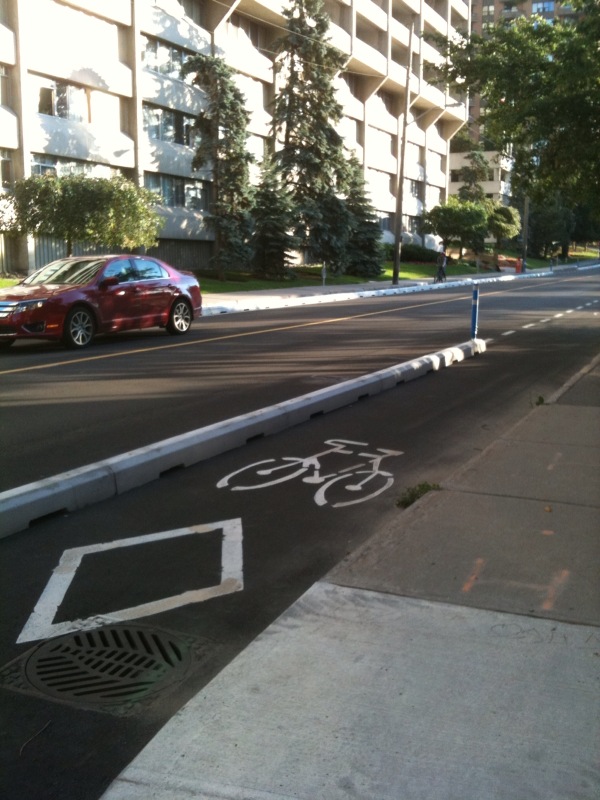
- Segregated cycle facilities
-
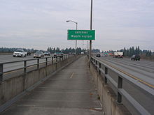
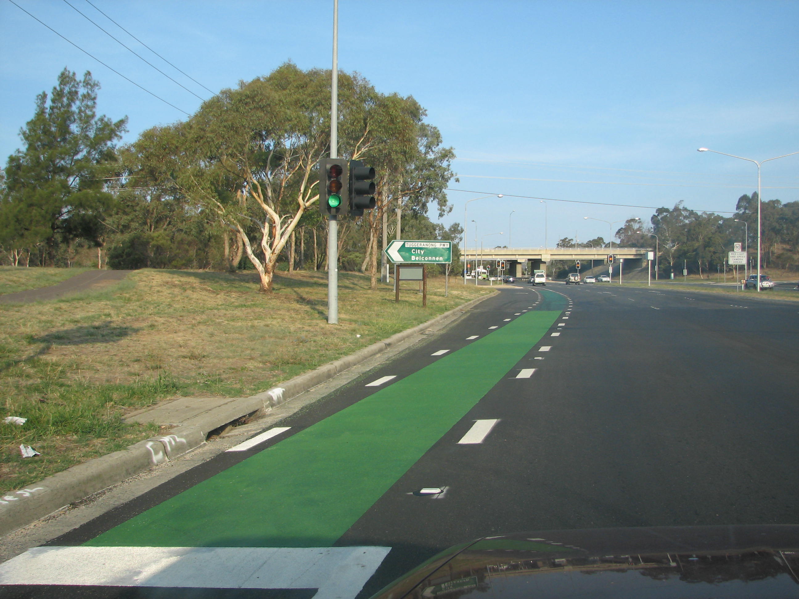
 A bike lane on the side of a highway.
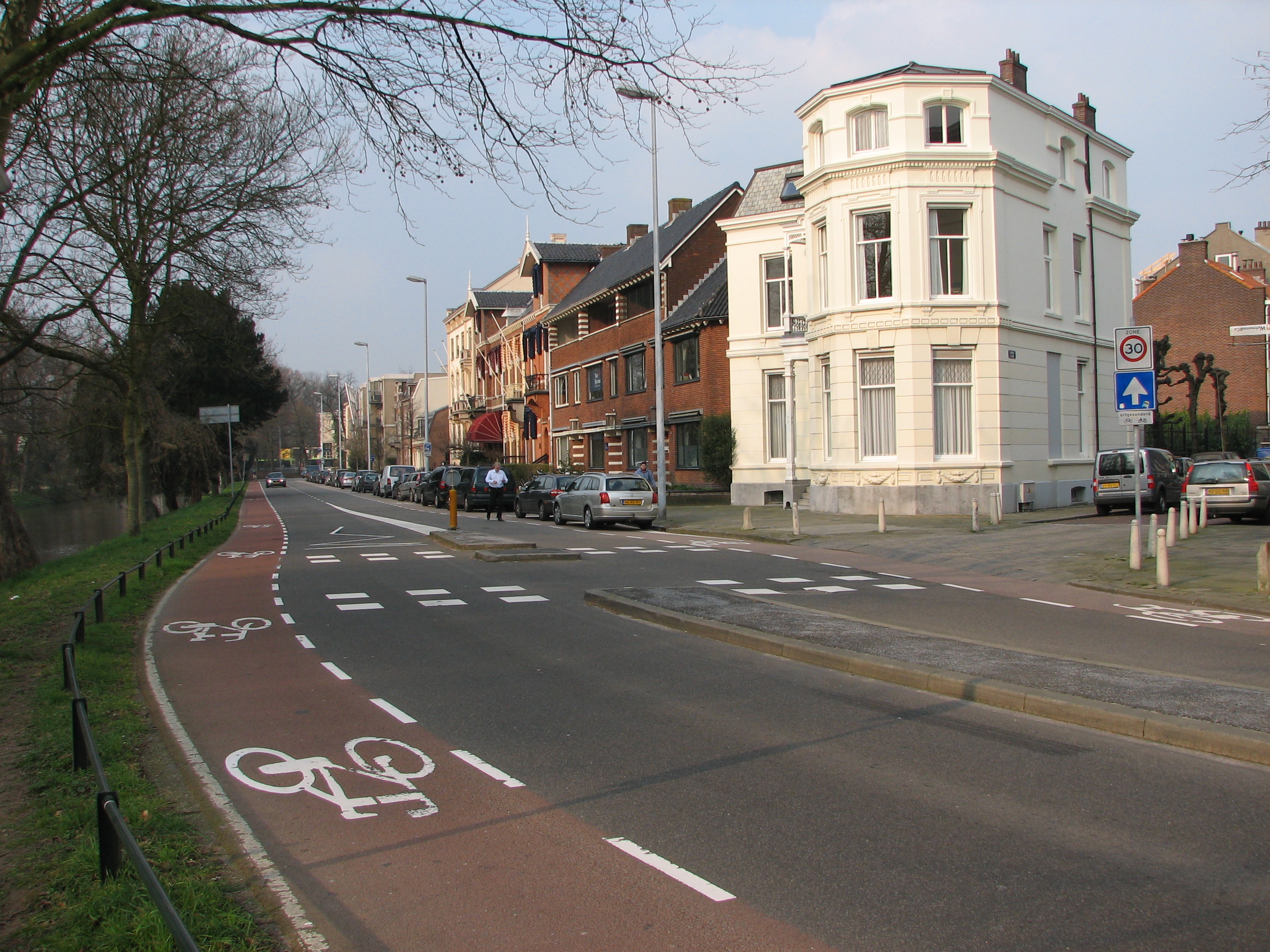
 Utrecht has specially-painted bicycle-only lanes.
 Cycle lane in Počernická street in Prague 10, Czech Republic
 A bikepath in Chapinero in Bogotá, Colombia
Segregated cycle facilities are marked lanes, tracks, shoulders and paths designated for use by cyclists from which motorised traffic is generally excluded. The term includes bike lanes, cycle tracks/separated bike lanes, road shoulders and side paths located within a road right-of-way.
The names and definitions of the various cycle facility types vary from country to country, but besides local naming conventions, one of the main subdivisions is whether the facility is physically separated by barriers, parking or bollards from other (especially motor vehicle) traffic, or whether the segregation is due to painted markings. The facilities have been modified over time and increased in variety as usage changes, and as cities receive feedback and experiment with improvements.
Bike lanes and road shoulders demarcated by a painted marking are quite common both in many European and American cities. Segregated cycle facilities demarcated by barriers, bollards or boulevards are quite common in some European countries such as the Netherlands, Denmark and Germany. They are also increasingly being installed in other major cities such as New York City, Bogotá, Melbourne, Vancouver, Ottawa and San Francisco. Montreal and Davis, California are among the North American cities that have had segregated cycle facilities with barriers for several decades.
Terminology
Various guides exist to define the different types of bikeway infrastructure, including the AASHTO Guide to Bikeway Facilities, the Manual on Uniform Traffic Control Devices (MUTCD), and the NACTO Urban Bikeway Design Guide all in the U.S. North American guides and manuals are starting to include more of the infrastructure found in European guides such as CROW in the Netherlands.[1]
On road: bike/cycle lanes

Cycle lanes (UK) or bike lanes (USA) are lanes, for cyclists only, marked on an existing portion of a carriageway (UK) or roadway (USA).
 A bicycle lane in Canberra, Australia. Bicycles in the green-painted lane have right of way. Other road traffic must give way before crossing into the left turning lane at the lights.
- A cycle lane (UK) is a traffic lane marked on an existing roadway or carriageway and generally restricted to cycle traffic. It can be mandatory (marked with a solid white line, entry by motor vehicles is generally prohibited) or advisory (marked with a broken white line, entry by motor vehicles is permitted).
- In the U.S., a designated bicycle lane (1988 MUTCD) or class 2 bikeway (Caltrans) is a portion of a roadway which is separated from traffic lanes by the use of a solid white stripe on the pavement and has been designated for preferential use by bicyclists. A class 3 bicycle route has roadside signs suggesting a route for cyclists, and urging sharing the road.
On road: cycle track
 Cycle Track: Car parking lane protects bike lane from motor traffic
A cycle track is an exclusive bike facility that has elements of a separated path and on-road bike lane. A cycle track, while still within the roadway, is physically separated from motor traffic and is distinct from the sidewalk.[2]
Cycle tracks may be one-way or two-way, and may be at road level, at sidewalk level, or at an intermediate level. They all share in common some separation from motor traffic with bollards, car parking, barriers or boulevards.[2]
In the UK, cycle track is a roadway constructed specifically for use by cyclists, but not by any other vehicles. In Ireland cycle track also covers cycle lanes marked on the carriageway but only if accompanied by a specific sign. In the UK, a cycle track may be alongside a roadway (or carriageway) for all vehicles or it may be on its own alignment. The term does not include cycle lanes or other facilities within an all-vehicle carriageway.[3]
Off road: shoulder
A road shoulder is a reserved area outside of a roadway, but within the road right-of-way. Road shoulders (a) are a buffer area between the roadway and possible off-road hazards intended to prevent accidents in the event of a temporary loss of vehicle control, (b) provide emergency access for ambulances and police cars and (c) provide a space for inoperable vehicles so that they do not block the traveled way. In addition, road shoulders are used by bicyclists when other bicycle-specific facilities are absent, or inferior.
A sidepath in the US is a path or sidewalk that has been designated for use by cyclists within the right of way of a public road but outside of the roadway. It is usually not immediately adjacent to the portion of the way for vehicular traffic (i.e., the traveled way).
A shared-use footway is for use by both cyclists and pedestrians[4] in the UK and will usually be to a lower standard than a cycle track. While cyclists may be required to yield right of way to foot traffic on a shared use footway which is unsegregated (i.e., where both types mix freely), cyclists are usually considered to be the primary users on cycle tracks. Note that the design standards and recommendations for shared use footways and cycle tracks in the UK are different from those for shared use paths[5] in the U.S.
History
Pre-motorisation
By the end of the 19th century, cycling was growing from a hobby to an established form of transport. Cyclists campaigned to improve the existing, often poorly surfaced, roads and tracks. A US group was the Good Roads Movement.[6][7] In the UK, the Cyclists' Touring Club (CTC) distributed a treatise entitled Roads:Their construction and maintenance.[8] In the Netherlands the bicycle was introduced in 1870 and by the 1920s was the most popular mode of transportation (at about 75%). The first bicycle path was a 1.4 km stretch built with two paved bicycle paths alongside the Breda-Tilburg cobblestone road. Following this successful installation numerous bicycle paths separate from the roadway were constructed by "bicycle path associations"[9] In Germany, concerns arose regarding conflicts between cyclists, horse traffic and pedestrians, leading to sections of routes being upgraded to provide smoother surfaces and separate portions for the different groups.[10]
An early example of an American segregated cycle facility was the nine-mile dedicated Cycle-Way built in 1897 to connect Pasadena, California to Los Angeles. Its right of way followed the stream bed of the Arroyo Seco and required 1,250,000 board feet (2,950 m3) of pine to construct. The roundtrip toll was 15¢ US and it was lit with electric lights along its entire length. The route did not succeed, and the right of way later became the route for the Arroyo Seco Parkway, an automobile freeway opened in 1940.[11]
Pre World War II
With the advent of the motor car, conflict arose between the increasingly powerful car lobby and bicycle users.[8] By the 1920s and 1930s the German car lobbies initiated efforts to have cyclists removed from the roads so as to improve the convenience of motoring.[12] In the UK, the cycling lobby was attempting to remove motor vehicles from the roads by calling for the building of special "motor roads" to accommodate them.[13] This idea was opposed by the Motorists' Union, who feared that it would lead to motorists' losing the freedom to use public roads.[13]
United Kingdom
In 1926 the CTC discussed an unsuccessful motion calling for cycle tracks to be built on each side of roads for "the exclusive use of cyclists", and that cyclists could be taxed, providing the revenue was used for the provision of such tracks.[14] Since the 1930s, the established cycling lobby in the UK and Ireland has taken a critical and measured view of the utility and value of segregating cyclists.[15] In 1947, in response to official suggestions that cyclists should use cycle-tracks, the CTC adopted a motion expressing determined opposition to cycle paths alongside public roads.[8]
The first (and one of the very few) dedicated roadside optional cycle tracks was built, as an experiment for the Ministry of Transport, beside Western Avenue between Hanger Lane and Greenford Road in 1934.[16] It was thought that "the prospect of cycling in comfort as well as safety would be appreciated by most cyclists themselves".[16] However, the idea ran into trenchant opposition from cycling groups, with the CTC distributing pamphlets warning against the threat of cycle paths.[8][17]
Local CTC branches organised mass meetings to reject the use of cycle tracks and any suggestion that cyclists should be forced to use such devices.[18] In 1935, a packed general meeting of the CTC adopted a motion rejecting ministerial plans for cycle path construction.[8] The CTC were listened to, and the use of cycle tracks largely fell out of favour in the UK.
Post World War II
In the UK, little use of separate cycle track systems took place except in the so-called "new towns" such as Stevenage and Harlow. From the end of the 1960s in Nordic countries, the Swedish SCAFT guidelines on urban planning were highly influential and argued that non-motorised traffic must be segregated from motorised traffic wherever possible. Under the influence of these guidelines cyclists and pedestrians were treated as a homogeneous group to be catered for using similar facilities.
The guidelines strongly influenced cities such as Helsinki and Västerås to build large cycle path networks. By the late 1960s and 1970s, with the cyclists mainly gone, many German towns began removing cycle tracks so as to accommodate more car parking. Increasing traffic congestion and the 1970s oil shocks contributed to a resurgence in cycling in some countries. Outside of SCAFT-inspired developments in Nordic countries, the use of segregated cycle facilities was mainly confined to university towns with established populations of bicycle users.
1970s
In 1970 in the United Kingdom, the Milton Keynes Development Corporation produced the "Master Plan for Milton Keynes".[19] One of the important elements of this plan, and of its subsequent implementation, was the Milton Keynes redway system of segregated cycle/pedestrian paths. These are fully separated from the road system, only occasionally running along side it. One of the aims of the redways was to make travel for pedestrians and cyclists convenient, safe, pleasant and accident free, but a study suggests that the system has only partially met these expectations.[20]
More recent statistical data shows that the accident rate for pedestrians in Milton Keynes is just 46% of the average for England and the rate for cyclists is 87%.[21] However, the secluded semi-rural nature of many redways that make them pleasant by day can make some people feel unsafe to use them after dark.[21]
In the Netherlands bicycle use declined from the post-war period up to about 1975 as automobile use increased and commuting distances increased. Bicycle traffic policy was almost completely excluded from the national government vision. Things began to turn around in about 1972 with the oil crisis. Local and national policy began to pay more attention to cycling. Bicycle use, which had been dropping dramatically, stabilized and even rose over the next two decades.[22] Amsterdam's traffic circulation plan of 1978 gave priority to bicycle facilities, in particular separated cycle tracks, which also meant taking some road space away from motor vehicles. The national government soon followed with subsidies for constructing bike paths alongside secondary and minor roads so that "lost ground could be made up".[9]
In 1971 in the United States, the California state government contracted with University of California, Los Angeles (UCLA) for the design of bikeways (bicycle paths, bicycle side-paths, bicycle lanes).[23] UCLA largely copied Dutch bicycle facilities practice (primarily sidepaths) to create their bikeway designs, but the derived designs were not made public.[24] The California Statewide Bicycle Committee (CSBC) was created in 1975,[25] initially composed of representatives of governmental and motoring organisations. When John Forester, a cyclist representative, became a member he concluded that the real motivation for moving cyclists aside was the convenience of motorists, although the stated reason was the safety of cyclists.[26]
When serious safety issues were identified with the proposed designs, the resulting cyclist opposition discredited the designs and prevented enactment of a mandatory side-path law. This forced the state to start over with new bikeway design standards in 1976. Those designs were subsequently adapted by the Association of American State Highway and Transportation Officials (AASHTO) to form the first edition of the AASHTO Guide for Bicycle Facilities, which is widely followed in the USA.[24]
1980s to present
The 1980s saw the start of experimental cycle route projects in Danish towns such as Århus, Odense and Herning, and the beginning of a large programme of cycle facilities construction as part of a "bicycle masterplan" in the Netherlands. Following the "bicycle boom" of the early 1980s, German towns began revisiting the concept.[27]
The use of segregated cycle facilities is promoted by a large segment of the cycling community, for example lane and path cyclists, and also by many organisations associated with the environmental movement. The rise of the "Green" movement in the 1990s has been accompanied by requests for the construction of cycle networks in many countries. This has led to various high-profile cycle network projects, in Bogotá, Montreal, Dublin, Portland, New York, Boston,[28] and many other cities.
Segregated facilities and safety
 Diagram showing relative increases in collision rates for users of some cycle paths.
Segregated cycling facilities are controversial, in particular concerning safety. Proponents tout segregation of cyclists as necessary to the provision of a safe cycling environment, as recent research has suggested. A 2010 Montreal study found that cycle tracks resulted in fewer injuries when compared to comparable parallel roads with no cycling facilities.[29][30] In contrast, opponents argue that research implies increases in the rate and severity of car/bicycle collisions due to such segregation.[31]
Safety data on segregated cycling facility is still incomplete and difficult to draw definite conclusions, though some evidence is pointing towards the lower risk of cycling-specific infrastructure. A 2006 report by the National Cooperative Highway Research Program in the UK concludes that "bicycle safety data are difficult to analyse, mostly because bicycle trip data (and thus accident probability per trip) are hard to uncover" (see NCHRP Report 552, 2006, "Guidelines for Analysis of Investment in Bicycle Facilities", National Cooperative Highway Research Program, Transportation research Board of the National Academies, page F-1). One major reason for the inability to draw definite conclusion may be that facilities with different risks are often categorized together so that off-road paths - paved or unpaved, bicycle-only or multi-use - were lumped together, as found by research at the Cycling in Cities program at the University of British Columbia.[32]
Supporting evidence
Cycling in Cities stated in their 2009 review of the scientific literature of bicycle facilities: "It may be straightforward to count the injuries that occur on different route types (numerator data), but it is more difficult to gather data on the number of cyclists who use various route types (the denominator data needed to calculate the risk)." When they were able to look at injury and crash data separated by bicycle facility type, they found the evidence suggested that "purpose-built bicycle-only facilities have the lowest risk of crashes and injuries". They found such bike-only facilities had lower risk than cycling on-road with motor traffic as well as off-road with pedestrians on sidewalks or multi-use paths. The highest risk of crashes and injuries were found to be on sidewalks and unpaved off-road trails.[32]
The Netherlands and Denmark, which have the highest rates of cycle usage combined with the best records for safety, place importance on their segregated cycle track networks in achieving these goals. A large study undertaken into the safety of Copenhagen cycle tracks concludes that their construction resulted in an increase in cycle traffic of 18-20% and a decline in car traffic of 9-10%, contributing to an increase in cycle usage along those routes. On those same reconstructed routes accidents and injuries increased by 9-10% (the increase of accidents and injuries increased at intersections while decreased mid-block).[33] On the surface it appears as if overall the cycle tracks actually *decrease* safety, but from the perspective of an individual cyclist, claims Dr. Lon D. Roberts, the Copenhagen shows that the "likelihood an individual bicyclist will experience an accident goes down as the number of bicycle riders go up".[34]
The Copenhagen study also found accident and injury rates were related to the amount of car parking, turn lanes, blue cycle crossing markings, and raised exits at non-signalised intersections, suggesting that risk is dependent on making various improvements to the cycle tracks. For instance, recent planning guidelines in the US advise that cycle tracks drop to a bike lane before arriving at an intersection to increase the visibility of cyclists.[35]
A 2010 study in Montreal, Canada, compared the motor vehicle/bicycle crashes and injuries on six Montreal cycle tracks (physically separated bicycle-exclusive paths along roads) with comparable reference roads (a parallel road with approximately the same intersection frequency and cross traffic). The authors found 2.5 times as many cyclists rode on the cycle tracks compared to the reference roads. They also found that the relative risk of injury was lower on a cycle track than on the comparable reference road (the average being 0.72 the relative risk). They concluded that "[c]ycle tracks lessen, or at least do not increase, crash and injury rates compared to bicycling in the street"[30]
The New York City Department of Transportation implemented a bicycle path and traffic calming pilot project for Prospect Park West in Brooklyn in 2010 and published their results in early 2011. It created a 2-way bicycle path with a three foot parking lane buffer and the removal of one lane from motor vehicles. They found that weekday cycling traffic tripled after the implementation; cyclists riding on the sidewalk fell to 3% from 46% (the count included children who are legally allowed to ride on the sidewalk); speeding dropped from 74% to 20% of all vehicles; crashes for all road users were down 16% and injuries to all road users were down 21%.[36]
Evidence against
In the 1970s the California Statewide Bicycle Committee arranged with Kenneth D. Cross for a study of car-bike collisions, expecting that this study would support their arguments on collision prevention. When presented to the Committee in Sacramento on 19 June 1974, Cross's study showed the opposite: only 0.5% of car-bike collisions had occurred between straight-ahead cyclists and overtaking straight-ahead motorists.[37] Cross later had a contract with the National Highway Traffic Safety Administration (NHTSA) to produce an improved study (on a pseudo-random national sample), and the results were much the same.[38]
The UK Cycle Campaign Network made a 2007 statement that they know "of no evidence that cycle facilities and in particular cycle lanes, generally lead to safer conditions for cycling".[39]
A 1994 study in Palo Alto, California found that cyclists on a sidewalk or bike path incur a greater risk of collision with a motor vehicle than on the roadway (including bike lanes on the roadway)[40] The study, however, combined the results from sidewalks and bike paths, making it unclear what are the relative risks in the two different types of infrastructure. It's unclear from the study, as well, how Palo Alto bike paths compare to the bike paths or cycle tracks of other cities.
Other countries have had negative results from cycle tracks: In Germany, Sweden,[41] Denmark[42]and Finland,[43] it has been found that cycling on roadside urban cycle tracks/sidepaths results in increases in the rate of car/bicycle collisions of between 1.1 and 12-fold, depending on the form of the bike lane. At a 1990 European conference on cycling, the term Russian roulette was used to describe the use of roadside cycle paths.[44]
In Helsinki, research has shown that cyclists are safer cycling on roads with traffic than when using the city's 800 kilometres (500 mi) of cycle paths.[45] The Berlin police and Senate conducted studies which led to a similar conclusion in the 1980s.[46]
Crash types
The source of the direct safety problem lies in the nature of the predominant car/bicycle collision types. The majority of collisions on urban roads occur at junctions and involve turning vehicles.[47] Rear-end type collisions are a major factor only on arterial or interurban roads.[48][49][50][51][52][53][54] More width for cyclists to use on rural/arterial roads with few junctions might lower the net number of collisions, but the data does not help answer the question of whether separating cyclist from other users would make a significant difference one way or the other.[55]
Crash locations
 Relative risks of crossing an intersection. Crossing on a set-back cycle path was found to be up to 11.9 times more risky in one study than straight crossing on a road with a bike lane.[56]
There is more risk of crashes where cycle paths meet roads. When the path entrance is set back from the road, motorists often have difficulty seeing cyclists approaching from the path. Research presented at a conference at Lund University in 1990 found that "crash risk" for cycle users crossing the intersection on a set-back path are up to 11.9 times higher than when cycling on the roadway in a bike lane (see diagrams).[56]
-

An obstructed cycle lane in New York City.
-

Bicycle lane sign in New York City.
-

Share the road sign, New York City.
-

United States bicycle lane sign with diamond (lozenge) symbol.
-

Bike Allowed Use of Full Lane CVC 21202, San Francisco.
Segregated facilities and roundabouts

There is some concern to the use of cycle lanes in large urban roundabouts. For adults, the standard vehicular cycling advice for handling roundabouts is to try to maintain a prominent position while circulating.[57] The use of cycle lanes runs counter to this advice and places cyclists outside the main "zone of observation" of entering motorists, who represent the overwhelming source of risk (50% of collisions).[58] In 2002, cycle lanes were removed from a roundabout in the English town of Weymouth after 20 months because the casualty rate had increased significantly.[59] German research has indicated that cyclists are safer negotiating roundabouts in traffic rather than on separate cycle lanes or cycle paths.[60] A recent paper on German roundabout design practice states "Cycle lanes at the peripheral margin of the circle are not allowed since they are very dangerous to cyclists".[61] See also cycle facilities at roundabouts.
Rural and arterial roads
Direct rear impacts with cyclists are a more prominent collision type in arterial/rural road type situations. When they occur in such circumstances they are also associated with significantly increased risk of fatality. Data collated by the OECD indicates that rural locations account for 35% or more of cycling fatalities in Denmark, Finland, France, Great Britain, Japan, the Netherlands, and Spain.[62]
In the UK, cycling collision data recorded by police indicates that at non-junction locations, where a cyclist was struck directly from behind there was an overall fatality rate of 17%. The rate of fatality increases with speed limit of the road:
- 5% on 30 mph (48 km/h),
- 13% on 40 mph (64 km/h),
- 21% on 60 mph (97 km/h) and
- 31% on 70 mph (110 km/h) roads.[63]
The use of appropriately designed segregated space on arterial or interurban routes appears to be associated with reductions in overall risk. In Ireland, the provision of hard shoulders on interurban routes in the 1970s reportedly resulted in a 50% decrease in accidents.[64] It is reported that the Danes have also found that separate cycle tracks lead to a reduction in rural collisions.[65]
Indirect benefits
Safety in Numbers effect
There is evidence that one of the main factors influencing the individual safety of cyclists is the number of cyclists using the roads, commonly called the safety in numbers effect. Cycling facilities increase the perception of safety, leaving aside the evidence supporting or detracting from their actual risk. Cycling increases on routes with cycling facilities, particularly if they are separated cycle tracks.[30][33] With greater numbers of cyclists in relation to motorists the safety in number effect is seen.
A wide ranging study by P L Jacobsen found that as cycling and walking increase, the chance that a given cyclist will be struck by a motor vehicle actually decreases. This pattern is consistent across communities of varying size, from specific intersections to cities and countries, and across time periods. Jacobsen found that doubling the number of cyclists on the road tends to bring about a 1/3 drop in the per-cyclist frequency of a crash with a motor vehicle. By the same token, tripling the rate of cycling cuts the crash rate in half.[66] A study of the accident impacts of re-engineering bicycle crossings in the Swedish city of Gothenburg appears to corroborate those findings by attributing collision rate reductions in part to significant increases in cyclist volumes at the treated sites.[67]
Detractors argue that the most prominent examples of "successful" cycle networks were implemented in towns that already had significant numbers of cyclists.[15] In such cases it is speculated that a existing large cycling population might already exert a "safety in numbers" effect, and it is this, rather than their diversion onto off-road tracks, that accounts for the better safety record.[68] More people might start cycling if the perceived safety of doing so improved sufficiently.
Health Benefits
In addition it has been shown that in Western countries the health benefits of regular cycling significantly outweigh the risks due to traffic danger.[69][70][71] Therefore, notwithstanding their effect on crashes and injuries, measures that promote cycling should produce an overall societal health benefit.[33]
Dutch analysts have argued as a statistical exercise that given that three times as many cyclists as car occupants are injured in collisions, and that cars harm about three times the number of other road users that bicycles do, in situations where casualties due to car traffic predominate increasing the number of cycling journeys and reducing the number of car journeys will reduce the total number of casualties[72]
Remedial measures
 Bicycle path in Florence.For more information, see Segregated cycle facilities: Official definitions and legislation.
Various remedial measures have been developed in an attempt to reduce the risk along segregated cycle facilities. In some environments these represent established engineering practice while in others they may have to be retroactively applied in response to complaints and safety concerns. Examples include the addition of a separate system of traffic signals for bicycle traffic; markings - either coloured or sharrows continued through the intersection; bike boxes with no right turn on red lights for motorists, raised intersections, and elimination of car parking or the barrier as the cycle track approaches the intersection.[33][35]
Some treatments involve raising the cycle track onto a speed ramp type structure where it crosses side roads. In addition, various road markings have been developed in an attempt to remedy the issue of increased junction collisions. Examples of these include the use of special road markings, e.g. "sharks teeth" or "elephants footprints", and treatments using red, green or blue coloured tarmac. Other approaches include efforts to "traffic calm" the bicycle traffic by introducing tight curves or bends to slow the cyclists down as they near a junction. Alternatively, traffic engineers may remove priority from the cyclists and require them to yield to turning traffic at every side road. In 2002, engineers proposing a sidepath scheme in the Irish university city of Galway stated that cyclists would be required to dismount and "become pedestrians" at every junction on the finished route.[73]
Alternative approaches to safety
Segregated cycle facilities are one way to improve the perception of safety. There are other approaches, such as shared space, which improve actual safety in part by decreasing the difference between real and perceived safety.[74] More recently, shared space redesigns of urban streets in Denmark, and the Netherlands have arguably achieved significant improvements in safety (as well as congestion and quality of life) by replacing segregated facilities with integrated space. Traffic reform advocates including David Engwicht and John Adams suggest that the added perception of risk among all road users - motorists, cyclists and pedestrians - in shared facilities increases safety.[74] See the Utility cycling article for other examples of measures to improve both actual and perceived safety.
Road traffic legislation and its implications
One of the potential pitfalls for observers trying to interpret the operation of segregated cycle facilities is that the same legal assumptions do not apply in all environments. For instance, in contrast to most English speaking countries, some European countries, including Germany, France, Denmark, Belgium, and the Netherlands have defined liability legislation.[75] Thus there is a legal assumption that motorists are automatically considered liable in law for any injuries that occur if they collide with a cyclist.[76] This may hold regardless of any fault on the part of the cyclist and may significantly affect the behaviour of motorists when they encounter cyclists.[77][78] In some countries it is legal for cyclists to overtake motor-vehicles on the inside, and cyclists doing so may enjoy the protection of the law. In this case, the use of segregated cycle facilities conforms to existing traffic law. In other jurisdictions similar "undertaking" manoeuvres by cyclists are illegal.[79] Such distinctions form the basis of the argument that segregated cycle facilities encourage behaviours that flout existing traffic law and in which cyclists enjoy no legal protection.[80][81][82]
This variation also applies to the operation of traffic signals and cyclist-specific traffic lights. For instance, in Germany and elsewhere at junctions with segregated facilities all the traffic in a given direction (motorists, pedestrians and cyclists) may get a green signal at the same time.[83] Turning motor traffic is obliged to wait for cyclists and pedestrians to clear the junction before proceeding. In this situation all the transport modes get equal green time. In contrast, UK and Irish practice restricts pedestrians to a dedicated signal phase, separate from and usually much shorter than the green phase for motorists (e.g. 6–12 seconds, vs. signal cycle times of up to 120 seconds).[84][85] If cyclists were to be segregated and treated in a similar manner this would imply a significant reduction in green time for cycle traffic at every junction. In the English city of Cambridge the use of cyclist-specific traffic signals is reported to have resulted in increased delays for cyclists, leading some to ignore the cycle-facilities and stay on the road.[86] A similar example occurred in a Parisian bikepath scheme in 1999. Cyclists faced twice the number of traffic signals as motorised traffic and were expected to wait over one minute to get seven seconds of green time.[87] Conversely, in Copenhagen cyclist-specific traffic signals on a major arterial bike lane have been linked to provide "green waves" for rush hour cycle-traffic.[88]
Context controversy
Some detractors argue that one must be careful in interpreting the operation of segregated cycle facilities across different designs and contexts. The Netherlands, for instance, is a flat country and Dutch town planning keeps cycling distances short. The typical Dutch town bike or "granny bike" has no gears or a three-speed hub gear and back pedal brakes. In countries with different geographies and cycling cultures, people may have more bicycles with a wider range of gears and cyclists that travel more quickly, for example in North America. Sports cyclists can travel even faster: with tailwinds or downhill gradients, some cyclists may exceed 50 km/h (30 mph). While a Dutch sidepath system may work for Dutch cyclists, they might not work for cyclists using faster bicycle types who cannot use such a system safely at their higher normal cycling speeds.[89] The Danish Roads Directorate acknowledges that the cycle track system "functions best when cyclists travel at relatively low speeds"[65]
As more cycle tracks are built in North American cities, more research is being conducted on the uptake and safety of cycle tracks. North American cities that have recently installed cycle tracks have seen significant growth in cyclists using these roads.[30][90] It is useful, therefore, to use North American examples of cycle tracks/side paths and compare them to similar roads used by cyclists. This will provide better data using cyclists on similar terrain and presumably similar bicycles and experience.
 A minivan merging into cycling traffic on Foothill Expressway in Los Altos, California.
Some cycling activists have opposed cycle tracks and paths on the principle that they might be created with the "fast cyclist type" in mind. The UK’s Sustrans guidelines for the National Cycle Network are based on recreational use with a design user who is an unaccompanied twelve-year-old. The Dublin Transportation Office has advertised their cycle facilities as being based on an unaccompanied ten-year-old design user. This raises the issue of what happens if different cyclist types find themselves forced onto such devices either by legal coercion or as a result of motorist aggression. This issue is captured in a 1996 review of the Sustrans approach from the Proceedings of the Institution of Civil Engineers.
The fast cycle commuter must not be driven off the highway onto a route that is designed for a 12-year-old or a novice on a leisure trip, because if that happens, the whole attempt to enlarge the use of the bicycle will have failed[91]
Maintenance controversy
 Debris in a cycle lane
The cleaning and plowing of bike lanes and cycle tracks needs to be taken into consideration. They either need to be made wide enough for the street sweepers and snow plows typically used in a locale, or the locale will need to ensure that they are regularly swept or plowed by machines that will fit.
Some locales have issues with debris in the cycle paths, such as Milton Keynes, UK, finding that cycle path users are seven times more likely to get punctures than are road cyclists.[92] In Ireland some cyclists have demanded simultaneous commitment to maintenance and sweeping as cycle paths are built.[93]
In areas subject to high leaf-fall in autumn, or high snowfall in winter, any cycle facilities must be subject to regular clearing if they are to remain usable. Danish guidance specifies three different categories of cycle track.[65] Category "A" tracks must be kept clear of snow 24 hours a day, category "B" tracks are swept or cleared daily, and category "C" receive less regular winter maintenance. In 2007 the city of Copenhagen spent DKK 9.9 million (US$1.72 million, €1.33 million) annually on maintaining its cycle track network.[94] German federal law requires local authorities to declassify cycle tracks that do not conform to strict design and maintenance criteria.[95] In the UK, facilities for non-motorized traffic are not normally salted or gritted in icy conditions, potentially making them dangerous or unrideable.
Usage controversy
There are many factors, such as cycle tracks and other cycling infrastructure, which contribute to cycling levels. A number of cities have demonstrated that particular cycle tracks will increase bike traffic on those routes, as shown, for example, in Montreal, New York City and Copenhagen. Bike usage increased by 40% in areas of Montreal where the city invested in bike paths and lanes.[30][90] In Copenhagen bike traffic increased by about 20% because of the construction of cycle tracks.[33] The construction of separated bike lanes on Dunsmuir Street and Viaduct in Vancouver, Canada, saw bike traffic volumes on the street more than double from before the construction.[96] NYC likewise saw cycling rates nearly triple on weekdays and doubled on weekends when the bike path was installed alongside Prospect Park West.[36]
Seville, Spain is an example of what is possible on a city scale when a large investment is made in cycling infrastructure over a short period of time. In 2006 there were around 6000 bike trips made daily in the city of around 700,000. By 2009 there were about 50,000 daily bike trips. During those three years 8 urban bike paths totaling 70 km were built; the city centre was closed to motorised traffic; school projects were funded to create safe school paths; traffic calming measures were provided in school districts and the bicycle sharing system ‘Sevici’ was launched. The combination of all these factors helped to create a dramatic change in cycling rates.[97]
After a certain trip modal share it may take more than just installing cycle tracks to create large increases in cycle rates. Cycling rates in the Netherlands peaked in the 1960s and dropped dramatically until the mid 1970s. The decline in bicycle use was "not only caused by mass motorization but also by the related, fairly unco-ordinated process of urbanization and by scores of social, spatial and economic developments", such as a decrease in population density and increased travel distances. The bicycle was almost completely left out of the national government's vision. Certain cities, however, such as Amsterdam and Eindhoven were slowly implementing more bicycle-positive policies: for example, bike-only streets and allowing cyclists to ignore one way streets.[98] Throughout the 70s cycling rates increased, but the investments in bike paths made in the subsequent period had less effect. Between the late 1980s and early 1990s the Netherlands spent 1.5 billion guilders (US$945 million) on cycling infrastructure, yet cycling levels stayed practically the same.[99]
When the flagship Delft Bicycle Route project was evaluated, the Institute for Road Safety Research claimed that the results were "not very positive: bicycle use had not increased, neither had the road safety. A route network of bicycle facilities has, apparently, no added value for bicycle use or road safety".[100] The study by Louisse, C.J. et al. however, did find that "[a]lthough the total number of victims among cyclists did not decline, the percentage of fatalities and severely injured did drop dramatically."[101] A more comprehensive policy change in addition to bicycle routes, on the other hand, helped to raise the cycling rates in Groningen where 75% of all traffic is by bike or foot. Groningen focused on land use policy, city planning and economic policy changes to achieve very high cycling rates.[99]
In the UK, a ten-year study of the effect of cycle facilities in eight towns and cities found no evidence that they had resulted in any diversion from other transport modes.[102] The construction of 320 kilometres (200 mi) of "Strategic cycle network" in Dublin has been accompanied by a 15% fall in commuter cycling and 40% falls in cycling by second and third level students.
In some locales bike traffic increases first and bike paths and lanes are installed in order to catch up to the demand. For instance, bike planning in Davis, California was driven by the prior existence of a "dramatic volume" of cyclists in the 1960s.[103] Research on the German bicycle boom of the 1980s paints a picture of German local authorities struggling to keep up with the growth of cycling rather than this growth being driven by their interventions.[27] In relation to the UK, it has been argued that locally high levels of cycling are more likely to result from factors other than cycle facilities. These include an existing cycling culture and historically high levels of cycle use, compact urban forms, lack of hills and lack of barriers such as high speed intersections.[104]
However, U.S.-based observers have stated that "the provision of separate cycling facilities" appears to be one of the keys to the achieving of high levels of cycling in the Netherlands, Denmark and Germany.[105]
Segregating cyclists controversy
In some cases, cycle paths have been constructed so bicycles could be prohibited from the main roadway.[10][12] There is a debate among cyclists as to whether this is for the benefit of motorists or bicyclists.
In 1996 the UK Cyclists' Touring Club and the Institute of Highways and Transportation jointly produced a set of Cycle-Friendly Infrastructure guidelines that placed segregated cycling facilities at the bottom of the hierarchy of measures designed to promote cycling.[106] Planners at the Directorate Infrastructure Traffic and Transport[107] in Amsterdam place cyclists and motorists together on roads with speed limits at or below 30 km/h (19 mph), and segregate them through bicycle lanes at higher limits. This is in a context where most of the measures prioritised by Cycle-Friendly Infrastructure (HGV restrictions, area-wide traffic calming, speed limit enforcement etc.) are already in place - see Utility cycling for more detail.
Bikeways that use independent rights-of-way
-

Mosel Maare cycle route on a converted railway corridor between Daun and Wittlich, Eifel, Germany
-

The first completed stretch of a planned recreational loop around Louisville, Kentucky, USA
-

Part of the Milton Keynes redway system runs along the disused track bed of the former Wolverton to Newport Pagnell Line.
Bike paths that follow independent rights-of-way are less controversial. Such paths are often used to promote recreational cycling. In Northern European countries, cycling tourism represents a significant proportion of overall tourist activity. Extensive interurban bike path networks can be found in countries such as Denmark, which has had a national system of cycle routes since 1993. These networks may use routes dedicated exclusively to cycle traffic or minor rural roads whose use is otherwise restricted to local motor traffic and agricultural machinery. The UK has recently implemented the National Cycle Network.
Where available these routes often make use of abandoned railway corridors - see picture right of Mosel Maar cycle route. A prominent example in the UK is the Bristol & Bath Railway Path, a 13 miles (21 km) bike path that is part of National Cycle Route 4. Other UK examples include The Ebury Way Cycle Path, The Alban Way, the Hillend Loch Railway Path and the Nicky Line. In 2003 the longest continuous bike path in Europe was opened, along the Albacete-Valdeganga highway in Spain, a distance of 22 kilometres (14 mi).[108] Bogota's Bike Paths Network or "Ciclo-Ruta" in Spanish, designed and built during the administration of Mayor Enrique Peñalosa attracts significant recreational use.
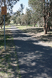 A bike path with original directional signage as found in older suburbs of Canberra, Australia.
The relative safety of bike paths that follow independent rights-of-way closed to motorized traffic is difficult to assess. In terms of car/bicycle collisions, this is clearly mediated by how the bike path network rejoins the main road network. In the English town of Milton Keynes, a study showed that cyclists using the off-road Milton Keynes redway system had on a per-journey basis a significantly higher rate of fatal car-bicycle collisions at path/roadway crossings than cyclists on ordinary roads.[109]
The consequences of other risks — falls, cyclist–cyclist collisions and cyclist–pedestrian collisions — are frequently not recorded in official accident figures and may be available only via local hospital surveys. As a general rule those bike paths with the highest perceived safety tend to be those engineered on the assumption of vehicular rather than pedestrian traffic. Thus the most popular examples tend to be converted road or railway alignments or constructed to the same standards used by road and railway engineers.[citation needed]
Other bikeways
Other types of bikeway infrastructure are also in use by cities. They are often used for different reasons: the locale may have a different planning philosophy; the street may be too narrow for bike lanes or cycle tracks; the location may be inappropriate; or for political reasons it may be easier to install something other than a fully segregated cycle facility. They include:
- Shared space - Urban design concept that removes traditional segregation among motor vehicles, pedestrians and cyclists and replaces with more "people-oriented" infrastructure.
- Sharrows - Usually a bike symbol with chevrons painted in a regular lane to demarcate where cyclists should ride.
- Bicycle boulevard - a low speed street that has been optimized for bicycle traffic.
See also
- List of cycleways
- Bogotá's Bike Paths Network
- Cycling in Copenhagen
- Door zone
- Effective Cycling
- Rail trail
- Utility cycling
- Vehicular cycling
- Motorcycle lane - similar facilities intended for motorcycle segregation from other vehicles.
- EuroVelo - European cycle route network
References
- ^ CROW
- ^ a b NACTO Urban Bikeway Guide
- ^ UK Department of Transport Legal Definition
- ^ Code of Practice
- ^ Federal Highway Administration
- ^ "League of American Wheelman 1896 Ride". League of Illinois Bicyclists. http://bikelib.org/mapstrails/law1896ride.htm. Retrieved 29 August 2007.[dead link]
- ^ "Lincoln Highway: Photos: From Wyoming Tales and Trails". www.wyomingtalesandtrails.com. http://www.wyomingtalesandtrails.com/lincoln.html. Retrieved 29 August 2009.
- ^ a b c d e The Winged Wheel, by William Oakley Cyclists Touring Club, 1977
- ^ a b Directorate General for Passenger Transport (9 March 1991). "The Ducth Bicycle Master Plan 1999". Het Masterplan Fiets. Minister of Public Transport, Public Works and Water Management. http://www.fietsberaad.nl/.../The%20Dutch%20Bicycle%20Master%20Plan%201999.pdf. Retrieved 23 March 2011.
- ^ a b Burkhard Horn (translated by Shane Foran) (9 March 1991). "The decline of a means of mass transport to the history of urban cycle planning". Bicycle Research Report 136. Allgemeiner Deutscher Fahrrad Club/European Cyclists Federation (on the Galway Cycling Campaign website). Archived from the original on 27 September 2007. http://web.archive.org/web/20070927212346/http://galwaycycling.org/archive/info/bhorn_abstract.html. Retrieved 29 August 2007.
- ^ T. D. Denham. "California's Great Cycle-Way". Infrastructure. U.S. Federal Highway Administration. http://www.fhwa.dot.gov/infrastructure/the_great_cycle_way_.cfm. Retrieved 21 October 2007.
- ^ a b http://www-2.informatik.umu.se/adfc/fdf/fdf-218.html
- ^ a b Robert Davis (1992). Death on the Streets: Cars and the mythology of road safety. Leading Edge Press. ISBN 0-948135-46-8.
- ^ "The Cyclists' Touring Club: Proposal for Special Cycle Tracks Defeated". The Times. 12 April 1926.
- ^ a b Getting rid of the Cyclists: Frank Urry and the 1938 DoT Advisory Committee by Jeremy Parker, Bikereader.com (accessed 27 January 2007)
- ^ a b "Roadside Cycle Tracks: An Experiment At Greenford". The Times. 7 June 1934.
- ^ The Perils of the Cycle Path, Cyclists Touring Club, 1935
- ^ Notes from history and the Hull mass cyclist demonstration of 1935 by Howard Peel, The Bike Zone, The Thinking Cyclist, accessed 23 January 2007
- ^ Modern Milton Keynes: the master plan MK Web
- ^ "Two decades of the Redway cycle paths in Milton Keynes" by John Franklin, Traffic Engineering + Control, July/August 1999
- ^ a b MKi Observatory: Quality of life indicators - Community safety. 2003/2004 data.
- ^ Ministerie van Verkeer en Waterstaat, Fietsberaad (2009). "Cycling in the Netherlands". Cycling in the Netherlands. Ministerie van Verkeer en Waterstaat. http://www.fietsberaad.nl/library/repository/bestanden/CyclingintheNetherlands2009.pdf. Retrieved 06 September 2011.
- ^ UCLA School of Engineering and Applied Science; Institute of Transportation and Traffic Engineering (April 1972) (PDF). Bikeway Planning Criteria and Guidelines. State of California, Division of Highways. http://drusilla.hsrc.unc.edu/cms/downloads/BikewayPlanningGuidelines1972.pdf. Retrieved 22 January 2008.
- ^ a b Forester, John (August 1994). Bicycle Transportation. MIT Press. pp. 24–25. ISBN 0-262-56079-8.
- ^ Ullrich, Howard. "SCR 47 Statewide Bicycle Committee" (PDF). Final Report. http://www.cyclelicio.us/files/scr-47-report.pdf. Retrieved 22 January 2008.
- ^ Forester, John (PDF). AMICUS CURIAE BRIEF, DAVID PROKOP v. CITY OF LOS ANGELES. http://www.cabobike.org/prokop/Amicus-Forester.pdf. Retrieved 23 January 2008.
- ^ a b Another look at Germany's bicycle boom: implications for local transportation policy & planning strategy in the USA, H. Maddox, World Transport Policy and Practice, Vol. 7, No.3 pp. 44-48, 2001
- ^ Freedman, Nicole, "Boston Bike Czar calls city 'bike-friendly,' says 'ridership has doubled in three years'", The Boston Globe, January 27, 2011
- ^ Lalonde, Michelle. "Bike paths reduce injuried: study" 10, February, 2011.
- ^ a b c d e Anne C. Lusk, Peter G. Furth, Patrick Morency, Luis F. Miranda-Moreno, Walter C. Willet, Jack T. Dennerlein (1 December 2010) (PDF). Risk of injury for bicycling on cycle tracks versus in the street. Injury Prevention. http://injuryprevention.bmj.com/content/early/2011/02/02/ip.2010.028696.full.pdf. Retrieved 07 February 2011.
- ^ Cycle Path Safety Summary of Research, John Franklin, accessed 23 January 2007
- ^ a b Conor Reynolds, M Anne Harris, Kay Teschke, Peter A Cripton and Meghan Winters (21 October 2009). The impact of transportation infrastructure on bicycling injuries & crashes: a review of the evidence. Environmental Health. http://www.ehjournal.net/content/pdf/1476-069x-8-47.pdf. Retrieved 7 February 2011.
- ^ a b c d e Road safety and perceived risk of cycle facilities in Copenhagen, S.U. Jensen, C. Rosenkilde, N Jensen, Road & Park, City of Copenhagen, Presentation to European Cycling Federation AGM 2006
- ^ Ask the Experts: Søren Underlien Jensen and Dr. Lon D. Roberts, PhD.
- ^ a b Cycle Track lessons learned by Alta Planning
- ^ a b Prospect Park West Bicycle Path and Traffic Calming NYC Department of Transportation. Accessed on 07 February 2011
- ^ Kenneth D. Cross (19 June 1974). IDENTIFYING CRITICAL BEHAVIOR LEADING TO COLLISIONS BETWEEN BICYCLES AND MOTOR VEHICLES. Anacapa Sciences, Inc.. http://www.johnforester.com/Articles/Safety/Cross01.htm. Retrieved 22 January 2008.
- ^ Kenneth D. Cross (September 1977) (PDF). A study of bicycle/motor vehicle accidents: Identification of problem types and countermeasure approaches. United States, National Highway Traffic Safety Administration. http://ntl.bts.gov/lib/25000/25400/25439/DOT-HS-803-315.pdf. Retrieved 22 January 2008.
- ^ Proposed revised Highway Code Response to the further changes to rules 61 and 63, Cycle Campaign Network, June 2006
- ^ Risk factors for bicycle-motor vehicle collisions at intersections, A. Wachtel and D. Lewiston, Journal of the Institute of Transportation Engineers, pp 30-35, September, 1994.
- ^ Leif Linderholm: Signalreglerade korsningars funktion och olycksrisk för oskyddade trafikanter ─ Delrapport 1: Cyklister. Institutionen för trafikteknik, LTH: Bulletin 55, Lund 1984, In: »Russian Roulette« turns spotlight of criticism on cycleways, Proceedings of conference »Sicherheit rund ums Radfahren«, Vienna 1991.
- ^ Junctions and Cyclists, S.U. Jensen, K.V. Andersen and E.D. Nielsen, Velo-city ‘97 Barcelona, Spain.
- ^ Finland: The safety effect of sight obstacles and road markings at bicycle crossings, M Rasanen and H. Summala, Traffic Engineering and Control, pp 98-101, February, 1998.
- ^ Vélo Secur 90 – Issues of bicycling Safety. Report from the German Cycling Federation
- ^ Abstract: The risks of cycling, Dr. Eero Pasanen, Helsinki City Planning Department (Undated) (accessed 23 January 2007)
- ^ Berlin Police Department study, 1987, in English translation and in the original German, with commentaries (accessed 8 July 2007)
- ^ TD 42/95, Design Manual for Roads and Bridges, Part 6, Geometric Design of Major Minor Priority Junctions
- ^ Chapter 2 Car-Bike Crashes 1 Those Bothersome Bumps From Behind, Listening to Bike Lanes Jeffrey A Hiles, September 1996. (accessed 12 June 2006)
- ^ Motorist Overtaking Failed To Detect - Part I, Crash-Type Manual for Bicyclists by Carol Tan, Turner Fairbank Highway Research Center FHWA-RD-96-104, 1996
- ^ Motorist Overtaking Failed To Detect - Part II, Crash-Type Manual for Bicyclists by Carol Tan, Turner Fairbank Highway Research Center FHWA-RD-96-104, 1996
- ^ Motorist Overtaking - Counteractive Evasive Actions - Part I Crash-Type Manual for Bicyclists by Carol Tan, Turner Fairbank Highway Research Center FHWA-RD-96-104, 1996
- ^ Motorist Overtaking - Counteractive Evasive Actions - Part II Crash-Type Manual for Bicyclists by Carol Tan, Turner Fairbank Highway Research Center FHWA-RD-96-104, 1996
- ^ Motorist Overtaking—Misjudged Passing Space - Part I Crash-Type Manual for Bicyclists by Carol Tan, Turner Fairbank Highway Research Center FHWA-RD-96-104, 1996
- ^ Motorist Overtaking—Misjudged Passing Space - Part II Crash-Type Manual for Bicyclists by Carol Tan, Turner Fairbank Highway Research Center FHWA-RD-96-104, 1996
- ^ Chapter 3 Car-Bike Crashes 2 A Broader View, Listening to Bike Lanes Jeffrey A Hiles, September 1996. (Accessed 12 June 2006)
- ^ a b "Russian roulette" on sidepaths - sidepaths are the target of criticism - Rauh, W. (ARGUS Vienna), p. 78 of the proceedings of the Velo Secur 90 conference, Issues of Bicycling Safety, Lund University, 1990
- ^ Cyclecraft: Skilled Cycling Techniques for Adults, John Franklin, The Stationery Office Books, UK, 2004 ISBN 0-11-702051-6
- ^ Pedal Cyclists at Roundabouts, Layfield R.E. and Maycock G., Traffic Engineering and Control, June 1986
- ^ Cycle lane withdrawn after casualty rise, Cycle Campaign Network News, page 5, Issue No 45, March 2002
- ^ Sicherung von Radfahrern an städtischen Knotenpunkten. Schnüll, R., Lange, J., Fabian, I., Kölle, M., Schütte, F., Alrutz, D., Fechtel, H.W., Stellmacher-Hein, J., Brückner, T. & Meyhöfer, H., Bericht zum Forschungsprojekt 8925 der Bundesanstalt für Strassenwesen BASt Nr. 262. Bundesanstalt für Strassenwesen BASt, Bergisch Gladbach, 1992
- ^ Roundabouts : A State of the Art in Germany, Werner Brilon, paper presented at the National Roundabout Conference, Vail, Colorado, USA, May 22–25, 2005
- ^ Figure IV.7 Pedestrian and cyclist accidents by road type. RS7:Safety of Vulnerable Road Users, Organisation for Economic Co-operation and Development, August 1998
- ^ Stone, M. & Broughton, M. (2003). Getting off your bike: Cycling accidents in Great Britain 1990-1999. Accident Analysis & Prevention, 35, 549–556.
- ^ The bicycle, a study of efficiency usage and safety., D.F. Moore, An Foras Forbatha, Dublin 1975
- ^ a b c Collection of Cycle Concepts, Danish Roads Directorate, Copenhagen, 2000
- ^ P L Jacobsen (2003) (PDF). Safety in numbers: more walkers and bicyclists, safer walking and bicycling. Injury Prevention. http://safetrec.berkeley.edu/newsletter/Spring04/JacobsenPaper.pdf.
- ^ An expert judgment model applied to estimating the safety effect of a bicycle facility, Leden L., Garder P., Pulkkinen U., Accident Analysis and Prevention, Volume 32, Number 4, pp. 589-599(11), July 2000
- ^ Assessing the actual risks faced by cyclists, M. Wardlaw, Traffic Engineering & Control, December 2002. 352-356
- ^ Cycling Towards Health and Safety, Hillman et al., British Medical Association, Oxford University Press, 1992
- ^ All-cause mortality associated with physical activity during leisure time, work, sports, and cycling to work. L.B. Andersen, P. Schnohr, M. Schroll, and H.O. Hein, Archives of Internal Medicine. 160(11), pp. 1621-8, 2000.
- ^ Briefing Note: The Health Benefits of Cycling, Adam Coffman, Cyclists Touring Club (accessed 8 June 2007)
- ^ "SWOV Fact sheet: Cyclists" (PDF). NL Institute for Road Safety Research (SWOV). 2006. http://www.swov.nl/rapport/Factsheets/FS_Cyclists.pdf.
- ^ "Cyclists told to get off and walk at oral hearing on Seamus Quirke Rd". Galway Cycling Campaign. July 2002. http://galwaycycling.org/archive/news3.html#story1. Retrieved 13 July 2006.[dead link]
- ^ a b Does increasing intrigue and uncertainty compromise safety?, David Engwicht, Accessed 8 June 2007
- ^ Road Safety Needs a New Vision, Road Safety Bill: A Safer Streets Coalition briefing for the House of Commons Standing Committee, Safer Streets Coalition (UK) 2006.
- ^ Safety in Road Traffic for Vulnerable Users, European Conference of Ministers of Transport, OECD 2006
- ^ ETRA apologises for "incorrect" motorist liability press release, Bike biz Breaking News, 4 March 2005
- ^ Driver liability in Newsletter no 57, Dorset Cyclists’ Network, May 2007
- ^ S.I. No. 182/1997: Road Traffic (Traffic and Parking) Regulations, 1997, Irish Statute Book
- ^ The Effect of Bikelane System Design Upon Cyclists' Traffic Errors, John Forester, August 1978; Revised April 1982
- ^ http://galwaycycling.org/archive/paths/paths02.html "Rules of the Road" a la Galway Corporation Galway Cycling Campaign 2002
- ^ Cambridge bike lanes: political statement or road improvement? John S. Allen (accessed 8 June 2007)
- ^ German Traffic Signs & Signals Brian's Guide to Getting Around Germany (accessed 7 June 2007)
- ^ Pedestrian Facilities at Traffic Signal Installations: Design Manual for Roads and Bridges, Volume 8 Section 1 Part 1 - TA 15/81, UK DfT, 1981
- ^ General Principles of Control by Traffic Signals Design Manual for Roads and Bridges, Volume 8 Section 1 - TA16/81, UK DfT, 1981
- ^ Left Turn Lanes Cambridge Cycling Campaign, Document No. N9814 19 July 1989
- ^ The scandal of Maréchaux, Opinion of bicyclists' organisations concerning the special corridor for the PC1 bus, Mouvement pour la défense de la bicyclette et al., October 1999 (accessed 8 March 2007)
- ^ Green wave for cycles, Cycle Campaign Network News, No 85, November 2006
- ^ The Bikeway Controversy, J Forester, Transportation Quarterly, Vol 55 No 2. Spring 2001
- ^ a b More people cycling, thanks to bike paths, posted by Monique Beaudin, Montreal Gazette. Dec. 24, 2010.
- ^ Book reviews, The National Cycle Network-guidelines and practical details, M.N. Fargher, Proceedings of the Institute of Civil Engineers, Transport, 117, p. 239, August 1996
- ^ Two decades of the Redway cycle paths of Milton Keynes, J. Franklin. Traffic Engineering and Control, August 1999.
- ^ Achieving a Cycling-Friendly Ireland: A National Cycling Promotion Policy Version 1.1, Cyclist.ie 19th October 2008.
- ^ Cycle track maintenance, Copenhagen City Commune, accessed January 2007.
- ^ New rights for cyclists, Allgemeine Deutsche Fahrrad Club (ADFC), November, 1997
- ^ Dunsmuir Results. City of Vancouver. Retrieved 13 February 2011.
- ^ Promotion of Cycling Directorate General for Internal Policies, Structural and Cohesion Policies. European Parliament, 2010. Retrieved 13 February 2011.
- ^ The Dutch Bicycle Master Plan 1999
- ^ a b The autumn of the Bicycle Master Plan: after the plans, the products. Ton Welleman, Dutch Ministry of Transport, Velo-city conference Basle, 1995
- ^ SWOV Fact sheet Bicycle facilities on road segments and intersections of distributor roads, SWOV Institute for Road Safety, Leidschendam, Netherlands, October 2004
- ^ Louisse, C.J.; Grotenhuis, D.H. ten & Vliet, J.M.C. van (1994). Evaluatie Fietsroutenetwerk Delft: lessen en leergeld voor integraal stedelijk beleid. In: J.M. Jager (ed.), Colloquium Vervoersplanologisch Speurwerk 1994. Implementatie van beleid. De moeizame weg van voornemen naar actie. CVS, Delft. pp. 937-956.
- ^ UK: Cycle Routes, Traffic Advisory Leaflet 5/95, UK Department for Transport, 1995
- ^ Comprehensive Bicycle Plan, City of Davis Public Works Department, May, 2001
- ^ Assessing the Impact of Local Transport Policy Instruments Susan Grant-Muller (Editor), ITS Working Paper 549, Institute of Transport Studies, Leeds University, April 2000
- ^ Pucher and Buehler (2008-06-12) (PDF). Making Cycling Irresistible: Lessons from the Netherlands, Denmark, and Germany. http://policy.rutgers.edu/faculty/pucher/Irresistible.pdf.
- ^ Cycle-Friendly Infrastructure: Guidelines for Planning and Design, Institution of Highways and Transportation, Cyclists Touring Club, 1996.
- ^ http://www.ivv.amsterdam.nl
- ^ http://209.85.135.104/search?q=cache:1SgLl9zPBIsJ:www.lacerca.com/local%25202003/pagina(11-04-03)-6.htm+%22mas+largo+de+europa%22&hl=en&ct=clnk&cd=16&gl=uk
- ^ Two decades of the Redway cycle paths of Milton Keynes, J. Franklin (Cycling Skills and Safety Consultant), Traffic Engineering and Control, pp. 393-396, July/August 1999
External links
Historical
- History of Dutch Cycle paths - first bike path built in 1885 in Utrecht
- California's Great Cycle-Way - printed in Good Roads Magazine, 1901
- Video of the first cycle track in the UK - British Pathe
- Cycle Path Safety: A Summary of Research - John Franklin
- A history of cycle paths in Europe and USA - John Franklin
- History of cycle tracks in Germany - up until 1940
- History of cycling in the UK - Howard Peel
- National Socialist traffic planning - segregated bike traffic in 1930s Germany
Contemporary
- NACTO Urban Bikeway Design Guide
- PRESTO - Promoting Cycling for Everyone as a Daily Transport Mode” is a project of the EU’s Intelligent Energy – Europe Programme granted by the Executive Agency for Competitiveness and Innovation (EACI).]
- Collection of Cycle Concepts, Danish Roads Directorate, 2000.
- Bikeway Planning and Design, Chapter 1000, Caltrans Highway Design Manual, California USA, February 2001.
- The impact of transportation infrastructure on bicycling injuries & crashes: a review of the evidence
- Pedestrian and Bicyclist Safety and Mobility in Europe by US Department of Transportation
- Bicycle sidepath hazards - at a university campus
- Critiques of bikeways The Vehicular Cyclist
- Facility of the Month by the Warrington Cycle Campaign
- Road safety and perceived risk of cycle tracks and lanes in Copenhagen
- Shared Space - a UK TV news piece about an urban alternative to segregated cycling facilities
- Vassar Street critique - a detailed look at a sidepath design in Cambridge, Massachusetts
- Weird cycle lanes of Brighton - short and strange cycle lanes in Brighton
- Mexico City Ciclopista
- Livable Communities Resource Guide
- Cycle path safety: A summary of research
- Opencyclemap
Utility cycling Road cycling · Segregated cycle facilities · Vehicular cycling · Bicycle commuting · Utility bicycle · Bicycle trailer · Bike sharingCycling General Recreational Utility Safety & infrastructure Bicycle safety · Bicycle-friendly · Bicycle transportation engineering · Segregated cycle facilitiesCategories:- Road infrastructure
- Cycleways
- Transportation planning
- Cycling safety
- Car-free areas


Wikimedia Foundation. 2010.