- Middlesex County, Virginia
-
Middlesex County, Virginia 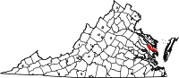
Location in the state of Virginia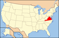
Virginia's location in the U.S.Founded 1673 Seat Saluda Area
- Total
- Land
- Water
211 sq mi (546 km²)
132 sq mi (342 km²)
80 sq mi (207 km²), 38.18%Population
- Density
10,959
75/sq mi (29/km²)Website www.co.middlesex.va.us Middlesex County is a county located on the Middle Peninsula in the U.S. state of Virginia. As of 2010, the population was 10,959.[1] Its county seat is Saluda[2].
Contents
History
Settlement of the area began around 1640 with the county being officially formed in 1669 from a part of Lancaster County. The county's only incorporated town, Urbanna, was established in 1680 serving initially as a port for shipping agricultural products and later as the county's commercial and governmental center.
Rosegill Estate, a Middlesex County plantation first constructed in 1649, served as the temporary seat of the colony under two royal Governors of Virginia, (Sir Henry Chicheley, who served under Thomas Culpeper, 2nd Baron Culpeper of Thoresway, and Lord Francis Howard, 5th Baron Howard of Effingham). The home remains a private residence to this day, though the estate has been purchased by a Northern Virginia Development firm, and much of it is slated to become a 700 home subdivision. An archaeological survey of the ground underneath the planned development's first phase has revealed what appear to be parts of the Nimcock Native American village, and also parts of the Rosegill slave community.[3] The developer intends to proceed with building houses over a portion of the artifacts, which will render excavation and study of them impossible.
During the American Civil War, Urbanna was initially planned as the point of landing for General George B. McClellan's 1862 Peninsula Campaign of 1862 to take Richmond, but ultimately, the failed campaign utilized Fort Monroe as its starting point, almost doubling the distance by land to the Confederate citadel. Delays in reaching the gates of Richmond allowed the Confederates ample time to erect substantial defensive batteries, contributing to the Union failure.
The Historic Middlesex County Courthouse was built in 1850-1874 by architects William R. Jones and John P. Hill, and is listed in the National Register of Historic Places.[4] Construction of a new courthouse[5] began in 2003 and was completed in 2004. It was not occupied until September 2007, however, due to a legal dispute between the county and the architect. The Historic Courthouse has been remodeled and now serves as the Board of Supervisors meeting room and the Registrar's Office.[citation needed]
Urbanna was incorporated on April 2, 1902, comprising an area of 0.49 square miles (1.27 km2). The Town of Urbanna remains the county's largest commercial center and its only incorporated area but the county seat of government has moved to the Village of Saluda on U.S. Route 17. To the east, almost to Stingray Point, the Village of Deltaville is situated on State Route 33 between the mouths of the Rappahannock and Piankatank Rivers. Once a major center for wooden boat building, the village remains a commercial and recreational center. The waterfront east to Stingray Point is home to many marinas, with a heavy concentration on Broad Creek.
Geography
Middlesex County is located at the eastern end of Virginia's Middle Peninsula region. The County is bounded by the Rappahannock River to the north, by the Chesapeake Bay to the east, by the Piankatank River and Dragon Run Swamp to the southwest, and by Essex County to the northwest. The County has a land area of 132 square miles (342 km2) and 135 miles (217 km) of shoreline.
According to the U.S. Census Bureau, the county has a total area of 211 square miles (546 km²), of which 130 square miles (337 km²) is land and 80 square miles (208 km²) (38.18%) is water.
Adjacent Counties
- Lancaster County - North
- Mathews County - South
- Gloucester County - Southwest
- King and Queen County - West
- Essex County - Northwest
Demographics
Historical populations Census Pop. %± 1790 4,140 — 1800 4,203 1.5% 1810 4,414 5.0% 1820 4,057 −8.1% 1830 4,122 1.6% 1840 4,392 6.6% 1850 4,394 0% 1860 4,364 −0.7% 1870 4,981 14.1% 1880 6,252 25.5% 1890 7,458 19.3% 1900 8,220 10.2% 1910 8,852 7.7% 1920 8,157 −7.9% 1930 7,273 −10.8% 1940 6,673 −8.2% 1950 6,715 0.6% 1960 6,319 −5.9% 1970 6,295 −0.4% 1980 7,719 22.6% 1990 8,653 12.1% 2000 9,932 14.8% 2010 10,959 10.3% As of the census[6] of 2000, there were 9,932 people, 4,253 households, and 2,913 families residing in the county. The population density was 76 people per square mile (29/km²). There were 6,362 housing units at an average density of 49 per square mile (19/km²). The racial makeup of the county was 78.50% White, 20.13% Black or African American, 0.25% Native American, 0.12% Asian, 0.41% from other races, and 0.58% from two or more races. 0.55% of the population were Hispanic or Latino of any race.
There were 4,253 households out of which 32.40% had children under the age of 18 living with them, 56.10% were married couples living together, 9.50% had a female householder with no husband present, and 31.50% were non-families. 27.10% of all households were made up of individuals and 14.40% had someone living alone who was 65 years of age or older. The average household size was 2.27 and the average family size was 2.73.
In the county, the population was spread out with 19.20% under the age of 18, 5.10% from 18 to 24, 22.90% from 25 to 44, 30.30% from 45 to 64, and 22.50% who were 65 years of age or older. The median age was 47 years. For every 100 females there were 92.50 males. For every 100 females age 18 and over, there were 90.50 males.
The median income for a household in the county was $36,875, and the median income for a family was $43,440. Males had a median income of $30,842 versus $23,659 for females. The per capita income for the county was $22,708. About 9.70% of families and 13.00% of the population were below the poverty line, including 20.70% of those under age 18 and 10.70% of those age 65 or over.
Communities
Town
Unincorporated communities
- Deltaville
- Saluda
- Topping
See also
References
- ^ [1]. Weldon Cooper Center 2010 Census Count Retrieved September 9, 2011
- ^ "Find a County". National Association of Counties. http://www.naco.org/Counties/Pages/FindACounty.aspx. Retrieved 2011-06-07.
- ^ Daily Press, Jan. 1, 2008
- ^ National Register of Historic Places - Middlesex, VA
- ^ Middlesex Courthouse Complex
- ^ "American FactFinder". United States Census Bureau. http://factfinder.census.gov. Retrieved 2008-01-31.
Further reading
- Gray, Louise E., et al. Historic Buildings in Middlesex County, Virginia: 1650-1875. (Delmar Publishing, Charlotte, NC, 1976.)
- Rutman, Darrett Bruce; Rutman, Anita H. A Place in Time: Middlesex County, Virginia 1650-1750. (W.W. Norton & Co, 1986).
External links
Municipalities and communities of Middlesex County, Virginia Town 
CDPs Unincorporated
communitiesButylo‡ | Stingray Point
Footnotes ‡This populated place also has portions in an adjacent county or counties
Categories:- Virginia counties
- Middlesex County, Virginia
- 1673 establishments


Wikimedia Foundation. 2010.