- Lexington, Virginia
-
For the unincorporated community in Albemarle County, see Lexington, Albemarle County, Virginia.
Lexington, Virginia — City — Stonewall Jackson House, 8 East Washington Street
Nickname(s): Lex Vegas Location of Lexington, Virginia
Coordinates: 37°46′59″N 79°26′43″W / 37.78306°N 79.44528°WCoordinates: 37°46′59″N 79°26′43″W / 37.78306°N 79.44528°W Country United States State Virginia County Rockbridge Government – Mayor Mimi Elrod Area – Total 2.5 sq mi (6.5 km2) – Land 2.5 sq mi (6.5 km2) – Water 0.0 sq mi (0.0 km2) Elevation 1,063 ft (324 m) Population (2010) – Total 7,042 – Density 2,753.8/sq mi (1,056.5/km2) Time zone Eastern (EST) (UTC-5) – Summer (DST) EDT (UTC-4) ZIP code 24450 Area code(s) 540 FIPS code 51-45512[1] GNIS feature ID 1498506[2] Website www.ci.lexington.va.us Lexington is an independent city within the confines of Rockbridge County in the Commonwealth of Virginia. The population was 7,042 in 2010[3]. Lexington is about 55 minutes east of the West Virginia border and is about 50 miles north of Roanoke, Virginia. It was first settled in 1777.
It is home to the Washington and Lee University (W&L) and Virginia Military Institute (VMI). It is the county seat of Rockbridge County.[4] The Bureau of Economic Analysis combines the city of Lexington (along with nearby Buena Vista) with Rockbridge County for statistical purposes.
Union General David Hunter led a raid on Virginia Military Institute during the American Civil War. Robert E. Lee and Stonewall Jackson are buried here. It is also the site of the only house Jackson ever owned, now open to the public as a museum. At the Sam Houston Wayside is a 38,000 pound piece of Texas pink granite commemorating the birthplace of Sam Houston, governor of both Tennessee and Texas.
Contents
Economy
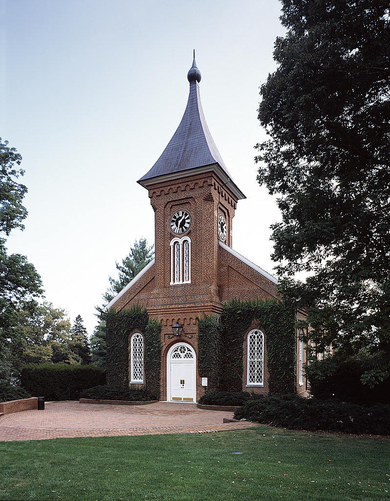
 Lee Chapel
Today, Lexington's primary economic activity stems from higher education and tourism. Located at the intersection of historic U.S. Route 11 and U.S. Route 60 and more modern highways, Interstate 64 and Interstate 81, Lexington is host to Washington and Lee University and Virginia Military Institute. With its various connections to the Civil War, Lexington attracts visitors from around the country. Places of interest in Lexington include the Stonewall Jackson House, Lee Chapel, George C. Marshall Museum, Virginia Military Institute Museum, Museum of Military Memorabilia and the downtown historic district. There are also two non-profit theaters in Lexington that attract visitors to the area: Theater at Lime Kiln and Hull's Drive In.
Lexington also contains a host of small retail businesses catering to a unique mixture of local, tourist, and collegiate clientele.
Lexington has been the site for several movies. Parts of at least six motion pictures were filmed here. The first was the 1938 movie, Brother Rat, which starred Ronald Reagan. After the movie's release he was made an honorary VMI cadet. The second was the 1958 Mardi Gras, which starred Pat Boone as a VMI cadet and actress Christine Carere. The third was Sommersby, starring Richard Gere, Bill Pullman, James Earl Jones, and Jodie Foster. Filming for parts of several Civil War films also took place in Lexington, including the documentary "Lee Beyond the Battles" and Gods and Generals. Most recently, in the fall of 2004, director Steven Spielberg and Tom Cruise filmed scenes for War of the Worlds here, with Dakota Fanning and Tim Robbins.
The city is also home to a number of independent newspapers. The News-Gazette is a weekly community paper; it also produces a free shopper known as The Weekender. The Rockbridge Weekly, is noted for printing police blotters and other crime reports. The Rockbridge Advocate is a monthly newsmagazine with the motto "Independent as a hog on ice."
Geography
Lexington is located at 37°46′58″N 79°26′42″W / 37.78278°N 79.445°W (37.782938, -79.445198).[5]
According to the United States Census Bureau, the city has a total area of 2.5 square miles (6.5 km2), all land. The Maury River, a tributary of the James River, forms the city's northeastern boundary.
Demographics
Traditional demographic statistics may be misleading for communities with a large proportion of students, such as Lexington. As of the census[1] of 2000, there were 6,867 people, 2,232 households, and 1,080 families residing in the city. The population density was 2,753.8 people per square mile (1,064.8/km²). There were 2,376 housing units at an average density of 952.8 per square mile (368.4/km²). The racial makeup of the city was 86.01% White, 10.38% African American, 0.26% Native American, 1.92% Asian, 0.01% Pacific Islander, 0.48% from other races, and 0.93% from two or more races. Hispanics or Latinos of any race were 1.59% of the population.
There were 2,232 households out of which 18.3% had children under the age of 18 living with them, 36.9% were married couples living together, 8.8% had a female householder with no husband present, and 51.6% were non-families. 41.0% of all households were made up of individuals and 17.7% had someone living alone who was 65 years of age or older. The average household size was 2.06 and the average family size was 2.76.
The age distribution, heavily influenced by the city's two colleges, was 11.0% under the age of 18, 41.4% from 18 to 24, 14.5% from 25 to 44, 16.7% from 45 to 64, and 16.4% who were 65 years of age or older. The median age was 23 years. For every 100 females there were 123.2 males. For every 100 females age 18 and over, there were 127.2 males. The unusual sex distribution can be partially explained by the presence of VMI, which did not admit women until 1997 and remains overwhelmingly male today.
The median income for a household in the city was $28,982, and the median income for a family was $58,529. Males had a median income of $35,288 versus $26,094 for females. The per capita income for the city was $16,497. About 8.4% of families and 21.6% of the population were below the poverty line, including 12.9% of those under age 18 and 12.0% of those age 65 or over. However, traditional poverty statistics can be misleading when applied to communities with a large proportion of students, such as Lexington.
 Lexington High School, designed by architect Charles M. Robinson and constructed in 1908, was typical of the modern public schools that cities built during the Progressive Era.
Points of interest
- Virginia Military Institute
- The George C. Marshall Foundation
- Washington and Lee University
- Robert E. Lee grave site, found in Lee Chapel on the W&L campus.
- Traveller (Lee's horse) grave site, found along a walkway just outside Lee Chapel.
- Stonewall Jackson grave site
- Sam Houston place of birth (Nearby)
- Cyrus McCormick place of residence (nearby)
- Kappa Alpha Order International Headquarters
- Omicron Delta Kappa Leadership Honor Society National Headquarters
- Sigma Nu International Headquarters
- Boxerwood Gardens
- Natural Bridge (Virginia)
- Virginia Horse Center
- Hull's Drive In, the only non-profit drive-in theatre in the U.S.
See also
References
- ^ a b "American FactFinder". United States Census Bureau. http://factfinder.census.gov. Retrieved 2008-01-31.
- ^ "US Board on Geographic Names". United States Geological Survey. 2007-10-25. http://geonames.usgs.gov. Retrieved 2008-01-31.
- ^ [1]. Weldon Cooper Center 2010 Census Count Retrieved September 9, 2011
- ^ "Find a County". National Association of Counties. http://www.naco.org/Counties/Pages/FindACounty.aspx. Retrieved 2011-06-07.
- ^ "US Gazetteer files: 2010, 2000, and 1990". United States Census Bureau. 2011-02-12. http://www.census.gov/geo/www/gazetteer/gazette.html. Retrieved 2011-04-23.
External links
- City of Lexington
- Official tourism website
- Chamber Of Commerce
- Virginia Main Street Communities: Lexington Historic District
- Lexington During the Civil War in Encyclopedia Virginia
- Rockbridge Historical Society
Municipalities and communities of Rockbridge County, Virginia County seat: LexingtonTowns 
CDP East Lexington
Unincorporated
communitiesBrownsburg | Marlbrook | Mechanicsville | Raphine | Rockbridge Baths
Categories:- Cities in Virginia
- Lexington, Virginia
- County seats in Virginia
- Rockbridge County, Virginia


Wikimedia Foundation. 2010.