- Craig County, Virginia
-
Craig County, Virginia 
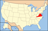
Location in the state of Virginia
Virginia's location in the U.S.Founded 1851 Seat New Castle Area
- Total
- Land
- Water
331 sq mi (857 km²)
331 sq mi (857 km²)
0 sq mi (0 km²), 0.00%Population
- (2010)
- Density
5,190
26/sq mi (10/km²)Craig County is a county located in the Commonwealth of Virginia. As of 2010, the population was 5,190.[1] Its county seat is New Castle[2].
Craig County is part of the Roanoke Metropolitan Statistical Area.
Contents
Geography
According to the U.S. Census Bureau, the county has a total area of 331 square miles (857.3 km2), all land.
Adjacent Counties
- Alleghany County - north
- Botetourt County - east
- Roanoke County - southeast
- Montgomery County - south
- Giles County - southwest
- Monroe County, West Virginia - west
National protected area
- Jefferson National Forest (part)
Demographics
Historical populations Census Pop. %± 1860 3,553 — 1870 2,942 −17.2% 1880 3,794 29.0% 1890 3,835 1.1% 1900 4,293 11.9% 1910 4,711 9.7% 1920 4,100 −13.0% 1930 3,562 −13.1% 1940 3,769 5.8% 1950 3,452 −8.4% 1960 3,356 −2.8% 1970 3,524 5.0% 1980 3,948 12.0% 1990 4,372 10.7% 2000 5,091 16.4% 2010 5,190 1.9% As of the census[3] of 2000, there were 5,091 people, 2,060 households, and 1,507 families residing in the county. The population density was 15 people per square mile (6/km²). There were 2,554 housing units at an average density of 8 per square mile (3/km²). The racial makeup of the county was 98.94% White, 0.20% Black or African American, 0.22% Native American, 0.16% Asian, 0.14% from other races, and 0.35% from two or more races. 0.33% of the population were Hispanic or Latino of any race.
There were 2,060 households out of which 30.80% had children under the age of 18 living with them, 61.90% were married couples living together, 7.00% had a female householder with no husband present, and 26.80% were non-families. 23.90% of all households were made up of individuals and 10.50% had someone living alone who was 65 years of age or older. The average household size was 2.45 and the average family size was 2.88.
In the county, the population was spread out with 23.60% under the age of 18, 6.40% from 18 to 24, 29.70% from 25 to 44, 26.70% from 45 to 64, and 13.60% who were 65 years of age or older. The median age was 40 years. For every 100 females there were 103.40 males. For every 100 females age 18 and over, there were 101.50 males.
The median income for a household in the county was $37,314, and the median income for a family was $41,750. Males had a median income of $26,713 versus $21,337 for females. The per capita income for the county was $17,322. About 6.60% of families and 10.30% of the population were below the poverty line, including 15.90% of those under age 18 and 10.50% of those age 65 or over.
Politics
Presidential election results Year GOP DEM Others 2008 64.7% 1,695 33.5% 877 1.9% 49 2004 65.1% 1,706 34.4% 901 0.5% 14 2000 63.4% 1,580 34.1% 851 2.7% 62 1996 45.3% 979 41.5% 895 13.2% 285 1992 43.9% 1,008 42.0% 965 14.1% 324 1988 55.5% 1,112 43.1% 864 1.4% 29 1984 57.7% 1,173 41.6% 845 0.7% 15 1980 43.2% 768 53.2% 946 3.6% 65 1976 32.8% 546 66.2% 1,103 1.1% 18 1972 63.4% 774 34.8% 425 1.7% 21 1968 46.2% 581 33.3% 419 20.3% 256 1964 38.3% 477 61.7% 767 0.0% 0 1960 44.8% 433 55.2% 534 0.0% 0 Communities
- Abbott (unincorporated community)
- New Castle (town)
- Paint Bank (town)
- Simmonsville
See also
References
- ^ [1]. Weldon Cooper Center 2010 Census Count Retrieved September 8, 2011
- ^ "Find a County". National Association of Counties. http://www.naco.org/Counties/Pages/FindACounty.aspx. Retrieved 2011-06-07.
- ^ "American FactFinder". United States Census Bureau. http://factfinder.census.gov. Retrieved 2008-01-31.

Alleghany County 
Monroe County, West Virginia 
Botetourt County  Craig County, Virginia

Giles County Montgomery County Roanoke County Municipalities and communities of Craig County, Virginia Town Unincorporated
communitiesAbbott | Captain | Huffman | Maggie | Marshalltown | Paint Bank | Simmonsville
Categories:- Virginia counties
- 1851 establishments in the United States
- Craig County, Virginia
- Roanoke metropolitan area
Wikimedia Foundation. 2010.

