- Arlington County, Virginia
Infobox U.S. County
county = Arlington County
state = Virginia

map size=
founded =9 July ,1846
seat = Arlington
area_total_sq_mi =26
area_land_sq_mi =26
area_water_sq_mi =0
area percentage = 0.35%
census yr = 2007
pop = 206,800
density_km2 = 3087
web = www.arlingtonva.usArlington County is an urban
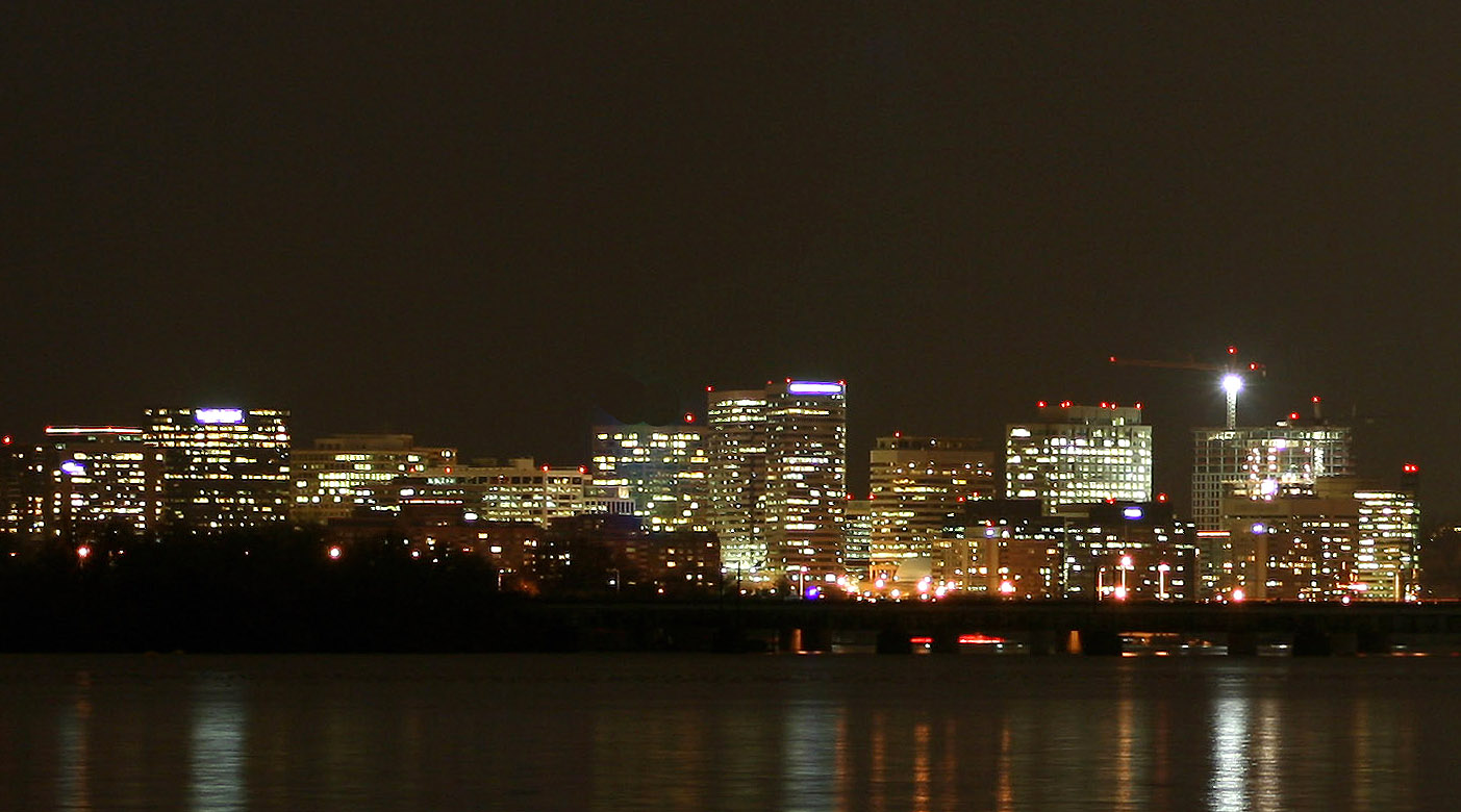
county of about 206,800 residents in the Commonwealth ofVirginia . It is located directly across thePotomac River fromWashington, D.C. cite web | url = http://www.arlingtonva.us/departments/CPHD/planning/data_maps/CPHDPlanningDataandMapsProfile.aspx?lnsLinkID=1150 | title = Profile | accessmonthday = January 1|accessyear = 2008] Formerly part of the District of Columbia, the land now comprising the county was retroceded to Virginia onJuly 9 ,1846 , in an act of Congress that took effect in 1847.Despite being a county, it is considered a Central City of the
Washington Metropolitan Area by the Census Bureau, along with the adjacent cities of Washington andAlexandria, Virginia . At a land area of convert|26|sqmi|km2, it is geographically the smallest self-governing county in the United States. cite web | url = http://www.naco.org/Content/NavigationMenu/About_Counties/County_Government/A_Brief_Overview_of_County_Government.htm| title = National Association of Counties | accessmonthday = September 1|accessyear = 2008]"CNN Money" ranked Arlington as the most educated city in 2006 with 35.7% of residents having held
graduate degrees . Along with five otherNorthern Virginia counties, Arlington ranked among the twenty U.S. counties with the highest median household income in 2006. [ [http://www.forbes.com/2008/01/22/counties-rich-income-forbeslife-cx_mw_0122realestate.html Matt Woolsey, America's Richest Counties, Forbes.com, 01.22.08, 6:00 PM ET] Forbes.com Web site. Retrieved on 2008-02-08.] [ [http://www.forbes.com/2008/01/22/counties-rich-income-forbeslife-cx_mw_0122realestate_slide_10.html Matt Woolsey, America's Richest Counties, Forbes.com, 01.22.08: Complete List: America's Richest Counties: 9. Arlington County, Va.] Forbes.com Web Site. Retrieved on 2008-02-08.]Arlington is the location of
Arlington National Cemetery , National Airport,the Pentagon , and numerous monuments.General characteristics
As of January 1, 2008, the estimated population was 206,800. cite web | url = http://www.arlingtonva.us/departments/CPHD/planning/data_maps/CPHDPlanningDataandMapsProfile.aspx | title = Profile | accessmonthday = January 1|accessyear = 2008] All cities within the Commonwealth of Virginia are independent of counties, though towns may be incorporated within counties. Considering this, it is inaccurate to refer to Arlington County as a city. However, Arlington has no existing incorporated towns because
Virginia law prevents the creation of any new municipality within a county that has apopulation density greater than 1,000 persons per square mile. Itscounty seat is thecensus-designated place (CDP) of ArlingtonGR|6, which is coincident with the Census Boundary of Arlington County; however, the county courthouse and most governmental offices are located in the Courthouse neighborhood.History
Alexandria County, District and Commonwealth jurisdictions
Once part of Fairfax County in the
Colony of Virginia , the area that contains Arlington County was ceded to the new U.S. government by the Commonwealth of Virginia. In 1791, the U.S. Congress formally established the limits of the federal territory that would be the nation's capital as a square of convert|10|mi|km on a side, the maximum area permitted by Article I, Section 8, of theUnited States Constitution . However, the legislation that established these limits contained a clause that prohibited the federal government from locating any offices within the portion of the territory that Virginia had ceded.During 1791 and 1792,
Andrew Ellicott led a team of surveyors that determined the boundaries of the federal territory. The team placed along the boundaries forty markers that were approximately one mile from each other. Fourteen of these markers were in Virginia. [ Boundary markers of the Nation's Capital : a proposal for their preservation & protection : a National Capital Planning Commission Bicentennial report. National Capital Planning Commission, Washington, DC, 1976; for sale by the Superintendent of Documents, U.S. Government Printing Office]When Congress moved to the new District of Columbia in 1801, it enacted legislation that divided the District into two counties: (1) the county of Washington, which lay on the east side of the Potomac River, and (2) the county of Alexandria, which lay on the west side of the River.Sixth Congress, Session II, Chapter XV (An Act concerning the District of Columbia), Section 2 (Stat. II, Feb. 27, 1801) (United States Statutes at Large, Vol. II, p. 103)] Alexandria County contained the present area of Arlington County, then mostly rural, and the settled town of Alexandria (now "Old Town" Alexandria), a port located on the Potomac River in the southeastern part of the area of the present City of Alexandria.
Residents of Alexandria County had expected the federal capital's location would result in land sales and the growth of commerce. Instead the county found itself struggling to compete with the town of Georgetown, a port located in Washington County adjacent to the capital city (Washington City).
As the federal government could not establish any offices in the County, and as the economically important
Chesapeake and Ohio Canal (C&O Canal) on the north side of the Potomac River favored Georgetown, Alexandria's economy stagnated. It didn't help that some Georgetown residents opposed federal efforts to maintain the Alexandria Canal, which connected the C&O Canal in Georgetown to Alexandria's port. Moreover, as residents of the District of Columbia, Alexandria's citizens had no representation in Congress and could not vote in federal elections.The town of Alexandria had been a port and market for the slave trade. With growing talk of abolishing slavery in the nation's
capital , some Alexandrians feared the local economy would suffer if the federal government took this step.At the same time, there arose in Virginia an active abolitionist movement that created a division on the question of slavery in Virginia's General Assembly (subsequently, during the Civil War, Virginia's division on the slavery issue led to the formation of the state of West Virginia by the most anti-slavery counties). Pro-slavery Virginians recognized that Alexandria County could provide two new representatives who favored slavery in the General Assembly if the County returned to the Commonwealth.
As a result, a movement grew to separate Alexandria County from the District of Columbia. After a referendum, the county's residents petitioned the U.S. Congress and the Virginia legislature to permit the County to return to Virginia. The area was retroceded to Virginia on
July 9 ,1846 .cite web | url = http://www.citymuseumdc.org/gettoknow/faq.asp | title = Frequently Asked Questions About Washington, D.C. | accessmonthday = August 30 | accessyear = 2006 | work = The Historical Society of Washington, D.C.]In 1852, the
independent city of Alexandria was incorporated from a portion of Alexandria County.cite web | url = http://alexandriava.gov/city/about-alexandria/about.html#history | title = Alexandria's History | accessmonthday = August 30 | accessyear = 2006] This led to occasional confusion, as the adjacent county and municipal entities continued to share the name of "Alexandria". Alexandria County renamed itself in 1920 as Arlington County. The new name was borrowed fromArlington National Cemetery .Arlington National Cemetery
Arlington National Cemetery is an American
military cemetery established during theAmerican Civil War on the grounds of Confederate GeneralRobert E. Lee 's home, Arlington House (also known as the Custis-Lee Mansion). It is directly across thePotomac River fromWashington, D.C. , north ofthe Pentagon . With nearly 300,000 people buried there, Arlington National Cemetery is the second-largest national cemetery in the United States.Arlington House was named after the Custis family's homestead on Virginia's Eastern Shore. It is associated with the families of Washington, Custis, and Lee. Begun in 1802 and completed in 1817, it was built by
George Washington Parke Custis . After his father died, young Custis was raised by his grandmother and her second husband, the first US PresidentGeorge Washington , atMount Vernon . Custis, a far-sighted agricultural pioneer, painter, playwright, and orator, was interested in perpetuating the memory and principles of George Washington. His house became a "treasury" of Washington heirlooms.In 1804, Custis married Mary Lee Fitzhugh. Their only child to survive infancy was Mary Anna Randolph Custis, born in 1808. Young Robert E. Lee, whose mother was a cousin of Mrs. Custis, frequently visited Arlington. Two years after graduating from West Point,
Lieutenant Lee married Mary Custis at Arlington onJune 30 ,1831 . For 30 years, Arlington House was home to the Lees. They spent much of their married life traveling between U.S. Army duty stations and Arlington, where six of their seven children were born. They shared this home with Mary's parents, the Custis family.When George Washington Parke Custis died in 1857, he left the Arlington estate to Mrs. Lee for her lifetime and afterwards to the Lees' eldest son,
George Washington Custis Lee .The U.S. government confiscated Arlington House and 200
acre s (81hectare s) of ground immediately from the wife of General Robert E. Lee during the Civil War. The government designate the grounds as a military cemetery onJune 15 ,1864 , by Secretary of WarEdwin M. Stanton . In 1882, after many years in the lower courts, the matter of the ownership of Arlington National Cemetery was brought before the United States Supreme Court. The Court decided that the property rightfully belonged to the Lee family. TheUnited States Congress then appropriated the sum of $150,000 for the purchase of the property from the Lee family.Veterans from all the nation's wars are buried in the cemetery, from the
American Revolution through the military actions in Afghanistan and Iraq. Pre-Civil War dead were re-interred after 1900.The
Tomb of the Unknowns , also known as theTomb of the Unknown Soldier , stands atop a hill overlooking Washington, DC. PresidentJohn F. Kennedy is buried in Arlington National Cemetery with his wife and some of their children. His grave is marked with an "Eternal Flame." His brother SenatorRobert F. Kennedy is also buried nearby. Another President,William Howard Taft , who was also a Chief Justice of the U.S. Supreme Court, is the only other President buried at Arlington.Other frequently visited sites near the cemetery are the U.S. Marine Corps War Memorial, commonly known as the "Iwo Jima Memorial", the U.S. Air Force Memorial, the
Women in Military Service for America Memorial , theNetherlands Carillon and the U.S. Army'sFort Myer .The Pentagon
The Pentagon in Arlington is the headquarters of theUnited States Department of Defense. It was dedicated onJanuary 15 ,1943 and it is the world's largest office building. Although it is located in Arlington, theUnited States Postal Service requires that "Washington, D.C." be used as the place name in mail addressed to theZIP code s assigned toThe Pentagon .The building is
pentagon -shaped in plan and houses about 23,000 military and civilian employees and about 3,000 non-defense support personnel. It has five floors and each floor has five ring corridors. The Pentagon's principle law enforcement arm is theUnited States Pentagon Police , the agency that protects the Pentagon and various other DoD jurisdictions throughout the National Capital Region.Built during the early years of
World War II , it is still thought of as one of the most efficient office buildings in the world. It has 17.5 miles (28 km) of corridors, yet it takes only seven minutes or so to walk between any two points in the building.It was built from 680,000 tons of sand and gravel dredged from the nearby
Potomac River that were processed into 435,000 cubic yards (330,000 m³) of concrete and molded into the pentagon shape. Very little steel was used in its design due to the needs of the war effort.The open-air central plaza in the Pentagon is the world's largest "no-salute, no-cover" area (where U.S. servicemembers need not wear hats nor salute). The snack bar in the center is informally known as the Ground Zero Cafe, a nickname originating during the
Cold War when the Pentagon was targeted by Soviet nuclear missiles.During World War II, the earliest portion of the
Henry G. Shirley Memorial Highway was built in Arlington in conjunction with the parking and traffic plan for the Pentagon. This earlyfreeway , opened in 1943, and completed toWoodbridge, Virginia in 1952, is now part of Interstate 395.Demographics
USCensusPop
1890=4258
1900=6430
1910=10231
1920=16040
1930=26615
1940=57040
1950=135449
1960=163401
1970=174284
1980=152599
1990=170936
2000=189453
estyear=2007
estimate=204568The [http://www.arlingtonva.us/Departments/CPHD/Planning/data_maps/CPHDPlanningDataandMapsMain.aspx Arlington County Planning Research and Analysis Team] (PRAT) estimates the January 1, 2008 population at 206,800As of the 2000
census GR|2, there were:
*189,453 people
*86,352 households,
*and 39,290 families residing in Arlington.The
population density was 7,323 people per square mile (2,828/km²), the highest of any county in Virginia.Fact|date=July 2008 There were 90,426 housing units at an average density of 3,495/sq mi (1,350/km²).The racial makeup of the county was 68.94% White, 9.35% Black or African American, 0.35% Native American, 8.62% Asian, 0.08% Pacific Islander, 8.33% from other races, and 4.34% from two or more races. Hispanic or Latino of any race were 18.62% of the population.
28% of Arlington residents were foreign-born.
In 2005 Arlington's population was 64.7% non-Hispanic whites. 8.8% of the population was African-American. Native Americans constituted 0.4% of the population. Asians now outnumbered African-Americans, constituting 8.9% of the population. Latinos were 16.1% of the population.
There were 86,352 households out of which 19.30% had children under the age of 18 living with them, 35.30% were married couples living together, 7.00% had a female householder with no husband present, and 54.50% were non-families. 40.80% of all households were made up of individuals and 7.30% had someone living alone who was 65 years of age or older. The average household size was 2.15 and the average family size was 2.96.
In the county, the population was spread out with 16.50% under the age of 18, 10.40% from 18 to 24, 42.40% from 25 to 44, 21.30% from 45 to 64, and 9.40% who were 65 years of age or older. The median age was 34 years. For every 100 females there were 101.50 males. For every 100 females age 18 and over, there were 100.70 males.
According to a 2006 estimate, the median income for a household in the county was $87,350, and the median income for a family was $116,114. [http://factfinder.census.gov/servlet/ACSSAFFFacts?_event=ChangeGeoContext&geo_id=05000US51013&_geoContext=01000US%7C04000US51%7C16000US5101000&_street=&_county=arlington&_cityTown=arlington&_state=04000US51&_zip=&_lang=en&_sse=on&ActiveGeoDiv=geoSelect&_useEV=&pctxt=fph&pgsl=010&_submenuId=factsheet_1&ds_name=ACS_2006_SAFF&_ci_nbr=null&qr_name=null®=null%3Anull&_keyword=&_industry=] Males had a median income of $51,011 versus $41,552 for females. The
per capita income for the county was $37,706. About 5.00% of families and 7.80% of the population were below the poverty line, including 9.10% of those under age 18 and 7.00% of those age 65 or over. In 2004 the average single-family home sales price passed $600,000, approximately triple the price less than a decade before, and the median topped $550,000 Fact|date=February 2007.Arlington Census Designated Place (CDP) population history
*1960.....163,401 [Although Arlington CDP had a population of 135,449 in 1950, the Census did not treat Arlington as a CDP because in 1950 CDPs were assigned to
rural areas only. They were first assigned to urban areas during the 1960 Census.]
*1970.....174,284
*1980.....152,299
*1990.....170,936
*2000.....189,453
*2006.....200,226
*2007.....202,800 (estimated)[http://www.arlingtonvirginiausa.com/index.cfm/7044 Arlington Economic Development] maintains regional economic data and statistics.
Development patterns
Arlington has won awards for its
smart growth development strategies. For over 30 years, the government has had a policy of concentrating much of its new development near transit facilities, such as Metrorail stations and the high-volume bus lines of Columbia Pike. Within the transit areas, the government has a policy of encouraging mixed-use and pedestrian- andtransit-oriented development . Outside of those areas, the government usually limits density increases, but makes exceptions for larger projects that are near major highways, such as in Shirlington, near I-395 (the Shirley Highway).Much of Arlington's development in the last generation has been concentrated around 7 of the County's 11 Metrorail stations. However,
infill development elsewhere in the County has recently replaced many undeveloped lots and small single-family dwellings with row houses and larger homes.Increasing land values and re-development (most of which is
by-right development Fact|date=August 2008) has diminished Arlington's tree canopy and reduced the supply of existingaffordable housing . To address x coverage and the construction of larger homes the County has recently limited the allowable coverage on some single-family lots.In addition, the County implemented in 2005 an affordable housing ordinance that requires most developers to contribute significant affordable housing resources, either in units or through a cash contribution, in order to obtain the highest allowable amounts of increased building density in new development projects, most of which are planned near Metrorail station areas. The County also permits greater heights and densities through zoning ordinance bonuses in exchange for the creation of additional on-site affordable housing units, at a target level of 1:1 (i.e. one committed affordable unit for every market-rate unit; since 2004, and including condominium projects, actual average production has been closer to 2:3.)
The County focuses its efforts to preserve, create and maintain for-sale and rental affordable housing units to households whose income is not greater than 80% of the Washington, DC Metropolitan Area Median Income (AMI); rental units are committed for no fewer than 30 years at no greater than 60% AMI. AMI tables are published annually by the US Department of Housing and Urban Development.
The Arlington County [http://www.arlingtonva.us/Departments/CPHD/Planning/data_maps/CPHDPlanningDataandMapsMain.aspx Planning Research and Analysis Team (PRAT)] maintains detailed data about current and historical [http://www.arlingtonva.us/Departments/CPHD/Planning/data_maps/CPHDPlanningDataandMapsDevelopment.aspx development in Arlington County] .

Rosslyn

">
Courthouse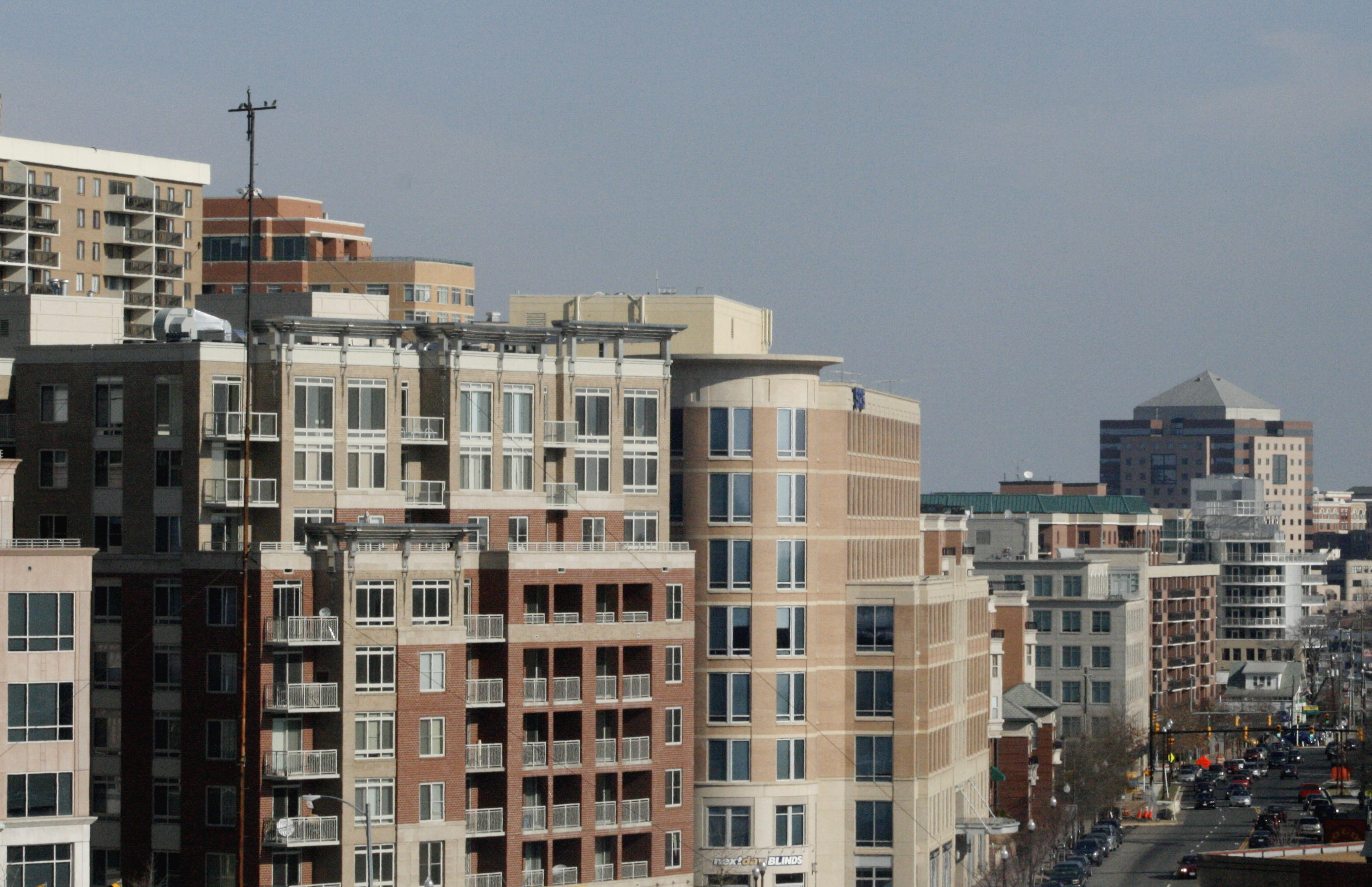
Ballston
">
Crystal City Pentagon City
Government
Arlington is governed by a five person County Board, whose members are elected to four year terms. They appoint a county manager, who is the chief executive of the County Government. Like all Virginia Counties, Arlington also has five elected constitutional officers: a sheriff, a clerk of court, a commonwealth's attorney, a treasurer, and a commissioner of the revenue. Starting in 1996, the County switched from a School Board appointed by the County Board to an elected School Board.
Starting in 2008, for the first time in many years, all elected officials in Arlington were either nominated by or, in the case of School Board members, endorsed by the Democratic Party. However, starting in the early 1980s, the Democratic Party was the predominant party in the County. The Republican Party controlled a School Board seat from 1999 until 2007, held a majority on the County Board from 1977 to 1982, and controlled at least one County Board seat until 1995 (and again briefly in 1999).
Arlington is governed or represented by three of the four openly gay elected officials in Virginia. Arlington County Board member Jay Fisette was the first in 1997. Adam Ebbin became the first openly gay Delegate in 2003. In 2006, School Board member Sally Baird became the first openly lesbian elected official in Virginia. (The fourth openly gay elected official is Councilman Paul Smedberg of the City of Alexandria Council.)
Arlington also has several Constitutional Officers, all of whom are elected County-wide.
Arlington County includes a large selection of
Sears Catalog Home s, which were offered between 1908 and 1940, Considered to be of exceptional quality, in modern times, these houses are sought after by many home buyers. As well, Arlington features some of the first and among the best examples of post-World War II garden style apartment complexes in the U.S., some of which were designed by architectMihran Mesrobian . Arlington Boulevard (Route 50) is the dividing line in the county.Neighborhood Historic Preservation Districts
A number of the county's residential neighborhoods and larger garden-style apartment complexes are listed in the
National Register of Historic Places and/or designated under the County government's zoning ordinance as local Historic Preservation Districts. [ [http://www.arlingtonva.us/departments/CPHD/ons/CPHDOnsHistoricPreservation.aspx Arlington County Government Historic Preservation Program] Official Arlington County Government Website. Retrieved on 2008-02-05.] [ [http://www.arlingtonva.us/departments/CPHD/planning/zoning/pdfs/Ordinance_Section31a.pdf Arlington County Zoning Ordinance: Section 31.A. Historic Preservation Districts] Official Arlington County Government Website. Retrieved on 2008-02-05.] These include Arlington Village, Arlington Forest, Ashton Heights, Buckingham, Cherrydale, Claremont, Colonial Village, Fairlington, Lyon Park, Lyon Village, Maywood, Penrose, Waverly Hills and Westover. [ [http://www.arlingtonva.us/Departments/CPHD/ons/hp/CPHDOnsHpDistricts.aspx List of Arlington County Government Designated Local Historic Districts] Official Arlington County Government Website. Retrieved on 2008-02-05.] [ [http://www.arlingtonva.us/Departments/CPHD/ons/hp/CPHDOnsHpHpNrsites.aspx List of Arlington County Sites in the National Register of Historic Places] Official Arlington County Government Website. Retrieved on 2008-02-05.]Neighborhood Conservation Plans
Many of Arlington County's neighborhoods participate in the Arlington County government's Neighborhood Conservation Program (NCP). [ [http://www.arlingtonva.us/Departments/CPHD/ons/CPHDOnsConservation.aspx Neighborhood Conservation Program] Official Arlington County Government Website. Retrieved on 2008-02-05.] Each of these neighborhoods has a Neighborhood Conservation Plan that describes the neighborhood's characteristics, history and recommendations for capital improvement projects that the County government funds through the NCP. [ [http://www.arlingtonva.us/Departments/CPHD/ons/conservation/CPHDOnsConservationPlans.aspx Neighborhood Conservation Plans] Official Arlington County Government Website. Retrieved on 2008-02-05.]
Postal areas
The three-digit zip code prefix 222 uniquely identifies Arlington. Delivery areas north of Arlington Boulevard have odd-numbered ZIP codes (22201, 22203, 22205, 22207, 22209, and 22213), while delivery areas south of Arlington Boulevard have even-numbered ZIP codes (22202, 22204, and 22206). ZIP codes that are assigned to
post office box es, large mailers, and military facilities do not always follow that rule.Ronald Reagan Washington National Airport and the Pentagon, both within the boundaries of Arlington County, are assigned with Washington, D.C., ZIP codes.
Education
Primary and secondary schools
Arlington County is served by the
Arlington Public Schools system. The public high schools in Arlington County are Yorktown High School,Washington-Lee High School , Wakefield High School, and theH-B Woodlawn program. Arlington County is also home to Bishop O'Connell, a Roman Catholic high school.Arlington County spends about half of its revenue on education, making it one of the top ten per-pupil spenders in the nation (as of 2004, over $13,000, the second highest amount spent on education in the United States, behind
New York City ).Through an agreement with Fairfax County Public Schools approved by the school board in 1999, up to 26 students residing in Arlington per grade level may be enrolled at the
Thomas Jefferson High School for Science and Technology in Fairfax at a cost to Arlington of approximately $8000 per student. For the first time in 2006, more students (36) were offered admission in the selective high school than allowed by the previously established enrollment cap.cite web | url = http://www.fcps.k12.va.us/mediapub/pressrel/tjhsstadmisstats2005-06.pdf | title = TJHSST Admissions Statistics for 2005-06 | accessmonthday = August 30 | accessyear = 2006 | format = PDF]Colleges and universities
Marymount University is the only university with its main campus located in Arlington. Founded in 1950 by theReligious of the Sacred Heart of Mary as Marymount College of Virginia located on North Glebe Road. The school has expanded into offering complete 4 year undergraduate degrees, graduate degrees and recently doctorial degrees in Fall 2004. The school expanded in the early 1990s and opened an additional campus in Ballston. They also have a Reston Center located inReston, Virginia .George Mason University operates an Arlington campus in theVirginia Square area between Clarendon and Ballston. The campus houses the School of Law, School of Public Policy and other programs. The University is commencing construction on a new building in October 2007, which is expected to open in 2010. This new building will provide additional space for the School of Law and other graduate programs.DeVry University operates a campus for undergraduate classes along with theKeller School of Management for its graduate classes, in Crystal City. The University established the campus in 2001.Institute for the Psychological Sciences is a regionally accredited institution offering postgraduate programs in Psychology with a Roman Catholic perspective. Its campus is in the Crystal City neighborhood.[http://www.umtweb.edu/ University of Management and Technology] is a distance learning university that is headquartered in Rosslyn.
The Art Institute of Washington , a local branch ofThe Art Institutes is located in the Ames Center across from the Rosslyn Metro Station.Strayer University has a campus in Arlington as well as its corporate headquarters.In addition,
Argosy University , Banner College,Everest College , George Washington University,Georgetown University ,Northern Virginia Community College ,Troy University , theUniversity of New Haven , theUniversity of Oklahoma , and Westwood College all have campuses in Arlington.ister cities
Arlington has four sister cities, as designated by [http://www.sister-cities.org/ Sister Cities International, Inc. (SCI)] :
*flagicon|Germany
Aachen ,Germany
*flagicon|FranceReims ,France
*flagicon|El Salvador San Miguel,El Salvador
*flagicon|MexicoCoyoacán ,Mexico ee also
*
Arlington Independent Media
*List of people from the Washington, D.C. metropolitan area
*List of federal agencies in Arlington County, Virginia
*Arlington Hall References
External links
* [http://www.arlingtonva.us/ Arlington County government]
* [http://www.arlingtonchamber.org/ Arlington Chamber of Commerce]
* [http://www.arlingtonhistoricalsociety.org/ Arlington Historical Society]
*
Wikimedia Foundation. 2010.