- Amherst County, Virginia
-
Amherst County, Virginia 
Seal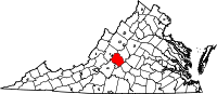
Location in the state of Virginia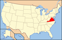
Virginia's location in the U.S.Founded 1761 Seat Amherst Area
- Total
- Land
- Water
479 sq mi (1,241 km²)
475 sq mi (1,230 km²)
4 sq mi (10 km²), 0.75%Population
- (2010)
- Density
32,353
68/sq mi (26.3/km²)Website www.countyofamherst.com Amherst County is a county located in the Commonwealth of Virginia. As of 2010, the population was 32,353.[1][2]. Its county seat is Amherst.[3]
Amherst County is part of the Lynchburg Metropolitan Statistical Area.
Contents
History
Amherst County was formed in 1761, from parts of Albemarle County. The county was named for Sir Jeffrey Amherst, known as the "Conqueror of Canada". Jeffrey Amherst was named Governor of Virginia, although he never came to the colony. Native Americans were the first humans to populate the area. They hunted and fished mainly along the countless rivers and streams in the county. With the establishment of the Virginia Colony in 1607, English emigrants arrived in North America. By the late 17th century English explorers and traders traveled up the James River to this area. Early trading posts formed between 1710 and 1720. By 1730, many new families moved into the land currently known as Amherst County drawn by the desire for land and the good tobacco-growing soil.
In 1761, Amherst County was formed from the southern half of Albemarle County. The original county seat had been in Cabelsville, now Colleen in what would later become Nelson County. The county was named for Sir Jeffrey Amherst who commanded the British forces that successfully secured Canada from the French. In 1806 the county assumed its present proportions when Nelson County was formed from its northern half. At that point, the county seat was moved to the village of Five Oaks, later renamed Amherst. The present county courthouse was built in 1870 and has served the county ever since. On a historically interesting note, Amherst County produced more Confederate soldiers per capita than anywhere else in the C.S.A.
In the early days, the major crop raised in Amherst County was tobacco. Apple orchards were part of mixed farming that replaced tobacco, especially in the late 19th century. Timber, mining and milling were also important industries. The introduction of the railroad in the late 19th century greatly influenced the county's growth. The county contains many good examples of 18th, 19th and early 20th century rural and small town architecture. The downtown area of Amherst is a classic example of early 20th century commercial architecture.
Geography
According to the U.S. Census Bureau, the county has a total area of 479 square miles (1,240 km2), of which 475 square miles (1,230 km2) is land and 4 square miles (10 km2) (0.75%) is water.
Adjacent counties / Independent city
- Rockbridge County, Virginia - northwest
- Nelson County, Virginia - northeast
- Appomattox County, Virginia - southeast
- Campbell County, Virginia - south
- Lynchburg, Virginia - south
- Bedford County, Virginia - southwest
National protected areas
- Blue Ridge Parkway (part)
- George Washington National Forest (part)
Demographics
Historical populations Census Pop. %± 1790 13,703 — 1800 16,801 22.6% 1810 10,548 −37.2% 1820 10,423 −1.2% 1830 12,071 15.8% 1840 12,576 4.2% 1850 12,699 1.0% 1860 13,742 8.2% 1870 14,900 8.4% 1880 18,709 25.6% 1890 17,551 −6.2% 1900 17,864 1.8% 1910 18,932 6.0% 1920 19,771 4.4% 1930 19,020 −3.8% 1940 20,273 6.6% 1950 20,332 0.3% 1960 22,953 12.9% 1970 26,072 13.6% 1980 29,122 11.7% 1990 28,578 −1.9% 2000 31,894 11.6% 2010 32,353 1.4% As of the census[4] of 2000, there were 31,894 people, 11,941 households, and 8,645 families residing in the county. The population density was 67 people per square mile (26/km²). There were 12,958 housing units at an average density of 27 per square mile (11/km²). The racial makeup of the county was 77.67% White, 19.79% Black or African American, 0.81% Native American, 0.35% Asian, 0.02% Pacific Islander, 0.41% from other races, and 0.94% from two or more races. 0.96% of the population were Hispanic or Latino of any race.
There were 11,941 households out of which 31.70% had children under the age of 18 living with them, 56.00% were married couples living together, 12.40% had a female householder with no husband present, and 27.60% were non-families. 24.00% of all households were made up of individuals and 9.90% had someone living alone who was 65 years of age or older. The average household size was 2.51 and the average family size was 2.95.
In the county, the population was spread out with 23.50% under the age of 18, 9.70% from 18 to 24, 27.70% from 25 to 44, 25.30% from 45 to 64, and 13.80% who were 65 years of age or older. The median age was 38 years. For every 100 females there were 91.10 males. For every 100 females age 18 and over, there were 87.10 males.
The median income for a household in the county was $37,393, and the median income for a family was $42,876. Males had a median income of $31,493 versus $22,155 for females. The per capita income for the county was $16,952. About 8.00% of families and 10.70% of the population were below the poverty line, including 13.20% of those under age 18 and 11.60% of those age 65 or over.
Communities
Town
Unincorporated
Notable residents
- William Barnett (1761–1834), born in Amherst County, United States Congressman [5]
- William Becknell, born in Amherst County, first white man to open what would become the Santa Fe Trail[5]
- Samuel Jordan Cabell (1756–1818), born in Amherst County, United States Congressman[5]
- Peter Cartwright (1785–1872), born in Amherst County, noted "hellfire and brimstone" preacher [5]
- Powhatan Ellis, (1790–1863), born in Amherst County, justice of the Mississippi Supreme Court, United States Senator from Mississippi, and minister to Mexico. Ellisville, Mississippi, is named in his honor.[5]
- David S. Garland (1769 – 1841), Congressman, master of the Brick House (Clifford, Virginia), founder of the New Glasgow Academy.
- Ottie Cline Powell (1890–1894), born in Amherst County four year old boy who died after getting lost collecting firewood outside his schoolhouse. Reportedly haunts the area he died at.[6][7]
See also
References
- ^ [1]
- ^ [2]. Weldon Cooper Center 2010 Census Count Retrieved September 8, 2011
- ^ "Find a County". National Association of Counties. http://www.naco.org/Counties/Pages/FindACounty.aspx. Retrieved 2011-06-07.
- ^ "American FactFinder". United States Census Bureau. http://factfinder.census.gov. Retrieved 2008-01-31.
- ^ a b c d e Who Was Who in America, Historical Volume, 1607-1896. Chicago: Marquis Who's Who. 1963.
- ^ http://www.usatoday.com/travel/destinations/10great/2006-07-27-10-great-haunted-hikes_x.htm
- ^ http://www.trails.com/list_12425_haunted-forests-north-america.html

Rockbridge County Nelson County 
 Amherst County, Virginia

Bedford County City of Lynchburg and Campbell County Appomattox County Municipalities and communities of Amherst County, Virginia Town 
CDP Unincorporated
communityCategories:- Virginia counties
- Amherst County, Virginia
- 1761 establishments in the Thirteen Colonies
- Counties on the James River (Virginia)
- Lynchburg metropolitan area
- Populated places established in 1761


Wikimedia Foundation. 2010.