- Cottle County, Texas
-
Cottle County, Texas 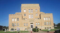 Cottle County Courthouse in Paducah
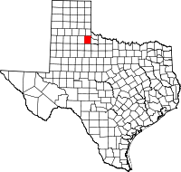
Location in the state of Texas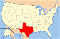
Texas's location in the U.S.Founded 1892 Seat Paducah Area
- Total
- Land
- Water
902 sq mi (2,336 km²)
901 sq mi (2,334 km²)
1 sq mi (3 km²), 0.05%Population
- (2000)
- Density
1,904
3/sq mi (1/km²)Website www.co.cottle.tx.us Cottle County is a county in the U.S. state of Texas. In 2000, its population was 1,904. Cottle was founded in 1892. Cottle is named for George Washington Cottle, who died defending the Alamo. Cottle County was formerly one of forty-six prohibition, or entirely dry counties in the state of Texas. It now allows beer and wine sales. Its seat is Paducah[1].
The Matador Ranch, based in Motley once reached into Cottle County.[2]
Contents
Geography
According to the U.S. Census Bureau, the county has a total area of 902 square miles (2,336.2 km2), of which 901 square miles (2,333.6 km2) is land and 1 square mile (2.6 km2) (0.05%) is water.
Major highways
 U.S. Highway 70
 U.S. Highway 83
 U.S. Highway 62
Adjacent counties
- Childress County (north)
- Hardeman County (northeast)
- Foard County (east)
- King County (south)
- Motley County (west)
- Hall County (northwest)
Demographics
As of the census[3] of 2000, there were 1,904 people, 820 households, and 550 families residing in the county. The population density was 2 people per square mile (1/km²). There were 1,088 housing units at an average density of 1 per square mile (0/km²). The racial makeup of the county was 81.46% White, 9.87% Black or African American, 7.20% from other races, and 1.47% from two or more races. 18.91% of the population were Hispanic or Latino of any race.
There were 820 households out of which 28.00% had children under the age of 18 living with them, 53.90% were married couples living together, 10.60% had a female householder with no husband present, and 32.90% were non-families. 32.00% of all households were made up of individuals and 20.90% had someone living alone who was 65 years of age or older. The average household size was 2.28 and the average family size was 2.84.
In the county, the population was spread out with 23.90% under the age of 18, 5.70% from 18 to 24, 21.50% from 25 to 44, 23.30% from 45 to 64, and 25.60% who were 65 years of age or older. The median age was 44 years. For every 100 females there were 87.20 males. For every 100 females age 18 and over, there were 81.90 males.
The median income for a household in the county was $25,446, and the median income for a family was $33,036. Males had a median income of $24,375 versus $16,667 for females. The per capita income for the county was $16,212. About 13.70% of families and 18.40% of the population were below the poverty line, including 28.40% of those under age 18 and 16.00% of those age 65 or over.
Presidential elections
Until 2000, the county had gone consistently Democratic in presidential elections. In 1972, Cottle County was the only one in Texas north of Maverick County (Eagle Pass) to have been won by George McGovern[4] and Walter Mondale won a majority of the county's votes in 1984.[5] It has since trended Republican and in the last three elections the Republican nominee has won more than two-thirds of the vote. In 2008, John S. McCain received 509 votes to Barack Obama's 187.[6]
Cities and towns
See also
References
- ^ "Find a County". National Association of Counties. http://www.naco.org/Counties/Pages/FindACounty.aspx. Retrieved 2011-06-07.
- ^ "Matador Ranch," Historical marker, Texas Historical Commission, Motley County, Texas
- ^ "American FactFinder". United States Census Bureau. http://factfinder.census.gov. Retrieved 2008-01-31.
- ^ David Leip Presidential Atlas
- ^ Ibid
- ^ The New York Times Electoral Map
External links
- Cottle County government's website
- Cottle County in Handbook of Texas Online at the University of Texas
- Paducah ISD -- Home of the Dragons!
- Cottle, George Washington (1811-1836)
- The TXGenWeb Project: Cottle County
- Historical Marker -- Cottle County Courthouse
- Historical Marker -- Cottle County
- Historical Marker -- Cottle County
- Historical Marker -- The Grey and the Blue

Hall County Childress County Hardeman County Motley County 
Foard County  Cottle County, Texas

King County Municipalities and communities of Cottle County, Texas Town 
Unincorporated
communityGhost town Categories:- Texas counties
- Cottle County, Texas
- 1892 establishments


Wikimedia Foundation. 2010.