- Collingsworth County, Texas
-
Collingsworth County, Texas 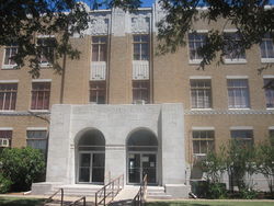 Collingsworth County Courthouse in Wellington
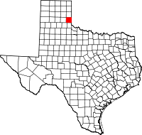
Location in the state of Texas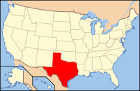
Texas's location in the U.S.Founded 1891 Seat Wellington Area
- Total
- Land
- Water
919 sq mi (2,380 km²)
918 sq mi (2,378 km²)
1 sq mi (3 km²), 0.07%Population
- (2010)
- Density
3,057
3/sq mi (1/km²)Website www.co.collingsworth.tx.us Collingsworth County is a county located in the U.S. state of Texas. In 2000, its population was 3,206. Collingsworth is named for James Collinsworth, a signer of the Texas Declaration of Independence and first chief justice of the Republic of Texas. The reason the county's name is spelled differently is because the bill creating the county misspelled Collinsworth's name. Collingsworth County is one of 30[1] prohibition, or entirely dry, counties in the state of Texas. Its seat is Wellington[2]. It is north of Childress County, which is named for George Campbell Childress, another founder of the Republic of Texas.
Contents
Geography
According to the U.S. Census Bureau, the county has a total area of 919 square miles (2,380.2 km2), of which 918 square miles (2,377.6 km2) is land and 1 square mile (2.6 km2) (0.07%) is water.
Major highways
 U.S. Highway 83
 State Highway 203
Adjacent counties
- Wheeler County (north)
- Beckham County, Oklahoma (northeast)
- Harmon County, Oklahoma (southeast)
- Childress County (south)
- Hall County (southwest)
- Donley County (west)
Demographics
As of the census[3] of 2000, there were 3,206 people, 1,294 households, and 916 families residing in the county. The population density was 4 people per square mile (1/km²). There were 1,723 housing units at an average density of 2 per square mile (1/km²). The racial makeup of the county was 79.82% White, 5.33% Black or African American, 1.62% Native American, 0.19% Asian, 10.89% from other races, and 2.15% from two or more races. 20.43% of the population were Hispanic or Latino of any race.
There were 1,294 households out of which 29.80% had children under the age of 18 living with them, 57.50% were married couples living together, 9.80% had a female householder with no husband present, and 29.20% were non-families. 27.80% of all households were made up of individuals and 17.50% had someone living alone who was 65 years of age or older. The average household size was 2.44 and the average family size was 2.97.
In the county, the population was spread out with 26.40% under the age of 18, 6.60% from 18 to 24, 22.60% from 25 to 44, 22.50% from 45 to 64, and 22.00% who were 65 years of age or older. The median age was 41 years. For every 100 females there were 93.00 males. For every 100 females age 18 and over, there were 88.00 males.
The median income for a household in the county was $25,438, and the median income for a family was $33,323. Males had a median income of $24,808 versus $17,679 for females. The per capita income for the county was $15,318. About 14.80% of families and 18.70% of the population were below the poverty line, including 27.20% of those under age 18 and 16.40% of those age 65 or over.
History
The county was created in 1876 from the Bexar and Young land district of Texas. Collingsworth County was organized in 1890 with Wellington as the county seat. From 1883 until 1896 the county was home to the English owned Rocking Chair Ranche.
Cities and towns
See also
References
- ^ http://www.tabc.state.tx.us/local_option_elections/index.asp
- ^ "Find a County". National Association of Counties. http://www.naco.org/Counties/Pages/FindACounty.aspx. Retrieved 2011-06-07.
- ^ "American FactFinder". United States Census Bureau. http://factfinder.census.gov. Retrieved 2008-01-31.
External links
- Collingsworth Public Library
- Collingsworth County Sheriff's Department
- Collingsworth County in Handbook of Texas Online at the University of Texas
- Collingsworth County Homepage

Wheeler County Beckham County, Oklahoma Donley County 
 Collingsworth County, Texas

Hall County Childress County Harmon County, Oklahoma Municipalities and communities of Collingsworth County, Texas County seat: Wellington City 
Town CDPs Categories:- Texas counties
- Collingsworth County, Texas
- 1891 establishments


Wikimedia Foundation. 2010.