- Collin County, Texas
-
Collin County, Texas 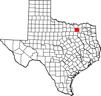
Location in the state of Texas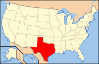
Texas's location in the U.S.Founded 1846 Seat McKinney Area
- Total
- Land
- Water
886 sq mi (2,295 km²)
848 sq mi (2,196 km²)
38 sq mi (98 km²), 4.32%Population
- (2010)
- Density
782,341
992.6/sq mi (383/km²)Website www.co.collin.tx.us Collin County is a suburban county located in the U.S. state of Texas. The county has been experiencing extensive growth in recent years. In 2000, its population was 491,675; in 2009 the U.S. Census Bureau estimated that its population had reached 791,631.[1] Its seat is McKinney.[2] The county and its seat are both named in honor of Collin McKinney, one of the five men who drafted the Texas Declaration of Independence and the oldest of the 59 men who signed it.
Collin County is part of the Dallas/Fort Worth Metroplex. A small portion of the city of Dallas is located in the county. Other important cities in the county include Allen, Frisco, McKinney, Plano, Richardson, Wylie, and Murphy.
Contents
Geography
According to the U.S. Census Bureau, the county has a total area of 886 square miles (2,294.7 km2), of which 848 square miles (2,196.3 km2) is land and 38 square miles (98.4 km2) (4.32%) is water.
Major highways
 U.S. Highway 75
 U.S. Highway 380
 Dallas North Tollway
- President George Bush Turnpike
 State Highway 5
 State Highway 78
 State Highway 289
 State Highway 121 - Sam Rayburn Tollway
Adjacent counties
- Grayson County (north)
- Fannin County (northeast)
- Hunt County (east)
- Rockwall County (southeast)
- Dallas County (south)
- Denton County (west)
Demographics
Historical populations Census Pop. %± 1850 1,950 — 1860 9,264 375.1% 1870 14,013 51.3% 1880 25,983 85.4% 1890 36,736 41.4% 1900 50,087 36.3% 1910 49,021 −2.1% 1920 49,609 1.2% 1930 46,180 −6.9% 1940 47,190 2.2% 1950 41,692 −11.7% 1960 41,247 −1.1% 1970 66,920 62.2% 1980 144,576 116.0% 1990 264,036 82.6% 2000 491,675 86.2% 2010 782,341 59.1% As of the census[3] of 2000, there were 491,675 people, 181,970 households, and 132,292 families residing in the county. The population density was 580 people per square mile (224/km²). There were 194,892 housing units at an average density of 230 per square mile (89/km²). The racial makeup of the county was 81.39% White, 4.79% Black or African American, 0.47% Native American, 6.92% Asian, 0.05% Pacific Islander, 4.26% from other races, and 2.11% from two or more races. 10.27% of the population were Hispanic or Latino of any race.
According to U.S. Census figures released in 2006, the racial makeup of the county was as follows: 77.21% White, 7.26% African American, 10.02% Asian, 0.45% Native American, 5.06% of other or mixed race. 12.8% Hispanic of any race.
There were 181,970 households out of which 40.60% had children under the age of 18 living with them, 62.10% were married couples living together, 7.50% had a female householder with no husband present, and 27.30% were non-families. 22.10% of all households were made up of individuals and 3.10% had someone living alone who was 65 years of age or older. The average household size was 2.68 and the average family size was 3.18.
In the county, the population was spread out with 28.70% under the age of 18, 7.40% from 18 to 24, 37.90% from 25 to 44, 20.70% from 45 to 64, and 5.30% who were 65 years of age or older. The median age was 33 years. For every 100 females there were 99.80 males. For every 100 females age 18 and over, there were 97.80 males.
The median income for a household in the county was $70,835, and the median income for a family was $81,856 (these figures had risen to $77,671 and $91,881 respectively as of a 2007 estimate).[4] Males had a median income of $57,392 versus $36,604 for females. The per capita income for the county was $33,345. About 3.30% of families and 4.90% of the population were below the poverty line, including 5.10% of those under age 18 and 7.10% of those age 65 or over. Based on median household income, as of 2006, Collin County is the second richest county in Texas after Fort Bend, and is considered one of the wealthiest counties in the United States.
However, Collin - like other Texas counties - has one of the nation's highest property tax rates. In 2007, it was #21 for property taxes as percentage of the homes value on owner occupied housing.[5] It also ranked ranked in the Top 100 for amount of property taxes paid and for percentage of taxes of income. Part of this is due to the Robin Hood plan school financing system in Texas.[6]
Politics
Presidential Election Results Year GOP DEM Others 2008 62.2% 184,897 36.7% 109,047 1.2% 3,513 2004 71.2% 174,435 28.1% 68,935 0.7% 1,784 2000 73.1% 128,179 24.4% 42,884 2.7% 4,357 1996 63.0% 83,750 28.5% 37,854 8.5% 11,321 1992 47.0% 60,514 19.0% 24,508 34.0% 43,811 1988 74.3% 67,776 25.1% 22,934 0.6% 520 1984 81.6% 61,095 18.2% 13,604 0.2% 139 1980 67.9% 36,559 28.2% 15,187 3.9% 2,115 1976 60.0% 21,608 39.0% 14,039 1.0% 353 1972 78.0% 17,667 21.1% 4,783 0.8% 187 1968 39.9% 6,494 36.4% 5,918 23.7% 3,850 1964 29.8% 3,341 70.0% 7,833 0.2% 19 1960 42.2% 3,865 57.1% 5,229 0.7% 64 Collin County is a Republican stronghold in presidential and congressional elections. The last Democrat to win the county was Lyndon Johnson in 1964. As the northern Dallas suburbs spilled into Collin County in the late 1960s and early 1970s its politics immediately swung to the Republican Party.
In the House of Representatives, the southwestern part of Collin County is represented in Texas's 3rd congressional district and the rest of the county is represented in the Texas's 4th congressional district. Both districts are held by Republicans, the 3rd by Sam Johnson, and the 4th by Ralph Hall, who only recently switched to the Republican Party.
Cities and towns
- Allen
- Anna
- Blue Ridge
- Carrollton†
- Celina†
- Copeville Unincorporated
- Dallas††
- Fairview
- Richardson†
- Royse City†
- Sachse†
- St. Paul
- Van Alstyne†
- Westminster Unincorporated
- Weston
- Wylie††
† City extends into one adjacent county.
†† City extends into two or more adjacent counties.Education
The following school districts lie entirely within Collin County:
- Allen Independent School District
- Anna Independent School District
- Farmersville Independent School District
- Lovejoy Independent School District
- McKinney Independent School District
- Melissa Independent School District
- Plano Independent School District
- Princeton Independent School District
- Wylie Independent School District
while only parts of the following districts lie within the county:
- Bland Independent School District (very small part only)
- Blue Ridge Independent School District
- Celina Independent School District
- Community Independent School District
- Frisco Independent School District
- Leonard Independent School District (very small part only)
- Prosper Independent School District
- Royse City Independent School District
- Trenton Independent School District (very small part only)
- Van Alstyne Independent School District (very small part only)
- Whitewright Independent School District (very small part only)
Colleges and Universities
The Central Campus of Collin College [7] which opened in January 1986 is located in McKinney. Dallas Baptist University [8] also has an extension site in Frisco, DBU Frisco.
Lakes
Parks
Collin County Parks and Open Spaces
- Bratonia Park
- Myers Park
- Parkhill Prairie
- Sister Grove Park
- Trinity Trail
See also
References
- ^ US Census Largest Counties 2008.
- ^ "Find a County". National Association of Counties. http://www.naco.org/Counties/Pages/FindACounty.aspx. Retrieved 2011-06-07.
- ^ "American FactFinder". United States Census Bureau. http://factfinder.census.gov. Retrieved 2008-01-31.
- ^ Collin County, Texas - Fact Sheet - American FactFinder. Retrieved on 2009-05-21.
- ^ http://www.taxfoundation.org/research/show/1888.html Taxfoundation.org
- ^ http://query.nytimes.com/gst/fullpage.html?res=9F04E5DB173BF934A35753C1A9629C8B63 Query.nytimes.com
- ^ Collin College website
- ^ DBU website
External links
- Collin County government's website
- 1846 Plat of Buckner the first county seat of Collin County, from the Collin County Historical Society, hosted by the Portal to Texas History
- Life in Collin County
- Collin County in Handbook of Texas Online at the University of Texas
- Collin Chronicles hosted by the Portal to Texas History
- Texas State Election History
- Collin County, Texas at the Open Directory Project
Municipalities and communities of Collin County, Texas Cities Allen | Anna | Blue Ridge | Carrollton‡ | Celina‡ | Dallas‡ | Farmersville | Frisco‡ | Garland‡ | Josephine‡ | Lavon | Lowry Crossing | Lucas | McKinney | Melissa | Murphy | Nevada | Parker | Plano‡ | Princeton | Richardson‡ | Royse City‡ | Sachse‡ | Van Alstyne‡ | Weston | Wylie‡
Towns Unincorporated
communitiesFootnotes ‡This populated place also has portions in an adjacent county or counties
Dallas–Fort Worth–Arlington Counties Major cities Cities and towns
100k-300kCarrollton • Denton • Frisco • Garland • Grand Prairie • Irving • McKinney • Mesquite • Plano • RichardsonCities and towns
25k-99kAllen • Bedford • Cedar Hill • Cleburne • The Colony • Coppell • DeSoto • Duncanville • Euless • Farmers Branch • Flower Mound • Grapevine • Haltom City • Highland Village • Hurst • Keller • Lancaster • Lewisville • Mansfield • North Richland Hills • Rockwall • Rowlett • WylieCities and towns
10k-25kAddison • Balch Springs • Benbrook • Burleson • Colleyville • Corinth • Ennis • Forest Hill • Greenville • Saginaw • Seagoville • Southlake • Terrell • University Park • Watauga • Waxahachie • Weatherford • White SettlementCoordinates: 33°11′N 96°35′W / 33.18°N 96.58°W

Grayson County Fannin County Denton County 
Hunt County  Collin County, Texas

Dallas County Rockwall County Categories:- Texas counties
- Collin County, Texas
- 1846 establishments in the United States
- Dallas – Fort Worth Metroplex


Wikimedia Foundation. 2010.