- Chestnut Township, Knox County, Illinois
-
Chestnut Township — Township — Location in Knox County Knox County's location in Illinois
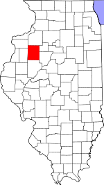
Coordinates: 40°45′12″N 90°16′27″W / 40.75333°N 90.27417°WCoordinates: 40°45′12″N 90°16′27″W / 40.75333°N 90.27417°W Country  United States
State  Illinois
County Knox Established November 2, 1852 Area – Total 36.16 sq mi (93.66 km2) – Land 36.16 sq mi (93.65 km2) – Water 0 sq mi (0.01 km2) 0.01% Elevation 676 ft (206 m) Population (2000) – Total 250 – Density 6.9/sq mi (2.7/km2) Time zone CST (UTC-6) – Summer (DST) CDT (UTC-5) ZIP codes 61410, 61436, 61458, 61474, 61544 GNIS feature ID 0428802 Chestnut Township is one of twenty-one townships in Knox County, Illinois, USA. As of the 2000 census, its population was 250[1].
Contents
Geography
According to the United States Census Bureau, Chestnut Township covers an area of 36.16 square miles (93.7 km2).
Cities, towns, villages
- London Mills (northeast quarter)
Unincorporated towns
(This list is based on USGS data and may include former settlements.)
Extinct towns
- Bridgeport at 40°44′36″N 90°14′13″W / 40.743372°N 90.237068°W
- Burnside at 40°46′10″N 90°16′24″W / 40.7694832°N 90.2734581°W
(These towns are listed as "historical" by the USGS.)
Cemeteries
The township contains these four cemeteries: Elias Bragg, Harper, Hermon Christian and Hermon Methodist.
Airports and landing strips
- Davies Landing Strip
School districts
- Abingdon Community Unit School District 217
- Knoxville Community Unit School District 202
- Spoon River Valley Community Unit School District 4
Political districts
- Illinois's 17th congressional district
- State House District 74
- State Senate District 37
References
- "Chestnut Township, Knox County, Illinois". Geographic Names Information System, U.S. Geological Survey. http://geonames.usgs.gov/pls/gnispublic/f?p=gnispq:3:::NO::P3_FID:0428802. Retrieved 2010-02-20.
- United States Census Bureau 2009 TIGER/Line Shapefiles
- United States National Atlas
External links
Municipalities and communities of Knox County, Illinois Cities 
Villages Altona | East Galesburg | Henderson | London Mills‡ | Maquon | Rio | St. Augustine | Victoria | Wataga | Williamsfield | Yates City
Townships Unincorporated
communitiesGhost town Etherly
Footnotes ‡This populated place also has portions in an adjacent county or counties
Categories:- Townships in Knox County, Illinois
- Galesburg micropolitan area


Wikimedia Foundation. 2010.