- Cheatham County, Tennessee
-
Cheatham County, Tennessee 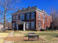 Cheatham County Courthouse in Ashland City
Location in the state of Tennessee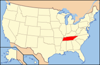
Tennessee's location in the U.S.Founded February 28, 1856 Seat Ashland City Largest city Ashland City Area
- Total
- Land
- Water
307 sq mi (795 km²)
302 sq mi (784 km²)
4 sq mi (12 km²), 1.46%Population
- (2010)
- Density
39,105
119/sq mi (46/km²)Time zone Central: UTC-6/-5 Cheatham County is a county located in the U.S. state of Tennessee. As of 2010, the population was 39,105. Its county seat is Ashland City[1].
Cheatham County is part of the Nashville-Davidson–Mufreesboro–Franklin Metropolitan Statistical Area founder: Edward S. Cheatham.
Contents
Geography
According to the U.S. Census Bureau, the county has a total area of 307 square miles (795.1 km2), of which 303 square miles (784.8 km2) is land and 4 square miles (10.4 km2) (1.46%) is water.
The county is bisected from northwest to southeast by the Cumberland River, with Ashland City located on its northern bank. The southern portion of the county is bisected from southeast to northwest by the Harpeth River, which meanders through generally hilly country, and along whose course are located the communities of Kingston Springs, largely to the north of Interstate 40, and Pegram, along State Highway 70. The western border of the central portion of the county is defined by the lower course of the Harpeth. The hills east of the Harpeth and south of the Cumberland are partly set aside by the state as the Cheatham State Wildlife Management Area. North of Ashland City the hills subside into more level highlands, where the community of Pleasant View is located just south of Interstate 24, which generally delineates the northern border of the county.
Adjacent counties
- Robertson County (northeast)
- Davidson County (east)
- Williamson County (south)
- Dickson County (west)
- Montgomery County (northwest)
Demographics
As of the census[2] of 2000, there were 35,912 people, 12,878 households, and 10,160 families residing in the county. The population density was 119 people per square mile (46/km²). There were 13,508 housing units at an average density of 45 per square mile (17/km²). The racial makeup of the county was 96.86% White, 1.48% Black or African American, 0.38% Native American, 0.18% Asian, 0.05% Pacific Islander, 0.36% from other races, and 0.70% from two or more races. 1.22% of the population were Hispanic or Latino of any race.
 Age pyramid Cheatham County[3]
In 2005 the racial makeup of the county was 94.8% non-Hispanic whites, 2.1% African-Americans and 1.7% Latinos. In 2000 there were 12,878 households out of which 39.60% had children under the age of 18 living with them, 64.90% were married couples living together, 9.60% had a female householder with no husband present, and 21.10% were non-families. 16.90% of all households were made up of individuals and 5.30% had someone living alone who was 65 years of age or older. The average household size was 2.76 and the average family size was 3.08.
In the county, the population was spread out with 27.70% under the age of 18, 7.30% from 18 to 24, 33.50% from 25 to 44, 23.00% from 45 to 64, and 8.60% who were 65 years of age or older. The median age was 35 years. For every 100 females there were 100.30 males. For every 100 females age 18 and over, there were 97.40 males.
The median income for a household in the county was $45,836, and the median income for a family was $49,143. Males had a median income of $34,476 versus $25,191 for females. The per capita income for the county was $18,882. About 5.30% of families and 7.40% of the population were below the poverty line, including 7.60% of those under age 18 and 9.40% of those age 65 or over.
Cities and towns
Unincorporated communities
- Bellsburg
- Bell Town
- Chapmansboro
- Cheap Hill
- Craggie Hope
See also
References
- ^ "Find a County". National Association of Counties. http://www.naco.org/Counties/Pages/FindACounty.aspx. Retrieved 2011-06-07.
- ^ "American FactFinder". United States Census Bureau. http://factfinder.census.gov. Retrieved 2008-01-31.
- ^ Based on 2000 census data
External links

Montgomery County Robertson County Dickson County 
Davidson County  Cheatham County, Tennessee

Williamson County Municipalities and communities of Cheatham County, Tennessee Cities and towns 
Unincorporated
communitiesBellsburg | Bell Town | Chapmansboro | Cheap Hill | Craggie Hope
Nashville Metropolitan Area Principal City Other Major Cities Counties Davidson County • Rutherford County • Robertson County • Sumner County • Wilson County • Cannon County • Cheatham County • Dickson County • Hickman County • Macon County • Smith County • Trousdale County • Williamson County
lCategories:- Tennessee counties
- Cheatham County, Tennessee
- 1856 establishments in the United States
- Nashville metropolitan area


Wikimedia Foundation. 2010.