- McCook County, South Dakota
-
McCook County, South Dakota 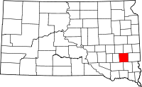
Location in the state of South Dakota
South Dakota's location in the U.S.Founded 1873 Named for Edwin Stanton McCook Seat Salem Area
- Total
- Land
- Water
577 sq mi (1,495 km²)
575 sq mi (1,488 km²)
3 sq mi (7 km²), 0.46%Population
- (2010)
- Density
5,618
4/sq mi (2/km²)Time zone Central: UTC-6/-5 McCook County is a county located in the U.S. state of South Dakota. As of the 2010 census, the population is 5,618.[1] It's county seat is Salem.[2] The county is named for the former governor of the Dakota Territory and Civil War general Edwin Stanton McCook.
McCook County is part of the Sioux Falls, South Dakota, Metropolitan Statistical Area.
Contents
Geography
The county has a total area of 577 square miles (1,490 km2), of which 575 square miles (1,490 km2) is land and 3 square miles (7.8 km2) (0.46%) is water.
Townships
The county is divided into sixteen townships: Benton, Bridgewater, Brookfield, Canistota, Emery, Grant, Greenland, Jefferson, Pearl, Montrose, Union, Ramsey, Richland, Salem, Spring Valley, Sun Prairie.
Major highways
 Interstate 90
 U.S. Highway 81
 South Dakota Highway 38
 South Dakota Highway 42
Adjacent counties
- Lake County, South Dakota - northeast
- Minnehaha County, South Dakota - east
- Turner County, South Dakota - southeast
- Hutchinson County, South Dakota - southwest
- Hanson County, South Dakota - west
- Miner County, South Dakota - northwest
Demographics
Historical populations Census Pop. %± 1880 1,283 — 1890 6,448 402.6% 1900 8,689 34.8% 1910 9,589 10.4% 1920 9,990 4.2% 1930 10,316 3.3% 1940 9,793 −5.1% 1950 8,828 −9.9% 1960 8,268 −6.3% 1970 7,246 −12.4% 1980 6,444 −11.1% 1990 5,688 −11.7% 2000 5,832 2.5% 2010 5,618 −3.7% U.S. Decennial Census As of the census[3] of 2000, there were 5,832 people, 2,204 households, and 1,558 families residing in the county. The population density was 10 people per square mile (4/km²). There were 2,383 housing units at an average density of 4 per square mile (2/km²). The racial makeup of the county was 98.87% White, 0.05% Black or African American, 0.36% Native American, 0.21% Asian, 0.15% from other races, and 0.36% from two or more races. 0.77% of the population were Hispanic or Latino of any race.
There were 2,204 households out of which 34.10% had children under the age of 18 living with them, 62.10% were married couples living together, 5.10% had a female householder with no husband present, and 29.30% were non-families. 26.80% of all households were made up of individuals and 15.60% had someone living alone who was 65 years of age or older. The average household size was 2.58 and the average family size was 3.15.
In the county, the population was spread out with 28.40% under the age of 18, 6.20% from 18 to 24, 25.50% from 25 to 44, 20.40% from 45 to 64, and 19.50% who were 65 years of age or older. The median age was 39 years. For every 100 females there were 99.50 males. For every 100 females age 18 and over, there were 97.20 males.
The median income for a household in the county was $35,396, and the median income for a family was $42,609. Males had a median income of $28,390 versus $21,073 for females. The per capita income for the county was $16,374. About 5.50% of families and 8.10% of the population were below the poverty line, including 8.90% of those under age 18 and 8.80% of those age 65 or over.
Cities and towns
- Bridgewater
- Canistota
- Montrose
- Salem
- Spencer
- Unityville
Other places in McCook County
- Laurent - (proposed / abandoned housing development)
See also
References
- ^ United States Census Bureau. "2010 Census Data". United States Census Bureau. http://2010.census.gov/2010census/data/. Retrieved 3 August 2011.
- ^ "Find a County". National Association of Counties. http://www.naco.org/Counties/Pages/FindACounty.aspx. Retrieved 2011-06-07.
- ^ "American FactFinder". United States Census Bureau. http://factfinder.census.gov. Retrieved 2008-01-31.

Miner County Lake County Hanson County 
Minnehaha County  McCook County, South Dakota

Hutchinson County Turner County Municipalities and communities of McCook County, South Dakota Cities Bridgewater | Canistota | Montrose | Salem | Spencer
 Categories:
- South Dakota counties
- McCook County, South Dakota
- Sioux Falls metropolitan area


Wikimedia Foundation. 2010.