- Deuel County, South Dakota
-
Deuel County, South Dakota 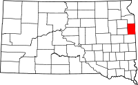
Location in the state of South Dakota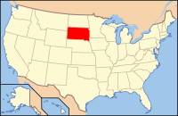
South Dakota's location in the U.S.Founded 1862 Seat Clear Lake Area
- Total
- Land
- Water
637 sq mi (1,649 km²)
624 sq mi (1,615 km²)
13 sq mi (34 km²), 2.07%Population
- (2010)
- Density
4,364
7/sq mi (3/km²)Deuel County (pronounced "DOOL"[1]) is a county located in the U.S. state of South Dakota. As of the 2010 census, the population was 4,364.[2] It's county seat is Clear Lake[3].
Contents
Geography
According to the U.S. Census Bureau, the county has a total area of 637 square miles (1,649.8 km2), of which 624 square miles (1,616.2 km2) is land and 13 square miles (33.7 km2) (2.07%) is water.
Townships
The county is divided into sixteen townships: Altamont, Antelope Valley, Blom, Brandt, Clear Lake, Glenwood, Goodwin, Grange, Havana, Herrick, Hidewood, Lowe, Norden, Portland, Rome, and Scandinavia.
Major Highways
 Interstate 29
 U.S. Highway 212
 South Dakota Highway 15
 South Dakota Highway 22
Adjacent Counties
- Grant County, South Dakota - north
- Lac Qui Parle County, Minnesota - northeast
- Yellow Medicine County, Minnesota - east
- Lincoln County, Minnesota - southeast
- Brookings County, South Dakota - south
- Hamlin County, South Dakota - southwest
- Codington County, South Dakota - northwest
Demographics
Historical populations Census Pop. %± 1870 37 — 1880 2,302 6,121.6% 1890 4,574 98.7% 1900 6,656 45.5% 1910 7,768 16.7% 1920 8,759 12.8% 1930 8,732 −0.3% 1940 8,450 −3.2% 1950 7,689 −9.0% 1960 6,782 −11.8% 1970 5,686 −16.2% 1980 5,289 −7.0% 1990 4,522 −14.5% 2000 4,498 −0.5% 2010 4,364 −3.0% U.S. Decennial Census As of the census[4] of 2000, there were 4,498 people, 1,843 households, and 1,258 families residing in the county. The population density was 7 people per square mile (3/km²). There were 2,172 housing units at an average density of 4 per square mile (1/km²). The racial makeup of the county was 98.51% White, 0.09% Black or African American, 0.29% Native American, 0.18% Asian, 0.02% Pacific Islander, 0.24% from other races, and 0.67% from two or more races. 0.76% of the population were Hispanic or Latino of any race. 46.9% were of German and 29.1% Norwegian ancestry according to Census 2000.
There were 1,843 households out of which 29.20% had children under the age of 18 living with them, 60.40% were married couples living together, 4.90% had a female householder with no husband present, and 31.70% were non-families. 28.60% of all households were made up of individuals and 14.40% had someone living alone who was 65 years of age or older. The average household size was 2.40 and the average family size was 2.97.
In the county, the population was spread out with 25.30% under the age of 18, 5.90% from 18 to 24, 25.40% from 25 to 44, 22.60% from 45 to 64, and 20.70% who were 65 years of age or older. The median age was 41 years. For every 100 females there were 99.60 males. For every 100 females age 18 and over, there were 99.60 males.
The median income for a household in the county was $31,788, and the median income for a family was $39,511. Males had a median income of $26,306 versus $19,282 for females. The per capita income for the county was $15,977. About 6.90% of families and 10.30% of the population were below the poverty line, including 9.80% of those under age 18 and 16.70% of those age 65 or over.
Cities and towns
See also
References
- ^ "Broadcast Pronunciation Guide and South Dakota Pronunciations". Associated Press. http://www.ap.org/southdakota/prono.html. Retrieved 2009-11-10.
- ^ United States Census Bureau. "2010 Census Data". United States Census Bureau. http://2010.census.gov/2010census/data/. Retrieved 4 August 2011.
- ^ "Find a County". National Association of Counties. http://www.naco.org/Counties/Pages/FindACounty.aspx. Retrieved 2011-06-07.
- ^ "American FactFinder". United States Census Bureau. http://factfinder.census.gov. Retrieved 2008-01-31.

Codington County Grant County Lac qui Parle County, Minnesota 
Yellow Medicine County, Minnesota  Deuel County, South Dakota

Hamlin County Brookings County Lincoln County, Minnesota Municipalities and communities of Deuel County, South Dakota Cities 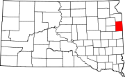
Towns Unincorporated
communityCategories:- South Dakota counties
- Deuel County, South Dakota


Wikimedia Foundation. 2010.