- Davison County, South Dakota
-
Davison County, South Dakota 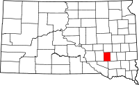
Location in the state of South Dakota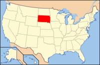
South Dakota's location in the U.S.Founded 1874 Seat Mitchell Area
- Total
- Land
- Water
437 sq mi (1,132 km²)
436 sq mi (1,129 km²)
1 sq mi (3 km²), 0.31%Population
- (2010)
- Density
19,504
44/sq mi (17/km²)Website www.davisoncounty.org Davison County is a county located in the U.S. state of South Dakota. As of the 2010 census, the population was 19,504. Its county seat is Mitchell.[1]
Davison County is part of the Mitchell, South Dakota, Micropolitan Statistical Area.
Contents
Geography
According to the U.S. Census Bureau, the county has a total area of 437 square miles (1,131.8 km2), of which 436 square miles (1,129.2 km2) is land and 1 square mile (2.6 km2) (0.31%) is water.
Townships
The county is divided into twelve townships:
- Badger Township
- Baker Township
- Beulah Township
- Blenden Township
- Tobin Township
- Lisbon Township
- Mitchell Township
- Mount Vernon Township
- Perry Township
- Prosper Township
- Rome Township
- Union Township
Major highways
Adjacent counties
- Sanborn County, South Dakota - north
- Hanson County, South Dakota - east
- Hutchinson County, South Dakota - southeast
- Douglas County, South Dakota - southwest
- Aurora County, South Dakota - west
Demographics
Historical populations Census Pop. %± 1880 1,256 — 1890 5,449 333.8% 1900 7,483 37.3% 1910 11,625 55.4% 1920 14,139 21.6% 1930 16,821 19.0% 1940 15,336 −8.8% 1950 16,522 7.7% 1960 16,681 1.0% 1970 17,319 3.8% 1980 17,820 2.9% 1990 17,503 −1.8% 2000 18,741 7.1% 2010 19,504 4.1% U.S. Decennial Census As of the census[2] of 2000, there were 18,741 people, 7,585 households, and 4,770 families residing in the county. The population density was 43 people per square mile (17/km²). There were 8,093 housing units at an average density of 19 per square mile (7/km²). The racial makeup of the county was 96.23% White, 0.27% Black or African American, 1.98% Native American, 0.43% Asian, 0.02% Pacific Islander, 0.30% from other races, and 0.77% from two or more races. 0.69% of the population were Hispanic or Latino of any race. 50.8% were of German, 10.1% Norwegian, 5.5% Irish and 5.4% American ancestry.
There were 7,585 households out of which 31.10% had children under the age of 18 living with them, 51.40% were married couples living together, 8.20% had a female householder with no husband present, and 37.10% were non-families. 30.80% of all households were made up of individuals and 13.40% had someone living alone who was 65 years of age or older. The average household size was 2.38 and the average family size was 3.00.
In the county, the population was spread out with 25.40% under the age of 18, 12.00% from 18 to 24, 25.90% from 25 to 44, 20.40% from 45 to 64, and 16.20% who were 65 years of age or older. The median age was 36 years. For every 100 females there were 94.10 males. For every 100 females age 18 and over, there were 91.80 males.
The median income for a household in the county was $33,476, and the median income for a family was $44,357. Males had a median income of $30,825 versus $20,940 for females. The per capita income for the county was $17,879. About 8.20% of families and 11.50% of the population were below the poverty line, including 11.30% of those under age 18 and 10.40% of those age 65 or over.
Cities and towns
See also
References
- ^ "Find a County". National Association of Counties. http://www.naco.org/Counties/Pages/FindACounty.aspx. Retrieved 2011-06-07.
- ^ "American FactFinder". United States Census Bureau. http://factfinder.census.gov. Retrieved 2008-01-31.
External links

Sanborn County Aurora County 
Hanson County  Davison County, South Dakota

Douglas County Hutchinson County Municipalities and communities of Davison County, South Dakota City 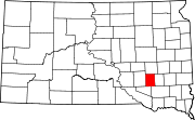
Town CDP Categories:- South Dakota counties
- Davison County, South Dakota
- 1874 establishments
- Mitchell micropolitan area


Wikimedia Foundation. 2010.