- Oconee County, South Carolina
-
Oconee County, South Carolina 
Seal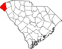
Location in the state of South Carolina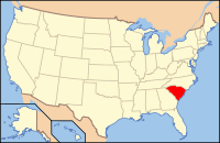
South Carolina's location in the U.S.Founded 1868 Seat Walhalla Area
- Total
- Land
- Water
674 sq mi (1,746 km²)
625 sq mi (1,619 km²)
48 sq mi (124 km²), 7.15%Population
- (2000)
- Density
66,215
106/sq mi (41/km²)Website www.oconeesc.com Oconee County is the westernmost county of South Carolina, a U.S. state. The 2000 census recorded its population to be 66,215. In 2005, the U.S. Census Bureau estimated that its population had reached 69,577.[1] Its county seat is Walhalla.[2] Other cities in the county include Seneca and Westminster. Towns include Salem and West Union. The county is included in the Seneca Micropolitan Statistical Area. South Carolina Highway 11, the Cherokee Foothills National Scenic Highway, begins in Southern Oconee County at Interstate Highway 85 at the Georgia state line.
Contents
Geography
According to the U.S. Census Bureau, the county has a total area of 674 square miles (1,745 km²), of which 625 square miles (1,620 km²) is land and 48 square miles (125 km²) (7.15%) is water. The hilly landscape has created a haven for man-made lakes. Three large man-made lakes provide residents with sport fishing, water skiing, and sailing as well as hydroelectric power. The largest lake is Lake Hartwell, built by the U.S. Army Corps of Engineers between 1955 and 1963. Lake Keowee is the second largest lake and the Oconee Nuclear Station operates by the lake. Lake Jocassee is the third largest and is a source of hydroelectric energy, but is also popular for its breathtaking scenery and numerous waterfalls. Bad Creek Reservoir, located in the mountains above Jocassee, is for generating electricity during peak hours. The water level can fall by tens of feet per hour and during off-peak times water is pumped back into the lake for the next peak period. Because of this, boating and swimming are prohibited in the reservoir.
Adjacent counties
- Jackson County, North Carolina - north
- Transylvania County, North Carolina - northeast
- Pickens County, South Carolina - east
- Anderson County, South Carolina - southeast
- Hart County, Georgia - south
- Franklin County, Georgia - south
- Stephens County, Georgia - southwest
- Habersham County, Georgia - west
- Rabun County, Georgia - west
- Macon County, North Carolina - northwest
Oconee County is one of the few counties in the U.S. to border 10 other counties.
National protected area
- Sumter National Forest (part)
History
Oconee County takes its name from the Cherokee word "Ae-quo-nee" meaning "land beside the water." Oconee was a local Cherokee town that was situated on the main British/Cherokee trading path between Charleston and the Mississippi River in the early 18th century. Its geographic position later placed it at the intersection of the trading path and the Cherokee treaty boundary of 1777. In 1792, a frontier outpost was built by the SC State Militia near the town site and was named Oconee Station. When Oconee County was created out of the Pickens District in 1868 it was named for Oconee Town.
- 1780s - The rare wildflower, Oconee Bell, first recorded by André Michaux.
- 1780s - After the American Revolutionary War, Colonel Benjamin Cleveland and a group of followers received land grants from Georgia and settled in present day Oconee County.
- 1787 - Georgia withdrew its claims to the land between the Tugaloo and Keowee River by the Treaty of Beaufort to South Carolina.
- 1816 - Cherokee sold their remaining South Carolina land.
- 1850s - The largest town was Tunnel Hill, located above Stumphouse Mountain Tunnel.
- 1868 - Oconee County was formed when Pickens County was divided. Walhalla was made the county seat.
- 1870- Air line Railroad build a railroad through the county which helped to form Seneca and Westminster
- 1893 - Newry was established as mill village to house workers of the Courtenay Manufacturing Company.
Demographics
As of the census[3] of 2000, there were 66,215 people, 27,283 households, and 19,589 families residing in the county. The population density was 106 people per square mile (41/km²). There were 32,383 housing units at an average density of 52 per square mile (20/km²). The racial makeup of the county was 89.14% White, 8.38% Black or African American, 0.22% Native American, 0.35% Asian, 0.02% Pacific Islander, 1.06% from other races, and 0.82% from two or more races. 2.36% of the population were Hispanic or Latino of any race. 26.5% were of American, 13.1% Irish, 11.9% German and 10.5% English ancestry according to Census 2000.
There were 27,283 households out of which 28.50% had children under the age of 18 living with them, 57.80% were married couples living together, 10.10% had a female householder with no husband present, and 28.20% were non-families. 24.70% of all households were made up of individuals and 9.50% had someone living alone who was 65 years of age or older. The average household size was 2.40 and the average family size was 2.85.
In the county, the population was spread out with 22.90% under the age of 18, 8.00% from 18 to 24, 27.40% from 25 to 44, 26.20% from 45 to 64, and 15.60% who were 65 years of age or older. The median age was 40 years. For every 100 females there were 96.70 males. For every 100 females age 18 and over, there were 93.50 males.
The median income for a household in the county was $36,666, and the median income for a family was $43,047. Males had a median income of $31,032 versus $22,156 for females. The per capita income for the county was $18,965. About 7.60% of families and 10.80% of the population were below the poverty line, including 14.00% of those under age 18 and 12.90% of those age 65 or over.
 Oconee County Courthouse, Walhalla, Oconee County, South Carolina
Cities and towns
The 2010 Census lists three cities, two towns and three census designated places for Oconee County.[4].
Incorporated:
Unincorporated:
- Fair Play (territory in Oconee and Anderson counties)
- Long Creek
- Mountain Rest
- Newry
- Oakway
- Richland
- Tamassee
- Townville (territory in Oconee and Anderson counties)
- Utica
Popular culture
The Oconee region is mentioned in the song "Yankee Bayonet (I Will Be Home Then)", by the indie rock group The Decemberists. The reference is "...how the hills of Oconee made a seam to hem me in."
See also
References
- ^ http://www.census.gov/popest/counties/tables/CO-EST2005-01-45.xls
- ^ "Find a County". National Association of Counties. http://www.naco.org/Counties/Pages/FindACounty.aspx. Retrieved 2011-06-07.
- ^ "American FactFinder". United States Census Bureau. http://factfinder.census.gov. Retrieved 2008-01-31.
- ^ See http://factfinder2.census.gov for population numbers and for municipality and CDP lists.
External links
- Oconee County and Vicinity Information
- Watch Heritage video about Oconee County
- Information about the area
- Oconee County Lodging at Lake Jocassee
Municipalities and communities of Oconee County, South Carolina Cities 
Towns CDPs Unincorporated
communitiesLong Creek | Mountain Rest | Tamassee
 State of South Carolina
Regions Larger cities Smaller cities Towns CDPs Counties - Abbeville
- Aiken
- Allendale
- Anderson
- Bamberg
- Barnwell
- Beaufort
- Berkeley
- Calhoun
- Charleston
- Cherokee
- Chester
- Chesterfield
- Clarendon
- Colleton
- Darlington
- Dillon
- Dorchester
- Edgefield
- Fairfield
- Florence
- Georgetown
- Greenville
- Greenwood
- Hampton
- Horry
- Jasper
- Kershaw
- Lancaster
- Laurens
- Lee
- Lexington
- Marion
- Marlboro
- McCormick
- Newberry
- Oconee
- Orangeburg
- Pickens
- Richland
- Saluda
- Spartanburg
- Sumter
- Union
- Williamsburg
- York
Topics - History
- Famous people
- Governors
- Legislature
- State House
- Congressional districts
- Census areas
- State parks
- Rivers
- Wildlife refuges
- Historic places
- Amusement parks
- Colleges and universities
- Sports venues
- Shopping malls
- Television stations
- Radio stations
- Highways
- Airports
- Visitor attractions
Categories:- South Carolina counties
- Oconee County, South Carolina
- 1868 establishments


Wikimedia Foundation. 2010.