- Newberry County, South Carolina
-
Newberry County, South Carolina 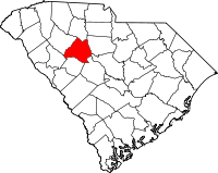
Location in the state of South Carolina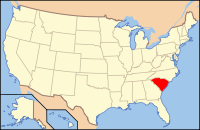
South Carolina's location in the U.S.Founded 1785 Seat Newberry Area
- Total
- Land
- Water
647 sq mi (1,676 km²)
631 sq mi (1,634 km²)
17 sq mi (44 km²), 2.55%Population
- (2000)
- Density
36,108
57/sq mi (22/km²)Website www.newberrycounty.org Newberry County is a county located in the U.S. state of South Carolina. In 2000, its population was 36,108. The 2005 Census estimate placed the population at 37,250.[1] Its county seat is Newberry.[2] The name is of unknown origin.
Contents
Geography
According to the U.S. Census Bureau, the county has a total area of 647 square miles (1,676 km²), of which 631 square miles (1,634 km²) is land and 17 square miles (43 km²) (2.55%) is water.
Adjacent Counties
- Union County, South Carolina - north
- Fairfield County, South Carolina - east
- Lexington County, South Carolina - southeast
- Richland County, South Carolina - southeast
- Saluda County, South Carolina - south
- Greenwood County, South Carolina - southwest
- Laurens County, South Carolina - northwest
National protected area
- Sumter National Forest (part)
History
Newberry County was formed from the Ninety Six District in 1785. Prior to its formal founding, the area was the site of several American Revolutionary War battles: Williams' Plantation, Dec. 31, 1780; Mud Lick, March 2, 1781; and Bush River, May 1781.[3] The town of Newberry was founded in 1789 as the county seat. Cotton was the primary crop grown in Newberry County before the Civil War and there were a number of plantations throughout the county. Newberry became a thriving trade center once the railroad arrived in the early 1850s. Lutheran-supported Newberry College was established in 1856. The Civil War not only interrupted growth in the county, it changed its social order. The first cotton mills were introduced in the county in the 1880s.[4] Jurist John Belton O'Neall (1795-1863), historian David Duncan Wallace (1874-1951) and S.C. Governor and U. S. Senator Coleman L. Blease (1868-1942) were all Newberry County natives.[5]
Demographics
As of the census[6] of 2000, there were 36,108 people, 14,026 households and 9,804 families residing in the county. The population density was 57 people per square mile (22/km²). There were 16,805 housing units at an average density of 27 per square mile (10/km²). The racial makeup of the county was 64.02 percent White, 33.12 percent Black or African American, 0.28 percent Native American, 0.29 percent Asian, 0.09 percent Pacific Islander, 1.30 percent from other races, and 0.90 percent from two or more races. Some 4.25 percent of the population were Hispanic or Latino of any race.
There were 14,026 households out of which 30.4 percent had children under the age of 18 living with them, 49.2 percent were married couples living together, 16.1 percent had a female householder with no husband present, and 30.1 percent were non-families. 26.5 percent of all households were made up of individuals and 12 percent had someone living alone who was 65 years of age or older. The average household size was 2.5 and the average family size was 2.99.
In the county, the population was spread out with 24.1 percent under the age of 18, 9.8 percent from 18 to 24, 27.6 percent from 25 to 44, 23.7 percent from 45 to 64, and 14.7 percent who were 65 years of age or older. The median age was 37 years. For every 100 females there were 93.20 males. For every 100 females age 18 and over, there were 89.8 males.
The median income for a household in the county was $32,867, and the median income for a family was $40,580. Males had a median income of $29,871 versus $21,274 for females. The per capita income for the county was $16,045. About 13.6 percent of families and 17 percent of the population were below the poverty line, including 23.8 percent of those under age 18 and 16 percent of those age 65 or over.
Towns
Utilities
- Newberry County Water & Sewer Authority[1]
- Newberry Electric Cooperative
- Clinton-Newberry Natural Gas Authority
See also
References
- ^ http://www.census.gov/popest/counties/tables/CO-EST2005-01-45.xls
- ^ "Find a County". National Association of Counties. http://www.naco.org/Counties/Pages/FindACounty.aspx. Retrieved 2011-06-07.
- ^ South Carolina Revolutionary War Military Engagements, SCIWay
- ^ Newberry County history, Newberrycounty.org
- ^ Newberry County, S.C., Genealogy and History, rootsweb.ancestry.com
- ^ "American FactFinder". United States Census Bureau. http://factfinder.census.gov. Retrieved 2008-01-31.

Laurens County Union County 
Fairfield County  Newberry County, South Carolina

Greenwood County Saluda County Lexington County and Richland County Municipalities and communities of Newberry County, South Carolina City 
Towns Little Mountain | Peak | Pomaria | Prosperity | Silverstreet | Whitmire
Unincorporated
communityFootnotes ‡This populated place also has portions in an adjacent county or counties
 State of South Carolina
Regions Larger cities Smaller cities Towns CDPs Counties - Abbeville
- Aiken
- Allendale
- Anderson
- Bamberg
- Barnwell
- Beaufort
- Berkeley
- Calhoun
- Charleston
- Cherokee
- Chester
- Chesterfield
- Clarendon
- Colleton
- Darlington
- Dillon
- Dorchester
- Edgefield
- Fairfield
- Florence
- Georgetown
- Greenville
- Greenwood
- Hampton
- Horry
- Jasper
- Kershaw
- Lancaster
- Laurens
- Lee
- Lexington
- Marion
- Marlboro
- McCormick
- Newberry
- Oconee
- Orangeburg
- Pickens
- Richland
- Saluda
- Spartanburg
- Sumter
- Union
- Williamsburg
- York
Topics - History
- Famous people
- Governors
- Legislature
- State House
- Congressional districts
- Census areas
- State parks
- Rivers
- Wildlife refuges
- Historic places
- Amusement parks
- Colleges and universities
- Sports venues
- Shopping malls
- Television stations
- Radio stations
- Highways
- Airports
- Visitor attractions
Categories:- South Carolina counties
- Newberry County, South Carolina
- 1785 establishments


Wikimedia Foundation. 2010.