- Chesterfield County, South Carolina
-
Chesterfield County, South Carolina 
Seal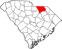
Location in the state of South Carolina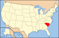
South Carolina's location in the U.S.Founded 1785 Seat Chesterfield Area
- Total
- Land
- Water
806 sq mi (2,088 km²)
799 sq mi (2,069 km²)
7 sq mi (18 km²), 0.89%Population
- (2010)
- Density
46,734
60/sq mi (23/km²)Website http://www.chesterfieldcountysc.com/ Chesterfield County is a county located in the Midlands of the U.S. state of South Carolina. In 2000, its population was 42,768; in 2005, the U.S. Census Bureau estimated that its population had reached 43,435.[1] Its county seat is Chesterfield.[2]
Contents
Geography
According to the U.S. Census Bureau, the county has a total area of 806 square miles (2,087.5 km2), of which 799 square miles (2,069.4 km2) is land and 7 square miles (18.1 km2) (0.89%) is water.
Adjacent counties
- Anson County, North Carolina - north
- Richmond County, North Carolina - northeast
- Marlboro County, South Carolina - east
- Darlington County, South Carolina - southeast
- Kershaw County, South Carolina - southwest
- Lancaster County, South Carolina - west
- Union County, North Carolina - northwest

Union County Anson County Richmond County Lancaster County 
Marlboro County  Chesterfield County, South Carolina

Kershaw County Darlington County National protected area
- Carolina Sandhills National Wildlife Refuge
Demographics
Historical populations Census Pop. %± 1900 20,401 — 1910 26,301 28.9% 1920 31,969 21.6% 1930 34,334 7.4% 1940 35,963 4.7% 1950 36,236 0.8% 1960 33,717 −7.0% 1970 33,667 −0.1% 1980 38,161 13.3% 1990 38,577 1.1% 2000 42,768 10.9% 2010 46,734 9.3% As of the census[3] of 2000, there were 42,768 people, 16,557 households, and 11,705 families residing in the county. The population density was 54 people per square mile (21/km²). There were 18,818 housing units at an average density of 24 per square mile (9/km²). The racial makeup of the county was 64.34% White, 33.22% Black or African American, 0.34% Native American, 0.30% Asian, 0.02% Pacific Islander, 1.04% from other races, and 0.75% from two or more races. 2.27% of the population were Hispanic or Latino of any race.
There were 16,557 households out of which 33.40% had children under the age of 18 living with them, 49.60% were married couples living together, 16.30% had a female householder with no husband present, and 29.30% were non-families. 25.90% of all households were made up of individuals and 10.00% had someone living alone who was 65 years of age or older. The average household size was 2.54 and the average family size was 3.05.
In the county, the population was spread out with 26.60% under the age of 18, 8.50% from 18 to 24, 29.00% from 25 to 44, 23.90% from 45 to 64, and 12.00% who were 65 years of age or older. The median age was 36 years. For every 100 females there were 93.20 males. For every 100 females age 18 and over, there were 90.00 males.
The median income for a household in the county was $29,483, and the median income for a family was $36,200. Males had a median income of $30,205 versus $20,955 for females. The per capita income for the county was $14,233. About 16.70% of families and 20.30% of the population were below the poverty line, including 24.70% of those under age 18 and 24.20% of those age 65 or over.
Politics
Chesterfield County is entirely located in South Carolina's 5th district and, as of the 2010 House elections, is represented by Republican Mick Mulvaney , who comes from neighboring Lancaster County. The district was one of the seats that the Democrats lost to the Republicans during the election; before the 2010 election, congressman John M. Spratt had represented the district since 1983 but was defeated 55% to 45% in 2010.
Presidential Election Results 2004-2008 Year Democrat Republican 2008 48% 7,842 51% 8,325 2004 48% 6,642 52% 7,176 Education
The county's youth are provided with an education through the Chesterfield County School District. The South Point Christian School is a private school located in Pageland and offers Kindergarten through 12th grade.
Northeastern Technical College has branches in Pageland and Cheraw.
High Schools
- Central High School, Pageland
- Cheraw High School, Cheraw
- Chesterfield High School, Chesterfield
- McBee High School, McBee, South Carolina
Middle Schools
- Chesterfield/Ruby Middle School, Chesterfield/Ruby
- Long Middle School, Cheraw
- New Heights Middle School, Jefferson
Elementary Schools
- Cheraw Intermediate School, Cheraw
- Edwards Elementary School, Chesterfield
- Jefferson Elementary School, Jefferson
- McBee Elementary School, McBee, South Carolina
- Pageland Elementary School, Pageland
- Plainview Elementary School, Plainview
- Ruby Elementary School, Ruby
Primary Schools
- Cheraw Primary School, Cheraw
- Petersburg Primary School, Pageland
Recreation
Chesterfield County features many different types of recreation. Although each town varies in its offerings, facilities such as baseball and softball fields, walking tracks, parks, and other outdoor areas are common throughout the area. Golf is extremely popular and many local courses are frequented by visitors from throughout the region. There is a lot of hunting and fishing in the swamps of the Black Creek and Lake Robinson.
Communities
Towns
Other community
- Middendorf
- Minden
- Cash
See also
- National Register of Historic Places listings in Chesterfield County, South Carolina
- USS Chesterfield County (LST-551)
References
- ^ http://www.census.gov/popest/counties/tables/CO-EST2005-01-45.xls
- ^ "Find a County". National Association of Counties. http://www.naco.org/Counties/Pages/FindACounty.aspx. Retrieved 2011-06-07.
- ^ "American FactFinder". United States Census Bureau. http://factfinder.census.gov. Retrieved 2008-01-31.
External links
Municipalities and communities of Chesterfield County, South Carolina Towns Cheraw | Chesterfield | Jefferson | McBee | Mount Croghan | Pageland | Patrick | Ruby

Unincorporated
community State of South Carolina
Regions Larger cities Smaller cities Towns CDPs Counties - Abbeville
- Aiken
- Allendale
- Anderson
- Bamberg
- Barnwell
- Beaufort
- Berkeley
- Calhoun
- Charleston
- Cherokee
- Chester
- Chesterfield
- Clarendon
- Colleton
- Darlington
- Dillon
- Dorchester
- Edgefield
- Fairfield
- Florence
- Georgetown
- Greenville
- Greenwood
- Hampton
- Horry
- Jasper
- Kershaw
- Lancaster
- Laurens
- Lee
- Lexington
- Marion
- Marlboro
- McCormick
- Newberry
- Oconee
- Orangeburg
- Pickens
- Richland
- Saluda
- Spartanburg
- Sumter
- Union
- Williamsburg
- York
Topics - History
- Famous people
- Governors
- Legislature
- State House
- Congressional districts
- Census areas
- State parks
- Rivers
- Wildlife refuges
- Historic places
- Amusement parks
- Colleges and universities
- Sports venues
- Shopping malls
- Television stations
- Radio stations
- Highways
- Airports
- Visitor attractions
Categories:- South Carolina counties
- Chesterfield County, South Carolina
- 1785 establishments


Wikimedia Foundation. 2010.