- Northampton County, Pennsylvania
-
Northampton County, Pennsylvania 
Seal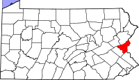
Location in the state of Pennsylvania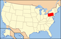
Pennsylvania's location in the U.S.Founded March 11, 1752 Seat Easton Largest city Bethlehem (partial) Area
- Total
- Land
- Water
377 sq mi (976 km²)
374 sq mi (969 km²)
4 sq mi (10 km²), 0.94%Population
- (2010)
- Density
297,735
796/sq mi (307.2/km²)Website www.northamptoncounty.org Northampton County is a county located in the U.S. state of Pennsylvania. It was formed in 1752 from parts of Bucks County with the county seat of Easton.[1] Its namesake was Northamptonshire and the country house, Easton Neston. As of 2010, the population was 297,735.
Northampton County is located in Pennsylvania's Lehigh Valley. Its northern edge borders The Poconos. The eastern section of the county borders the Delaware River, which divides Pennsylvania and New Jersey. It is bordered on the west by Lehigh County, Pennsylvania, the Lehigh Valley's more highly populated county.
The county is industrially-oriented, producing anthracite coal, cement, and other industrial products. Bethlehem Steel, once one of the world's largest manufacturers of steel, was located there prior to its closing in 2003.
Contents
Geography
According to the U.S. Census Bureau, the county has a total area of 377 square miles (977 km²), of which 374 square miles (968 km²) is land and 4 square miles (9 km²) (0.94%) is water.
Adjacent counties
- Monroe County (north)
- Warren County, New Jersey (east)
- Bucks County (south)
- Lehigh County (west)
- Carbon County (northwest)
National protected areas
- Delaware Water Gap National Recreation Area (part)
- Middle Delaware National Scenic River (part)
Government
Northampton is one of the six counties in Pennsylvania which has adopted a home rule charter. Instead of being run by a Board of Commissioners and several Row Officers, voters elect an Executive, a nine-person Council, a Controller, and a District Attorney. The Executive, Controller and District Attorney are elected by all voters in the County, as are five members of the Council. The other four Councilmen are elected by districts.
Elected Officials[1]
- County Executive:
- John Stoffa, Democrat
- County Council:
- Ron Angle, Republican
- John Cusick, Republican
- Thomas H Dietrich, Republican
- J. Michael Dowd, Republican
- Margaret (Peg) Ferraro, Republican
- Bruce A Gilbert, Republican
- Lamont G. McClure Jr., Democrat
- Ann McHale, Democrat
- Barbara A. Thierry, Republican
- Clerk of Courts:
- Leigh Ann Fisher, Democrat
- County Controller:
- Stephen Barron, Jr. , Democrat
- District Attorney:
- John Morganelli, Democrat
- Prothonotary:
- Holly Ruggiero, Democrat
- Register of Wills:
- Dorothy Cole, Democrat
- Sheriff:
- Randall Miller
Demographics
Historical populations Census Pop. %± 1790 24,238 — 1800 30,062 24.0% 1810 38,145 26.9% 1820 31,765 −16.7% 1830 39,482 24.3% 1840 40,996 3.8% 1850 40,235 −1.9% 1860 47,904 19.1% 1870 61,432 28.2% 1880 70,312 14.5% 1890 84,220 19.8% 1900 99,687 18.4% 1910 127,667 28.1% 1920 153,506 20.2% 1930 169,304 10.3% 1940 168,959 −0.2% 1950 185,243 9.6% 1960 201,412 8.7% 1970 214,368 6.4% 1980 225,418 5.2% 1990 247,105 9.6% 2000 267,066 8.1% 2010 297,735 11.5% [2][3] As of the 2010 census, the county was 86.3% White, 5.0% Black or African American, 0.2% Native American or Alaskan Native, 2.4% Asian, 0.0% Native Hawaiian, 2.2% were two or more races, and 3.8% were some other race. 10.5% of the population were of Hispanic or Latino ancestry.
As of the census[4] of 2000, there were 267,066 people, 101,541 households, and 71,078 families residing in the county. The population density was 714 people per square mile (276/km²). There were 106,710 housing units at an average density of 286 per square mile (110/km²). The racial makeup of the county was 91.23% White, 2.77% Black or African American, 0.15% Native American, 1.37% Asian, 0.03% Pacific Islander, 3.06% from other races, and 1.39% from two or more races. 6.69% of the population were Hispanic or Latino of any race. 24.0% were of German, 14.0% Italian, 8.8% Irish, 5.1% English and 5.1% American ancestry according to Census 2000. 89.3% spoke English and 5.5% Spanish as their first language.
There were 101,541 households out of which 31.20% had children under the age of 18 living with them, 56.40% were married couples living together, 9.80% had a female householder with no husband present, and 30.00% were non-families. 24.70% of all households were made up of individuals and 11.20% had someone living alone who was 65 years of age or older. The average household size was 2.53 and the average family size was 3.02.
In the county, the population was spread out with 23.30% under the age of 18, 9.20% from 18 to 24, 28.30% from 25 to 44, 23.40% from 45 to 64, and 15.70% who were 65 years of age or older. The median age was 38 years. For every 100 females there were 94.80 males. For every 100 females age 18 and over, there were 91.70 males.
Politics
As of January 2010, there are 196,862 registered voters in Northampton County.[5]
- Democratic: 98,451 (50.00%)
- Republican: 65,975 (33.51%)
- Other Parties: 32,436 (16.48%)
In recent decades, Northampton has been identified as one of Pennsylvania's "swing counties," with statewide winners carrying it in most cases. All five statewide winners carried it in November 2004 and all four statewide Democratic candidates carried it in November 2008, with its DA John Morganelli doing well there despite losing statewide to incumbent Attorney General Tom Corbett. The Democratic Party has been dominant most of the time in county-level politics in recent decades, County Executive John Stoffa, and most of the row offices. However with only two out of nine current county council seats.
County Council Members
- John Cusick, President, Republican, (At-Large)
- Margaret (Peg) Ferraro, Vice President, Republican, (At-Large)
- Ron Angle, Republican, District 4
- Thomas H Dietrich, Republican, (At-Large)
- J. Michael Dowd, Republican, District 2
- Bruce A Gilbert, Republican, (At-Large)
- Lamont G. McClure Jr., Democrat, District 3
- Ann McHale, Democrat, District 1
- Barbara A. Thierry, Republican, (At-Large)
State Representatives
- Justin Simmons, Republican, 131st district
- Joseph F. Brennan, Democrat, 133rd district
- Steve Samuelson, Democrat, 135th district
- Robert L. Freeman, Democrat, 136th district
- Joe Emrick, Republican, 137th district
- Marcia Hahn, Republican, 138th district
- Julie Harhart, Republican, 183rd district
State Senators
- Pat Browne, Republican, 16th district
- Lisa Boscola, Democrat, 18th district
- Bob Mensch, Republican, 24th district
- Dave Argall, Republican, 29th district
US Representative
- Charlie Dent, Republican, 15th district
Notable people
Main article: List of people from the Lehigh Valley- Marco Andretti, professional race car driver.
- Mario Andretti, former professional race car driver.
- Michael Andretti, professional racing team owner, former professional race car driver.
- Jonathan Frakes, director and actor.
- Larry Holmes, boxing's former heavyweight champion of the world.
- Daniel Dae Kim, actor.
- Samuel Henry Kress, founder of S. H. Kress & Co. and noted art collector.
- Kristen Maloney, gymnast and former Olympian.
- Bob Parsons, former professional football player, Chicago Bears.
- Aldo Ray, actor.
- Daniel Roebuck, actor.
- Brian Schneider, professional baseball player, Philadelphia Phillies.
- Tighe Scott, NASCAR and modified driver.
- Jonathan Taylor Thomas, actor.
- George Wolf, Governor of Pennsylvania 1829–1835.
Municipalities
 Map of Northampton County, Pennsylvania with Municipal Labels showing Cities and Boroughs (red), Townships (white), and Census-designated places (blue).
Under Pennsylvania law, there are four types of incorporated municipalities: cities, boroughs, townships, and two towns. The following cities, boroughs and townships are located in Northampton County:
Cities
Boroughs
Townships
- Allen Township
- Bethlehem Township
- Bushkill Township
- East Allen Township
- Forks Township
- Hanover Township
- Lehigh Township
- Lower Mount Bethel Township
- Lower Nazareth Township
- Lower Saucon Township
- Moore Township
- Palmer Township
- Plainfield Township
- Upper Mount Bethel Township
- Upper Nazareth Township
- Washington Township
- Williams Township
Census-designated places
Census-designated places are geographical areas designated by the U.S. Census Bureau for the purposes of compiling demographic data. They are not actual jurisdictions under Pennsylvania law. Other unincorporated communities, such as villages, may be listed here as well.
Education
Colleges & Universities
 Map of Northampton County, Pennsylvania School Districts
- Lafayette College, Easton.
- Lehigh University, Bethlehem.
- Moravian College, Bethlehem.
- Northampton County Area Community College, Bethlehem Township.
Public school districts & schools
- Bangor Area School District
- Bethlehem Area School District
- Catasauqua Area School District
- Easton Area School District
- Nazareth Area School District
- Northampton Area School District
- Pen Argyl Area School District
- Saucon Valley School District
- Wilson Area School District
Public Charter High Schools
The Lehigh Valley Charter High School for the Performing Arts, Bethlehem
Non-public high schools
- Bethlehem Catholic High School, Bethlehem
- Holy Family School, Nazareth
- Moravian Academy, Bethlehem
- Notre Dame High School, Bethlehem Township
- Pius X High School, Bangor
Transportation
 Main article: Transportation in the Lehigh Valley
Air transportation
Air transport to and from Northampton County is available through Lehigh Valley International Airport (IATA: ABE, ICAO: KABE).
Bus transportation
Public bus service in Northampton County is available through the Lehigh and Northampton Transportation Authority, known as LANTA. A shuttle bus service, The Bethlehem Loop, also operates in Bethlehem.
Expressways
- Interstate 78
- Pennsylvania Route 33
- U.S. Route 22
Telecommunications
Northampton County was once served only by the 215 area code from 1947 (when the North American Numbering Plan of the Bell System went into effect) until 1994. With the county's growing population, however, Northampton County was afforded area code 610 in 1994. Today, Northampton County is covered by 610. An overlay area code, 484, was added to the 610 service area in 1999.[6] A plan to introduce area code 835 as an additional overlay was rescinded in 2001.[7]
Recreation
There are 2 Pennsylvania state parks in Northampton County.
- Delaware Canal State Park follows the course of the old Delaware Canal along the Delaware River from Easton in Northampton County to Bristol in Bucks County.
- Jacobsburg Environmental Education Center
See also
- Lehigh Valley Conference
- List of shopping malls in the Lehigh Valley
- Media in the Lehigh Valley
- National Register of Historic Places listings in Northampton County, Pennsylvania
- Northampton County Prison
References
- ^ "Find a County". National Association of Counties. http://www.naco.org/Counties/Pages/FindACounty.aspx. Retrieved 2011-06-07.
- ^ http://factfinder2.census.gov
- ^ http://mapserver.lib.virginia.edu/
- ^ "American FactFinder". United States Census Bureau. http://factfinder.census.gov. Retrieved 2008-01-31.
- ^ "Running for office". Pennsylvania Department of State. http://www.dos.state.pa.us/elections/lib/elections/055_voter_registration_statistics/currentstats/currentvotestats.xls.
- ^ NANP-Overlay of 610 (Pennsylvania) Numbering Plan Area (NPA) with 484 NPAPDF (359 KB)
- ^ PA 835 Implementation for 484/610 NPA Rescinded – 835 NPA Code ReclaimedPDF (20.8 KB)
External links
- Northampton County travel guide from Wikitravel.
- Northampton County news at Lehigh Valley Live.
- Northampton County Official Web Site.
- "Living in the Greater Lehigh Valley," by The Allentown Morning Call.
Lehigh Valley States Counties Three Cities Cities and towns
100k-250kCities and towns
50k-99kCities and towns
10-50kBethlehem Township • Easton • Emmaus • Forks Township • Hanover Township • Lehigh Township • Lower Macungie Township • Lower Saucon Township • North Whitehall Township • Palmer Township • Phillipsburg • Salisbury Township • South Whitehall Township • Upper Macungie Township • Upper Saucon Township • Whitehall TownshipPeople List of people from the Lehigh ValleyMunicipalities and communities of Northampton County, Pennsylvania County seat: Easton Cities 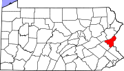
Boroughs Bangor | Bath | Chapman | East Bangor | Freemansburg | Glendon | Hellertown | Nazareth | North Catasauqua | Northampton | Pen Argyl | Portland | Roseto | Stockertown | Tatamy | Walnutport | West Easton | Wilson | Wind Gap
Townships CDPs Unincorporated
communitiesCherryville | Colesville‡ | Hollo | Lehigh Gap‡ | Martins Creek | Newburg | Schoenersville‡ | Slateford
Footnotes ‡This populated place also has portions in an adjacent county or counties
Categories:- Pennsylvania counties
- Northampton County, Pennsylvania
- 1752 establishments


Wikimedia Foundation. 2010.