- Forest County, Pennsylvania
-
Forest County, Pennsylvania 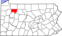
Location in the state of Pennsylvania
Pennsylvania's location in the U.S.Founded April 11, 1848 Seat Tionesta Largest city Tionesta Area
- Total
- Land
- Water
431 sq mi (1,116 km²)
428 sq mi (1,109 km²)
3 sq mi (8 km²), 0.76%Population
- (2010)
- Density
7,716
18/sq mi (6.9/km²)Website www.co.forest.pa.us Forest County is a county located in the U.S. state of Pennsylvania. As of 2010, the population is 7,716. Forest County is famous as a rural retreat. Nearly 75% of all dwellings in the county are second or vacation homes [1]. Forest County does not have a single traffic light, the only county in the state with such a distinction.[2] Despite all this, Forest County has become the fastest growing county in the state of Pennsylvania by percent, growing over 38% from 2000-2008.
Forest County was created on April 11, 1848, from part of Jefferson County. The county was enlarged on October 31, 1866, when part of Venango County was incorporated into the county.
Its county seat is Tionesta[1].
Contents
Geography
According to the U.S. Census Bureau, the county has a total area of 431 square miles (1,116.3 km2), of which 428 square miles (1,108.5 km2) is land and 3 square miles (7.8 km2) (0.76%) is water.
Adjacent counties
- Warren County (north)
- McKean County (northeast)
- Elk County (east)
- Jefferson County (south)
- Clarion County (south)
- Venango County (west)
National Forest
Part of Allegheny National Forest covers Forest County.
State Park
Part of Cook Forest State Park is in Forest County.
Demographics
Historical populations Census Pop. %± 1860 898 — 1870 4,010 346.5% 1880 4,385 9.4% 1890 8,482 93.4% 1900 11,039 30.1% 1910 9,435 −14.5% 1920 7,477 −20.8% 1930 5,180 −30.7% 1940 5,791 11.8% 1950 4,944 −14.6% 1960 4,485 −9.3% 1970 4,926 9.8% 1980 5,072 3.0% 1990 4,802 −5.3% 2000 4,946 3.0% 2010 7,716 56.0% [2][3][4] As of the census[5] of 2000, there were 4,946 people, 2,000 households, and 1,328 families residing in the county. The population density was 12 people per square mile (4/km²). There were 8,701 housing units at an average density of 20 per square mile (8/km²). The racial makeup of the county was 95.94% White, 2.22% Black or African American, 0.40% Native American, 0.14% Asian, 0.69% from other races, and 0.61% from two or more races. 1.21% of the population were Hispanic or Latino of any race. 38.1% were of German, 13.9% Irish, 8.1% American and 7.8% English ancestry according to Census 2000.
There were 2,000 households out of which 23.20% had children under the age of 18 living with them, 55.70% were married couples living together, 6.70% had a female householder with no husband present, and 33.60% were non-families. 29.10% of all households were made up of individuals and 15.10% had someone living alone who was 65 years of age or older. The average household size was 2.29 and the average family size was 2.81.
In the county, the population was spread out with 22.70% under the age of 18, 5.90% from 18 to 24, 22.60% from 25 to 44, 28.90% from 45 to 64, and 19.90% who were 65 years of age or older. The median age was 44 years. For every 100 females there were 111.20 males. For every 100 females age 18 and over, there were 102.30 males.
Municipalities
 Map of Forest County , Pennsylvania with Municipal Labels showing Boroughs (red) and Townships (white).
Under Pennsylvania law, there are four types of incorporated municipalities: cities, boroughs, townships, and, in at most two cases, towns. The following boroughs and townships are located in Forest County:
Boroughs
Townships
- Howe Township
- Jenks Township
- Kingsley Township
- Tionesta Township
Education
Public School Districts
See also
- List of municipal authorities in Forest County, Pennsylvania
- National Register of Historic Places listings in Forest County, Pennsylvania
References
- ^ "Find a County". National Association of Counties. http://www.naco.org/Counties/Pages/FindACounty.aspx. Retrieved 2011-06-07.
- ^ http://www.census.gov/population/www/censusdata/cencounts/files/pa190090.txt
- ^ http://factfinder2.census.gov
- ^ http://mapserver.lib.virginia.edu/
- ^ "American FactFinder". United States Census Bureau. http://factfinder.census.gov. Retrieved 2008-01-31.
Municipalities and communities of Forest County, Pennsylvania Borough 
Townships Unincorporated
communitiesCategories:- Pennsylvania counties
- Forest County, Pennsylvania
- 1848 establishments in the United States


Wikimedia Foundation. 2010.