- Beaver County, Pennsylvania
-
"Beaver County" redirects here. For other uses, see Beaver County (disambiguation).
Beaver County, Pennsylvania 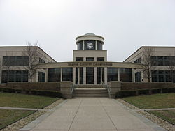 Beaver County Courthouse
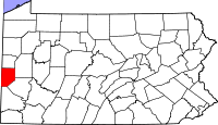
Location in the state of Pennsylvania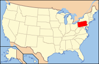
Pennsylvania's location in the U.S.Founded March 12, 1800 Seat Beaver Largest city Aliquippa Area
- Total
- Land
- Water
444 sq mi (1,150 km²)
434 sq mi (1,124 km²)
10 sq mi (26 km²), 2.18%Population
- (2010)
- Density
170,539
393/sq mi (151.7/km²)Website www.co.beaver.pa.us Beaver County is a county located in the U.S. state of Pennsylvania. As of the 2010 census, the population was 170,539.
Beaver County was created on March 12, 1800, from parts of Allegheny and Washington Counties. Its county seat is Beaver[1].
Beaver County is part of the Pittsburgh Metropolitan Statistical Area.
Contents
Geography
According to the U.S. Census Bureau, the county has a total area of 444 square miles (1,150.0 km2), of which 434 square miles (1,124.1 km2) is land and 10 square miles (25.9 km2) (2.18%) is water.
Adjacent counties
- Lawrence County (north)
- Butler County (east)
- Allegheny County (southeast)
- Washington County (southeast)
- Hancock County, West Virginia (west)
- Columbiana County, Ohio (west)

Lawrence County Columbiana County, Ohio and Hancock County, West Virginia 
Butler County  Beaver County, Pennsylvania

Allegheny County and Washington County Demographics
Historical populations Census Pop. %± 1800 5,776 — 1810 12,168 110.7% 1820 15,340 26.1% 1830 24,183 57.6% 1840 29,368 21.4% 1850 26,689 −9.1% 1860 29,140 9.2% 1870 36,148 24.0% 1880 39,605 9.6% 1890 50,077 26.4% 1900 56,432 12.7% 1910 78,253 38.7% 1920 111,621 42.6% 1930 149,062 33.5% 1940 156,754 5.2% 1950 175,192 11.8% 1960 206,948 18.1% 1970 208,418 0.7% 1980 204,441 −1.9% 1990 186,093 −9.0% 2000 181,412 −2.5% 2010 170,539 −6.0% [2][3] As of the census[4] of 2000, there were 181,412 people, 72,576 households, and 50,512 families residing in the county. The population density was 418 people per square mile (161/km²). There were 77,765 housing units at an average density of 179 per square mile (69/km²). The racial makeup of the county was 92.55% White, 5.96% Black or African American, 0.10% Native American, 0.25% Asian, 0.01% Pacific Islander, 0.20% from other races, and 0.92% from two or more races. 0.72% of the population were Hispanic or Latino of any race. 23.0% were of German, 17.4% Italian, 9.9% Irish, 6.5% English, 6.4% Polish and 5.8% American ancestry according to Census 2000.
There were 72,576 households out of which 28.60% had children under the age of 18 living with them, 54.50% were married couples living together, 11.40% had a female householder with no husband present, and 30.40% were non-families. 26.90% of all households were made up of individuals and 13.10% had someone living alone who was 65 years of age or older. The average household size was 2.44 and the average family size was 2.96.
In the county, the population was spread out with 22.60% under the age of 18, 7.40% from 18 to 24, 27.30% from 25 to 44, 24.20% from 45 to 64, and 18.40% who were 65 years of age or older. The median age was 41 years. For every 100 females there were 91.90 males. For every 100 females age 18 and over, there were 88.20 males.
Municipalities
 Map of Beaver County, Pennsylvania with Municipal Labels showing Cities and Boroughs (red), Townships (white), and Census-designated places (blue).
Under Pennsylvania law, there are four types of incorporated municipalities: cities, boroughs, townships, and, in at most two cases, towns. The following cities, boroughs and townships are located in Beaver County:
Cities
Boroughs
Townships
- Potter Township
- Pulaski Township
- Raccoon Township
- Rochester Township
- South Beaver Township
- Vanport Township
- White Township
Unincorporated communities
- Byersdale
- Cannelton
- Fombell
- Frisco
- Gringo
- Harshaville
- Kobuta
Area attractions
Beaver County offers many shops and places to eat. Beaver County is home to the Beaver Valley Mall located in Center Township which is home to hundreds of shops and restaurants.
Transportation
Major highways
 Interstate 76 (the Pennsylvania Turnpike)
 Interstate 376
 US Route 30 (the Lincoln Highway)
 Pennsylvania Route 18
 Pennsylvania Route 51
 Pennsylvania Route 65
 Pennsylvania Route 68
 Pennsylvania Route 168
 Pennsylvania Route 351
Airports
Public Transit
Public transit is provided by the Beaver County Transit Authority.
Bodies of Water
There are many bodies of water throughout Beaver County. The major bodies of water are:
- The Beaver River
- The Ohio River
Education
Colleges and universities
- Geneva College
- Mountain State University (Center Township Branch)
- Penn State Beaver Campus
- Trinity Episcopal School for Ministry
Community, junior, and technical colleges
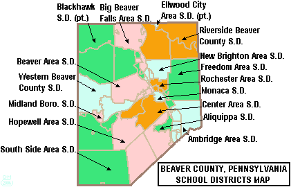
 Map of Beaver County, Pennsylvania Public School Districts
Public school districts
- Aliquippa School District - ranked 490th
- Ambridge Area School District - ranked 238th
- Beaver Area School District - ranked 56th
- Big Beaver Falls Area School District - ranked 364th
- Blackhawk School District (part) - ranked 126th
- Central Valley School District
- Ellwood City Area School District (part) - ranked 186th
- Freedom Area School District - ranked 193rd
- Hopewell Area School District - ranked 180th
- Midland Borough School District - not ranked no HS
- New Brighton Area School District - ranked 234th
- Riverside Beaver County School District - ranked 223rd
- Rochester Area School District - ranked 438th
- South Side Area School District - ranked 190th
- Western Beaver County School District - ranked 358th
The 498 school districts of Pennsylvania, that have high schools, were ranked for student academic achievement as demonstrated by three years of math and reading PSSA results by the Pittsburgh Business Times in 2008.
High schools
- Aliquippa High School
- Ambridge Area High School
- Beaver Area High School
- Beaver County Christian High School
- Beaver Falls High School
- Big Beaver Area High School
- Blackhawk High School
- Central Valley High School
- Freedom Area High School
- Hopewell High School
- Lincoln Park Performing Arts Charter School
- New Brighton High School
- Riverside High School
- Rochester Area High School
- Quigley Catholic High School
- South Side Beaver High School
- Western Beaver High School
Charter Schools
As reported by the Pennsylvania Department of Education - EdNA. April 2010.
- Beaver Area Academic Charter School
- Lincoln Park Performing Arts Charter School
- Pennsylvania Cyber Charter School
Private schools
As reported by the Pennsylvania Department of Education - EdNA. April 2010.
- Agapeland Children Garden - Beaver
- Beaver County Christian School -Upper - Beaver Falls
- Beaver Co Christian -West Park Elementary - Beaver Falls
- Bethel Christian School - Aliquippa
- Deliverance Temple Ministries ROOTS Inc Christian Academy - Aliquippa
- Divine Mercy Academy - Beaver Falls
- Hope Christian Academy - Aliquippa
- North Hills Christian School - Baden
- Our Lady of Fatima School - Aliquippa
- Pleasant Hill Wesleyan Academy - Hookstown
- Quigley Catholic High School - Baden
- St John the Baptist School - Monaca
- Sts Peter & Paul School - Beaver
- Sylvania Hills Christian - Rochester
Former School Districts
In 2009, Center Area School District and Monaca School District merged to form Central Valley School District.
Notable people
- Mark Javens
- William Ziegler, industrialist
- Gust Avrakotos, Central Intelligence Agency operative (See "Charlie Wilson's War")
- Lawrence Branchetti, Professional singer/entertainer
- Ed DeChellis, head men's basketball coach for The Naval Academy
- Mike Ditka, NFL player and Pro Football Hall of Fame inductee
- Tony Dorsett, NFL Player, Pro Football Hall of Fame
- Terry Francona, MLB Manager for the Boston Red Sox
- Sean Gilbert, NFL player
- Ty Law, NFL player
- Joe Letteri Visual imaging Artist winner of 3 Academy Award prize, visual effect supervisor of movie Avatar
- Henry Mancini, composer of "Moon River" and "The Pink Panther Theme", among many others
- Pete Maravich, National Basketball League Hall-of-Famer
- Press Maravich, basketball coach
- Doc Medich, Major League Baseball player
- Joe Namath, National Football League Hall Of Fame Player
- Babe Parilli, former All-American quarterback at the University of Kentucky; played in the NFL for the Cleveland Browns and Green Bay Packers, but notable for his AFL stint with the Boston Patriots(now called the New England Patriots)
- Paul Posluszny, NFL linebacker for the Jacksonville Jaguars
- Dan Radakovich, the Athletics Director at Georgia Tech
- Darrelle Revis, NFL player
- Jesse Steinfeld, former Surgeon General of the United States
- Pete Suder, Major League Baseball player
- Mark Vlasic, former Center High School and NFL Quarterback. He graduated from the University of Iowa and played four seasons in the NFL with the San Diego Chargers, Kansas City Chiefs, and Tampa Bay Buccaneers
Law and government/Politics
As of November 2008, there are 118,269 registered voters in Beaver County [1].
- Democratic: 70,819 (59.88%)
- Republican: 36,239 (30.64%)
- Other Parties: 11,211 (9.48%)
Beaver County used to be a Democratic stronghold and the Democrats continue to hold the commissioner majority and all county row offices, but in recent years it has been shifting heavily Republican. Multiple Democratic seats in both houses of the Pennsylvania Legislature have been lost to Republicans over the past few years. In statewide and federal elections it has been moving rightward as well. In 2004 Democrat John Kerry won Beaver County over Republican George Bush 51% to 48%. In 2008 Republican John McCain defeated Democrat Barack Obama 50% to 47%, becoming the first republican to win there since 1972. Each of the three state row office winners carried Beaver.
County commissioners
- Tony Amadio, Chairman, Democrat
- Joe Spanik, Democrat
- Charles A. Camp, Republican
Other county offices
- Clerk of Courts, Judy Enslen, Democrat
- Controller, David A. Rossi, Democrat
- Coroner, Teri Tatalovich-Rossi, Democrat
- District Attorney, Anthony Berosh, Democrat
- Prothonotary, Nancy Werme, Democrat
- Recorder of Deeds, Janice Jeschke Beall, Democrat
- Register of Wills, Carol Fiorucci, Democrat
- Sheriff, George David, Democrat
- Treasurer, Connie Javens, Democrat
Pennsylvania State Senate
- Barry Stout, Democrat, Pennsylvania's 46th Senatorial District
- Elder Vogel Jr., Republican, Pennsylvania's 47th Senatorial District
Pennsylvania House of Representatives
- Christopher Sainato, Democrat, Pennsylvania's 9th Representative District
- Jaret Gibbons, Democrat, Pennsylvania's 10th Representative District
- Jim Marshall, Republican, Pennsylvania's 14th Representative District
- Jim Christiana, Republican, Pennsylvania's 15th Representative District
- Robert F. Matzie, Democrat, Pennsylvania's 16th Representative District
- Jesse J. White, Democrat, Pennsylvania's 46th Representative District
United States House of Representatives
Protected areas
- Ohio River Islands National Wildlife Refuge (part)
- Raccoon Creek State Park, a Pennsylvania state park
- Bradys Run Park
- Brush Creek Park
- Old Economy Park
See also
- List of municipal authorities in Beaver County, Pennsylvania
- National Register of Historic Places listings in Beaver County, Pennsylvania
- Ohio River Trail
References
- ^ "Find a County". National Association of Counties. http://www.naco.org/Counties/Pages/FindACounty.aspx. Retrieved 2011-06-07.
- ^ http://factfinder2.census.gov
- ^ http://mapserver.lib.virginia.edu/
- ^ "American FactFinder". United States Census Bureau. http://factfinder.census.gov. Retrieved 2008-01-31.
External links
Municipalities and communities of Beaver County, Pennsylvania Cities 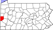
Boroughs Ambridge | Baden | Beaver | Big Beaver | Bridgewater | Conway | Darlington | East Rochester | Eastvale | Economy | Ellwood City‡ | Fallston | Frankfort Springs | Freedom | Georgetown | Glasgow | Homewood | Hookstown | Industry | Koppel | Midland | Monaca | New Brighton | New Galilee | Ohioville | Patterson Heights | Rochester | Shippingport | South Heights | West Mayfield
Townships Brighton | Center | Chippewa | Darlington | Daugherty | Franklin | Greene | Hanover | Harmony | Hopewell | Independence | Marion | New Sewickley | North Sewickley | Patterson | Potter | Pulaski | Raccoon | Rochester | South Beaver | Vanport | White
Unincorporated
communitiesByersdale | Cannelton | Fombell | Frisco | Gringo | Harshaville | Kobuta
Footnotes ‡This populated place also has portions in an adjacent county or counties
50 largest metropolitan statistical areas in the United States by population - New York
- Los Angeles
- Chicago
- Dallas–Fort Worth
- Philadelphia
- Houston
- Washington
- Miami
- Atlanta
- Boston
- San Francisco–Oakland
- Detroit
- Riverside–San Bernardino
- Phoenix
- Seattle
- Minneapolis–St. Paul
- San Diego
- St. Louis
- Tampa–St. Petersburg
- Baltimore
- Memphis
- Louisville
- Richmond
- Oklahoma City
- Hartford
- New Orleans
- Buffalo
- Raleigh
- Birmingham
- Salt Lake City
 Commonwealth of Pennsylvania
Topics - Cities
- Politics
- Government
- Delegations
- History
- Geography
- Geology
- Pennsylvanians
- State parks
- Symbols
- Visitor attractions
Metro areas Cities Largest
municipalities- Baldwin
- Berwick
- Bethel Park
- Brentwood
- Carlisle
- Chambersburg
- Columbia
- Darby
- Dunmore
- Elizabethtown
- Emmaus
- Ephrata
- Franklin Park
- Hanover
- Indiana
- Kingston
- Lansdale
- Lansdowne
- Monroeville
- Munhall
- Murrysville
- Norristown
- Penn Hills
- Phoenixville
- Plum
- Pottstown
- State College
- West Chester
- West Mifflin
- Whitehall
- Wilkinsburg
- Wyomissing
- Yeadon
Regions - Allegheny Mountains
- Allegheny National Forest
- Allegheny Plateau
- Atlantic Coastal Plain
- Blue Ridge
- Coal Region
- Cumberland Valley
- Delaware Valley
- Dutch Country
- Endless Mountains
- Happy Valley
- Laurel Highlands
- Lehigh Valley
- Main Line
- Northeast
- Northern Tier
- Northwestern
- Oil Region
- Pennsylvania Highlands
- Piedmont
- The Poconos
- Ridge and Valley
- South Central
- Susquehanna Valley
- Western
- Wyoming Valley
Counties - Adams
- Allegheny
- Armstrong
- Beaver
- Bedford
- Berks
- Blair
- Bradford
- Bucks
- Butler
- Cambria
- Cameron
- Carbon
- Centre
- Chester
- Clarion
- Clearfield
- Clinton
- Columbia
- Crawford
- Cumberland
- Dauphin
- Delaware
- Elk
- Erie
- Fayette
- Forest
- Franklin
- Fulton
- Greene
- Huntingdon
- Indiana
- Jefferson
- Juniata
- Lackawanna
- Lancaster
- Lawrence
- Lebanon
- Lehigh
- Luzerne
- Lycoming
- McKean
- Mercer
- Mifflin
- Monroe
- Montgomery
- Montour
- Northampton
- Northumberland
- Perry
- Philadelphia
- Pike
- Potter
- Schuylkill
- Snyder
- Somerset
- Sullivan
- Susquehanna
- Tioga
- Union
- Venango
- Warren
- Washington
- Wayne
- Westmoreland
- Wyoming
- York
Categories:- Pennsylvania counties
- Beaver County, Pennsylvania
- Ohio River counties
- 1800 establishments in the United States
- Pittsburgh metropolitan area
- Populated places established in 1800


Wikimedia Foundation. 2010.