- Okfuskee County, Oklahoma
-
Okfuskee County, Oklahoma 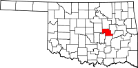
Location in the state of Oklahoma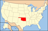
Oklahoma's location in the U.S.Founded 1907 Seat Okemah Area
- Total
- Land
- Water
629 sq mi (1,629 km²)
625 sq mi (1,619 km²)
4 sq mi (10 km²), 0.66%Population
- (2000)
- Density
11,814
18/sq mi (7/km²)Okfuskee County is a county located in the U.S. state of Oklahoma. As of 2000, the population was 11,814. Its county seat is Okemah[1].
Contents
Geography
According to the U.S. Census Bureau, the county has a total area of 1,629 km² (629 mi²). 1,618 km² (625 mi²) of it is land and 11 km² (4 mi²) of it (0.66%) is water.
Major highways
 Interstate 40
 U.S. Highway 62
 U.S. Highway 75
 State Highway 48
 State Highway 56
Adjacent counties
- Creek County (north)
- Okmulgee County (east)
- McIntosh County (southeast)
- Hughes County (south)
- Seminole County & Pottawatomie County (southwest)
- Lincoln County (west)
Demographics
 Age pyramid for Okfuskee County, Oklahoma, based on census 2000 data.
As of the census[2] of 2000, there were 11,814 people, 4,270 households, and 2,971 families residing in the county. The population density was 7/km² (19/mi²). There were 5,114 housing units at an average density of 3/km² (8/mi²). The racial makeup of the county was 65.46% White, 10.41% Black or African American, 18.20% Native American, 0.08% Asian, 0.57% from other races, and 5.27% from two or more races. 1.64% of the population were Hispanic or Latino of any race. 92.5% spoke English, 3.5% Muskogee, 2.1% Spanish and 1.3% German as their first language.
There were 4,270 households out of which 29.20% had children under the age of 18 living with them, 54.10% were married couples living together, 11.20% had a female householder with no husband present, and 30.40% were non-families. 27.80% of all households were made up of individuals and 14.50% had someone living alone who was 65 years of age or older. The average household size was 2.52 and the average family size was 3.06.
In the county, the population was spread out with 24.60% under the age of 18, 8.20% from 18 to 24, 26.70% from 25 to 44, 24.20% from 45 to 64, and 16.30% who were 65 years of age or older. The median age was 39 years. For every 100 females there were 106.50 males. For every 100 females age 18 and over, there were 107.90 males.
The median income for a household in the county was $24,324, and the median income for a family was $30,325. Males had a median income of $24,129 versus $17,819 for females. The per capita income for the county was $12,746. About 17.30% of families and 23.00% of the population were below the poverty line, including 29.60% of those under age 18 and 17.50% of those age 65 or over.
Cities and towns
NRHP sites
The following sites in Okfuskee County are listed on the National Register of Historic Places:
- Boley Historic District, Boley
- Woody Guthrie House, Okemah
- Okemah Armory, Okemah
- Okfuskee County Courthouse, Okemah
- Weleetka Town Hall and Jail, Weleetka
Popular culture
Okfuskee was the home county of American folk icon Woody Guthrie, who was born in Okemah. Guthrie refers to Okfuskee in one of his lost lyrics, "Way Over Yonder In the Minor Key." The lyrics were set to music by Billy Bragg and Wilco for their 1998 collaboration, Mermaid Avenue.
References
- ^ "Find a County". National Association of Counties. http://www.naco.org/Counties/Pages/FindACounty.aspx. Retrieved 2011-06-07.
- ^ "American FactFinder". United States Census Bureau. http://factfinder.census.gov. Retrieved 2008-01-31.
Municipalities and communities of Okfuskee County, Oklahoma City 
Towns Unincorporated
communitiesCategories:- Oklahoma counties
- Okfuskee County, Oklahoma
- 1907 establishments in the United States
- Populated places established in 1907


Wikimedia Foundation. 2010.