- Major County, Oklahoma
-
Major County, Oklahoma 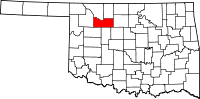
Location in the state of Oklahoma
Oklahoma's location in the U.S.Founded 1909 Seat Fairview Largest city Fairview Area
- Total
- Land
- Water
958 sq mi (2,481 km²)
957 sq mi (2,478 km²)
1 sq mi (3 km²), 0.12Population
- (2000)
- Density
7,545
8/sq mi (3/km²)Congressional district 3rd Time zone Central: UTC-6/-5 Major County is a county located in the U.S. state of Oklahoma. As of 2000, the population was 7,545. Its county seat is Fairview[1].
Contents
History
Upon statehood in 1907, Major County was created from southern part of a territorial county.[2] Fairview, which had been settled following the Land Run of 1893, was designated the county seat and voters reaffirmed the choice on December 22, 1908.[3] The county's commissioners rented office space until a brick courthouse was constructed.[3] A second courthouse, made of stone, was erected in 1928.[3]
Named for John Charles Major, a representative to the state's 1906 Constitutional Convention, the area was originally settled by large numbers of Kansas Mennonites.[2] One county town, Meno, received its name from an early leader of the Mennonite movement.[2]
The county experienced "Black Sunday" dust storms on April 14, 1935.[4]
Geography
According to the U.S. Census Bureau, the county has a total area of 958 square miles (2,480 km2), of which 957 square miles (2,480 km2) is land and 1 square mile (2.6 km2) (0.12%) is water.
The town of Ringwood is a well known producer of watermelons in the region and holds a Watermelon Festival annually.[4]
Major highways
 U.S. Highway 60
 U.S. Highway 281
 U.S. Highway 412
 State Highway 8
 State Highway 58
Adjacent counties
- Woods County (northwest)
- Alfalfa County (northeast)
- Garfield County (east)
- Kingfisher County (southeast)
- Blaine County (south)
- Dewey County (southwest)
- Woodward County (west)
Demographics
 Age pyramid for Major County, Oklahoma, based on census 2000 data.
As of the census[5] of 2000, there were 7,545 people, 3,046 households, and 2,208 families residing in the county. The population density was 8 people per square mile (3/km²). There were 3,540 housing units at an average density of 4 per square mile (1/km²). Nearly all of the county's residents (94.96 percent) were listed as white and 94.7 percent spoke English. Most of the remaining residents were listed as Hispanic or Latino (4.02 percent) who spoke Spanish (4.1 percent), Native American (.9 percent), or mixed (1.44 percent). A small group (1 percent) spoke German as their first language.
Of the 3,046 households in 2000, 31 percent had children under the age of 18, 63.7 percent belonged to married couples, 6 percent were run by a female householder with no husband present, and 27.5 percent were non-families. A quarter of the households were made up of individuals and 13.5 percent had someone living alone who was 65 year of age or older. The average household size was 2.44 and the average family size was 2.92.
The median age of the county's residents in 2000 was 42 years. The population was spread out with 24.7 percent under the age of 18, 6.7 percent age 18 to 24, 24.4 percent age 25 to 44, 24.9 percent age 45 to 64, and 19.4 percent who were 65 years of age or older. Women and girls slightly outnumber males, with 95.4 males for every 100 females and 91.5 males for every 100 females 18 and over.
The median income for a household in the county in 2000 was $30,949, and the median income for a family was $36,888. Males had a median income of $28,078 versus $17,658 for females. The per capita income for the county was $17,272. About 9.3 percent of families and 12 percent of the population were below the poverty line, including 15.1 percent of those under age 18 and 9.3 percent of those age 65 or over.
Politics
In Presidential election Major county has gone for the Republican candidate from 1936 to present. It was the only county in the state to be won by Alf Landon.[6] In the last five elections the Republican Presidential candidate has defeated the Democratic candidate by a margin of 36.7% to over 70%.[7]
It is part of Oklahoma's 3rd congressional district, which has a Cook Partisan Voting Index of R+18 and is represented by Frank Lucas. In the Oklahoma Senate it is part of the 27th district and is represented by Republican Bryce Marlatt. In the Oklahoma House of Representatives it is part of the 58th district and is represented by Republican Jeff Hickman.
Cities and towns
NRHP sites
The following sites in Major County are listed on the National Register of Historic Places:
- Major County Courthouse, Fairview
- First United Methodist Church, Fairview
References
- ^ "Find a County". National Association of Counties. http://www.naco.org/Counties/Pages/FindACounty.aspx. Retrieved 2011-06-07.
- ^ a b c Peterson-Veatch, Ross, "Major County," Encyclopedia of Oklahoma History and Culture (accessed June 11, 2010).
- ^ a b c Fairview," Encyclopedia of Oklahoma History and Culture (accessed June 11, 2010).
- ^ a b Peterson-Veatch, Ross, "Ringwood," Encyclopedia of Oklahoma History and Culture (accessed June 11, 2010).
- ^ "American FactFinder". United States Census Bureau. http://factfinder.census.gov. Retrieved 2008-01-31.
- ^ Geographie Electorale
- ^ New York Times Election Map (Zoom in on Oklahoma)
Municipalities and communities of Major County, Oklahoma City 
Towns Ames | Cleo Springs | Meno | Ringwood
Unincorporated
communitiesCategories:- Oklahoma counties
- Major County, Oklahoma
- 1909 establishments in the United States
- Populated places established in 1909


Wikimedia Foundation. 2010.