- Thornleigh, New South Wales
-
This article is about the suburb of Sydney, Australia. For the secondary school in Bolton, UK, see Thornleigh Salesian College.
Thornleigh
Sydney, New South Wales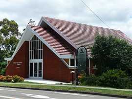
Seventh Day Adventist Church, Yarrara RoadPopulation: 7,505 Postcode: 2120 Location: 25 km (16 mi) north-west of Sydney CBD LGA: Hornsby Shire State District: Hornsby Federal Division: Berowra, Bradfield Suburbs around Thornleigh: Westleigh Hornsby Hornsby Westleigh Thornleigh Normanhurst Pennant Hills Pennant Hills Wahroonga Thornleigh is a suburb of Sydney, in the state of New South Wales, Australia. Thornleigh is located 25 kilometres (16 mi) north-west of the Sydney central business district in the local government area of Hornsby Shire. Thornleigh is bounded to the north by Waitara Creek.
Contents
History
Thornleigh is named after Constable John Thorn, who, along with Constable Horne, captured bushrangers Dalton and John MacNamara, leader of the North Rocks gang, on June 22, 1830, and were granted land as a reward (1838). Horne's land became Hornsby, and Thorn's land Thornleigh. The railway line was built in the 1880s and development followed.[1]
As part of the construction of the railway from Strathfield to Hornsby, a 1.2 km branch was constructed in 1884 by the contractors to a quarry in a gully west of Thornleigh. The tracks included a zig-zag section[2].
Unemployment was a problem during the Great Depression of the 1930s, so a local lady named Lorna Brand raised money for the construction of a walking track near the Lane Cove River as a way of providing relief work. The track begins at Thornleigh Oval, at the bottom of Handley Avenue, and goes through the bush towards the Lane Cove River. It then goes parallel to the river for a short distance before looping back to arrive at Comenarra Parkway. An extension goes down to the river, through a spot called Conscript Pass. At this spot, there are rock carvings done by the men who worked on the track. One of the carvings is a caricature of Bertram Stevens, Premier of New South Wales from 1932 to 1939.[3] The track is known as Lorna Pass in memory of Lorna Brand, and is now part of the Great North Walk, a long-distance walking trail between Sydney and Newcastle.[4]
Transport
Thornleigh railway station is on the Northern railway line of the CityRail network. Pennant Hills Road is one of Sydney's major thoroughfares.
Commercial Areas
Thornleigh is partly residential, partly industrial and commercial. Thornleigh Marketplace was completed in 2005 and contains a Woolworths supermarket, a Dan Murphy's liquor supermarket and speciality stores. Several dozen shops and restaurants are located around Thornleigh railway station and nearby Pennant Hills Road. Fast food restaurant chain McDonald's and tax preparation firm H&R Block have their Australian headquarters in Thornleigh.
Schools
Thornleigh West Public School is a primary school (K-6). It is situated in Giblett Avenue, opposite Oakleigh Oval. Formerly there was a Thornleigh Public School (K-6) which was situated at 218 Pennant Hills Road. It closed at the end of 1989 with the widening of Pennant Hills Road to six lanes. The site is now occupied by Bunnings. Normanhurst West Public School (K-6) is also in Thornleigh, although only just. It is situated at the corner of Sefton and Dartford Roads, right on the boundary with Normanhurst.
Population
The population of Thornleigh in 2001 was 7,505, with 67% over the age of 18, 91% being Australian citizens and 71% born in Australia. Of the 25.7% of residents born overseas, 5.3% are from United Kingdom, 2.2% from Lebanon and 1.9% from New Zealand. Hornsby Shire Council Community profile
Sport
The local sports clubs include the Thornleigh Thunderbolts with baseball, softball, athletics and netball divisions. This club is based at Brickpit Park, close the Thornleigh West Public School. There is also a football club known as Thunder FC that consists of teams ranging from Under 6s through to All Age divisions playing in the Gladesville Hornsby Football Association as well as a team in the Association's Premier League division. This club is also based out of Oakleigh Oval. There is also a Thunder Cricket Club which has teams in the lower divisions of the Hornsby Kuringai Hills District Cricket Association. The cricket club is based at Brickpit Park, affectionately known amongst the club as 'The Thunderdome'.
Gallery
-

Weatherboard home, Handley Avenue
-

Home with Federation-style woodwork, Oakleigh Avenue
-

Weatherboard bungalow, The Esplanade
-

St George Maronite Catholic Church, Yarrara Road
-

Baptist Church Activities Centre, The Esplanade
-

Caricature of Bertram Stevens at Conscript Pass
-

Original stone marker at Lorna Pass
-

Sign at Conscript Pass
References
- ^ The Book of Sydney Suburbs, Compiled by Frances Pollen, Angus & Robertson Publishers, 1990, Published in Australia ISBN 0-207-14495-8, page 255
- ^ Sydney's Forgotten Quarry Railways Oakes, John ISBN 0 9757870 3 9 pp65-71
- ^ The Great North Walk, McDougall, Shearer-Heriot (Kangaroo Press) 1988, p.49
- ^ Sydney and Blue Mountains Bushwalks, Neil Paton (Kangaroo Press) 2004, pp.19-20
Suburbs within Hornsby Shire | North Shore | Hills District | Sydney Arcadia · Asquith · Beecroft · Berowra · Berowra Heights · Berowra Waters · Berrilee · Brooklyn · Canoelands · Carlingford · Castle Hill · Cheltenham · Cherrybrook · Cowan · Dural · Epping · Fiddletown · Forest Glen · Galston · Glenhaven · Glenorie · Hornsby · Hornsby Heights · Kangaroo Point · Laughtondale · Maroota · Middle Dural · Milsons Passage · Mount Colah · Mount Ku-ring-gai · Normanhurst · North Epping · Pennant Hills · Round Corner · Thornleigh · Wahroonga · Waitara · Westleigh · West Pennant Hills · Wisemans Ferry
Coordinates: 33°44′00″S 151°04′32″E / 33.73340°S 151.07553°E
Categories:- Suburbs of Sydney
-


Wikimedia Foundation. 2010.