- Drummer Township, Ford County, Illinois
-
Drummer Township — Township — Location in Ford County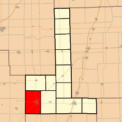 Ford County's location in Illinois
Coordinates: 40°27′52″N 88°24′16″W / 40.46444°N 88.40444°WCoordinates: 40°27′52″N 88°24′16″W / 40.46444°N 88.40444°W Country United States State Illinois County Ford Established March 1, 1869 Area – Total 53.65 sq mi (138.95 km2) – Land 53.55 sq mi (138.7 km2) – Water 0.1 sq mi (0.25 km2) 0.18% Elevation 745 ft (227 m) Population (2000) – Total 3,898 – Density 72.8/sq mi (28.1/km2) Time zone CST (UTC-6) – Summer (DST) CDT (UTC-5) ZIP codes 60936, 61845 GNIS feature ID 0428911 Drummer Township is one of twelve townships in Ford County, Illinois, USA. As of the 2000 census, its population was 3,898[1]. The township was formed from a portion of Dix Township on March 1, 1869.
Contents
Geography
According to the United States Census Bureau, Drummer Township covers an area of 53.65 square miles (139.0 km2); of this, 0.1 square miles (0.26 km2) or 0.18 percent is water.
Cities, towns, villages
Extinct towns
- Derby
- Garber
- Harpster
- Proctor
Cemeteries
The township contains Drummer Township Cemetery.
Major highways
Airports and landing strips
- Gibson Community Hospital Heliport
- Wright Airport
School districts
- Gibson City-Melvin-Sibley Community Unit School District 5
Political districts
- Illinois' 15th congressional district
- State House District 105
- State Senate District 53
References
- "Drummer Township, Ford County, Illinois". Geographic Names Information System, U.S. Geological Survey. http://geonames.usgs.gov/pls/gnispublic/f?p=gnispq:3:::NO::P3_FID:0428911. Retrieved 2010-01-16.
- United States Census Bureau 2007 TIGER/Line Shapefiles
- United States National Atlas
External links
Municipalities and communities of Ford County, Illinois Cities 
Villages Townships Unincorporated
communitiesFootnotes ‡This populated place also has portions in an adjacent county or counties
Categories:- Townships in Ford County, Illinois


Wikimedia Foundation. 2010.