- New Orleans Central Business District
-
Central Business District New Orleans Neighborhood  New Orleans Central Business District
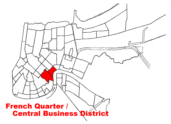
Country United States State Louisiana City New Orleans Planning District District 1, French Quarter/CBD Elevation 3 ft (0.9 m) Coordinates 29°56′59″N 90°04′14″W / 29.94972°N 90.07056°W Area 1.18 sq mi (3.1 km2) - land 1.06 sq mi (3 km2) - water 0.12 sq mi (0 km2), 10.17% Population 2,060 (2010) Density 1,746 / sq mi (674 / km2) Timezone CST (UTC-6) - summer (DST) CDT (UTC-5) Area code 504  Location of the French Quarter and Central Business District in New Orleans
The Central Business District is a neighborhood of the city of New Orleans. A subdistrict of the French Quarter/CBD Area, its boundaries as defined by the City Planning Commission are: Iberville, Decatur and Canal Streets to the north, the Mississippi River to the east, the New Orleans Morial Convention Center, Julia and Magazine Streets and the Pontchartrain Expressway to the south and South Claiborne Avenue, Cleveland and South and North Derbigny Streets to the west. It is the equivalent of what many cities call their "downtown", although in New Orleans "downtown" or "down town" was historically used to mean all portions of the city downriver from Canal Street in the direction of flow of the Mississippi River. In recent decades, however, use of the catch-all "downtown" adjective to describe neighborhoods downriver from Canal Street has largely ceased, having been replaced in usage by individual neighborhood names (e.g., Bywater).
Originally developed as the largely residential Faubourg Ste. Marie (Eng. "St. Mary Suburb") in the late-18th century, the modern Central Business District is today a dynamic, mixed-use neighborhood, home to professional offices housed within tall skyscrapers, specialty and neighborhood retail, numerous restaurants and clubs, and thousands of residents inhabiting restored historic commercial and industrial buildings.
Contents
Geography
The Central Business District is located at 29°56′59″N 90°04′14″W / 29.94972°N 90.07056°W [1] and has an elevation of 3 feet (0.9 m)[2]. As is true of most of metropolitan New Orleans, the parts of the district nearer the river are higher in elevation than areas further removed from it. According to the United States Census Bureau, the district has a total area of 1.18 square miles (3.1 km2). 1.06 square miles (2.7 km2) of which is land and 0.12 square miles (0.3 km2) (10.17%) of which is water.
Adjacent Neighborhoods
- Iberville Development (north)
- French Quarter (north)
- Mississippi River (east)
- Lower Garden District (south)
- Central City (south)
- Tulane/Gravier (west)
Boundaries
The City Planning Commission defines the boundaries of the Central Business District as these streets: Iberville Street, Decatur Street, Canal Street, the Mississippi River, the New Orleans Morial Convention Center, Julia Street, Magazine Street, the Pontchartrain Expressway, South Claiborne Avenue, Cleveland Street, South Derbigny Street and North Derbigny Street.[3]
Demographics
As of the census[4] of 2000, there were 3,435 inhabitants of the census tracts best corresponding to the boundaries of the New Orleans Downtown Development District. The population density was 1,692 /mi² (664 /km²). Another 4,142 inhabitants of the adjacent French Quarter neighborhood were recorded in the 2000 Census. The CBD, its subdistricts (e.g., the Warehouse District), and the bordering neighborhoods of Treme, the French Quarter, and the Lower Garden District possessed 21,630 residents, according to the 2000 Census.
History
Streets in the Central Business District (originally "Faubourg Ste. Marie") were initially platted in the late-18th century, representing the first expansion of New Orleans beyond its original French Quarter footprint. Significant investment began in earnest in the wake of the Louisiana Purchase of 1803, as people from other parts of the United States flocked to the city. Consequently, the district began to be referred to as the American Sector.
While traditionally Canal Street was viewed as the dividing line between the French Quarter and the American Sector, legally both sides of Canal Street are today considered part of the Central Business District for zoning and regulatory purposes.
Through the 19th and into the 20th century, the Central Business District continued developing almost without pause. By the mid-20th century, most professional offices in the region were located downtown, the hub of a well-developed public transit system conveying tens of thousands of workers to and from the area daily. Canal Street had evolved into the primary retail destination for New Orleanians, as well as for residents of the surrounding region. Local department stores Maison Blanche, D.H. Holmes, Godchaux's, Gus Mayer, Kreeger's and Krauss anchored numerous well-known specialty retailers, such as Rubenstein Bros., Adler's, Koslow's, Rapp's, and Werlein's Music. National retailers, like Kress, Woolworth and Walgreens were present alongside local drugstore K&B. Sears operated a large store one block off Canal, on Baronne Street. Theaters and movie palaces also abounded, with the neon marquees of the Saenger, Loews State, Orpheum, Joy and Civic nightly casting multicolored light onto surrounding sidewalks. In the 1950s, six-lane Loyola Avenue was constructed as an extension of Elk Place, cutting a swath through a low-income residential district and initially hosting the city's new civic center complex. The late-1960s widening of Poydras Street was undertaken to create another six-lane central area circulator for vehicular traffic, as well as to accommodate modern high-rise construction.
The portion of the CBD closer to the Mississippi River and upriver from Poydras Street is known as the Warehouse District, because it was heavily devoted to warehousing and manufacturing before shipping became containerized. The 1984 World's Fair drew attention to the then semi-derelict district, resulting in steady investment and redevelopment from the mid-1980s onwards. Many of the old 19th century warehouses have been converted into hotels, restaurants, condominiums, and art galleries.
Notable structures in the CBD include the Greek Revival Gallier Hall (the city's former city hall), the Louisiana Superdome, the New Orleans Arena, the city's present-day, International style city hall, and One Shell Square, the city's tallest building and Royal Dutch Shell's headquarters for Gulf of Mexico Exploration and Production. Other significant attractions include the postmodern Piazza d'Italia, Harrah's Casino, the World Trade Center New Orleans, the U.S. Fifth Circuit Court of Appeals, St. Patrick's Church, the Hibernia Bank Building and the former New Orleans Cotton Exchange.
The principal public park in the CBD is Lafayette Square, upon which face both Gallier Hall and the Fifth Circuit Court of Appeals. Other public spaces include Duncan Plaza, Elk Place, the Piazza d'Italia, Lee Circle, Mississippi River Heritage Park, Spanish Plaza and the Richard and Annette Bloch Cancer Survivor's Plaza.
Museums include the National World War II Museum, the Ogden Museum of Southern Art, the Louisiana Children's Museum, the New Orleans Contemporary Arts Center and Confederate Memorial Hall.
New Orleans CBD was one of the few areas of New Orleans that escaped the catastrophic flooding of Hurricane Katrina.[citation needed]
Government and infrastructure
The New Orleans City Hall and surrounding structures, including the circa-1960, architecturally award-winning Main Branch of the New Orleans Public Library face Duncan Plaza, an exercise in 1950s-style urban renewal embodying then-mayor Chep Morrison's desire to create a modern civic center. The New Orleans Civic Center is today much diminished, with the Louisiana Supreme Court building having been torn down in the wake of the court's departure for the French Quarter, the Louisiana State office building having suffered the same fate, and Duncan Plaza itself having been fenced off.
The United States Postal Service operates the New Orleans Main Post Office at 701 Loyola Avenue in the CBD.[5]
The Union Passenger Terminal is the terminus for three of Amtrak's long-distance trains, the City of New Orleans, the Crescent and, since 2005, the Sunset Limited and also offers inter-city bus service via Greyhound Lines.
Interstate Highway access is provided by I-10, via the Claiborne and Pontchartrain Expressways. When I-10 curves to the east by the Louisiana Superdome and becomes the Claiborne Expressway, elevated above N. Claiborne Avenue, the Pontchartrain Expressway continues as U.S. Route 90 Business and crosses the Mississippi River on the twin-bridge Crescent City Connection.
Significant thoroughfares in the CBD include St. Charles Avenue, Camp Street, Carondelet Street, Gravier Street, Poydras Street, Tchoupitoulas Street, Howard Avenue and Canal Street. Prior to the 1980s, the intersection of Gravier and Carondelet streets was the de facto heart of the city's financial district. Though still a vibrant area, that part of the CBD witnessed the migration of much business slightly upriver to Poydras Street, as many modern high-rise office towers were constructed there in the 1970s and 1980s. The widening of Loyola Avenue, Poydras Street and O'Keefe Avenue aimed to simultaneously create an effective downtown circulator high capacity road network for automobile traffic and make room for large-scale redevelopment (e.g., Duncan Plaza, Superdome). However, many of the development sites created in the wake of these improvements were never built upon, leaving a noticeable and unfortunate quantity of surface parking lots along these widened streets.
The New Orleans Downtown Development District was created by the Louisiana Legislature in 1974 as the first assessment-based business improvement district in the United States. Currently, the DDD is promoting its Canal Street redevelopment strategy, supporting the growth of an entrepreneurial, creative industries sector in the CBD, advocating on behalf of the regeneration strategy planned for the city's medical district, and reaching out to engage stakeholders and coordinate with other governmental bodies in crafting the city's new comprehensive zoning ordinance and master plan, the 21st Century Plan for New Orleans.
Economy
Entergy, the region's sole Fortune 500 firm, maintains its headquarters in the CBD, as does Reily Foods Company, which markets Luzianne products and Standard Coffee.[6][7] Other local companies headquartered downtown include McMoRan Exploration, Pan American Life Insurance, Superior Energy Services, TurboSquid, iSeatz, Historic Restoration Inc. (HRI), Whitney National Bank, Tidewater Marine, Energy Partners Ltd., Intermarine, IMTT, International Coffee Corp. and The Receivables Exchange.
The CBD also hosts the New Orleans I.P., an "Intellectual Property", home to numerous creative industries firms, and, within the downtown medical district, the New Orleans BioInnovation Center.
The regional economic alliance Greater New Orleans, Inc. (GNO Inc.), the New Orleans metropolitan area's lead economic development entity for the ten-parish New Orleans region, is also headquartered downtown.
Diplomatic missions
The Consulate of Mexico in New Orleans is located in the CBD.[8] The consulate re-opened in that location in 2008 because of the increase in Mexican immigrant workers during the rebuilding of New Orleans after Hurricane Katrina.[9]
At one time the Consulate-General of Japan in New Orleans was located in the Entergy Tower in the CBD.[10] In 2006 Japan announced that it was moving the consulate to Nashville, Tennessee.[11] The Japanese Government relocated the mission to be close to industries and operations owned by Japanese companies.[12]
See also
References
- ^ "US Gazetteer files: 2010, 2000, and 1990". United States Census Bureau. 2011-02-12. http://www.census.gov/geo/www/gazetteer/gazette.html. Retrieved 2011-04-23.
- ^ "US Board on Geographic Names". United States Geological Survey. 2007-10-25. http://geonames.usgs.gov. Retrieved 2008-01-31.
- ^ Greater New Orleans Community Data Center. "Central Business District Neighborhood". http://gnocdc.org/orleans/1/47/index.html. Retrieved 2008-06-21.
- ^ "American FactFinder". United States Census Bureau. http://factfinder.census.gov. Retrieved 2008-01-31.
- ^ "Post Office Location - N O MAIN OFC WINDOW SVE." United States Postal Service. Retrieved on May 5, 2009.
- ^ "Contact Us." Reily Foods Company. Retrieved on January 21, 2010.
- ^ "Entergy Corporate Headquarters Return to New Orleans." Entergy. April 20, 2006. Retrieved on January 21, 2010.
- ^ "Bienvenidos Consulado de México en Nueva Orleáns." Consulate of Mexico in New Orleans. Retrieved on March 7, 2010.
- ^ Hammer, David. "Mexican Consulate opens Monday." New Orleans Times Picayune. April 18, 2008. Retrieved on March 7, 2010.
- ^ "Overseas Establishments in the U.S." Embassy of Japan in Washington, D.C. Retrieved on March 7, 2010.
- ^ "Another hit for Nashville: Japan's consulate." The Kansas City Star. December 30, 2006. Page 2. Retrieved on March 7, 2010.
- ^ "Japan will close New Orleans consulate." The Times-Picayune. November 30, 2007. Accessed June 21, 2008.
External links
Neighborhoods of the French Quarter/Central Business District of New Orleans, Louisiana Central Business District | French Quarter
Planning Districts: French Quarter/CBD · Central City/Garden District · Uptown/Carrollton · Mid-City · Lakeview · Gentilly · Bywater · Lower Ninth Ward · New Orleans East · Village de L'Est · Venetian Isles/Lake Catherine · Algiers · English TurnCity of New Orleans Topics History · Geography · Demographics · Economy · Culture · Healthcare · Media · Music · Sports · Architecture · Tourism · Education · Notable people · Skyscrapers · Streetcars · Flag · Lists

Government Neighborhoods French Quarter · Central Business District · Garden District · New Orleans East · Audubon · Uptown · Mid-City · Lakeview · Bywater · Lower Ninth Ward · Algiers · Gentilly · Metro area
Categories:- Neighborhoods in New Orleans, Louisiana
- Economy of New Orleans, Louisiana
- Central business districts in the United States

Wikimedia Foundation. 2010.