- Durham Township, Hancock County, Illinois
-
Durham Township — Township — Location in Hancock County Hancock County's location in Illinois
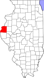
Coordinates: 40°35′42″N 91°04′25″W / 40.595°N 91.07361°WCoordinates: 40°35′42″N 91°04′25″W / 40.595°N 91.07361°W Country  United States
State  Illinois
County Hancock Established November 6, 1849 Area – Total 36.93 sq mi (95.65 km2) – Land 36.9 sq mi (95.58 km2) – Water 0.03 sq mi (0.07 km2) 0.07% Elevation 650 ft (198 m) Population (2000) – Total 302 – Density 8.2/sq mi (3.2/km2) Time zone CST (UTC-6) – Summer (DST) CDT (UTC-5) ZIP codes 61450, 62318, 62330 GNIS feature ID 0428922 Durham Township is one of twenty-five townships in Hancock County, Illinois, USA. As of the 2000 census, its population was 302[1].
Contents
Geography
According to the United States Census Bureau, Durham Township covers an area of 36.93 square miles (95.6 km2); of this, 36.9 square miles (96 km2) (99.93 percent) is land and 0.03 square miles (0.078 km2) (0.07 percent) is water.
Unincorporated towns
(This list is based on USGS data and may include former settlements.)
Cemeteries
The township contains these five cemeteries: Byley, Durham, Gittings, Gittings Mound and Vandruff.
Major highways
Airports and landing strips
- Douglas Airport
School districts
- Nauvoo-Colusa Community Unit School District 325
Political districts
- Illinois's 17th congressional district
- State House District 94
- State Senate District 47
References
- United States Census Bureau 2008 TIGER/Line Shapefiles
- "Durham Township". Geographic Names Information System, U.S. Geological Survey. http://geonames.usgs.gov/pls/gnispublic/f?p=gnispq:3:::NO::P3_FID:0428922. Retrieved 2009-09-20.
- United States National Atlas
External links

Lomax Township, Henderson County Terre Haute Township, Henderson County Dallas City Township 
La Harpe Township  Durham Township

Rock Creek Township Pilot Grove Township Fountain Green Township Municipalities and communities of Hancock County, Illinois Cities 
Town Villages Townships Appanoose | Augusta | Bear Creek | Carthage | Chili | Dallas City | Durham | Fountain Green | Hancock | Harmony | La Harpe | Montebello | Nauvoo | Pilot Grove | Pontoosuc | Prairie | Rock Creek | Rocky Run | Sonora | St. Albans | St. Mary's | Walker | Warsaw | Wilcox | Wythe
Unincorporated
communitiesFootnotes ‡This populated place also has portions in an adjacent county or counties
Categories:- Townships in Hancock County, Illinois


Wikimedia Foundation. 2010.