- Morrow County, Ohio
-
Morrow County, Ohio 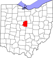
Location in the state of Ohio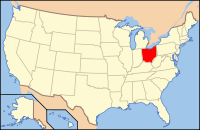
Ohio's location in the U.S.Founded March 1, 1848[1] Named for Jeremiah Morrow Seat Mount Gilead Largest village Mount Gilead Area
- Total
- Land
- Water
407 sq mi (1,055 km²)
406 sq mi (1,052 km²)
1 sq mi (3 km²), 0.28%Population
- (2000)
- Density
31,628
78/sq mi (30/km²)Time zone Eastern: UTC-5/-4 Website www.morrowcounty.info Historical populations Census Pop. %± 1850 20,280 — 1860 20,445 0.8% 1870 18,583 −9.1% 1880 19,072 2.6% 1890 18,120 −5.0% 1900 17,879 −1.3% 1910 16,815 −6.0% 1920 15,570 −7.4% 1930 14,489 −6.9% 1940 15,646 8.0% 1950 17,168 9.7% 1960 19,405 13.0% 1970 21,348 10.0% 1980 26,480 24.0% 1990 27,749 4.8% 2000 31,628 14.0% Est. 2007 34,520 9.1% Population 1800-2007.[1] Morrow County is a county located in the state of Ohio, United States. Shawnee people used the area for hunting purposes before white settlers arrived in the early 19th century. Morrow County was organized in 1848 from parts of four neighboring counties and named for Jeremiah Morrow, Governor of Ohio from 1822 to 1826. As of 2010, the population was 34,827. [1] and the census estimated the population to be 34,529 in 2006.[2] Its county seat is Mount Gilead[3]. The center of population of Ohio is also located east of Mount Gilead.[4] Morrow County is part of the Columbus, Ohio Metropolitan Statistical Area.
Famous people born in Morrow County include (1) Warren G. Harding, 29th President of the United States, who was born near Blooming Grove, Ohio, in northeast Morrow County; (2) Quaker abolitionist Richard Dillingham, who was born in Peru Township; (3) Reverend Frank W. Gunsaulus, cleryman, writer and educator (see Illinois Institute of Technology), who was born in Chesterville, Ohio; and (4) writer Dawn Powell, who was born in Mount Gilead.
Morrow County's historic World War I Victory Shaft, unique in the United States, is located in the center of downtown Mount Gilead. Other areas interesting to the tourist include: Mount Gilead State Park; Amish farms and businesses near Johnsville and Chesterville; the Mid-Ohio Race Track near Steam Corners; the rolling Allegheny foothills of eastern Morrow County; the site of the birthplace of President Warren G. Harding near Blooming Grove; the site of the former Ohio Central College in Iberia; the early 19th century architecture of buildings in Chesterville, Ohio; the Revolutionary War Soldiers' Memorial in Mount Gilead; the Civil War monument in Cardington; and the mid-19th century architecture of the Morrow County Courthouse and Old Jail in Mount Gilead.
Contents
Geography
According to the U.S. Census Bureau, the county has a total area of 407 square miles (1,050 km2).406 square miles (1,052 km²) of it is land and 1 square mile (2.6 km2) of it (0.28%) is water. Morrow County is considered to be a part of "Central Ohio."
Adjacent counties
- Crawford County (north)
- Richland County (northeast)
- Knox County (southeast)
- Delaware County (southwest)
- Marion County (west)
Demographics
As of the census[5] of 2000, there were 31,628 people, 11,499 households, and 8,854 families residing in the county. The population density was 78 people per square mile (30/km²). There were 12,132 housing units at an average density of 30 per square mile (12/km²). The racial makeup of the county was 98.37% White, 0.27% Black or African American, 0.30% Native American, 0.15% Asian, 0.18% from other races, and 0.74% from two or more races. 0.58% of the population were Hispanic or Latino of any race.
There were 11,499 households out of which 35.60% had children under the age of 18 living with them, 64.60% were married couples living together, 8.10% had a female householder with no husband present, and 23.00% were non-families. 19.00% of all households were made up of individuals and 7.90% had someone living alone who was 65 years of age or older. The average household size was 2.72 and the average family size was 3.09.
 Old Morrow County Jail.
In the county, the population was spread out with 27.30% under the age of 18, 7.60% from 18 to 24, 29.30% from 25 to 44, 24.30% from 45 to 64, and 11.50% who were 65 years of age or older. The median age was 36 years. For every 100 females there were 99.40 males. For every 100 females age 18 and over, there were 98.00 males.
The median income for a household in the county was $40,882, and the median income for a family was $45,747. Males had a median income of $33,129 versus $22,454 for females. The per capita income for the county was $17,830. About 6.60% of families and 9.00% of the population were below the poverty line, including 12.40% of those under age 18 and 7.10% of those age 65 or over.
Government
Main article: Ohio county government Morrow County Courthouse.
Communities
 Map of Morrow County, Ohio With Municipal and Township Labels
City
Villages
Townships
Unincorporated communities
- Bloomfield
- Blooming Grove
- Climax
- Denmark
- Fargo
- Iberia
- Johnsville
- Jugs Corners
- North Woodbury
- Penlan
- Pulaskiville
- Russell
- Shauck
- Shawtown
- South Woodbury
- St. James
- Vails Corners
- Westfield
- West Liberty
- West Point
- Williamsport
Notable residents
- Tim Belcher, former Major League Baseball pitcher
See also
References
- ^ a b "Ohio County Profiles: Morrow County" (PDF). Ohio Department of Development. http://www.odod.state.oh.us/research/FILES/S0/Morrow.pdf. Retrieved 2007-04-28.
- ^ "Morrow County data". Ohio State University Extension Data Center. http://www.osuedc.org/profiles/profile_entrance.php?fips=39117&sid=0. Retrieved 2007-04-28.[dead link]
- ^ "Find a County". National Association of Counties. http://www.naco.org/Counties/Pages/FindACounty.aspx. Retrieved 2011-06-07.
- ^ "Population and Population Centers by State: 2000". U.S. Census Bureau. http://www.census.gov/geo/www/cenpop/statecenters.txt. Retrieved 2007-04-28.
- ^ "American FactFinder". United States Census Bureau. http://factfinder.census.gov. Retrieved 2008-01-31.

Crawford County Richland County Marion County 
 Morrow County, Ohio

Delaware County Knox County Municipalities and communities of Morrow County, Ohio City 
Villages Cardington | Chesterville | Edison | Fulton | Marengo | Mount Gilead | Sparta
Townships Bennington | Canaan | Cardington | Chester | Congress | Franklin | Gilead | Harmony | Lincoln | North Bloomfield | Perry | Peru | South Bloomfield | Troy | Washington | Westfield
Unincorporated
communitiesFootnotes ‡This populated place also has portions in an adjacent county or counties
Categories:- Ohio counties
- Morrow County, Ohio
- 1848 establishments in the United States
- Columbus, Ohio metropolitan area


Wikimedia Foundation. 2010.