- Monroe County, Ohio
-
Monroe County, Ohio 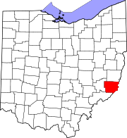
Location in the state of Ohio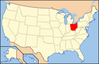
Ohio's location in the U.S.Founded January 29, 1813[1] Named for James Monroe Seat Woodsfield Largest village Woodsfield Area
- Total
- Land
- Water
457 sq mi (1,185 km²)
456 sq mi (1,180 km²)
2 sq mi (5 km²), 0.42Population
- (2000)
- Density
15,180
33/sq mi (13/km²)Time zone Eastern: UTC-5/-4 Historical populations Census Pop. %± 1820 4,645 — 1830 8,768 88.8% 1840 18,521 111.2% 1850 28,351 53.1% 1860 25,741 −9.2% 1870 25,779 0.1% 1880 26,496 2.8% 1890 25,175 −5.0% 1900 27,031 7.4% 1910 24,244 −10.3% 1920 20,660 −14.8% 1930 18,426 −10.8% 1940 18,641 1.2% 1950 15,362 −17.6% 1960 15,268 −0.6% 1970 15,739 3.1% 1980 17,382 10.4% 1990 15,497 −10.8% 2000 15,180 −2.0% Monroe County is a county located in the state of Ohio. As of the 2010 census, the population was 14,642. [1] Its county seat is Woodsfield[2] and is named for James Monroe, Secretary of State when the county was formed and later President of the United States.[3]
Contents
Geography
According to the U.S. Census Bureau, the county has a total area of 457 square miles (1,180 km2).456 square miles (1,180 km²) of it is land and 2 square miles (5.2 km2) of it (0.42%) is water.
Adjacent counties
- Belmont County (north)
- Marshall County, West Virginia (northeast)
- Wetzel County, West Virginia (east)
- Tyler County, West Virginia (southeast)
- Washington County (south)
- Noble County (west)
National protected area
- Wayne National Forest (part)
History
Monroe County was formed on January 28, 1813 from portions of Belmont, Guernsey and Washington counties. It was named after James Monroe, a US Secretary of State and later fifth President of the United States.
Demographics
As of the census[4] of 2000, there were 15,180 people, 6,021 households, and 4,413 families residing in the county. The population density was 33 people per square mile (13/km²). There were 7,212 housing units at an average density of 16 per square mile (6/km²). The racial makeup of the county was 98.72% White, 0.26% Black or African American, 0.15% Native American, 0.07% Asian, 0.01% Pacific Islander, 0.11% from other races, and 0.67% from two or more races. 0.41% of the population were Hispanic or Latino of any race.
There were 6,021 households out of which 29.50% had children under the age of 18 living with them, 61.70% were married couples living together, 8.10% had a female householder with no husband present, and 26.70% were non-families. 24.00% of all households were made up of individuals and 11.50% had someone living alone who was 65 years of age or older. The average household size was 2.50 and the average family size was 2.96.
In the county, the population was spread out with 23.60% under the age of 18, 7.10% from 18 to 24, 25.90% from 25 to 44, 27.20% from 45 to 64, and 16.30% who were 65 years of age or older. The median age was 41 years. For every 100 females there were 97.50 males. For every 100 females age 18 and over, there were 96.10 males.
The median income for a household in the county was $30,467, and the median income for a family was $36,297. Males had a median income of $33,308 versus $19,628 for females. The per capita income for the county was $15,096. About 11.00% of families and 13.90% of the population were below the poverty line, including 18.30% of those under age 18 and 11.40% of those age 65 or over.
Government
Main article: Ohio county governmentMonroe County is served by the Monroe County District Library from its administrative offices in Woodsfield, Ohio; it also offers a bookmobile service.
In 2005, the library loaned more than 141,000 items to its 6,000 cardholders. Total holding are over 64,000 volumes with over 140 periodical subscriptions.[5] This library is a member of the SOLO Regional Library System.
Communities
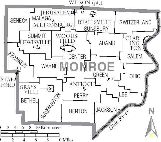
 Map of Monroe County, Ohio With Municipal and Township Labels
Villages
Townships
Unincorporated communities
Education
Monroe County contains the following schools through the Switzerland of Ohio Local School District:
- Elementary Schools
- Beallsville Elementary School in Beallsville, Ohio
- Hannibal Elementary School in Hannibal, Ohio
- Sardis Elementary School (Ohio) in Sardis, Ohio
- Skyvue Elementary School in Graysville, Ohio
- Woodsfield Elementary School in Woodsfield, Ohio
- St.Sylvester Central in Woodsfield, Ohio
- High Schools
- Career Center
- Swiss Hills Career Center in Woodsfield, Ohio
See also
References
- ^ "Ohio County Profiles: Monroe County" (PDF). Ohio Department of Development. http://www.odod.state.oh.us/research/FILES/S0/Monroe.pdf. Retrieved 2007-04-28.
- ^ "Find a County". National Association of Counties. http://www.naco.org/Counties/Pages/FindACounty.aspx. Retrieved 2011-06-07.
- ^ "Monroe County data". Ohio State University Extension Data Center. http://www.osuedc.org/profiles/profile_entrance.php?fips=39111&sid=0. Retrieved 2007-04-28.[dead link]
- ^ "American FactFinder". United States Census Bureau. http://factfinder.census.gov. Retrieved 2008-01-31.
- ^ "2005 Ohio Public Library Statistics:Statistics by County and Town". State Library of Ohio. http://winslo.state.oh.us/publib/2005_stats_by_county.xls. Retrieved october 3, 2006.
External links

Belmont County Marshall County, West Virginia Noble County 
Wetzel County, West Virginia  Monroe County, Ohio

Washington County Tyler County, West Virginia Municipalities and communities of Monroe County, Ohio County seat: Woodsfield Villages Antioch | Beallsville | Clarington | Graysville | Jerusalem | Lewisville | Miltonsburg | Stafford | Wilson‡ | Woodsfield

Townships Unincorporated
communitiesCameron | Hannibal | Laings | Malaga | Rinard Mills | Sardis | Sycamore Valley
Footnotes ‡This populated place also has portions in an adjacent county or counties
Categories:- Ohio counties
- Monroe County, Ohio
- 1813 establishments in the United States
- Populated places established in 1813
- Ohio River counties


Wikimedia Foundation. 2010.