- Meigs County, Ohio
-
Meigs County, Ohio 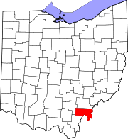
Location in the state of Ohio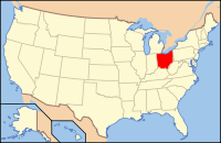
Ohio's location in the U.S.Founded April 1, 1819[1] Named for Return J. Meigs, Jr. Seat Pomeroy Largest village Middleport Area
- Total
- Land
- Water
432 sq mi (1,120 km²)
429 sq mi (1,112 km²)
3 sq mi (8 km²), 0.68Population
- (2010)
- Density
23,770
54/sq mi (21/km²)Time zone Eastern: UTC-5/-4 Historical populations Census Pop. %± 1820 4,480 — 1830 6,158 37.5% 1840 11,452 86.0% 1850 17,971 56.9% 1860 26,534 47.6% 1870 31,465 18.6% 1880 32,325 2.7% 1890 29,813 −7.8% 1900 28,620 −4.0% 1910 25,594 −10.6% 1920 26,189 2.3% 1930 23,961 −8.5% 1940 24,104 0.6% 1950 23,227 −3.6% 1960 22,159 −4.6% 1970 19,799 −10.7% 1980 23,641 19.4% 1990 22,987 −2.8% 2000 23,072 0.4% Meigs County is a county located in the state of Ohio, United States. As of the 2010 census, the population was 23,770.[1] Its county seat is Pomeroy,[2] and it is named for Return J. Meigs, Jr., the 4th Governor of Ohio.[3]
Contents
Geography
According to the U.S. Census Bureau, the county has a total area of 432 square miles (1,120 km2).429 square miles (1,112 km²) of it is land and 3 square miles (7.8 km2) of it (0.68%) is water. The Ohio River forms the eastern and southern boundary of the county.
Meigs County lies in the Appalachian Plateau physiographic region of the Appalachian Mountains. The landscape is considered to be anywhere from gently rolling to rugged, typical of a dissected plateau. Elevations range from 978 feet (298 m) asl (above sea level) in the northwest to about 535 feet (163 m) asl in the far south central part of the county along the Ohio River. The majority of Meigs County is drained by two subwatersheds of the Ohio River, Shade River and Leading Creek. Another stream of note is Raccoon Creek, which flows through a small area of the northwestern corner of the county.[4]
Coal mining, both strip and underground, has been an important industry in Meigs County since the late 19th century, although mining of all types largely ceased by the 1990s. The effects of mining are still readily seen on the landscape today. Features such as high walls, spoil piles, and irregular topography are still prevalent. Many tributaries in the Leading Creek basin are plagued by acid mine drainage and sedimentation.[citation needed]
In 2009, Gatling, Ohio LLC invested $75 million to open a new coal mine and coal prep plant near Racine. It is capable of employing 120 to 150 miners, and is capable of producing 3.5 million marketable tons of coal per year.[5][6]
Adjacent counties
- Athens County (north)
- Wood County, West Virginia (northeast)
- Jackson County, West Virginia (east)
- Mason County, West Virginia (southeast)
- Gallia County (southwest)
- Vinton County (west)
Climate
Meigs County's climate is considered humid continental, with warm to hot, humid summers and cool to cold, wet winters. Precipitation averages 41" annually, spread evenly throughout the year. High July temperatures average in the upper 80s F, while lows average in the low to mid 60s F. Temperatures above 90* F in the summer are common. January highs average about 40* F, with lows in the lower 20s. Temperatures around or even below 0* F occur during most winters. Snowfall averages 20–25", falling between late November and the first week of April.
The Ohio River creates a microclimate in its valley where temperatures tend to be moderated by the river, hence resulting in longer growing seasons compared to the rest of the county. Other microclimates, known as frost hollows or frost pockets, exist throughout the county in small isolated valleys. Here nocturnal temperatures are often several degrees colder than the surrounding terrain.
Demographics
As of the census[7] of 2000, there were 23,072 people, 9,234 households, and 6,574 families residing in the county. The population density was 54 people per square mile (21/km²). There were 10,782 housing units at an average density of 25 per square mile (10/km²). The racial makeup of the county was 97.73% White, 0.69% Black or African American, 0.27% Native American, 0.10% Asian, 0.25% from other races, and 0.96% from two or more races. 0.60% of the population were Hispanic or Latino of any race.
 Meigs County Courthouse
There were 9,234 households out of which 31.20% had children under the age of 18 living with them, 56.90% were married couples living together, 10.00% had a female householder with no husband present, and 28.80% were non-families. 25.00% of all households were made up of individuals and 11.70% had someone living alone who was 65 years of age or older. The average household size was 2.47 and the average family size was 2.94.
In the county, the population was spread out with 23.90% under the age of 18, 8.40% from 18 to 24, 27.70% from 25 to 44, 25.20% from 45 to 64, and 14.80% who were 65 years of age or older. The median age was 39 years. For every 100 females there were 94.70 males. For every 100 females age 18 and over, there were 92.80 males.
The median income for a household in the county was $27,287, and the median income for a family was $33,071. Males had a median income of $30,821 versus $19,621 for females. The per capita income for the county was $13,848. About 14.30% of families and 19.80% of the population were below the poverty line, including 26.30% of those under age 18 and 14.50% of those age 65 or over.
Government
Main article: Ohio county governmentEducation
Meigs county schools include:
- Meigs Elementary School
- Meigs Middle School
- Meigs High School
- Eastern High School
- Southern High School
Communities
 Map of Meigs County, Ohio With Municipal and Township Labels
Villages
Townships
Unincorporated communities
Protected areas
- Forked Run State Park
- Shade River State Forest
Notable natives and residents
- Mike Bartrum, an NFL long snapper/tight end
- Ambrose Bierce, an American editorialist, journalist, short story writer, fabulist and satirist best known for his short story "An Occurrence at Owl Creek Bridge".
- James Edwin Campbell, a poet, writer and educator
- Norman "Kid" Elberfeld, a Major League Baseball shortstop and manager
- Samuel Dana Horton, a bimetallism writer
- Reverend Fr. John Joseph Jessing, founder of the Pontifical College Josephinum in Columbus, Ohio
- Benny Kauff, Major League Baseball player
- Cy Morgan, a Major League Baseball pitcher
- David L. "Dave" Diles, a former American sports broadcaster and journalist
See also
References
- ^ "Ohio County Profiles: Meigs County" (PDF). Ohio Department of Development. http://www.odod.state.oh.us/research/FILES/S0/Meigs.pdf. Retrieved 2007-04-28.
- ^ "Find a County". National Association of Counties. http://www.naco.org/Counties/Pages/FindACounty.aspx. Retrieved 2011-06-07.
- ^ "Meigs County data". Ohio State University Extension Data Center. http://www.osuedc.org/profiles/profile_entrance.php?fips=39105&sid=0. Retrieved 2007-04-28.[dead link]
- ^ Ohio Atlas & Gazetteer. Yarmouth, Me.: DeLorme. 1991. p. 79-80, 87. ISBN 0-89933-233-1.
- ^ "Pomeroy Daily Sentinel - Gatling investing million in mine facility". Mydailysentinel.com. http://www.mydailysentinel.com/pages/full_story?page_label=news&article-Gatling-investing-million-in-mine-facility%20=&id=1556685-Gatling-investing-million-in-mine-facility&widget=push&instance=secondary_stories_left_column&open=&. Retrieved 2010-06-01.
- ^ "Coal Ties / Meigs County producing coal once again " Entangled Citizens". Spurse.org. 2009-05-18. http://www.spurse.org/entangled/?p=622. Retrieved 2010-06-01.
- ^ "American FactFinder". United States Census Bureau. http://factfinder.census.gov. Retrieved 2008-01-31.
External links

Athens County Wood County, West Virginia Vinton County 
Jackson County, West Virginia  Meigs County, Ohio

Gallia County Mason County, West Virginia Municipalities and communities of Meigs County, Ohio Villages Middleport | Pomeroy | Racine | Rutland | Syracuse

Townships Unincorporated
communitiesCarpenter | Chester | Darwin | Langsville | Long Bottom | Portland | Reedsville | Tuppers Plains
Categories:- Ohio counties
- Meigs County, Ohio
- 1819 establishments in the United States
- Populated places established in 1819
- Ohio River counties


Wikimedia Foundation. 2010.