- Towner County, North Dakota
-
Towner County, North Dakota 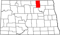
Location in the state of North Dakota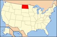
North Dakota's location in the U.S.Founded 1883 Seat Cando Largest city Cando Area
- Total
- Land
- Water
1,042 sq mi (2,699 km²)
1,025 sq mi (2,655 km²)
17 sq mi (44 km²), 1.63%Population
- (2010)
- Density
2,246
3/sq mi (1/km²)Website http://www.mylocalgov.com/townercountynd/ Towner County is a county located in the U.S. state of North Dakota. As of 2010, the population is 2,246.[1] Its county seat is Cando.[2] The city of Towner, North Dakota, is in McHenry County.
Contents
History
The county was founded in 1883 by territorial legislation (predating statehood). It was named after Oscar M. Towner (b. 1842, d. 1897), a businessman and member of the 15th territorial legislature. After founding, the county government was fully organized on January 24, 1884.[3]
Geography
According to the U.S. Census Bureau, the county has a total area of 1,042 square miles (2,700 km2), of which, 1,025 square miles (2,650 km2) of it is land and 17 square miles (44 km2) of it (1.63%) is water.
Major highways
 U.S. Highway 281
 North Dakota Route 5
 North Dakota Route 17
 North Dakota Route 66
Townships
- Armourdale
- Atkins
- Bisbee
- Bethel
- Cando
- Coolin
- Crocus
- Dash
- Egeland
- Gerrard
- Grainfield
- Hansboro
- Howell
- Lansing
- Maza
- Monroe
- Mount View
- New City
- Olson
- Paulson
- Perth
- Picton
- Rock Lake
- Sidney
- Smith
- Sorenson
- Springfield
- Teddy
- Twin Hill
- Victor
- Virginia
- Zion
Adjacent counties and rural municipalities
- Turtle Mountain, Manitoba (north)
- Roblin, Manitoba (north)
- Louise, Manitoba (north)
- Cavalier County (east)
- Ramsey County (southeast)
- Benson County (south)
- Pierce County (southwest)
- Rolette County (west)

Turtle Mountain, Manitoba, Canada; Roblin, Manitoba, Canada; and Louise, Manitoba, Canada Rolette County 
Cavalier County  Towner County, North Dakota

Pierce County Benson County Ramsey County National protected areas
- Brumba National Wildlife Refuge
- Lake Alice National Wildlife Refuge (part)
- Rock Lake National Wildlife Refuge
- Snyder Lake National Wildlife Refuge
Demographics
Historical populations Census Pop. %± 1890 1,450 — 1900 6,491 347.7% 1910 8,963 38.1% 1920 8,327 −7.1% 1930 8,393 0.8% 1940 7,200 −14.2% 1950 6,360 −11.7% 1960 5,624 −11.6% 1970 4,645 −17.4% 1980 4,052 −12.8% 1990 3,627 −10.5% 2000 2,876 −20.7% 2010 2,246 −21.9% U.S. Decennial Census As of the census[4] of 2000, there were 2,876 people, 1,218 households, and 785 families residing in the county. The population density was 3 people per square mile (1/km²). There were 1,558 housing units at an average density of 2 per square mile (1/km²). The racial makeup of the county was 97.32% White, 0.07% Black or African American, 2.05% Native American, 0.07% Asian, 0.03% from other races, and 0.45% from two or more races. 0.17% of the population were Hispanic or Latino of any race. 35.1% were of German and 31.0% Norwegian ancestry according to Census 2000. 98.4% spoke English as their first language.
There were 1,218 households out of which 27.30% had children under the age of 18 living with them, 56.90% were married couples living together, 4.60% had a female householder with no husband present, and 35.50% were non-families. 33.60% of all households were made up of individuals and 18.70% had someone living alone who was 65 years of age or older. The average household size was 2.31 and the average family size was 2.93.
In the county the population was spread out with 24.60% under the age of 18, 3.60% from 18 to 24, 24.00% from 25 to 44, 24.50% from 45 to 64, and 23.30% who were 65 years of age or older. The median age was 44 years. For every 100 females there were 97.00 males. For every 100 females age 18 and over, there were 96.00 males.
The median income for a household in the county was $32,740, and the median income for a family was $39,286. Males had a median income of $24,917 versus $17,335 for females. The per capita income for the county was $17,605. About 6.30% of families and 8.90% of the population were below the poverty line, including 9.20% of those under age 18 and 8.80% of those age 65 or over.
Places
Cities
The western portion of Sarles lies within Towner County, while the balance of the city lies within Cavalier County to the east.[5]
Note: all incorporated communities in North Dakota are called "cities" regardless of their size.
Other community
See also
References
- ^ "2010 Census Redistricting Data (Public Law 94-171) Summary File". American FactFinder. United States Census Bureau. http://factfinder2.census.gov/faces/tableservices/jsf/pages/productview.xhtml?pid=DEC_10_PL_GCTPL2.ST05&prodType=table. Retrieved 3 May 2011.
- ^ "Find a County". National Association of Counties. http://www.naco.org/Counties/Pages/FindACounty.aspx. Retrieved 2011-06-07.
- ^ nd.gov: Official Portal for North Dakota State Government
- ^ "American FactFinder". United States Census Bureau. http://factfinder.census.gov. Retrieved 2008-01-31.
- ^ 2007 Taxable Valuation Survey, North Dakota League of Cities
External links
Municipalities and communities of Towner County, North Dakota Cities 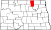
Townships Armourdale | Atkins | Bethel | Cando | Coolin | Crocus | Dash | Gerrard | Grainfield | Howell | Lansing | Maza | Monroe | Mount View | New City | Olson | Paulson | Picton | Rock Lake | Sidney | Smith | Sorenson | Springfield | Teddy | Twin Hill | Victor | Virginia | Zion |
Unincorporated
communitiesFootnotes ‡This populated place also has portions in an adjacent county or counties
Categories:- North Dakota counties
- Towner County, North Dakota
- States and territories established in 1883


Wikimedia Foundation. 2010.