- Divide County, North Dakota
-
Divide County, North Dakota 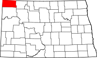
Location in the state of North Dakota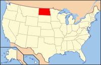
North Dakota's location in the U.S.Founded 1910 Seat Crosby Largest city Crosby Area
- Total
- Land
- Water
1,295 sq mi (3,354 km²)
1,260 sq mi (3,263 km²)
35 sq mi (91 km²), 2.68%Population
- (2010)
- Density
2,071
2/sq mi (0.7/km²)Divide County is a county located in the U.S. state of North Dakota. As of 2010, the population was 2,071.[1] Its county seat is Crosby.[2]
Divide County was formed following a vote at the November 1910 general election to divide Williams County into two counties. This division is the most likely origin of the name,[3] though additional deciding factors[citation needed] may have been the fact that Divide County lies on the continental divide between the watersheds that flow into the Gulf of Mexico and those that flow into Hudson Bay and that the county lies on the boundary between the United States and Canada. The county government was first organized on December 9, 1910; Crosby has always been the county seat.[3]
Contents
Geography
According to the U.S. Census Bureau, the county has a total area of 1,294 square miles (3,351.4 km2), of which 1,260 square miles (3,263.4 km2) is land and 35 square miles (90.6 km2) (2.68%) is water.
Economy
Farming and oil. Divide County is one of several western North Dakota counties with significant exposure to the Bakken Formation in the Williston Basin.
Townships
- Alexandria
- Ambrose
- Blooming Prairie
- Blooming Valley
- Border
- Burg
- Clinton
- Coalfield
- Daneville
- De Witt
- Elkhorn
- Fertile Valley
- Fillmore
- Frazier
- Frederick
- Garnet
- Gooseneck
- Hawkeye
- Hayland
- Lincoln Valley
- Long Creek
- Mentor
- Palmer
- Plumer
- Sioux Trail
- Smoky Butte
- Stoneview
- Troy
- Twin Butte
- Upland
- Westby
- Writing Rock
Adjacent counties and rural municipalities
- Lake Alma No. 8, Saskatchewan (northwest)
- Souris Valley No. 7, Saskatchewan (north)
- Cambria No. 6, Saskatchewan (north)
- Estevan No. 5, Saskatchewan (northeast)
- Burke County (east)
- Williams County (south)
- Sheridan County, Montana (west)

Lake Alma No. 8, Saskatchewan, Canada Souris Valley No. 7, Saskatchewan, Canada and Cambria No. 6, Saskatchewan, Canada Estevan No. 5, Saskatchewan, Canada Sheridan County, Montana 
Burke County  Divide County, North Dakota

Williams County Major highways
 U.S. Highway 85
 North Dakota Highway 5
 North Dakota Highway 40
 North Dakota Highway 42
Places of interest
Two petroglyphs are displayed at Writing Rock State Historical Site in Writing Rock Township.
Demographics
Historical populations Census Pop. %± 1910 6,015 — 1920 9,637 60.2% 1930 9,636 0% 1940 7,086 −26.5% 1950 5,967 −15.8% 1960 5,566 −6.7% 1970 4,564 −18.0% 1980 3,494 −23.4% 1990 2,899 −17.0% 2000 2,283 −21.2% 2010 2,071 −9.3% U.S. Decennial Census As of the census[4] of 2000, there were 2,283 people, 1,005 households, and 649 families residing in the county. The population density was 1.8 people per square mile (0.7/km²). There were 1,469 housing units at an average density of 1.2 per square mile (0.4/km²). The racial makeup of the county was 98.99% White, 0.13% Native American, 0.53% Asian, 0.18% from other races, and 0.18% from two or more races. 0.61% of the population were Hispanic or Latino of any race.
There were 1,005 households out of which 22.5% had children under the age of 18 living with them, 56.8% were married couples living together, 4.2% had a female householder with no husband present, and 35.4% were non-families. 33.4% of all households were made up of individuals and 19.9% had someone living alone who was 65 years of age or older. The average household size was 2.18 and the average family size was 2.79.
In the county the population was spread out with 20.2% under the age of 18, 3.6% from 18 to 24, 20.1% from 25 to 44, 26.6% from 45 to 64, and 29.5% who were 65 years of age or older. The median age was 49 years. For every 100 females there were 100.8 males. For every 100 females age 18 and over, there were 97.5 males.
The median income for a household in the county was $30,089, and the median income for a family was $39,292. Males had a median income of $28,333 versus $16,371 for females. The per capita income for the county was $16,225. About 9.5% of families and 14.6% of the population were below the poverty line, including 19.5% of those under age 18 and 14.7% of those age 65 or over.
The Top 4 Largest Ancestries are Norwegian (64.7%), German (24.0%), Swedish (8.8%), and Irish (5.9%).
Population by decade

Places
Cities
Note: all incorporated communities in North Dakota are called "cities" regardless of their size.
Unicorporated Communities
See also
References
- ^ "2010 Census Redistricting Data (Public Law 94-171) Summary File". American FactFinder. United States Census Bureau. http://factfinder2.census.gov/faces/tableservices/jsf/pages/productview.xhtml?pid=DEC_10_PL_GCTPL2.ST05&prodType=table. Retrieved 3 May 2011.
- ^ "Find a County". National Association of Counties. http://www.naco.org/Counties/Pages/FindACounty.aspx. Retrieved 2011-06-07.
- ^ a b "County History". Official Portal for North Dakota State Government. http://www.nd.gov/content.htm?parentCatID=83&id=County%20History. Retrieved 4 May 2011.
- ^ "American FactFinder". United States Census Bureau. http://factfinder.census.gov. Retrieved 2008-01-31.
Municipalities and communities of Divide County, North Dakota Cities 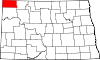
Townships Alexandria | Ambrose | Blooming Prairie | Blooming Valley | Border | Burg | Clinton | Coalfield | Daneville | De Witt | Elkhorn | Fertile Valley | Fillmore | Frazier | Frederick | Garnet | Gooseneck | Hawkeye | Hayland | Lincoln Valley | Long Creek | Mentor | Palmer | Plumer | Sioux Trail | Smoky Butte | Stoneview | Troy | Twin Butte | Upland | Westby | Writing Rock
Unincorporated
communitiesAlkabo | Bounty | Colgan | Juno | Kermit | Paulson | Stady
Categories:- North Dakota counties
- Divide County, North Dakota


Wikimedia Foundation. 2010.