- River Cuckmere
-
River Cuckmere 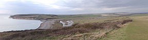
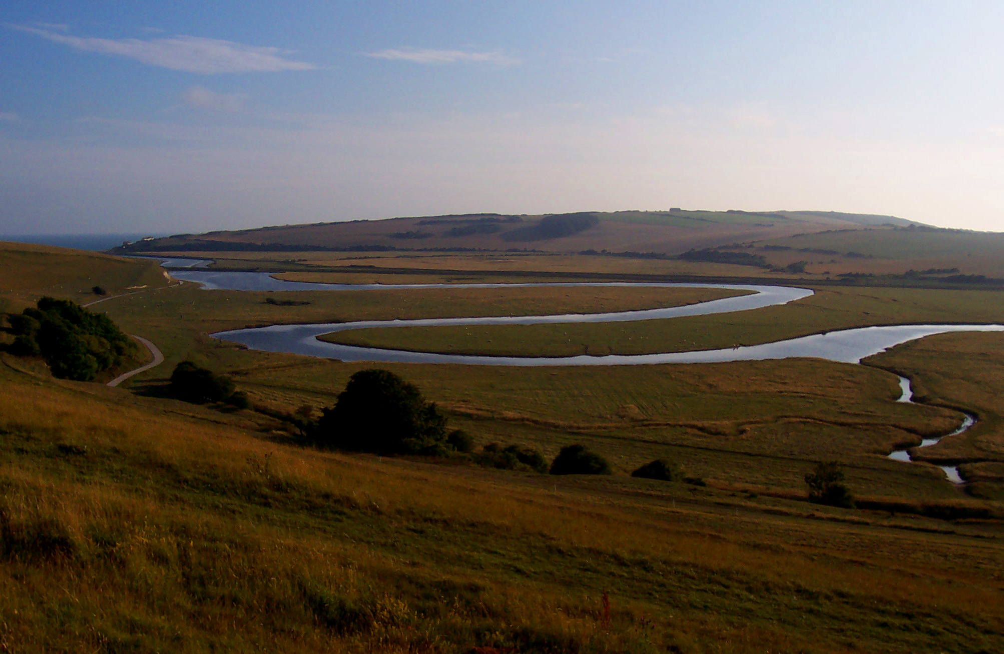
Looking West over Cuckmere HavenOrigin Near Heathfield Mouth English Channel Basin countries England (East Sussex) 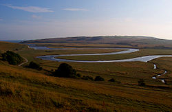 Meander of the River Cuckmere
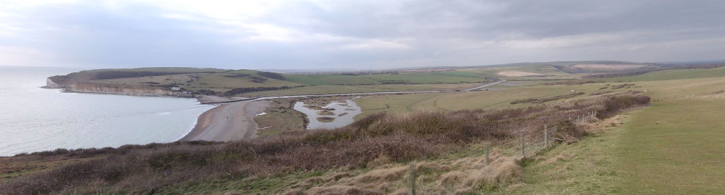
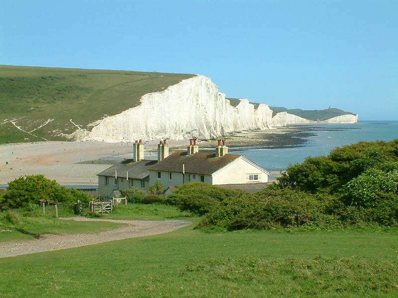
 The Seven Sisters cliffs and the lifeboat cottages, from Seaford Head showing Cuckmere Haven (looking East)
The River Cuckmere rises near Heathfield in East Sussex, England on the southern slopes of the Weald. The name of the river probably comes from an Old English word meaning fast-flowing, since it descends over 100 m (328 ft) in its initial four miles (6.4 km). Eventually flowing into the English Channel, it is the only undeveloped river mouth on the Sussex coast.[1]
Contents
Description
The river has many tributaries at its upper end, the principal one being the River Bull; and its main channel begins at Hellingly. After crossing the Low Weald area of farmland, the Cuckmere cuts through the South Downs in its own valley. It reaches the English Channel at Cuckmere Haven, between Seaford and the Seven Sisters cliff face. The lower part of its course in the floodplain is marked by meandering, which is a well-known feature of the area.[2][3] The Cuckmere Valley Nature Reserve is located in the lower estuary portion of the river. The valley is of very high importance for nature conservation. It has been designated a Site of Special Scientific Interest and is planned as a National Park.[4]
History and environmental issues
The Cuckmere Valley civil parish takes its name from the river. During the 19th century, defensive measures were taken to prevent flooding of the upper valley. Shingle was regularly dug from the mouth of the river and the banks were made higher. In 1846, the course of the river was straightened in an artificial cut; the Cut mostly prevented flooding upstream, which used to reach to the town of Alfriston. It also provided support for irrigation.[5] In addition, artificially higher river banks, or levees, were constructed to protect areas from flooding. In recent decades, the area has become a major tourist destination, with tourism contributing to the local economy more than does agriculture. On the west side of the river, where the A259 crosses the river at Exceat, is the popular Golden Galleon Public House.
In the last decade, the Cuckmere Estuary Partnership was established as a collaboration of the National Trust, Natural England, Environment Agency, East Sussex County Council, Sussex Wildlife Trust, and various other environmental and conservation groups. They are working together to create long-term plans for the natural area. Government guidelines prohibit continuing to maintain hard defences where houses are not at risk. In addition, there is growing scientific evidence that the area would be more ecologically rich if allowed to return to its natural state. The partnership and the Environment Agency have proposed estuary restoration, and have been talking to local residents, businesses and visitors about how to proceed in the future. Presently, a shingle beach and artificial river banks (levees) prevent seawater from penetrating the uppermost areas of the Cuckmere Valley. But, the Environment Agency projects that expected sea level rise due to climate change will increase the already steep costs of physical reinforcement, and current measures will not be sufficient. They intend to stop repair of the levees and to allow the cycle of natural processes, including periodic flooding of the area. The planning collaborators believe that in the long term, restoration of the saltwater estuary and marshes will enrich the ecological habitat, attract more wildlife and improve tourism.[6]
The Environment Agency plans have provoked controversy in the valley, especially among some property owners. Some residents have formed a group called "Rescue the Cuckmere Valley" to try to create an alternative to proposed seasonal flooding.[6][7] In early 2008 the Cuckmere Parish Council issued a public statement urging the Environment Agency to take less drastic steps in the near term, protecting the Cut while developing longer-term plans over the next 25–50 years.[5]
References
- ^ "River Cuckmere", Waterscape, accessed 29 Oct 2010
- ^ Meander on the River Cuckmere(photo)
- ^ Photo looking towards the sea
- ^ "Congratulations to the Environment Agency on the Cuckmere Valley!", Tony Whitbread Blog, 7 Jan 2009, accessed 29 Oct 2010
- ^ a b "'Dangerous message' over Cuckmere's future", Sussex Express Series (Lewes, England), 19 Jan 2008, accessed 29 Oct 2010
- ^ a b "Cuckmere Valley flood plans to be revealed", Sussex Express Series (Lewes, England), 30 Aug 2007, accessed 29 Oct 2010
- ^ "ALTERNATIVE PLAN FOR CUCKMERE VALLEY?", Eastbourne Herald (Eastbourne, England), 27 Apr 2004, accessed 29 Oct 2010
External links
- "The Cuckmere Estuary", Cuckmere Estuary Partnership
Coordinates: 50°45′34.1″N 0°8′54″E / 50.759472°N 0.14833°E
Categories:- Rivers of Sussex
- Wealden
- Estuaries of England
Wikimedia Foundation. 2010.