- Moore County, North Carolina
-
Moore County, North Carolina 
Location in the state of North Carolina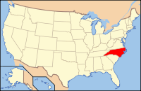
North Carolina's location in the U.S.Founded 1784 Seat Carthage Area
- Total
- Land
- Water
706 sq mi (1,829 km²)
698 sq mi (1,808 km²)
8 sq mi (21 km²), 1.13%PopulationEst.
- (2006)
- Density
83,162
106/sq mi (41/km²)Website www.co.moore.nc.us Moore County is a county located in the U.S. state of North Carolina. As of 2000, the population was 74,769. Its county seat is Carthage[1].
Contents
History
The county was formed in 1784 from Cumberland County. It was named for Alfred Moore, an officer in the American Revolutionary War and associate justice of the Supreme Court of the United States.
In 1907 parts of Moore County and Chatham County were combined to form Lee County.
Moore County has many golf resorts in the Southern Pines/Pinehurst area, and has played host to the 1996 and 2001 Women's U.S. Opens as well as the 1999 and 2005 Men's U.S. Opens. The Women's Open returned to Southern Pines in 2007.
As a result of the area's rare combination of prestige and isolation, many celebrities escape to this area from time to time. Among those who frequent or have private homes in the area are Michael Jordan, Tiger Woods, Jack Nicklaus, and Sean Connery. Past residents of the area include Annie Oakley, Harvey Firestone, and John D. Rockefeller.
John Edwards, Charles Brady, Shannon Moore, Jeff Hardy and Matt Hardy, were also raised here.
Law and government
Moore County is a member of the regional Triangle J Council of Governments.
Geography
According to the U.S. Census Bureau, the county has a total area of 706 square miles (1,828 km²), of which, 698 square miles (1,807 km²) of it is land and 8 square miles (21 km²) of it (1.13%) is water.
Townships
The county is divided into ten townships, which are both numbered and named: 1 (Carthage), 2 (Bensalem), 3 (Sheffields), 4 (Ritter), 5 (Deep River), 6 (Greenwood), 7 (McNeill), 8 (Sandhill), 9 (Mineral Springs), and 10 (Little River).
Adjacent counties
- Chatham County, North Carolina - north-northeast
- Lee County, North Carolina - northeast
- Harnett County, North Carolina - east
- Cumberland County, North Carolina - southeast
- Hoke County, North Carolina - south-southeast
- Richmond County, North Carolina - south-southwest
- Montgomery County, North Carolina - west
- Randolph County, North Carolina - north-northwest
- Scotland County, North Carolina - south

Randolph County Chatham County Lee County Montgomery County 
Harnett County  Moore County, North Carolina

Richmond County Hoke County and Scotland County Cumberland County Demographics
As of the census[2] of 2000, there were 74,769 people, 30,713 households, and 21,959 families residing in the county. The population density was 107 people per square mile (41/km²). There were 35,151 housing units at an average density of 50 per square mile (19/km²). The racial makeup of the county was 80.25% White, 15.50% Black or African American, 0.68% Native American, 0.44% Asian, 0.05% Pacific Islander, 2.20% from other races, and 0.88% from two or more races. 3.99% of the population were Hispanic or Latino of any race.
By 2005 78.0% of the county population was non-Hispanic whites. 5.1% of the population was Latino. 14.8% of the population was African-American.
There were 30,713 households out of which 26.70% had children under the age of 18 living with them, 58.10% were married couples living together, 10.20% had a female householder with no husband present, and 28.50% were non-families. 24.90% of all households were made up of individuals and 11.30% had someone living alone who was 65 years of age or older. The average household size was 2.38 and the average family size was 2.81.
In the county the population was spread out with 22.10% under the age of 18, 6.60% from 18 to 24, 25.80% from 25 to 44, 23.80% from 45 to 64, and 21.80% who were 65 years of age or older. The median age was 42 years. For every 100 females there were 93.00 males. For every 100 females age 18 and over, there were 89.80 males.
The median income for a household in the county was $41,240, and the median income for a family was $48,492. Males had a median income of $31,260 versus $23,526 for females. The per capita income for the county was $23,377. About 8.00% of families and 11.40% of the population were below the poverty line, including 16.60% of those under age 18 and 10.10% of those age 65 or over.
Cities and towns
 Map of Moore County, North Carolina With Municipal and Township Labels
- Aberdeen
- Cameron
- Carthage
- Foxfire
- Pinebluff
- Pinehurst
- Robbins
- Seven Lakes
- Southern Pines
- Taylortown
- Vass
- West End
- Whispering Pines
See also
References
- ^ "Find a County". National Association of Counties. http://www.naco.org/Counties/Pages/FindACounty.aspx. Retrieved 2011-06-07.
- ^ "American FactFinder". United States Census Bureau. http://factfinder.census.gov. Retrieved 2008-01-31.
External links
- Moore County government official website
- Moore County Chamber of Commerce
- Moore County NC History
- Moore County Schools
- Go Sandhills History
- Moore County boy scouts
- Moore County Historical Association
Municipalities and communities of Moore County, North Carolina City 
Towns Aberdeen | Cameron | Carthage | Pinebluff | Southern Pines | Taylortown | Vass
Villages CDP Unincorporated
communitiesCategories:- North Carolina counties
- Moore County, North Carolina
- States and territories established in 1784


Wikimedia Foundation. 2010.