- McDowell County, North Carolina
-
McDowell County, North Carolina  McDowell County Courthouse in Marion
Seal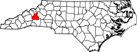
Location in the state of North Carolina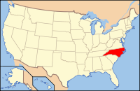
North Carolina's location in the U.S.Founded 1842 Seat Marion Area
- Total
- Land
- Water
446 sq mi (1,155 km²)
441 sq mi (1,142 km²)
5 sq mi (13 km²), 1.06%Population
- (2010)
- Density
44,996
101/sq mi (39/km²)Website www.mcdowellgov.com McDowell County is a county located in the U.S. state of North Carolina. The population was 44,996 at the 2010 United States Census. Its county seat is Marion[1].
Contents
History of McDowell County
Archaeological excavations performed by Dr. David Moore, during the early 1980s, revealed the earliest inhabitants of McDowell County to be from the Mississippian and Woodland eras. Dr. Moore discovered evidence in an area close to the Catawba River in and around an unusual topographical site known as Round Hill. These early Native Americans lived in this section prior to Juan Pardo's exploration of the region.
Cherokee and Catawba Indians were known inhabitants of what is now McDowell County.
In 1566, the Spanish explorer Juan Pardo came to Western North Carolina traveling through the area that is now McDowell county. His purpose was to acquire territory for Spain, but he had also hoped to find precious metals. Pardo and his men built a log blockhouse at the headwaters of the Catawba River. Apparently intimidated by the formidable range of the Blue Ridge Mountains and the home of the Cherokee Nation, Pardo left the area the following year.
In 1748, "Hunting" John McDowell received a land grant for property known today as "Pleasant Gardens" including acreage originally located from Swan's Pond (Catawba County) up the Catawba River west to present day Marion and into the region known as Buck Creek. During a hunting expedition with his friend Henry Weidner, the two came upon a lush green valley with thousands upon thousands of acres of virgin forest. During that time, it was customary when settling a dispute to engage in a "friendly" wrestling match. McDowell came out the winner.
"Hunting" John McDowell received two land grants and after establishing residence along the Catawba River of Pleasant Gardens, raised his family. He is noted in Max Dixon's, The Wautagans as being instrumental in Jacob Brown's Purchase of one of the last remaining pieces of acreage along the Nolichucky River in Tennessee when he hosted a negotiations with the Cherokee on his farm in North Carolina.
His son, Joseph McDowell, is noted in history as a significant contributor to the Battle at Kings Mountain. McDowell County is named in his honor. Today, his home stands as one of the few remaining homes in North Carolina still standing and built by its namesake.
The settlement of Old Fort was later established and it had become the westernmost outpost of Colonial civilization at the time. These early pioneers established a close community protected by a series of forts which remained active until the early 19th century. Thus, Old Fort.
 Historic Carson House
In 1793, Colonel John Carson built a plantation house near Buck Creek in the Pleasant Gardens community, which still stands today as the Historic Carson House. He also operated gold mines in the southern part of the county. Colonel Carson was a significant historical figure in the American Revolutionary War.
Marion, the county seat of McDowell County, was planned and built on land selected by the first McDowell County Commissioners on March 14, 1844 at the Historic Carson House. It was not until 1845, however, that the official name of Marion was sanctioned as the county seat by the state legislature. The name of Marion came from Francis Marion, the American Revolutionary War hero, known as the “Swamp Fox” and the man upon whom the movie "The Patriot" was based.
During the Carolina Gold Rush period of the early 19th century, the south county area was known for its gold production. The banks of the Muddy Creek and mines at Vein Mountain were productive areas. Many mines and thriving gold rush towns such as Brackettown no longer exist, although scattered ruins and cemeteries mark many locations of the gold rush period.There were other mines in the area also including an old mine in Woodlawn. In that community someone opened a mine on Tom's Creek which may have been a Mica mine. There are remnants of the a sorting house and the old mine shaft itself. Who opened and ran this mine is unknown.
McDowell County is rich in American Civil War History. The movie Last of the Mohicans was filmed along the shores of the picturesque Lake James.
McDowell county was first formed in 1842 from parts of Burke County and Rutherford County. It was named for Joseph McDowell, a Revolutionary War leader and hero of the Battle of King's Mountain, and a member of the United States House of Representatives from 1797 to 1799.
In 1861, parts of McDowell County, Burke County, Caldwell County, Watauga County, and Yancey County were combined to form Mitchell County.
Law and government
McDowell County is a member of the Isothermal Planning and Development Commission regional council of governments.
Geography
According to the U.S. Census Bureau, the county has a total area of 446 square miles (1,156 km²), of which, 442 square miles (1,144 km²) of it is land and 5 square miles (12 km²) of it (1.06%) is water.
Numerous small creeks and streams flow through the county. The Catawba River crosses the county and empties into Lake James. It flows over Catawba Falls on its way, which is accessible to the public. Other waterfalls can be found in the county, such as Toms Creek Falls. Almost half of the county, including the two aforementioned waterfalls, is located inside the Pisgah National Forest. Linville Caverns, North Carolina's only limestone cavern system open to the public, is located in the far northern part of the county.
The Blue Ridge Parkway follows the northwestern boundary of the county. McDowell County lies within the Piedmont (United States) and Foothills (North Carolina) regions of Western North Carolina.
Townships
The county is divided into eleven townships: Crooked Creek, Dysartsville, Glenwood, Marion, Montford Cove, Nebo, North Cove, Pleasant Gardens, Woodlawn-Sevier, Sugar Hill, and Old Fort.
Adjacent counties
- Mitchell County, North Carolina - north
- Avery County, North Carolina - north-northeast
- Burke County, North Carolina - east
- Rutherford County, North Carolina - south
- Buncombe County, North Carolina - west
- Yancey County, North Carolina - northwest

Yancey County Mitchell County Avery County Buncombe County 
Burke County  McDowell County, North Carolina

Rutherford County National protected areas
- Blue Ridge Parkway (part)
- Pisgah National Forest (part)
Cities and towns
 Map of McDowell County, North Carolina With Municipal and Township Labels
Unincorporated places
- West Marion
- Little Switzerland
- Nebo
- Glenwood
- Pleasant Gardens
- North Cove
Education
The following is a list of schools located in McDowell County:
- Marion Elementary School
- West Marion Elementary School
- Old Fort Elementary School
- Pleasant Gardens Elementary School
- Eastfield Elementary School
- Glenwood Elementary School
- North Cove Elementary School
- West McDowell Junior High School
- East McDowell Junior High School
- McDowell High School (Marion, North Carolina)
- McDowell Early College High School (Marion, North Carolina)
- Phoenix Academy
- New Manna Christian School
- Marion Christian Academy
- McDowell Technical Community College
See also
References
- ^ "Find a County". National Association of Counties. http://www.naco.org/Counties/Pages/FindACounty.aspx. Retrieved 2011-06-07.
External links
Municipalities and communities of McDowell County, North Carolina City 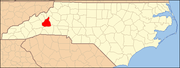
Town CDP Unincorporated
communitiesGlenwood | Linville Falls‡ | Little Switzerland‡ | Nebo | Pleasant Gardens | Providence
Footnotes ‡This populated place also has portions in an adjacent county or counties
Categories:- North Carolina counties
- McDowell County, North Carolina
- 1842 establishments in the United States
- Populated places established in 1842


Wikimedia Foundation. 2010.