- Durham County, North Carolina
-
Durham County, North Carolina 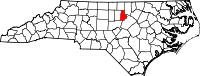
Location in the state of North Carolina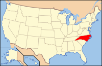
North Carolina's location in the U.S.Founded 1881 Seat Durham Area
- Total
- Land
- Water
298 sq mi (772 km²)
290 sq mi (751 km²)
7 sq mi (18 km²), 2.51%PopulationEst.
- (2010)
- Density
267,587
769/sq mi (297/km²)Website www.co.durham.nc.us Durham County is a county located in the U.S. state of North Carolina. Its county seat is Durham.[1]
Contents
History
The county was formed on April 17, 1881, from parts of Orange County and Wake County, taking the name of its own county seat. In 1911 parts of Cedar Fork Township of Wake County was transferred to Durham County and became Carr Township.
Law and government
Durham County is a member of the regional Triangle J Council of Governments. Durham County is governed by a five-member board of county commissioners, currently consisting of Chairman Michael Page, Vice Chairwoman Ellen Reckhow, Joe Bowser, Brenda Howerton and Pam Karriker.[2] Each elected member serves a four-year term.
Geography
According to the U.S. Census Bureau, the county has a total area of 298 square miles (771.8 km2), of which 290 square miles (751.1 km2) is land and 7 square miles (18.1 km2) (2.51%) is water. The county's population is 267,587, according to the 2010 census.[3]
Townships
The county is divided into six townships: Carr, Durham, Lebanon, Mangum, Oak Grove, and Triangle.
Adjacent counties
- Person County, North Carolina - north
- Granville County, North Carolina - northeast
- Wake County, North Carolina - southeast
- Chatham County, North Carolina - south-southwest
- Orange County, North Carolina - west

Person County Granville County Orange County 
 Durham County, North Carolina

Chatham County Wake County Demographics
As of the census[4] of 2000, there were 223,314 people, 89,015 households, and 54,032 families residing in the county. The population density was 769 people per square mile (297/km²). There were 95,452 housing units at an average density of 329 per square mile (127/km²). The racial makeup of the county was 50.91% White, 39.46% Black or African American, 0.30% Native American, 3.29% Asian, 0.04% Pacific Islander, 4.21% from other races, and 1.80% from two or more races. 7.63% of the population were Hispanic or Latino of any race.
There were 89,015 households out of which 29.10% had children under the age of 18 living with them, 42.00% were married couples living together, 14.80% had a female householder with no husband present, and 39.30% were non-families. 30.00% of all households were made up of individuals and 7.00% had someone living alone who was 65 years of age or older. The average household size was 2.40 and the average family size was 2.99.
In the county the population was spread out with 22.90% under the age of 18, 12.80% from 18 to 24, 34.80% from 25 to 44, 19.80% from 45 to 64, and 9.70% who were 65 years of age or older. The median age was 32 years. For every 100 females there were 93.00 males. For every 100 females age 18 and over, there were 89.70 males.
The median income for a household in the county was $43,337, and the median income for a family was $53,223. Males had a median income of $35,939 versus $30,683 for females. The per capita income for the county was $23,156. About 9.80% of families and 13.40% of the population were below the poverty line, including 17.20% of those under age 18 and 12.30% of those age 65 or over.
Communities
 Map of Durham County, North Carolina, With Municipal and Township Labels
Cities and towns
The only incorporated municipality centered in Durham County is the city of Durham. However, parts of the town of Chapel Hill in Orange County, are in Durham County. A small portion of the city of Raleigh is also in Durham County.[5]
Unincorporated communities
There are several unincorporated communities along the outskirts of the city of Durham or in the rural parts of the county.
See also
References
- ^ "Find a County". National Association of Counties. http://www.naco.org/Counties/Pages/FindACounty.aspx. Retrieved 2011-06-07.
- ^ http://www.co.durham.nc.us/departments/bocc/
- ^ "American FactFinder". United States Census Bureau. http://factfinder2.census.gov. Retrieved 2011-05-14.
- ^ "American FactFinder". United States Census Bureau. http://factfinder.census.gov. Retrieved 2008-01-31.
- ^ Raleigh Durham Annexation Agreement Lines
External links
- Durham County government official website
- Durham Convention and Visitors Bureau
- Durham County Library website
- Greater Durham Chamber of Commerce
- North Carolina Room of the Durham County Library Website for an archive which collects materials concerning the city and county of Durham
Municipalities and communities of Durham County, North Carolina Cities 
Towns CDP Unincorporated
communitiesTownships Footnotes ‡This populated place also has portions in an adjacent county or counties
Greater Durham-Chapel Hill Metropolitan Region (Durham MSA) Principal cities 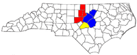
Other significant cities Counties Major universities Transportation Raleigh-Durham International Airport • I-40 • I-85 • I-540 • US 15-501 • US 64 • US 70 • NC 147 • NC 54Media The Herald-Sun • The Daily Tar Heel • Independent Weekly • The News & Observer • Carrboro Citizen • The Courier TimesMiscellaneous Other significant cities Counties Major universities Miscellaneous Categories:- North Carolina counties
- 1881 establishments in the United States
- Durham County, North Carolina
- Populated places established in 1881


Wikimedia Foundation. 2010.