- Davie County, North Carolina
-
Davie County, North Carolina 
Seal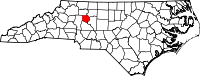
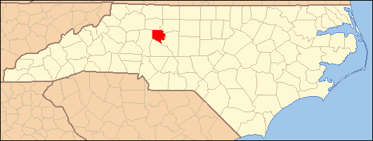
Location in the state of North Carolina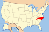
North Carolina's location in the U.S.Founded 1836 Seat Mocksville Area
- Total
- Land
- Water
267 sq mi (692 km²)
265 sq mi (686 km²)
2 sq mi (5 km²), 0.64%Population
- (2010)
- Density
41,240
132/sq mi (51/km²)Website www.co.davie.nc.us Davie County is a county located in the U.S. state of North Carolina. As of 2010, the population was 41,240. Its county seat is Mocksville[1].
Contents
History
The county was formed in 1836 from Rowan County. It was named for William R. Davie, Governor of North Carolina from 1798 to 1799. 1,147 soldiers from Davie County fought in the American Civil War for the Confederate States of America[2] .
Law and government
Davie County is a member of the regional Northwest Piedmont Council of Governments.
Geography
According to the U.S. Census Bureau, the county has a total area of 267 square miles (691.5 km2), of which 265 square miles (686.3 km2) is land and 2 square miles (5.2 km2) (0.64%) is water.
Townships
The county is divided into seven townships: Calahaln, Clarksville, Farmington, Fulton, Jerusalem, Mocksville, and Shady Grove.
Adjacent counties
- Yadkin County, North Carolina - north
- Forsyth County, North Carolina - northeast
- Davidson County, North Carolina - southeast
- Rowan County, North Carolina - south
- Iredell County, North Carolina - west

Yadkin County Forsyth County Iredell County 
 Davie County, North Carolina

Rowan County Davidson County Wine region
Portions of Davie County are located in the Yadkin Valley AVA, an American Viticultural Area. Wines made from grapes grown in the Yadkin Valley AVA may use the appellation Yadkin Valley on their labels.
Demographics
As of the census[3] of 2000, there were 34,835 people, 13,750 households, and 10,257 families residing in the county. The population density was 131 people per square mile (51/km²). There were 14,953 housing units at an average density of 56 per square mile (22/km²). The racial makeup of the county was 90.44% White, 6.80% Black or African American, 0.23% Native American, 0.31% Asian, 0.02% Pacific Islander, 1.31% from other races, and 0.89% from two or more races. 3.47% of the population were Hispanic or Latino of any race.
There were 13,750 households out of which 32.70% had children under the age of 18 living with them, 61.40% were married couples living together, 9.20% had a female householder with no husband present, and 25.40% were non-families. 22.20% of all households were made up of individuals and 9.70% had someone living alone who was 65 years of age or older. The average household size was 2.51 and the average family size was 2.91.
In the county the population was spread out with 24.30% under the age of 18, 7.10% from 18 to 24, 29.40% from 25 to 44, 25.50% from 45 to 64, and 13.80% who were 65 years of age or older. The median age was 38 years. For every 100 females there were 97.00 males. For every 100 females age 18 and over, there were 94.00 males.
The median income for a household in the county was $40,174, and the median income for a family was $47,699. Males had a median income of $33,179 versus $24,632 for females. The per capita income for the county was $21,359. About 6.40% of families and 8.60% of the population were below the poverty line, including 10.20% of those under age 18 and 11.30% of those age 65 or over.
Cities and towns
 Map of Davie County, North Carolina With Municipal and Township Labels
Unincorporated communities
See also
References
- ^ "Find a County". National Association of Counties. http://www.naco.org/Counties/Pages/FindACounty.aspx. Retrieved 2011-06-07.
- ^ “The Civil War Roster for Davie County, North Carolina.”.
- ^ "American FactFinder". United States Census Bureau. http://factfinder.census.gov. Retrieved 2008-01-31.
External links
- Davie County government official website
- Davie County Official Web Portal
- Digital Davie: Historic Photos and Documents from the Davie County Public Library
- Sisters Pen Book on Civil War History
Coordinates: 35°56′N 80°32′W / 35.93°N 80.54°W
Municipalities and communities of Davie County, North Carolina Towns 
Unincorporated
communitiesAdvance | Cornatzer | Farmington | Hillsdale | Sheffield | Turkeyfoot
Categories:- North Carolina counties
- Davie County, North Carolina
- 1836 establishments in the United States
- Populated places established in 1836


Wikimedia Foundation. 2010.