- Davidson County, North Carolina
-
Davidson County, North Carolina 
Seal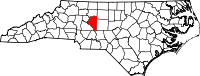
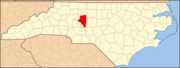
Location in the state of North Carolina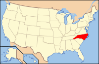
North Carolina's location in the U.S.Founded 1822 Seat Lexington Area
- Total
- Land
- Water
567 sq mi (1,469 km²)
552 sq mi (1,430 km²)
15 sq mi (39 km²), 2.58%Population
- (2010)
- Density
149,331
267/sq mi (103/km²)Website www.co.davidson.nc.us Davidson County is a county located in the U.S. state of North Carolina. As of 2010, the population was 149,331 . Its county seat is Lexington.[1]
Contents
History
The county was formed in 1822 from Rowan County. It was named after Brigadier General William Lee Davidson, an American Revolutionary War general killed at the Battle of Cowan's Ford on the Catawba River in 1781.[2]
In 1911, a new county called Piedmont County was proposed, with High Point as its county seat, to be created from Guilford, Davidson and Randolph Counties. Many people appeared at the Guilford County courthouse to oppose the plan, vowing to go to the state legislature to protest. The state legislature voted down the plan in February 1911.[3][4]
Law and government
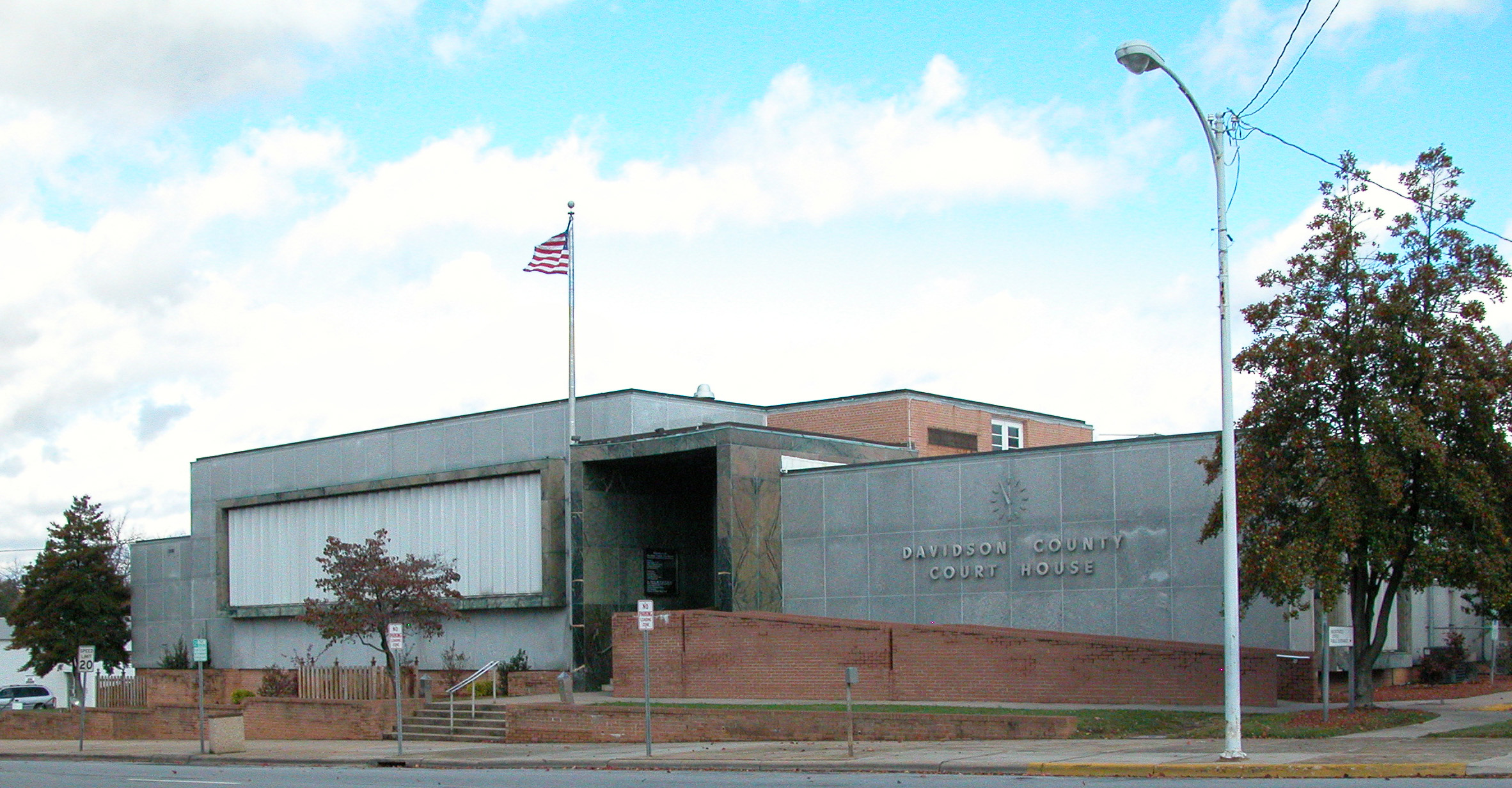
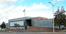 Davidson County Courthouse in Lexington
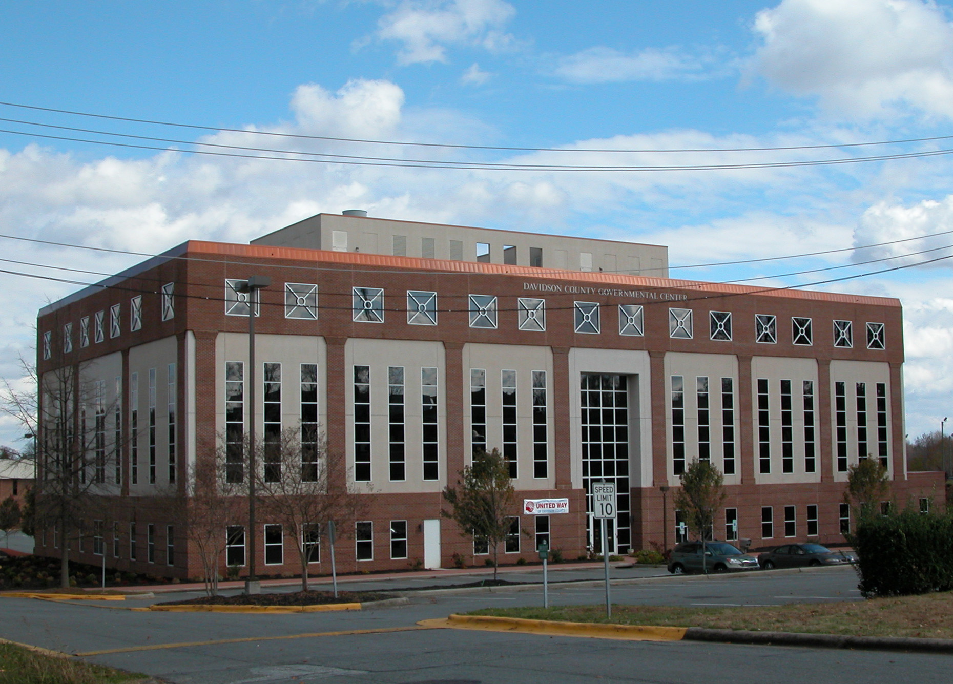
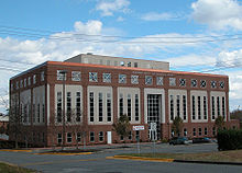 Davidson County Governmental Center in Lexington
Davidson County is a member of the regional Piedmont Triad Council of Governments.
Davidson County gained national attention when Gerald Hege, Sheriff from 1995–2003, became a minor celebrity for his unconventional prisoner treatment methods.
Education
Davidson County is served by Davidson County Schools; however, the cities of Thomasville and Lexington have their own school districts. Davidson County Schools is one of the county's largest employers.
Davidson County is also served by Davidson County Community College, a comprehensive community college that is a member school of the North Carolina Community College System. Davidson County Community College was chartered in 1958 as an Industrial Education Center designed to provide adults with the education and skills needed to move from an agricultural to a manufacturing-based economy.
In 1965, the institution was chartered as Davidson County Community College. The Associate in Arts and Associate in Science degrees were added to the existing Associate in Applied Science degree, Diploma, and Certificate programs. University transfer courses were added in 1966. In 1997, the College participated in the Comprehensive Articulation Agreement (CAA) that allows college transfer students to move easily to the 16 UNC schools, as well as many independent college and universities. Presently the Davidson Campus has grown to 11 buildings and two emergency services training facilities on approximately 97 acres (390,000 m2).
Geography
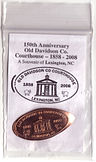 Souvenir celebrating the 150th Anniversary of the Old Courthouse
According to the U.S. Census Bureau, the county has a total area of 567 square miles (1,468.5 km2), of which 552 square miles (1,429.7 km2) is land and 15 square miles (38.8 km2) (2.58%) is water. Davidson County is located entirely within the Piedmont region of central North Carolina. The Piedmont consists of gently rolling terrain frequently broken by hills or shallow valleys formed by rivers and streams. An exception to this terrain are the Uwharrie Mountains in the county's western and southwestern sections. The Uwharries are the oldest mountain range in North America,[citation needed] and at one time they rose to nearly 20,000 feet (6,100 m) above sea level. However, time has worn them down to little more than high hills; yet due to the relative flatness of the surrounding countryside they still rise from 250 to 500 feet (150 m) above their base. The highest point in the Uwharries - and the highest point in Davidson County - is High Rock Mountain in the county's southwestern corner. It has an elevation of 1,119 feet (341 m) above sea level.
Townships
The county is divided into seventeen townships: Abbotts Creek, Alleghany, Arcadia, Boone, Conrad Hill, Cotton Grove, Emmons, Hampton, Healing Spring, Jackson Hill, Lexington, Midway, Reedy Creek, Silver Hill, Thomasville, Tyro, and Yadkin College.
Adjacent counties
- Davie County - northwest
- Forsyth County - north
- Guilford County - northeast
- Montgomery County - south
- Randolph County - east
- Rowan County - southwest
- Stanly County - southwest

Davie County Forsyth County Guilford County 
Randolph County  Davidson County, North Carolina

Rowan County and Stanly County Montgomery County National protected area
- Uwharrie National Forest (part)
Wine region
Parts of Davidson County are in the Yadkin Valley wine region.
Demographics
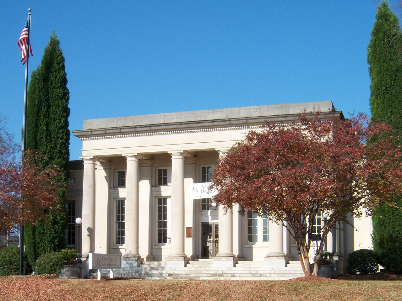
 Arts United of Davidson County
As of the census[5] of 2010, there were 149,331 people, 58,156 households, and 42,512 families residing in the county. The population density was 267 people per square mile (103/km²). There were 62,432 housing units at an average density of 113 per square mile (44/km²). The racial makeup of the county was 84.05% White, 11.14% Black or African American, 0.37% Native American, 0.82% Asian, 0.01% Pacific Islander, 1.66% from other races, and 0.94% from two or more races. 3.24% of the population were Hispanic or Latino of any race.
There were 58,156 households out of which 32.70% had children under the age of 18 living with them, 58.00% were married couples living together, 10.80% had a female householder with no husband present, and 26.90% were non-families. 22.90% of all households were made up of individuals and 8.80% had someone living alone who was 65 years of age or older. The average household size was 2.50 and the average family size was 2.92.
In the county the population was spread out with 24.30% under the age of 18, 7.60% from 18 to 24, 31.20% from 25 to 44, 24.10% from 45 to 64, and 12.80% who were 65 years of age or older. The median age was 37 years. For every 100 females there were 96.00 males. For every 100 females age 18 and over, there were 93.70 males.
The median income for a household in the county was $38,640, and the median income for a family was $46,241. Males had a median income of $31,287 versus $23,622 for females. The per capita income for the county was $18,703. About 7.00% of families and 10.10% of the population were below the poverty line, including 13.30% of those under age 18 and 12.10% of those age 65 or over.
Attractions
 The Old Davidson County Courthouse in Lexington, NC
Festivals
One of the county's most famous attractions is the yearly Lexington Barbecue Festival, held in the city of Lexington during the month of October, bringing in over 100,000 visitors from all over the southeastern U.S. There is also a yearly Davidson County Agriculture Fair held in September. Thomasville hosts an annual "Everybody's Day Festival",[6] the longest running festival in the state. The "Southeastern Old Threshers Reunion"[7] is held every year at the Denton Farmpark.
Landmarks
In addition, there are many year-long attractions in Davidson County. Some of which include Historic Uptown Lexington, which consists of the Davidson County Historical Museum located in the old courthouse and Boone's Cave Park (where legend says an adolescent Daniel Boone hid from Indians). Other attractions include Denton Farm Park, Mrs. Hanes Moravian Cookie Factory, Walter Johnson Camp and Conference Center, and the North Carolina Vietnam Veterans Memorial. The Big Chair in Thomasville is also a major landmark.
Art
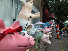 Pigs on Parade during the Lexington Barbecue Festival
Pigs in the City in an art initiative held each summer in Lexington, and attracts tens of thousands of visitors.
In 2005, Davidson County Community College and the City of Thomasville formed a partnership for the creation of the Thomasville Artisan Center. This art studio allowed the College to reinvigorate its Associate in Fine Arts Degree and offer both university transfer classes as well as adult community interest classes in painting, drawing, and sculpting. The Artisan Center is part of the College's Thomasville Education Center complex which is part of the College's outreach to the community. The College has a second campus in Davie County in the city of Mocksville, as well as the Uptown Lexington Education Center, located within a few blocks of the Arts Center of Davidson County and the historic Court House.
Barbecue
One of the two major styles of North Carolina barbecue originated in Lexington, the county seat and home to the annual Lexington Barbecue Festival. Therefore, many Lexington-style barbecue restaurants are found throughout the county. Some include Lexington BBQ ("Honeymonk's"), The BBQ Center, Jimmy's, Whitley's BBQ Restaurant, Smokey Joe's, Backcountry, Speedy's, Smiley's, Tarheel Q, Stamey's, Kerley's, Welcome BBQ, and Cook's.
Richard Childress
Davidson County is home to many supporting race fans and the famous Richard Childress. Here you will find his personal Childress Vineyards and Richard Childress Racing Museum and Shops.
The Big Chair
Finally, Davidson County is known for its oversized chair, "The Big Chair." This chair is located in central Thomasville and is a symbol of Davidson County's world famous furniture industry.
High Rock Lake
Main article: High Rock Lake High Rock Lake
High Rock Lake is the northernmost of the Uwharrie Lakes and the second largest lake in North Carolina behind Lake Norman. Its water surface covers 15,180 acres (61.4 km2) and there are 365 miles (587 km) of shoreline. It begins at the confluence of the Yadkin River and the South Yadkin River. It has been the host of the Bassmaster Classic in 1994, 1995, 1997 and 2007 [8] and is the site of frequent other local angling competitions. Lexington is just north of the Abbotts Creek section of the lake.
Notable people
- Wilmer "Vinegar Bend" Mizell- Professional Baseball player for the Pirates and Cardinals, and a Congressman who served three terms. (1930–1999)
- Max Lanier and son Hal Lanier, both Major League Baseball players are from Denton.[9]
- Eddie Mathews, Hall of Fame baseball player, played for Thomasville in 1949 before going to the majors.
Cities and towns
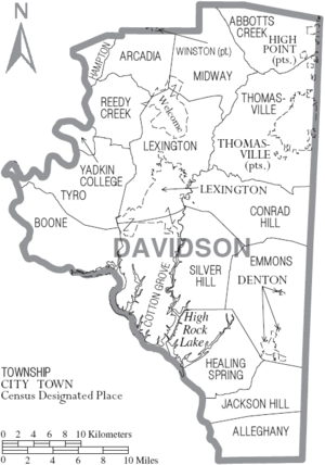 Map of Davidson County, North Carolina With Municipal and Township Labels
Unincorporated
- Arcadia
- Churchland
- Reeds
- Silver Hill
- Silver Valley
- Southmont
- Tyro
- Welcome
- Yadkin College
See also
References
- ^ "Find a County". National Association of Counties. http://www.naco.org/Counties/Pages/FindACounty.aspx. Retrieved 2011-06-07.
- ^ "Davidson County Genealogy". North Carolina Genealogy. http://www.northcarolinagenealogy.net/north-carolina-counties/davidson/. Retrieved 2011-04-14.
- ^ Jack Scism, "Rembember When?", Greensboro News & Record, January 23, 2011.
- ^ Jack Scism, "Rembember When?", Greensboro News & Record, February 6, 2011.
- ^ "American FactFinder". United States Census Bureau. http://factfinder.census.gov. Retrieved 2008-01-31.
- ^ Everybodysday.com
- ^ "Farmpark". http://www.threshers.com/farmpark/.
- ^ Camping in Piedmont, North Carolina
- ^ "Max Lanier History and Photos". http://sites.google.com/site/memoryyear/denton-nc-stuff/max-lanier.
External links
- Davidson County and High Rock Lake Forum The best forum for information and news regarding Davidson County, High Rock Lake, and the surrounding communities
- Davidson County Tourism & Recreation Calendar of Events & more
- Davidson County Images Articles and Photos
- The Lexington Dispatch Local News and Features
- Davidson County government official website
- Live EMS Audio Feed Listen to Davidson County EMS online
- Davidson County Community College
- Thomasville City Schools
- Lexington City Schools
- Davidson County School System
Municipalities and communities of Davidson County, North Carolina County seat: Lexington Cities High Point‡ | Lexington | Thomasville‡
Towns CDP Unincorporated
communitiesArcadia | Bethesda | Churchland | Linwood | Montclair | Reeds | Silver Valley | Southmont | Tyro | Yadkin College
Footnotes ‡This populated place also has portions in an adjacent county or counties
Categories:- North Carolina counties
- 1822 establishments in the United States
- Populated places established in 1822
- Davidson County, North Carolina


Wikimedia Foundation. 2010.