- Columbus County, North Carolina
-
Columbus County, North Carolina 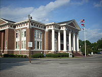 Columbus County Courthouse, Whiteville
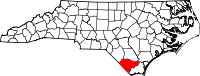
Location in the state of North Carolina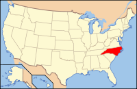
North Carolina's location in the U.S.Founded 1808 Seat Whiteville Area
- Total
- Land
- Water
954 sq mi (2,471 km²)
937 sq mi (2,427 km²)
17 sq mi (44 km²), 1.76%Population
- (2000)
- Density
54,749
60/sq mi (23/km²)Website www.columbusco.org Columbus County is a county located in the U.S. state of North Carolina. Its county seat is Whiteville[1].
Contents
History
The county was formed in 1808 from parts of Bladen County and Brunswick County. It was named for Christopher Columbus.
Law and government
Columbus County is a member of the regional Cape Fear Council of Governments.
Geography
According to the U.S. Census Bureau, the county has a total area of 954 square miles (2,470.8 km2), of which 937 square miles (2,426.8 km2) is land and 17 square miles (44.0 km2) (1.76%) is water.
Townships
The county has seven incorporated towns: Bolton, Cerro Gordo, Chadbourn, Fair Bluff, Tabor City, Lake Waccamaw, and Whiteville. In addition there are nine townships: Bogue, Bug Hill, Lees, Ransom, South Williams, Tatums, Welch Creek, Western Prong and Williams
Adjacent counties
- Bladen County, North Carolina - north
- Pender County, North Carolina - northeast
- Brunswick County, North Carolina - southeast
- Horry County, South Carolina - southwest
- Robeson County, North Carolina - northwest

Robeson County Bladen County Pender County 
 Columbus County, North Carolina

Horry County, South Carolina Brunswick County Demographics
As of the census[2] of 2000, there were 54,749 people, 21,308 households, and 15,043 families residing in the county. The population density was 58/sq mi (23/km²). As of 2004, there were 24,668 housing units at an average density of 26/sq mi (10/km²). The racial makeup for the county was 68.9% White, 23.1% Black or African American, 5.1% Native American, 0.2% Asian, 4.7% from other races, and 0.6% from two or more races. 2.7% of the population were Hispanic or Latino of any race.
By 2005 62.3% of the county population was non-Hispanic whites. 31.1% of the population was African-American. 3.2% of the population was Native American. 2.8% of the population was Latino.
There were 21,308 households out of which 31.50% had children under the age of 18 living with them, 50.80% were married couples living together, 15.80% had a female householder with no husband present, and 29.40% were non-families. 26.50% of all households were made up of individuals and 11.70% had someone living alone who was 65 years of age or older. The average household size was 2.50 and the average family size was 3.01.
In the county the population was spread out with 25.70% under the age of 18, 8.70% from 18 to 24, 27.40% from 25 to 44, 24.40% from 45 to 64, and 13.80% who were 65 years of age or older. The median age was 37 years. For every 100 females there were 92.60 males. For every 100 females age 18 and over, there were 89.40 males.
The 2003 median income for a household in the county was $27,659, and the median income for a family was a little more than $33,800. Males had a median income of $28,494 versus $19,867 for females. The per capita income for the county was $14,415. About 17.60% of families and 20.30% of the population were below the poverty line, including 30.00% of those under age 18 and 25.50% of those age 65 or over.
Communities
Cities and towns
 Map of Columbus County, North Carolina With Municipal and Township Labels
Cities:
Towns:
Unincorporated areas
- Cherry Grove
- Delco
- Evergreen, Ransom Township
- Evergreen, Tatums Township
- Hallsboro
- Nakina
- Olyphic
- Pireway
- Riegelwood
- Sellerstown
See also
References
- ^ "Find a County". National Association of Counties. http://www.naco.org/Counties/Pages/FindACounty.aspx. Retrieved 2011-06-07.
- ^ "American FactFinder". United States Census Bureau. http://factfinder.census.gov. Retrieved 2008-01-31.
External links
Municipalities and communities of Columbus County, North Carolina City 
Towns Boardman | Bolton | Brunswick | Cerro Gordo | Chadbourn | Fair Bluff | Lake Waccamaw | Sandyfield | Tabor City
Unincorporated
communitiesCherry Grove | Delco | Evergreen in Ransom Township | Evergreen in Tatums Township | Hallsboro | Nakina | Olyphic | Pireway | Riegelwood | Sellerstown
Categories:- North Carolina counties
- Columbus County, North Carolina


Wikimedia Foundation. 2010.