- Cabarrus County, North Carolina
-
- For the Spanish financier, see François Cabarrus.
Cabarrus County, North Carolina 
Seal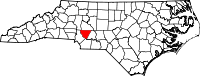
Location in the state of North Carolina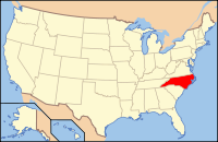
North Carolina's location in the U.S.Founded 1792 Seat Concord Area
- Total
- Land
- Water
365 sq mi (945 km²)
364 sq mi (943 km²)
1 sq mi (3 km²), 0.16%Population
- (2010)
- Density
178,011
360/sq mi (139/km²)Website www.co.cabarrus.nc.us Cabarrus County is a county located in the south-central part of the U.S. state of North Carolina. As of 2010, the population was 178,011. The county seat is Concord[1], which was incorporated in 1803. Among its significant historic sites is the Reed Gold Mine, a National Historic Landmark.
Contents
History
The county was formed on December 29, 1792 from Mecklenburg County. It was named after Stephen Cabarrus of Chowan County, speaker of the North Carolina House of Commons.
Gold was first discovered here in 1799 by Conrad Reed in an unincorporated part of southeast Cabarrus County. Reed was the son of John Reed, one of thousands of Hessian soldiers brought over by British troops to fight against rebellious colonists in the American Revolution. John Reed deserted, as did many other Hessians, and migrated from Georgia to North Carolina, where he settled in an ethnic German community. There he started a farm. Later his son Conrad Reed discovered a large gold nugget on the property.[citation needed]
John Reed first developed placer mining on his property, then underground mining, and became wealthy from the gold. His mine became known as Reed's Gold Mine. So much gold was discovered in the county that the Charlotte Mint was built to handle it.
The Reed Gold Mine was designated a National Historic Landmark, as it was the first gold mine in the country. Gold was mined in North Carolina into the early 20th century. Visitors at the site today can explore some of the mine's reconstructed tunnels.
Law and government
Cabarrus County is a member of the regional Centralina Council of Governments. Cabarrus County is governed by a five-member Board of Commissioners, elected at large in countywide elections to serve four-year staggered terms. The county's operations are managed by a "County Manager". Michael K. Downs is the current County Manager. The current Chair is Jay White and the Vice-Chair is Elizabeth "Liz" Poole. The other board members are Christopher Measmer, Larry Burrage, and Robert Carruth.[2]
Education
The Cabarrus County School System services all of the county with the exception of parts of Kannapolis, which operates its own school district. The system is generally regarded as one of the better school districts in the state with high student achievement and low instances of violence and other problems.
The county is also home to Barber-Scotia College, the Cabarrus College of Health Sciences (a four year college), and a branch of Rowan-Cabarrus Community College. UNC Charlotte, although in Mecklenburg County, is actually located near Harrisburg and is easily accessible to Cabarrus residents via Interstate 85.
Geography
According to the U.S. Census Bureau, the county has a total area of 365 square miles (945.3 km2), of which 364 square miles (942.8 km2) is land and 1 square mile (2.6 km2) (0.16%) is water.
Cabarrus County is situated in the gently rolling countryside of the Carolina Piedmont There are no significantly high peaks or points, although the eastern half of the county contains the westernmost foothills of the Uwharrie Mountains. Altitude ranges from approximately 500–800 feet above sea level. No large or navigable rivers flow through the county; the nearest navigable waterway is the Yadkin River in nearby Rowan County. Land slope is generally toward the southeast. The longest waterway within the county is Rocky River, which rises in Iredell County and empties into the Pee Dee below Norwood in Stanly County. Weather is temperate with hot summers and mild to chilly winters. Severe weather occurs occasionally, with thunderstorms in the warmer months of the year and ice storms and snowfalls occurring on occasion in winter. From zero to three accumulating snowfalls may be expected in an average winter. Snow generally melts between accumulating snowfalls, and there is no consistent snowpack. An average of four inches (102 mm) of snow and 46 inches (1,200 mm) of rain falls each year. At summer solstice, the length of day is approximately 14 hours and 33 minutes, with visible light lasting 15 hours and 32 minutes.
Lake Lynn is a small 18-acre (7.3 ha) lake located in the central part of Cabarrus County. It is situated between state highway 73 East and Old Airport Road. Lake Lynn Road connects these two through a twisting two lane road and affords some views of the lake and its small ponds. Lake Lynn is a natural lake and averages 28 feet (8.5 m) in depth. Species of deer, squirrel, raccoon, opossum, skunk, smallmouth bass, brim[disambiguation needed
 ] populate the area around the lake.
Townships
The county is divided into thirteen townships, which are both numbered and named: 1. Harrisburg; 2. Poplar Tent; 3. Odell; 4. Kannapolis; 5. New Gilead; 6. Rimertown; 7. Gold Hill; 8. Mt Pleasant; 9. Georgeville; 10. Midland; 11. Central Cabarrus 12.Cold Water and 13.City of Concord.
Adjacent counties
- Rowan County, North Carolina - north
- Stanly County, North Carolina - east
- Union County, North Carolina - south
- Mecklenburg County, North Carolina - west
- Iredell County, North Carolina - northwest

Iredell County Rowan County Mecklenburg County 
Stanly County  Cabarrus County, North Carolina

Union County Demographics
As of the census[3] of 2000, there were 131,063 people, 49,519 households, and 36,545 families residing in the county. The population density was 360 people per square mile (139/km²). There were 52,848 housing units at an average density of 145 per square mile (56/km²). The racial makeup of the county was 83.26% White, 12.18% Black or African American, 0.34% Native American, 0.91% Asian, 0.02% Pacific Islander, 2.30% from other races, and 0.99% from two or more races. 5.05% of the population were Hispanic or Latino of any race.
There were 49,519 households out of which 34.90% had children under the age of 18 living with them, 59.20% were married couples living together, 10.50% had a female householder with no husband present, and 26.20% were non-families. 21.80% of all households were made up of individuals and 8.00% had someone living alone who was 65 years of age or older. The average household size was 2.60 and the average family size was 3.03.
In the county the population was spread out with 25.80% under the age of 18, 8.10% from 18 to 24, 32.50% from 25 to 44, 22.10% from 45 to 64, and 11.60% who were 65 years of age or older. The median age was 35 years. For every 100 females there were 97.00 males. For every 100 females age 18 and over, there were 94.10 males.
The median income for a household in the county was $46,140, and the median income for a family was $53,692. Males had a median income of $36,714 versus $26,010 for females. The per capita income for the county was $21,121. About 4.80% of families and 7.10% of the population were below the poverty line, including 8.30% of those under age 18 and 9.60% of those age 65 or over.
Agriculture has played an important part in the economic life of the county for over 200 years. In the late 19th and early 20th centuries, textiles became a vital part of the local economy, especially in the northern portion of the county. Today, the local economy has a more varied base.
Communication is via an Interstate highway, Interstate 85, which travels southwest to northeast across the county's northern portion, and several U.S. and state highways. These principal highways include U.S. highways 52, 29, 601, and NC highways 73, 24/27, 200, 49, and 3. A regional airport (airport code JQF) is located seven miles (11 km) west of Concord. Commercial flights to the area are accessed through the airports at Charlotte, or at Greensboro, North Carolina. Passenger rail service to Kannapolis is available via Amtrak. Both wired and wireless telephone services are nearly universally available in the county. Cable television is available in much of the county. Cabarrus County is within the Greater Charlotte area for broadcast communications.
Most residents of Cabarrus County are Caucasian of Scots-Irish, German, or English-Welsh extraction. A minority population of African American residents inhabit the county.
Religion
Culturally, Cabarrus County residents are historically Christian of low-church protestant traditions, especially Southern Baptist, Presbyterian and Methodist. A small Jewish synagogue, Temple Or Olam exists in the area. Eastern Orthodox and Islamic congregations are available in nearby Charlotte.[citation needed]
Attractions
Essential services, including Carolinas Medical Center-NorthEast with a 24-hour emergency department and trauma center, are available in Concord. There are no VA hospitals or military installations in the county.
The state's largest tourist attraction, Concord Mills Mall, is located in Cabarrus County. The Great Wolf Lodge is located near the mall on the opposite side of Interstate 85.
The county is home to Reed Gold Mine, site of the first gold discovery in the United States in 1799.
NASCAR
Self-branded as the Center of American Motorsports, Cabarrus County is rich in NASCAR history.
The western part of the county is home to a large racing complex in Concord, including Charlotte Motor Speedway, which hosts three NASCAR Sprint Cup Series events a year, The Dirt Track at Charlotte Motor Speedway, and zMAX Dragway, which now hosts the NHRA Full Throttle Drag Racing Series twice a year. Concord Speedway (formerly Concord Motorsport Park), located southeast of Concord in Midland, hosts weekly NASCAR Whelen All-American Series races in the early spring through fall.
The county is also home to several major race shops, including Hendrick Motorsports, Roush Fenway Racing, Yates Racing, Hall of Fame Racing, and Earnhardt Ganassi Racing in Concord, Stewart Haas Racing in Kannapolis, and Wood Brothers Racing in Harrisburg.
A state of the art and first of its kind wind tunnel, Windshear, opened July 18, 2008 in Concord. It offers services to NASCAR and Formula One racing teams and automobile manufacturers.
Cities and towns
 Map of Cabarrus County, North Carolina With Municipal and Township Labels
Also notable is the recent push for incorporation in the Odell School community, which is located in the northwestern corner of the county. The current residents hope to incorporate as a means to avoid annexation by the city of Kannapolis.
Communities
- Georgeville
- Odell School
- Rimertown
See also
References
- ^ "Find a County". National Association of Counties. http://www.naco.org/Counties/Pages/FindACounty.aspx. Retrieved 2011-06-07.
- ^ Cabarrus County Board of Commissioners, Retrieved 3-22-2011
- ^ "American FactFinder". United States Census Bureau. http://factfinder.census.gov. Retrieved 2008-01-31.
External links
- Cabarrus County government official website
- Cabarrus County official tourism website
- Concord Macaroni Kid - Family Friendly Events Calendar
- Cabarrus Now is a Local Online Guide to Community Activities , Events, Local Businesses, Local Restaurants, and Local Services
Municipalities and communities of Cabarrus County, North Carolina Cities Concord | Locust‡ | Kannapolis‡

Towns Unincorporated
communityOdell School | Rimertown
Footnotes ‡This populated place also has portions in an adjacent county or counties
Charlotte Metropolitan Area Counties 
Major city Cities and towns
20k-99kConcord • Gastonia • Huntersville • Kannapolis • Matthews • Monroe • Hickory • Mooresville • Rock Hill • Salisbury • Shelby • StatesvilleCities and towns
5k-20kAlbemarle • Belmont • Bessemer City • Chester • Cherryville • Conover • Cornelius • Davidson • Fort Mill • Indian Trail • Kings Mountain • Lancaster • Lincolnton • Mint Hill • Mount Holly • South Gastonia • Unionville • Wadesboro • Weddington • YorkFootnotes Bold = principal metro cities • Italic = places and counties part of CSACategories:- North Carolina counties
- 1792 establishments in the United States
- Populated places established in 1792
- Cabarrus County, North Carolina
- Charlotte metropolitan area


Wikimedia Foundation. 2010.