- Dimitsana
-
Dimitsana
Δημητσάνα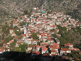
Location 
 Dimitsana
Coordinates 37°36′N 22°3′E / 37.6°N 22.05°ECoordinates: 37°36′N 22°3′E / 37.6°N 22.05°E Location within the peripheral unit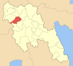
Government Country: Greece Region: Peloponnese Regional unit: Arcadia Municipality: Gortynia Population statistics (as of 2001) Municipal unit - Population: 1,337 Other Time zone: EET/EEST (UTC+2/3) Elevation (center): 944 m (3,097 ft) Postal: 220 07 Telephone: 27950 Auto: TP Website www.dimitsana.gr Dimitsana (Greek: Δημητσάνα) is a village and a former municipality in Arcadia, Peloponnese, Greece. Since the 2011 local government reform it is part of the municipality Gortynia, of which it is the seat and a municipal unit.[1] It is built on the ruins of the ancient town Teuthis. Its population is 730.
It is located SE of Olympia and Pyrgos, SW of Vytina, 60 km W of Tripoli, W of Megalopoli and Karytaina and NE of Andritsaina.
The village has a school, a historical library, several churches, a post office, a water-power museum, an open amphitheater, hotels and a square (plateia). The village is located on the valley which has a small creek to its west and the residential area covers the eastern part of a mountain. Another mountain is located to its west. The area north and east of Dimitsana is covered with pine forests. Deforested mountains cover the area west and south of Dimitsaina.
Contents
Subdivisions
The municipal unit Dimitsana is subdivided into the following communities (constituent villages in brackets):
- Dimitsana (Dimitsana, Karkalou, Moni Aimyalon i Filosofou, Palaiochori)
- Melissopetra
- Panagia
- Rados
- Rizospilia (Rizospilia, Kato Rizospilia)
- Zatouna (Zatouna, Vlongos, Markos)
- Zigovisti
Population history
Year Village Municipal district Municipality 1981 - 760 - 1991 - 739 1,529 2001 611 730 1,337 Notable people
- Germanos, metropolitan bishop of Patras (1771-1826)
- Gregory V (1746-1821), Ecumenical Patriarch of Constantinople
- Theophanes III, Greek Orthodox Patriarch of Jerusalem
- Tassos Gritsopoulos, historian
- Archbishop Ieremias of Gortyna
Gallery
-

House in Dimitsana.
-

The statue of Gregory V in Dimitsana.
-

Old Houses
-

Snapshot
-
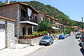
Street in Dimitsana
References
- ^ Kallikratis law Greece Ministry of Interior (Greek)
External links
- Municipality of Dimitsana (official site, pages in Greek and in English)
- Dimitsana
- Dimitsana in Gortynia (in Greek)
- GTP - Dimitsana
- GTP - Dimitsana municipality
See also
- Communities of Arcadia
North: Lagkadia West: Iraia Dimitsana East: Falanthos, Megalopoli South: Gortyna, Trikolonoi Municipal unit of Dimitsana Municipal unit of Iraia Municipal unit of Kleitor Agridi · Drakovouni · Kerpini · Mygdalia · Pournaria · Prasino · Theoktisto · Valtesiniko · XirokarotainaMunicipal unit of Kontovazaina Dimitra · Kardaritsi · Kontovazaina · Monastiraki · Paralongoi · Vachlia · Velimachi · Vidiaki · VoutsisMunicipal unit of Lagkadia Lagkadia · LefkochoriMunicipal unit of Trikolonoi Municipal unit of Tropaia Aetorrachi · Chora · Doxa · Kalliani · Kastraki · Livadaki · Neochori · Perdikoneri · Raches · Spatharis · Stavrodromio · Tripotamia · Tropaia · VyzikiMunicipal unit of Vytina Categories:- Populated places in Arcadia


Wikimedia Foundation. 2010.