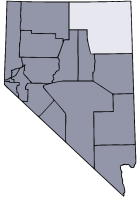
- Elko County, Nevada
Infobox U.S. County
county = Elko County
state = Nevada
map size =
founded = 1869
seat = Elko | area_total_sq_mi =17203
area_land_sq_mi =17178
area_water_sq_mi =24
area percentage = 0.14%
census yr = 2007
pop = 50434
density_km2 =1
web = www.elkocountynv.net
|Elko County is located in the western
U.S. state ofNevada . As of the 2000 census, the population was 45,291. As ofJuly 1 ,2007 , the population of Elko County was estimated at 50,434 [ [http://www.nsbdc.org/what/data_statistics/demographer/pubs/pop_increase/ 2006 Estimates by County ] ] . Itscounty seat is ElkoGR|6. The county was organized on March 5th, 1869, being taken from Lander County. In area, Elko County is the fourth-largest county in the United States (though its ranking is lower if one includes the boroughs of Alaska).Elko County is part of the Elko Micropolitan Statistical Area.
History
Elko County was created out of eastern Lander County in 1869. Several explanations for the derivation of its name have been offered. One explanation is that Elko is an Indian word meaning either "white woman" or "beautiful." Another explanation credits railroad owner
Charles Crocker with the naming of a railroad station after elk roaming in the area, and adding an "o" to form "Elko".Geography
According to the U.S. Census Bureau, the county has a total area of 17,203 sq mi (44,555 km²),of which, 17,179 square miles (44,493 km²) of it is land and 24 square miles (62 km²) of it (0.14%) is water. Not counting
Alaska 's boroughs (four of which are also larger), it is the fourth largest county in area in the United States, afterSan Bernardino County in California,Coconino County in Arizona, andNye County in Nevada. Most of the county lies within theGreat Basin , with areas along the northern boundary draining into the Snake River Basin. The elevation ranges from about convert|4300|ft|m at the edge of the salt flats of theGreat Salt Lake Desert , to convert|11157|ft|m in theRuby Mountains . TheHumboldt River has its source in Elko County and is a major water source for northern Nevada. ·Adjacent counties
*
Humboldt County, Nevada - west
*Lander County, Nevada - southwest
*Eureka County, Nevada - southwest
*White Pine County, Nevada - south
*Tooele County, Utah - east
*Box Elder County, Utah - east
*Cassia County, Idaho - northeast
*Twin Falls County, Idaho - northeast
*Owyhee County, Idaho - northDemographics
As of the
census GR|2 of 2000, there were 45,291 people, 15,638 households, and 11,493 families residing in the county. Thepopulation density was 3/sq mi (1/km²). There were 18,456 housing units at an average density of 1/sq mi (0/km²). The racial makeup of the county was 82.04% White, 0.59% Black or African American, 5.30% Native American, 0.68% Asian, 0.11% Pacific Islander, 8.50% from other races, and 2.78% from two or more races. 19.73% of the population were Hispanic or Latino of any race.There were 15,638 households out of which 43.00% had children under the age of 18 living with them, 59.30% were married couples living together, 8.40% had a female householder with no husband present, and 26.50% were non-families. 20.90% of all households were made up of individuals and 4.80% had someone living alone who was 65 years of age or older. The average household size was 2.85 and the average family size was 3.33.
In the county the population was spread out with 32.50% under the age of 18, 8.80% from 18 to 24, 31.50% from 25 to 44, 21.30% from 45 to 64, and 5.90% who were 65 years of age or older. The median age was 31 years. For every 100 females there were 108.80 males. For every 100 females age 18 and over, there were 109.40 males.
The median income for a household in the county was $48,383, and the median income for a family was $52,206. Males had a median income of $41,322 versus $24,653 for females. The
per capita income for the county was $18,482. About 7.00% of families and 8.90% of the population were below thepoverty line , including 9.50% of those under age 18 and 7.60% of those age 65 or over.Political Parties
Elko is a highly conservative area. Of 12 partisan county officials, 11 were registered Republican and only one was a Democrat.cite web|url=http://www.elkocountynv.net/clerk/ELKO%20COUNTY%20ELECTED%20OFFICIALS%202006.pdf|title=Elko County. (2006). Elected Officials.|accessdate=2007-09-28] In the 2004 presidential election,
George W. Bush won 78% of the vote, with only 20% having voted forJohn F. Kerry . [cite news |title=Presidential Election Results 2004 |work=CNN |url=http://www.cnn.com/ELECTION/2004/pages/results/states/NV/P/00/county.000.html#32007 ] Both former President Jimmy Carter and President George W. Bush made visits to the city of Elko during the 2006 mid-term election.cite web|url=http://72.14.253.104/search?q=cache:wHpz5c4DMSYJ:www.city-data.com/county/Elko_County-NV.html+Elko+county+election+results&hl=en&ct=clnk&cd=6&gl=us|title=City-Data.com (2007). Elko County, NV.|accessdate=2007-09-28] These were not the first presidents to come to Elko County: William McKinley visited in 1901; Herbert Hoover made his final campaign broadcast as president from a railroad car in Elko in 1932; President Roosevelt spoke in Carlin in 1938 during his whistle stop tour. In addition there have been many other high profile political figures to come to Elko, including Vice President Cheney."'Active PoliticalParties Include:"'
The Elko County Democratic Party [cite web |title=Elko County Democratic Party |url=http://www.elkocountydemocrats.org |publisher=Elko County Democratic Central Committee ]
The Elko County Republican Party
The Independent Party
The Green Party
The Libertarian PartyCities and towns
*Arthur
*Bullion
*Carlin
*Cobre
*Contact
*Currie
*Deeth
*Dinner Station
*Elko
*Halleck
*Hunter
*Jack Creek
*Jackpot
*Jarbidge
*Jiggs
*Lamoille
*Lee
*Metropolis
*Midas
*Montello
*Mountain City
*North Fork
*Oasis
*Owyhee
*Patsville
*Pequop
*Pleasant Valley
*Ryndon
*San Jacinto
*Shafter
*Shantytown
*South Fork
*Spring Creek
*Thousand Springs
*Tuscarora
*Twin Bridges
*Welcome
*Wells
*West Wendover
*Wild HorseReferences
External links
* [http://www.elkocountynv.net/ Elko County]
* [http://www.eceda.com/ Elko County Economic Diversification Authority]
* [http://www.elkocountylibrary.org/ Elko County Library]
* [http://www.westernfolklife.org/ Western Folklife Center]
* [http://www.museum-elko.us/ Northeastern Nevada Museum]
* [http://www.gbcnv.edu/ Great Basin College]
* [http://nnrhospital.com/ Northeastern Nevada Regional Hospital]
Wikimedia Foundation. 2010.